
A messy overnight ahead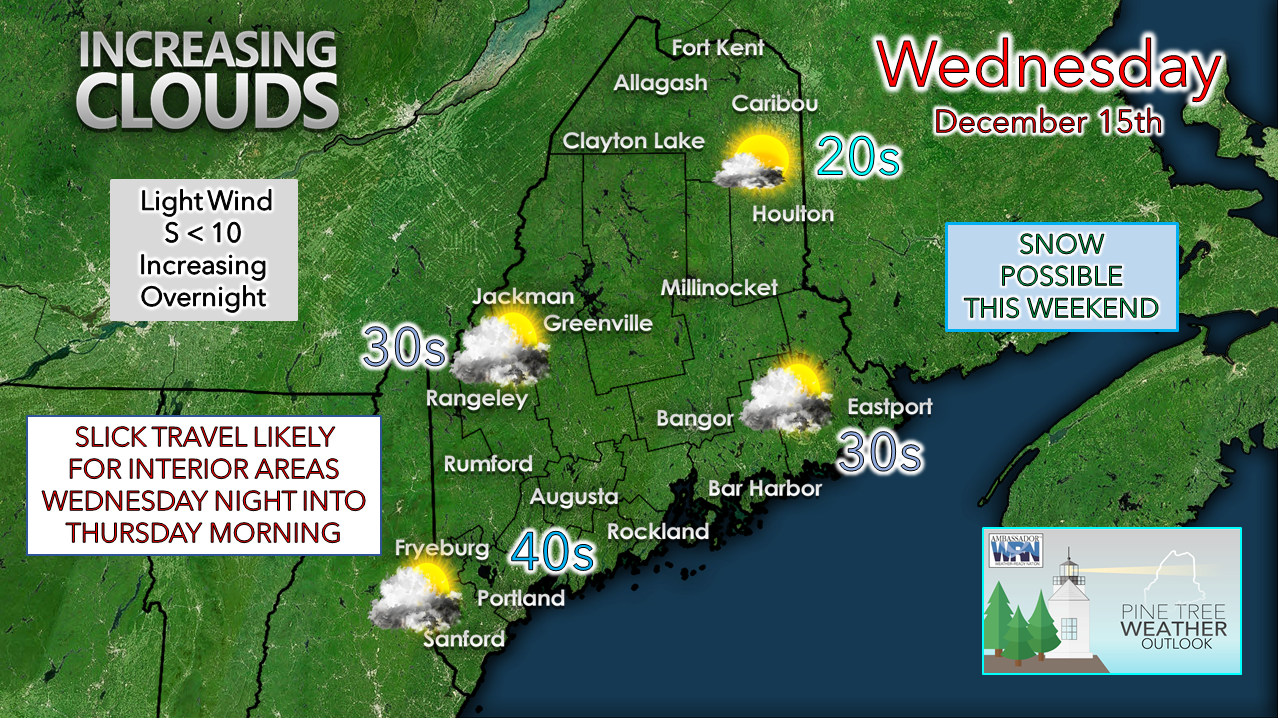 High pressure over the region to start the day slides off to the east out to sea. Warm air intrudes at the higher levels as a ridge over the Midwest moves eastward and increases cloud cover through the day. Temperatures mirror Tuesday's highs with less wind. Precipitation arrives over the region heading into the evening and overnight. 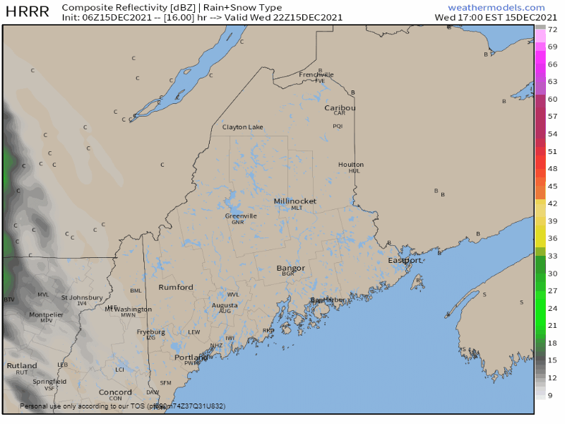 Wednesday 5 PM to Thursday 5 AM - A southerly breeze pumps warm air in along the coast to keep it warm enough for rain there. How far inland the rain/snow line sets up depends on the strength of the breeze and where the low-level temperatures are at. It would not surprise me to see enhancement along the baroclinic zone (coastal front) which could bring a quick hit of snow and/or freezing rain and/or sleet pending on air temperatures in the column. As warm air intrudes northward, areas seeing snow at the onset appear to flip to freezing rain and/or sleet as the low-level jet pushes warm air and moisture inland.  Thursday 5 AM to 5 PM - Steady precipitation ends from west to east during the day. With cold air damming a concern, there is potential for areas of patchy freezing drizzle and/or fog for interior areas until the front works northeastward in the morning. Towards evening, the region appears to be fully in the warm sector and fog could generate in the late afternoon / early evening over interior areas. A cold front approaches the region Thursday night, which may touch off an isolated rain shower or two ahead of it, and potential for snow shower or squall in the mountains on the backside overnight into Friday morning. Expect a southwesterly breeze increase ahead of the front, then a shift to the northwest after the passage. 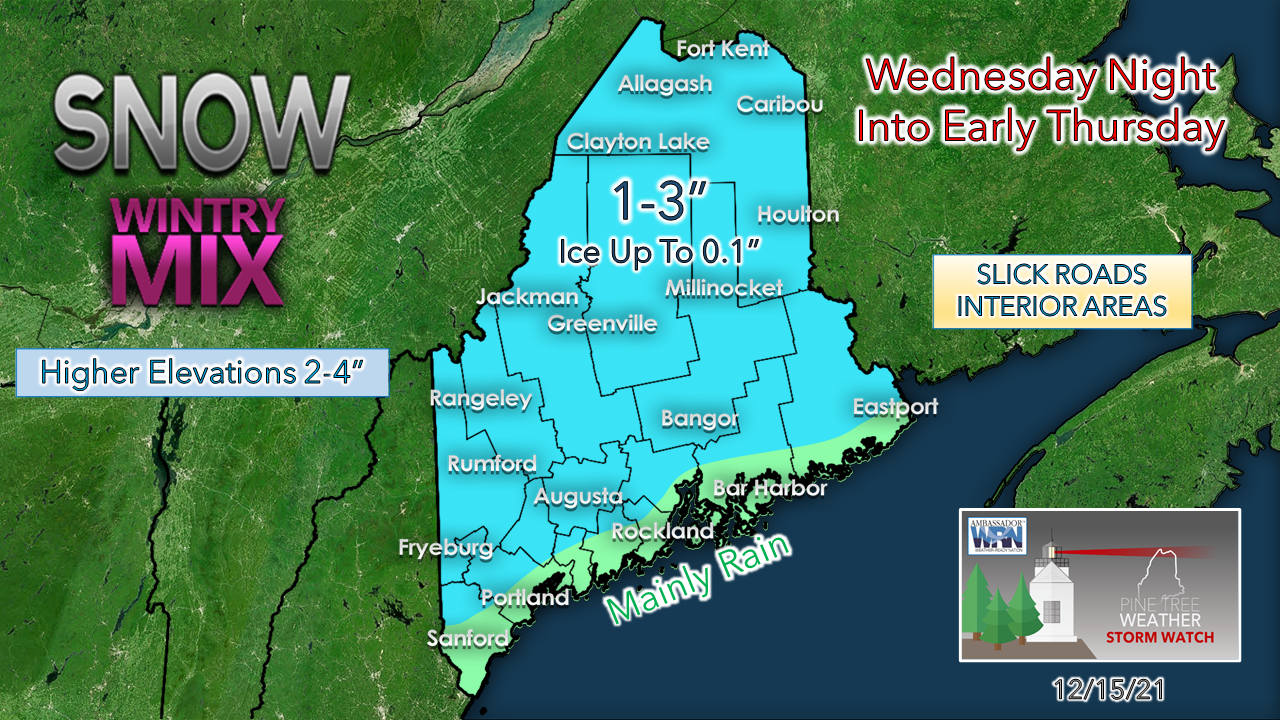 Where the coastal front sets up and where will dictate how much snow and ice accumulates over the coastal plain. The further inland, the more likelihood of accumulation. The ideas that I have seen over the past couple of days indicate that there could be an injection of cold that could creep into this at the onset and could bring a couple extra inches of snow, so there is potential this could bust on the high end in spots IF that occurs. Funny things can happen around the coastal front boundary and bring a thump of snow on the cold side, also. Snow potential for the weekend turning likely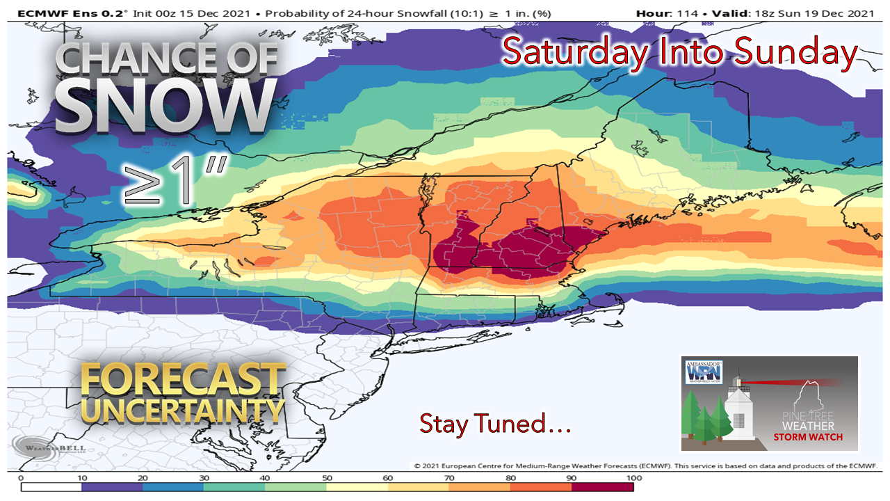 Model ideas remain scattered on what happens this weekend. High pressure moves in with breezy conditions for Friday. How far south high pressure sinks over the region determines where an area of low pressure travels along the stalled boundary of it. It is a fair bet that light snow is possible at this point for all but the north, but there is still plenty of uncertainty on where the stalled front sets up. Stay tuned. 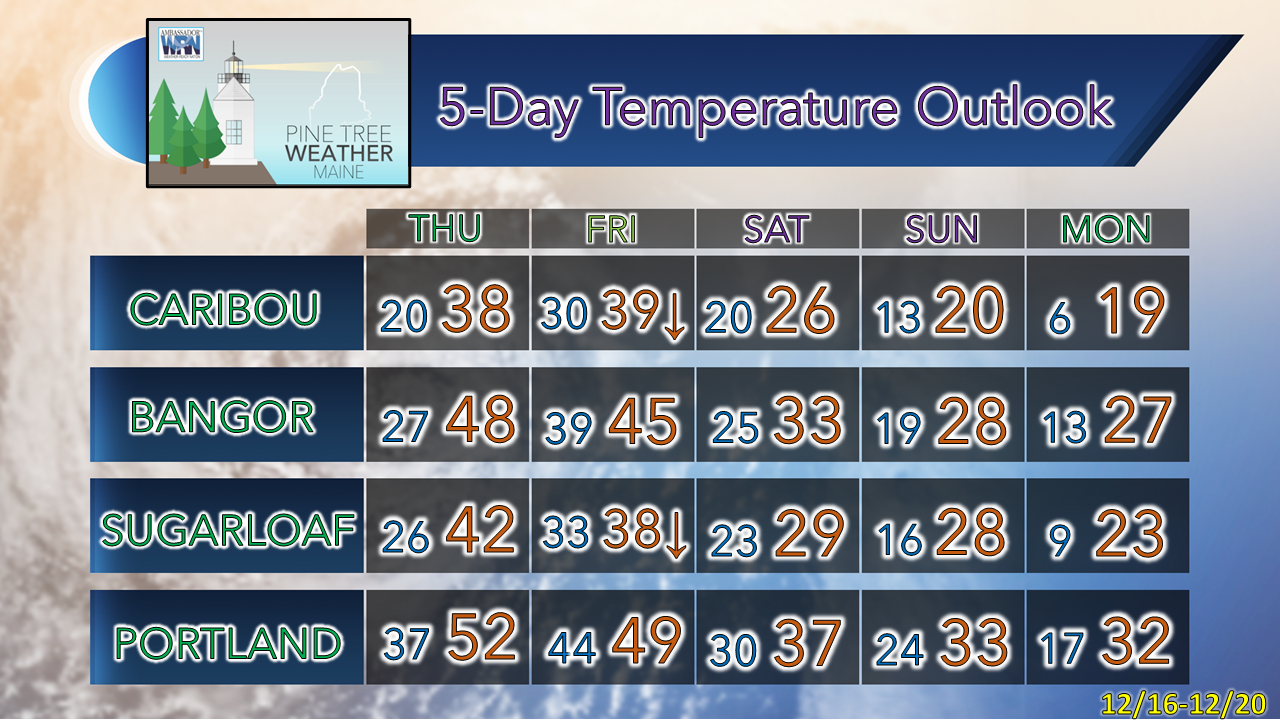  Ice and Snow, Take it Slow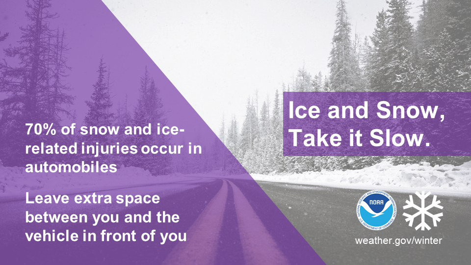 Winter driving can be hazardous. One simple way to keep yourself and everyone on the road safe is to slow down. Remember, “Ice and snow, take it slow”. Learn more at weather.gov/winter Be prepared to receive alerts and stay updated!
 For more information in between posts, please follow Pine Tree Weather on Facebook and Twitter.
Thank you for supporting this community-based weather information source which operates by reader supported financial contributions. - Mike |

Mike Haggett
|


