
After a quiet Wednesday, unsettled pattern returns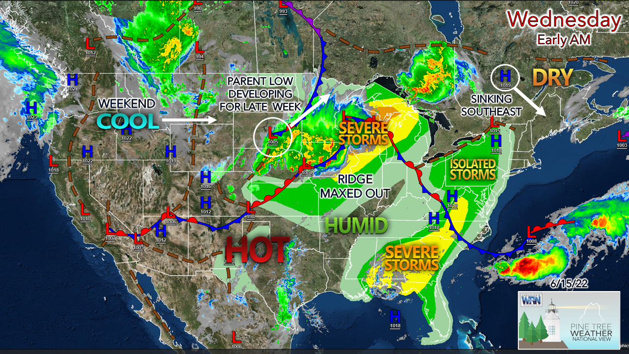 Finally, a bit of a respite region wide from showers and storms for the first day in almost a week. High pressure slides in from the northwest to keep the region dry. The two main features on the national map are the ridge over the Midwest and the developing low in the Plains. The ridge has achieved its poleward progression and gets cut off by the approaching trough from the west. The forecast looks rough for Wisconsin as hot and sticky battles cold and dry. Low pressure over the Dakotas intensifies and heads for Ontario. This low brings a frontal boundary into the region for Thursday and Friday. An upper-level low and associated trough enters the region as the frontal boundary departs and is expected to bring unsettled and cool temperatures for the region for the weekend into early next week. 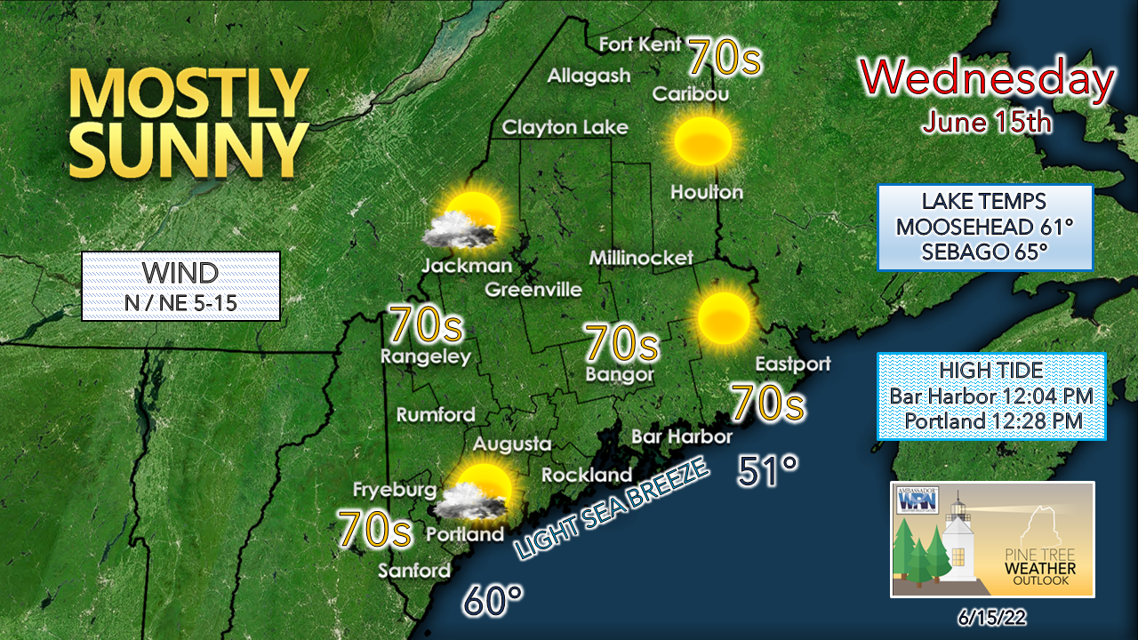 For Wednesday, the more east and north, the more sun for the day. High level cirrus is expected to stream in over the west and south in the afternoon. Shoreline areas can expect a light sea breeze to generate in the afternoon. Tides have shifted to afternoon highs and are running astronomically high with the Strawberry moon. Showers and storms likely Thursday into Friday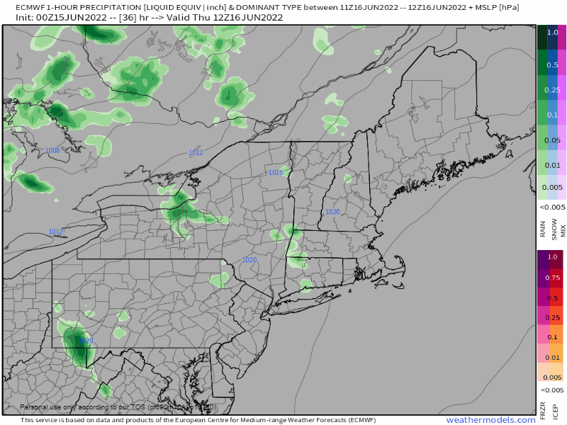 Thursday 8 AM to Friday 8 AM - A warm front approaches the region from the west for Thursday and brings the risk for hit-or-miss showers and storms for the day and into Thursday night. Shower activity during the daytime appears isolated, with a better chance in the overnight hours into Friday morning. Storms may bring a quick downpour and some wind and may disturb sleep. Night owls may be able to enjoy a light show in spots where storms occur. Expect a southerly wind to be gusty at times Thursday with the arrival of the front. 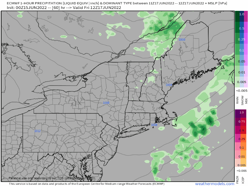 Friday 8 AM to 8 PM - Expect a sticky start with dew points in the 60s for much of the region along with areas of fog to start off. A cold front approaches the region in the morning and passes through in the afternoon. Depending on how much the sun gets out will dictate strong to severe storm potential as the front passes through. A southwesterly breeze ahead of the cold front shifts to the west / northwest in its departure Friday afternoon for western and southern areas, early evening for the north and east. Chilly times for the weekend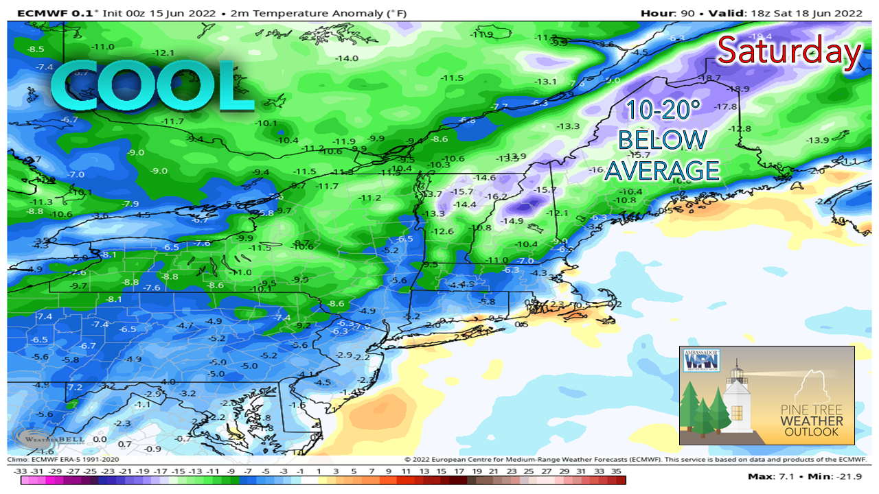 Some folks may quip that summer is over as temperatures feel more like early fall. The airmass moving in appears cold enough where snow showers are possible for Mount Washington as the upper low spins around the region through early next week. Showers are possible for interior areas for Saturday, Father's Day Sunday appears cloudy for the north and west with a mix of sun & clouds for the south and east, with a slight chance of a shower for the far north. While it will be abnormally cool, I do not expect frost for most of the region, with a chance for it possible for northwest Aroostook. 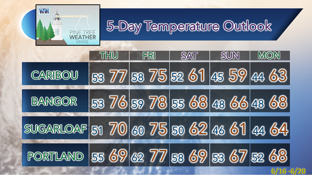 Thank you for supporting this community-based weather information source which operates by financial contributions from people like you. Stay updated, stay on alert, and stay safe! - Mike NOTE: The forecast information depicted on this platform is for general information purposes only for the public and is not designed or intended for commercial use. For those seeking pinpoint weather information for business operations, you should use a private sector source. For information about where to find commercial forecasters to assist your business, please message me and I will be happy to help you. |

Mike Haggett
|


