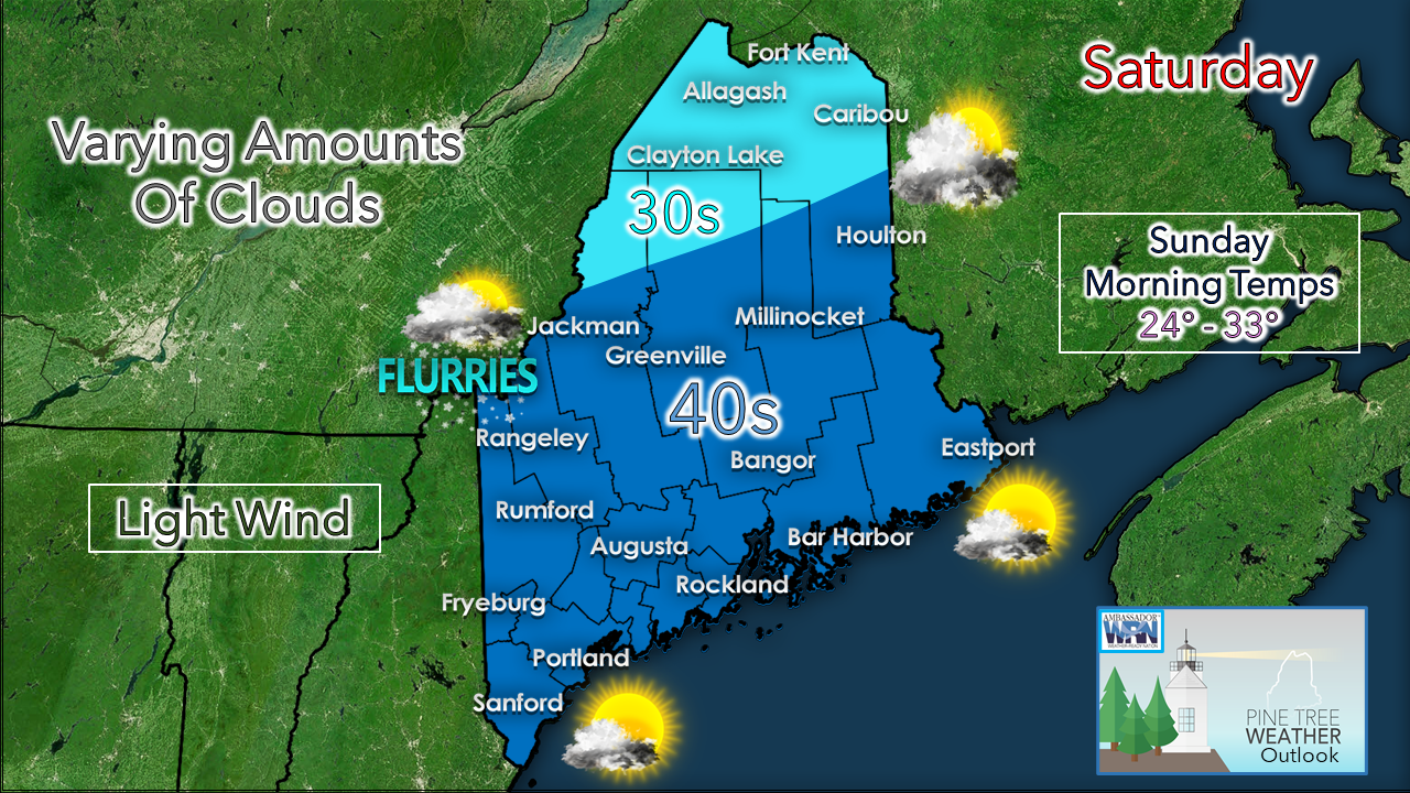
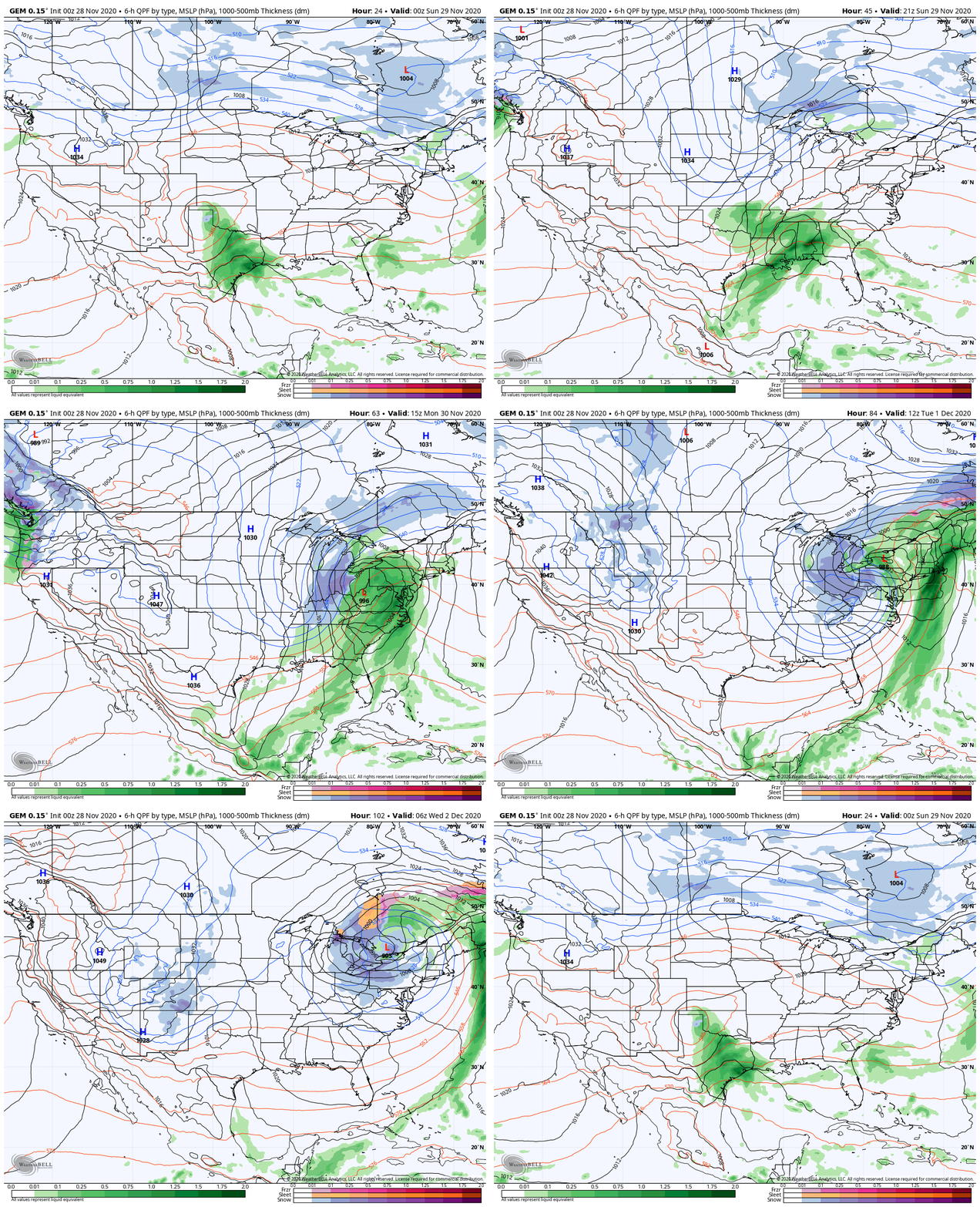
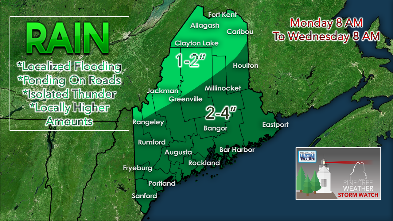
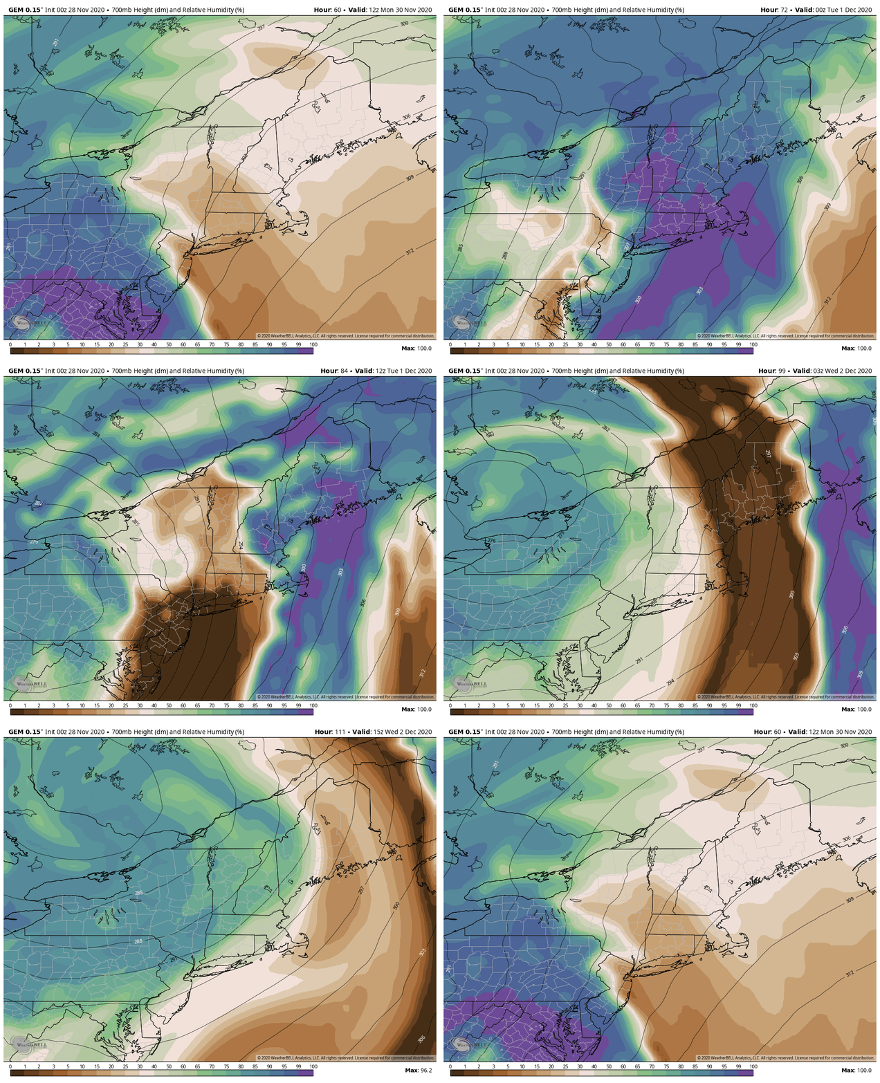
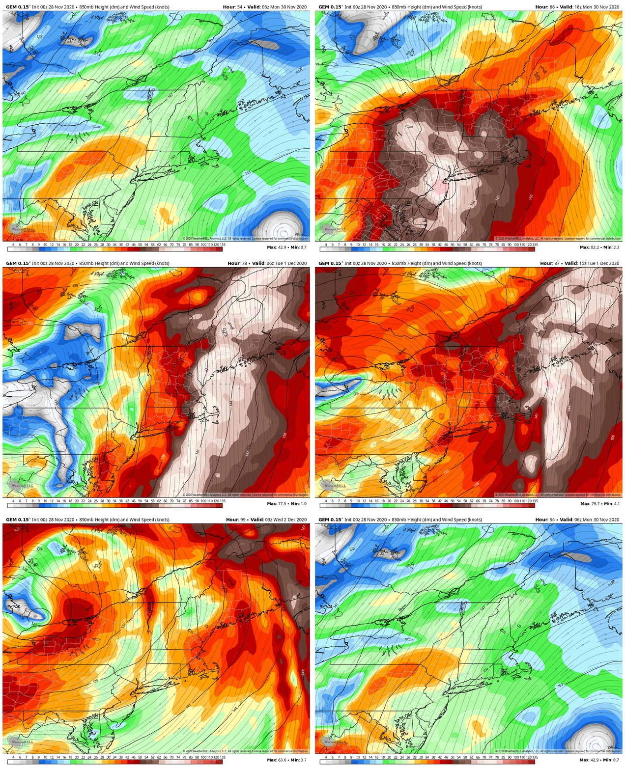
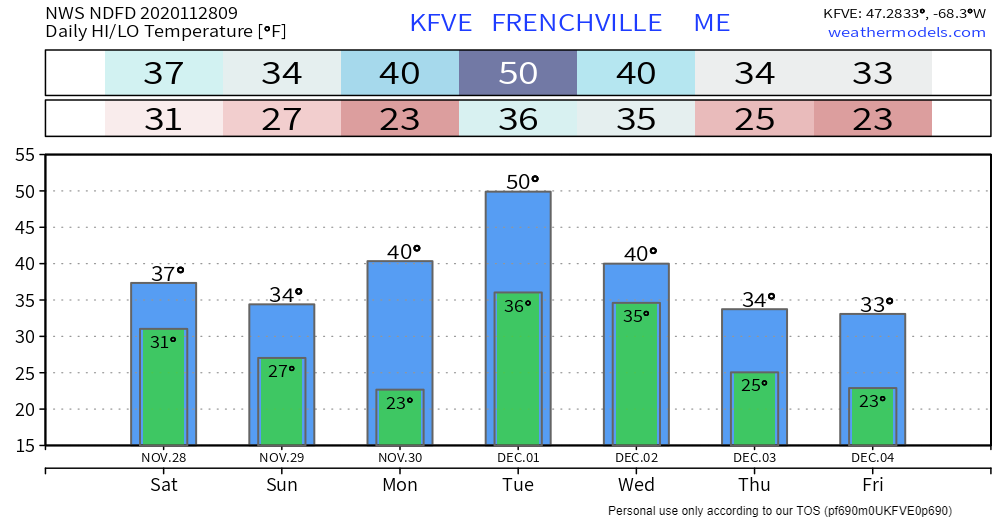
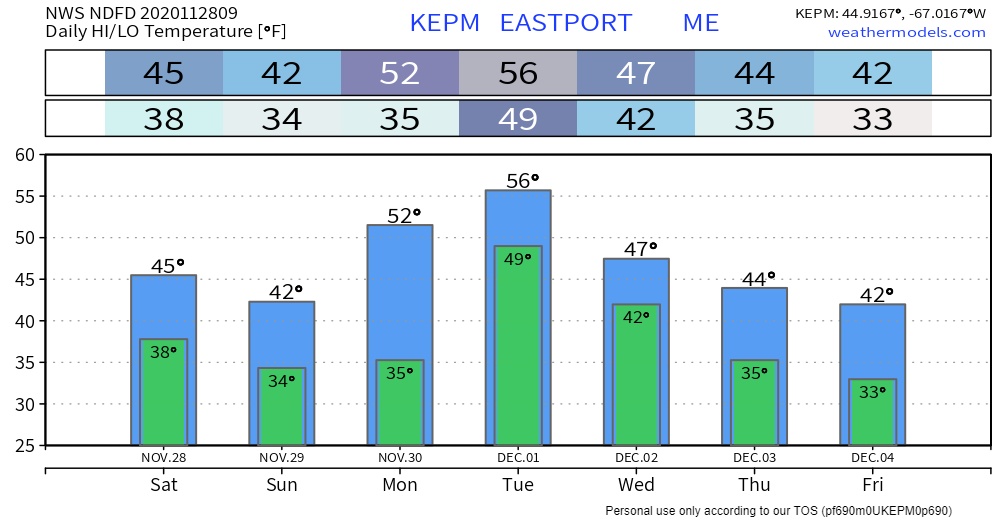
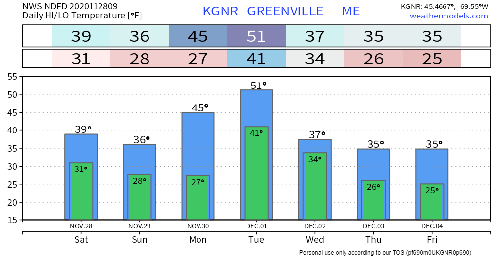
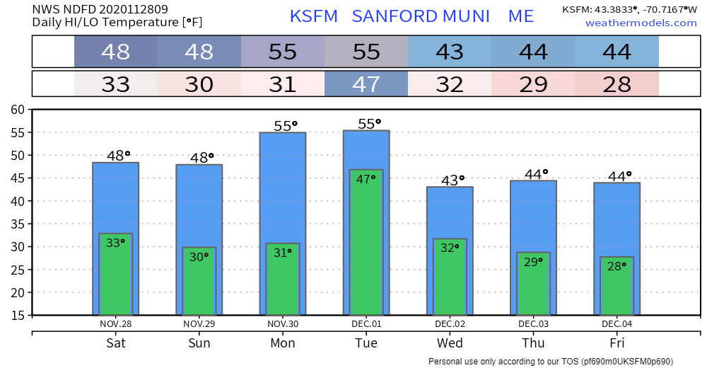
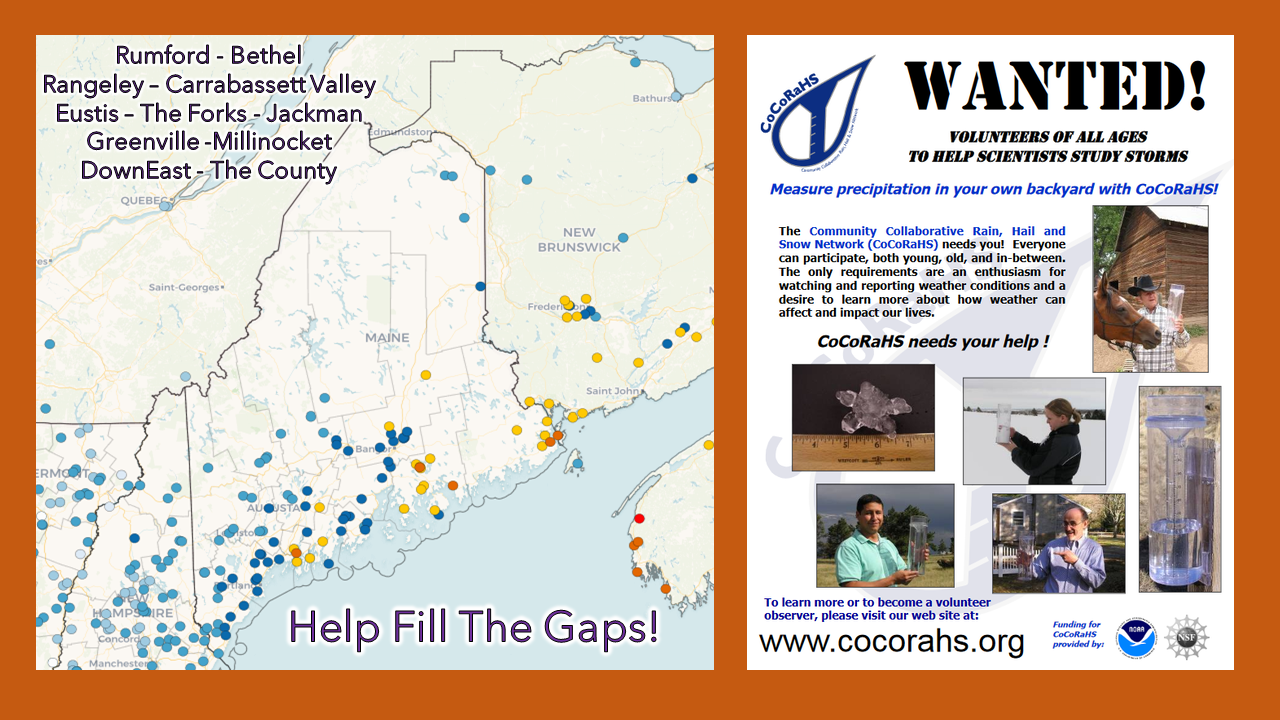
A peaceful SaturdayAn upper level disturbance passes through the region for Saturday. It will bring varying amounts of clouds at times, with a chance for flurries and/or snow showers for the western mountains. The wind will generally be light, with temperatures running above normal. Sunday features sun for most areas, with the possible exception for the mountains where it appears to be a mix of sun and clouds for the day. This will be our last quiet day until Friday. Strong storm to have lingering effects through the weekAs mentioned here in the Thanksgiving Day post, a strong storm is expected to develop over the eastern part of the country beginning Sunday. Low pressure from the subtropical jet heads northeast and phases with the polar jet from the north. The storm tracks towards western New York and rapidly intensifies on Monday. This puts Maine on the warm side of the system, which means this is to be windswept rain event. Timing as of Saturday morning appears that rain will move into western and southern regions Monday morning, and overspread the state in the afternoon. The heaviest rain passes through the state Monday night. Scattered showers are expected Tuesday. This could be the drought buster the region has been waiting for. Moisture streaming up from the southeast in conjunction with a strong low level jet present the idea of a solid soaking event. MidCoast and DownEast areas are favored to have the higher rainfall amounts, which could reach 5" in spots. The only concern with the forecast rain amounts is with the rapid intensification. Anytime a storm "bombs" out there runs the risk of dry slotting (shades of brown in the loop). That said, I do think 2-4" of rain is attainable given the dynamics. The big key in the dynamics is the low level jet depicted here. The timing of its arrival coincides with the heaviest rainfall Monday night into the wee hours of Tuesday. This is also the time of concern for power outages. This is another southeast wind event, which is another concern. Any of the heavy downpours and possible thunderstorms could deliver damaging wind gusts to the surface. Wind gusts 40-50+ mph are possible for the coast and higher elevations. The forecast will be fine tuned over the next day as short term models get a better handle on the storm. With the storm running into blocking in the atmosphere, expect breezy conditions to continue into Thursday as the storm spins itself out and slowly weakens. We may have a storm with a similar set up next weekend. Keep your storm supplies stocked and on the ready for use. Temperature outlook through FridayThe normal high and low for Caribou is 33° and 20°. For Portland, 44° and 28°. Temperatures appear to run above those seasonal averages through the week, cooling down towards the weekend. Help fill the gaps!For folks in western, eastern, and northern areas, the Community Collaborative Rain, Hail and Snow Network could use your support! Verification of precipitation is very important to improve forecasts. All ages can participate. Reporting is easy, and it takes very little time to do. For more information, please check the CoCoRaHS Maine website. I would be more than happy to answer any questions you may have about the program! Be prepared to receive alerts and stay updated!
For more information, please follow Pine Tree Weather on Facebook and Twitter.
** FUNDING NEEDED FOR 2021 ** Thank you for supporting this community based weather information source that is funded by your financial contributions. Stay updated, stay on alert, and stay safe! - Mike |
Mike Haggett
|

