
Flood watches posted for the coast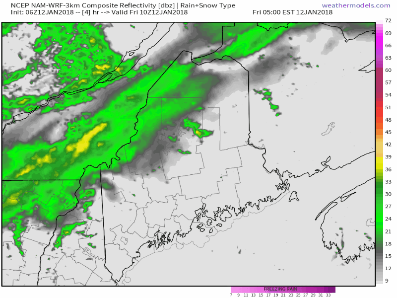 Futurecast radar idea from the 06z (1 AM) NAM model run through Saturday afternoon shows all that is likely to happen over the state. Rain will be heavy at times during the day on Friday. Given the clash of warm and cold, it would not be a shock that there is a clap or two of thunder embedded in this in the afternoon leading into the overnight. It will be a bit on the breezy side with gusts in the 20-30 mph range over most areas, and upwards of 40 mph along the DownEast shorelines. The low along front is a brisk mover. Precipitation ends Saturday afternoon over southern and western areas, and by early evening over northern and eastern zones. The sun may actually make an appearance by sunset for western and southern areas, and the Bangor area may see some beams of it also. 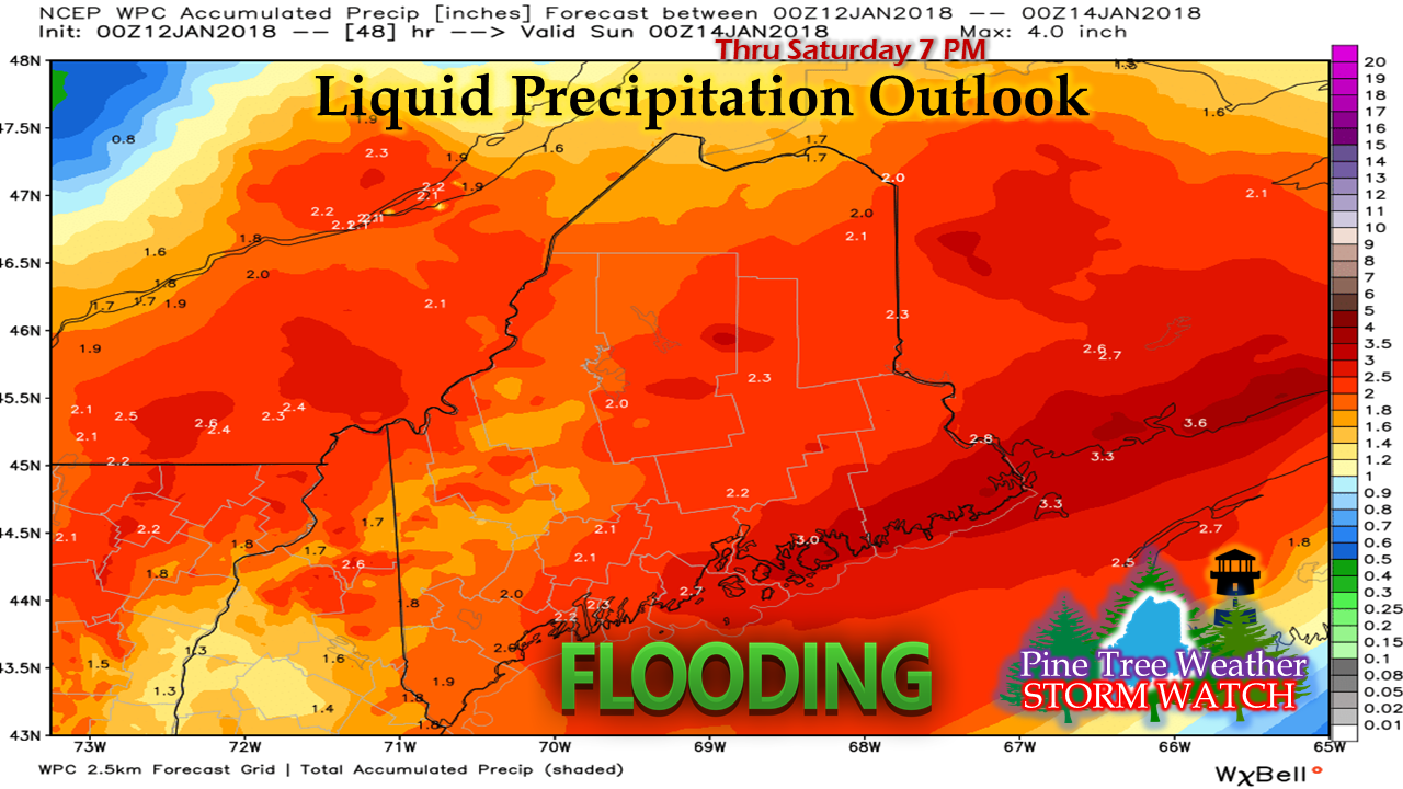 As I have been saying for the past couple of days, there is plenty of water associated with this frontal boundary. Flooding is certainly possible for rivers, brooks, and streams from any ice jams that develop from the runoff. Any clogged storm drains or ditches where culverts are plugged are likely to lead to localized flooding also. If dodging the puddles isn't enough, hydroplaning on the highways and byways are a concern, along with locally dense fog which will cut visibility into feet in areas through Friday night. A laundry list of Saturday issues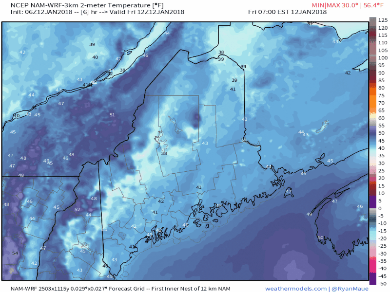 First issue of concern temperatures that are on track to crash overnight which will freeze all of the rain and runoff from Friday. With sleet and freezing rain playing a factor in overnight precipitation, roads will become greasy quick over interior areas. Coastal areas do not appear to fall below freezing until most of the precipitation is over Saturday afternoon, but travel will be hazardous once the mercury falls below 32° by around noon. 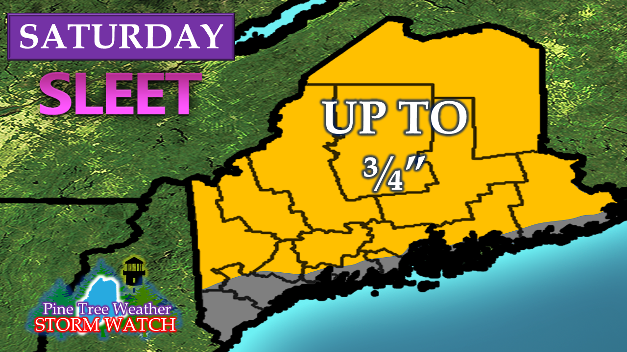 Sleet is likely to be a factor for much of the region with up to 3/4" possible. 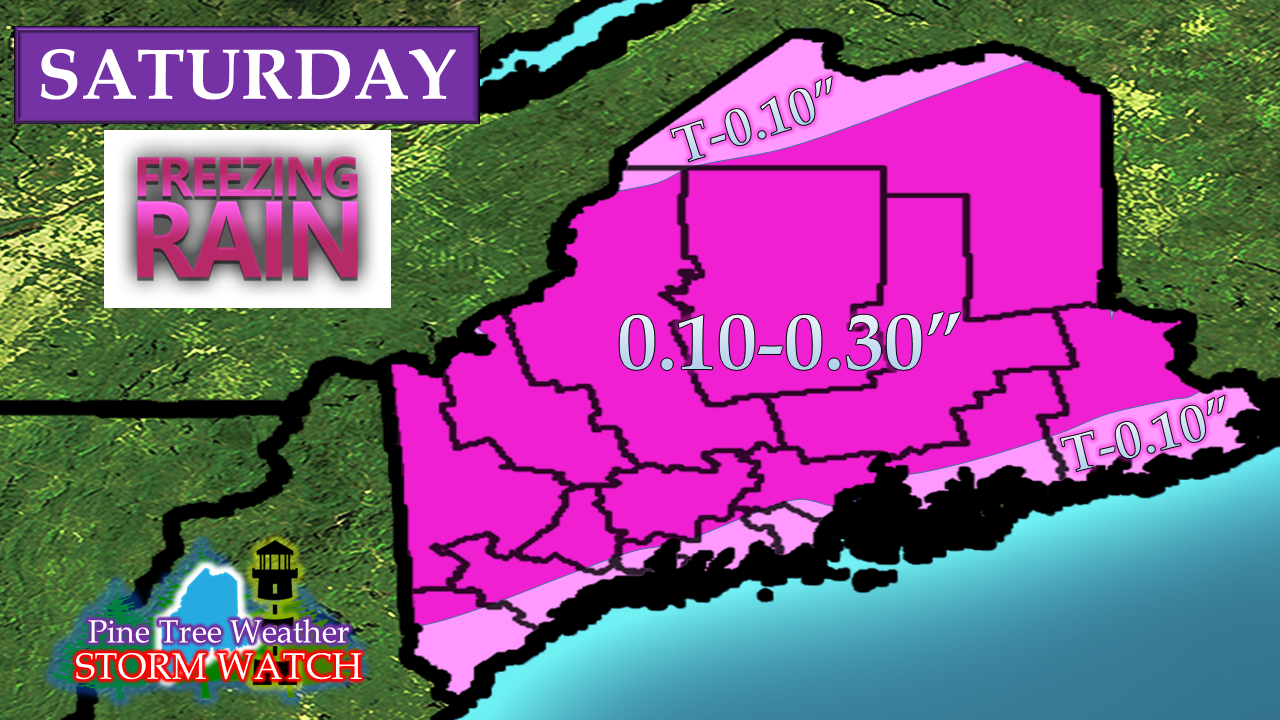 Sleet in combination with freezing rain will add insult to injury for road crews to keep the roads passable. 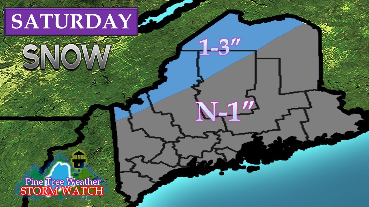 Given the frontal boundary stall close to the coast, snow is almost an afterthought in all of this with accumulations mainly along the international border. I will eat a bit of crow here as I was thinking the front would sag further south setting up more of a snow event over the interior based on the model runs of Wednesday. Guidance fooled me because it was not keeping up with the speed of the cold front advancement, which did not become noticeable to me until the Thursday morning model suites came out. Consequently, it will be more of an ice and sleet event for the interior. Expect hazardous travelWith all of these precipitation types in play here, it will take time for the road crews to treat the roads. Southern and western areas will see conditions improve by Saturday evening. Eastern and northern areas will see improvement Saturday night. Expect slick spots on secondary roads to be a common hazard going forward. Sidewalks and parking lots are likely to be skating rinks until properly treated. With all of this rain with the sleet and freezing rain there is going to be a lot of ice everywhere, and it is not going away anytime soon. Next chance for snow midweek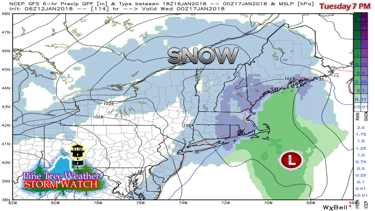 Sunday and Monday appear void of any precipitation. The next concern will be an area of low pressure that is on track to bring some snow to the region Tuesday into Wednesday. It's a bit early to get into details on this, but it does not appear to be a big event. I do have Body Shop Special concerns for southern areas in time for the Tuesday evening commute, as there may be enough snow on the ground to slick up the roads.
A much cooler 5-Day Outlook has been updated through Wednesday. Click on the tab on the menu to get you there. Please stay in touch with the National Weather Service for any bulletins and information in regards to this storm. - Mike |

Mike Haggett
|


