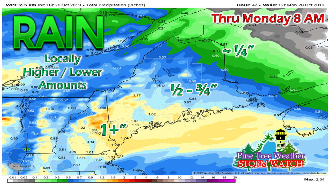
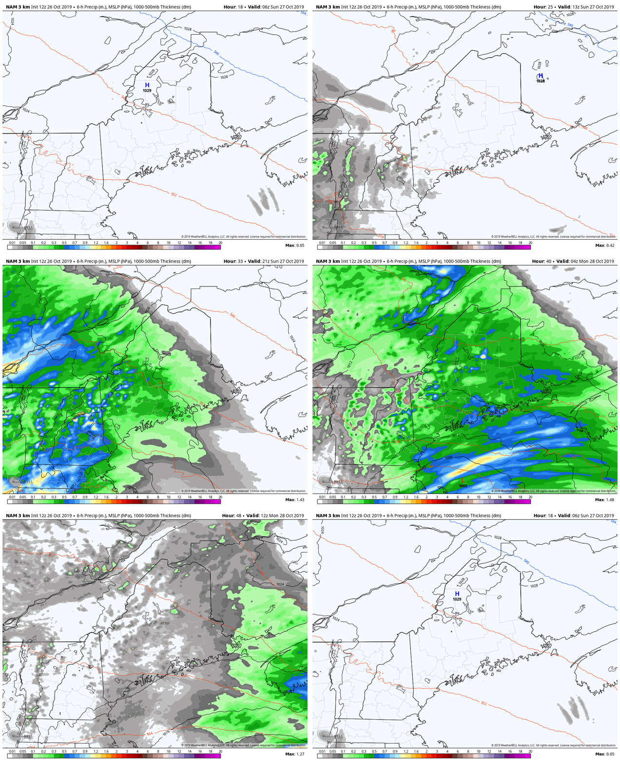
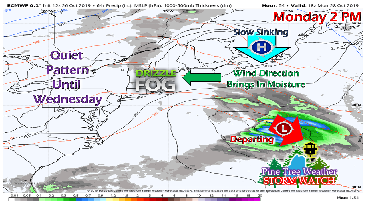
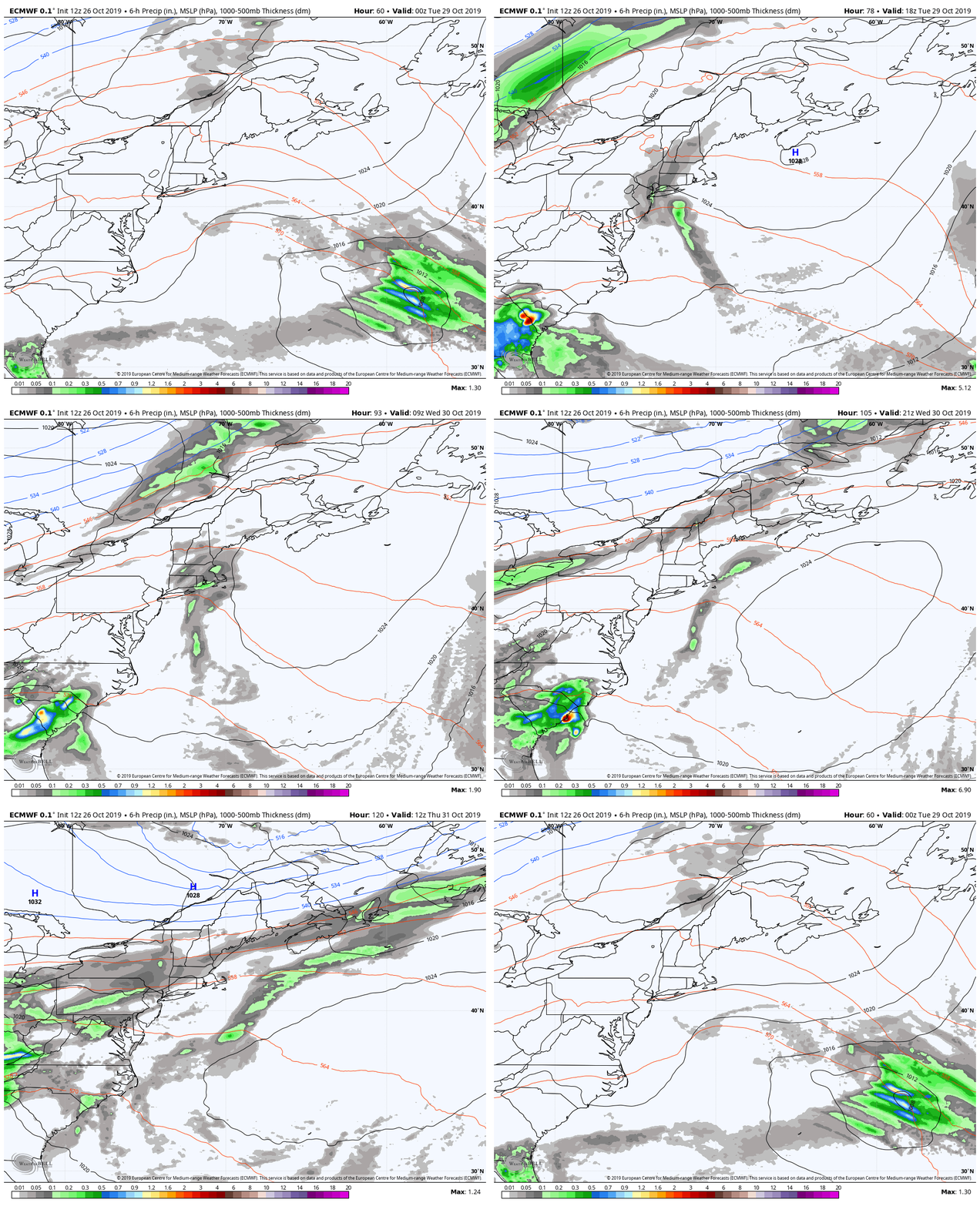
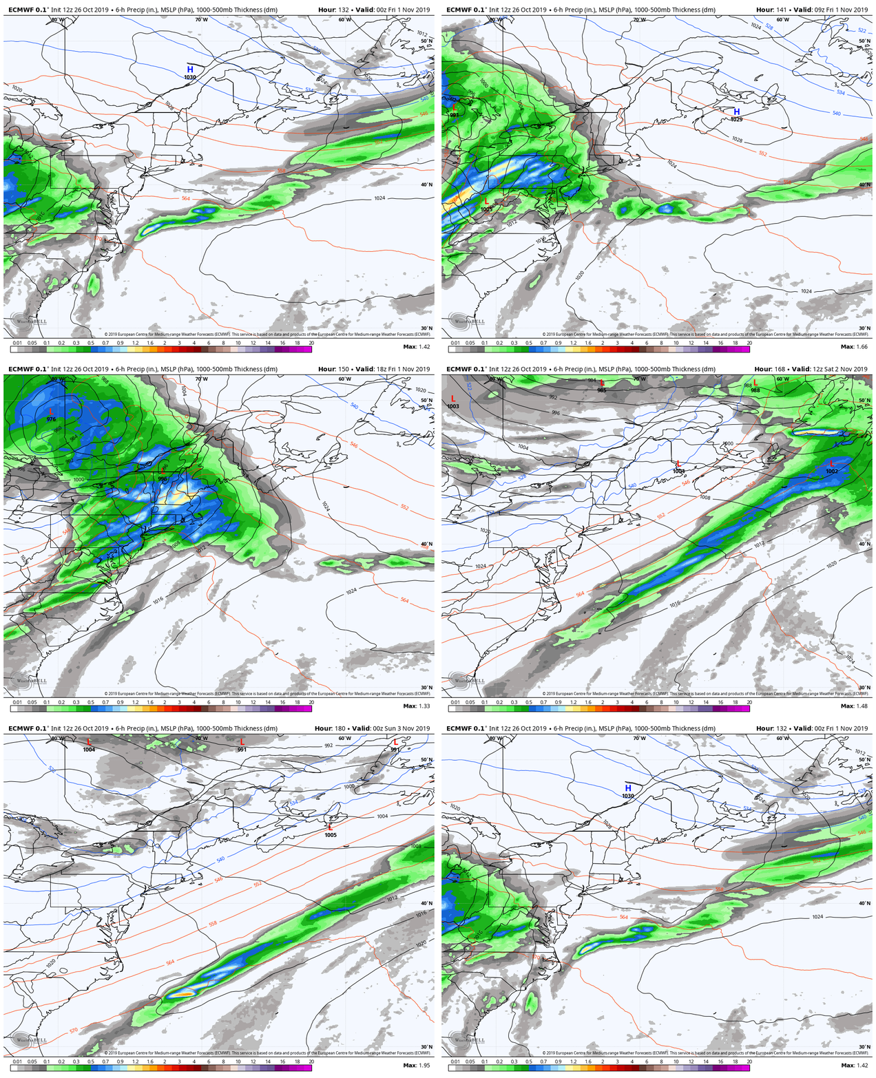
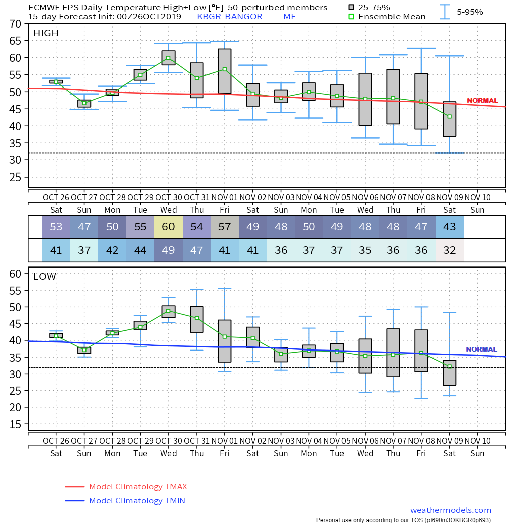
Time to throw a roast in the ovenSunday will be great day for indoor activities for the day. A little known fact: before I ventured into sports media and then this project, I was a professionally trained chef, and worked in some of the finer establishments in the Portland and Kennebunkport area before I got out of the business 20 years ago. It's days like this where I tap into my former life and fire the stove up for a good meal that gives plenty of tasty leftovers for the rest of the week. It will be another soaker for southern and western areas from the looks, with lesser amounts to the north and east by the time this wraps up early Monday. Rain begins over southwestern areas soon after sunrise, then expands to the northeast during the morning. Higher elevations above 2500 feet may see some snow early, but will change to rain as the morning progresses. It will be a breezy one with gusts 20-25 mph (35 mph shorelines) through much of the day. High temperatures for the day will generally be in the 40s to around 50° along the southern coast. Steady rain ends from northwest to southeast early Monday. Higher elevations may see some snow flurry activity before precipitation ends around midday. Outlook for the week: generally dampWe're headed into a new moon phase, and tides will be astronomically high during the course of the week. This may cause splash-over in the usual areas for high tides starting Sunday night and will run through the middle part of the week. After the Sunday storm passes to our southeast, high pressure slowly sinks south over the Canadian Maritimes. This sets up an easterly air flow, and consequently brings areas of drizzle and fog to the coastal plain. It will be damp and chilly through Tuesday. High pressure sinks towards Bermuda, then kicks up a southwest flow. A weak frontal boundary moves through the region Wednesday, and finally moves the fog and drizzle, along with a few showers associated with it out of the area Thursday morning. Our break from inclement weather will only be short lived, however. A Colorado Low ejects into eastern Quebec and drags a long wave frontal boundary along with it. For now the front appears to soak the region Friday, and then races northeast Friday night. Cold air drops down behind the front, and appears to give the region a cool, dry weekend to start November. Temperatures for the week will run above normal for most areas for the final days of October. November appears to start off near seasonal average.
What is your favorite things to do on cold, damp rainy days? Leave a comment on Facebook or tweet me what you like to do! ► ► For the latest official forecasts, bulletins and advisories, please check in with the National Weather Service in Gray for western and southern areas, or Caribou for northern and eastern parts of Maine. ► ► DONATION DRIVE UPDATE - $840 shortfall for the year ahead! You can help keep Pine Tree Weather going with a donation of any amount now through VENMO @PineTreeWeather, a monthly donation on Patreon or messaging me on Facebook or Twitter to send a check in the mail. Thank you for your support! For more information from me, please check the Pine Tree Weather Facebook page as well as my Twitter feed. Always stay weather aware! - Mike |
Mike Haggett
|

