
A mild Sou'Easter storm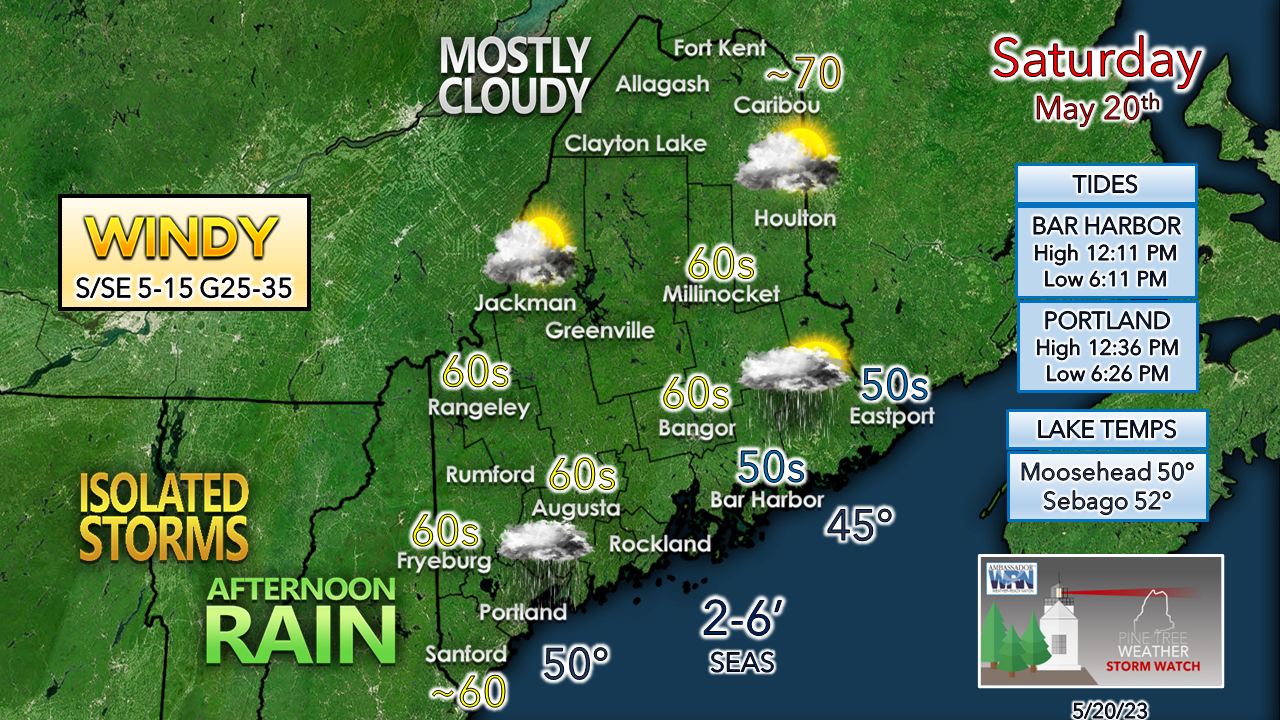 For those with outdoor work or recreational plans, it would be best to get that activity done in the morning over the southern two-thirds of the state. Northern areas stay dry after an early morning shower until Saturday night. A south / southeast wind picks up this morning and the breeze becomes stiffer in the afternoon. There is a slight risk of thunder for southern and MidCoast areas with this system given the tropical connection. All it may amount to is a couple rumbles and heavy rain. I am not expecting severe storms. We've dealt with worse sou'easter storms in the past than what this one is expected to turn out to be. It does supply some much-needed rain for the region since the faucet shut off back on May 5th. 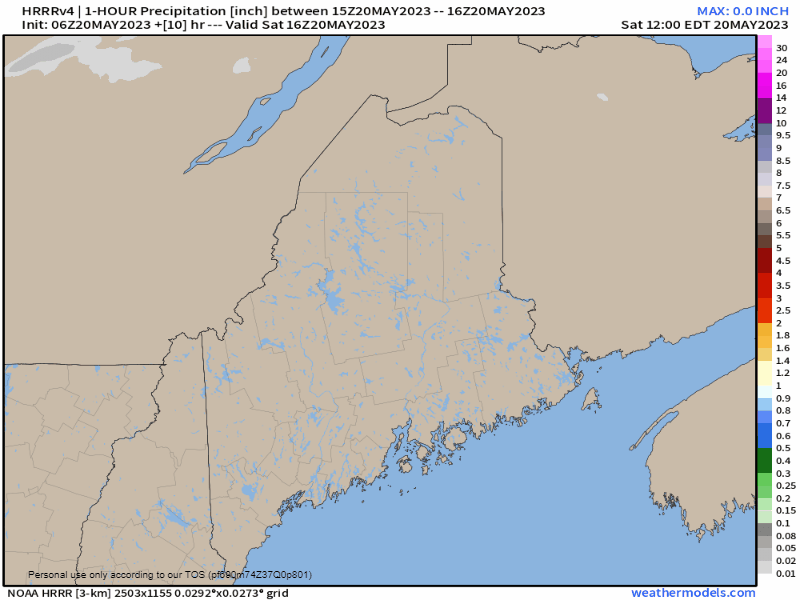 Saturday Noon to Sunday Noon - This is one hour precipitation estimate to get a better read on when it will start, when it will end, and potential for rain intensity. This isn't to say some outflow sprinkles or light shower activity may start before then. The morning hours appear dry, but that shifts into the afternoon. Showers become more numerous heading into the evening hours and reach the far north by around midnight. Showers end quickly over southwestern areas just after sunrise Sunday morning and clear out over the north and east by midday. There is a risk of an isolated shower Sunday afternoon for the north and the west. 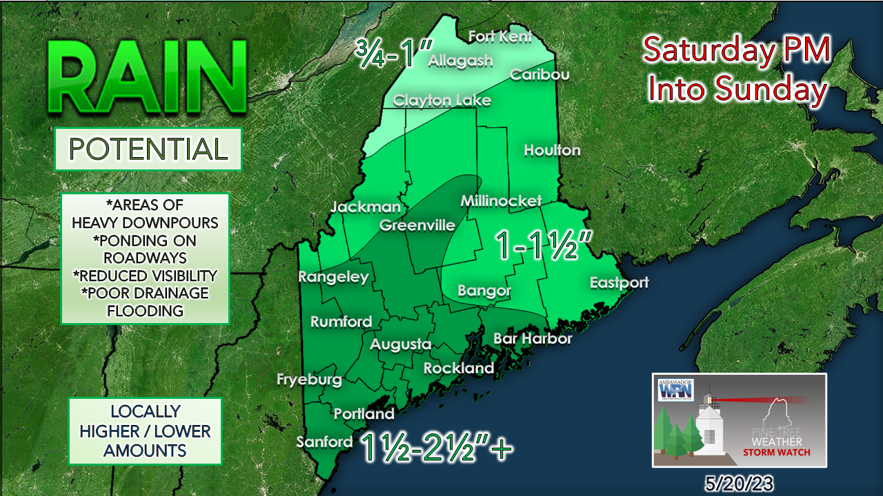 Total rainfall amounts have increased, but given the dry stretch, no major flooding issues are expected. There could be some nuisance flooding from usual poor drainage areas and potential for urban street flooding with downpours. Astronomical tides are occurring with the new moon. This may cause some splash-over to occur along the low-lying shorelines with the overnight high tide between midnight and 1 AM, but otherwise I am not expecting any issues of significance. Frost potential for the interior Monday night For folks around the Route 2 corridor and northward, you're now on notice to cover up any vegetation of importance Sunday night. Growing season officially starts on Sunday for the western mountains, so NWS bulletins will be issued there. Keep the coverings handy... patchy frost is possible once again Monday night. Pine Tree Weather is funded from followers like you. I would appreciate your financial support. Click here for how you can contribute. You may not like the weather, but I hope you like what I do! Please hit the like button on Twitter and Facebook, and share! I sincerely appreciate your support! Stay updated, stay on alert, and stay safe! - Mike NOTE: The forecast information depicted on this platform is for general information purposes only for the public and is not designed or intended for commercial use. For those seeking pinpoint weather information for business operations, you should use a private sector source. For information about where to find commercial forecasters to assist your business, please message me and I will be happy to help you.
|

Mike Haggett
|


