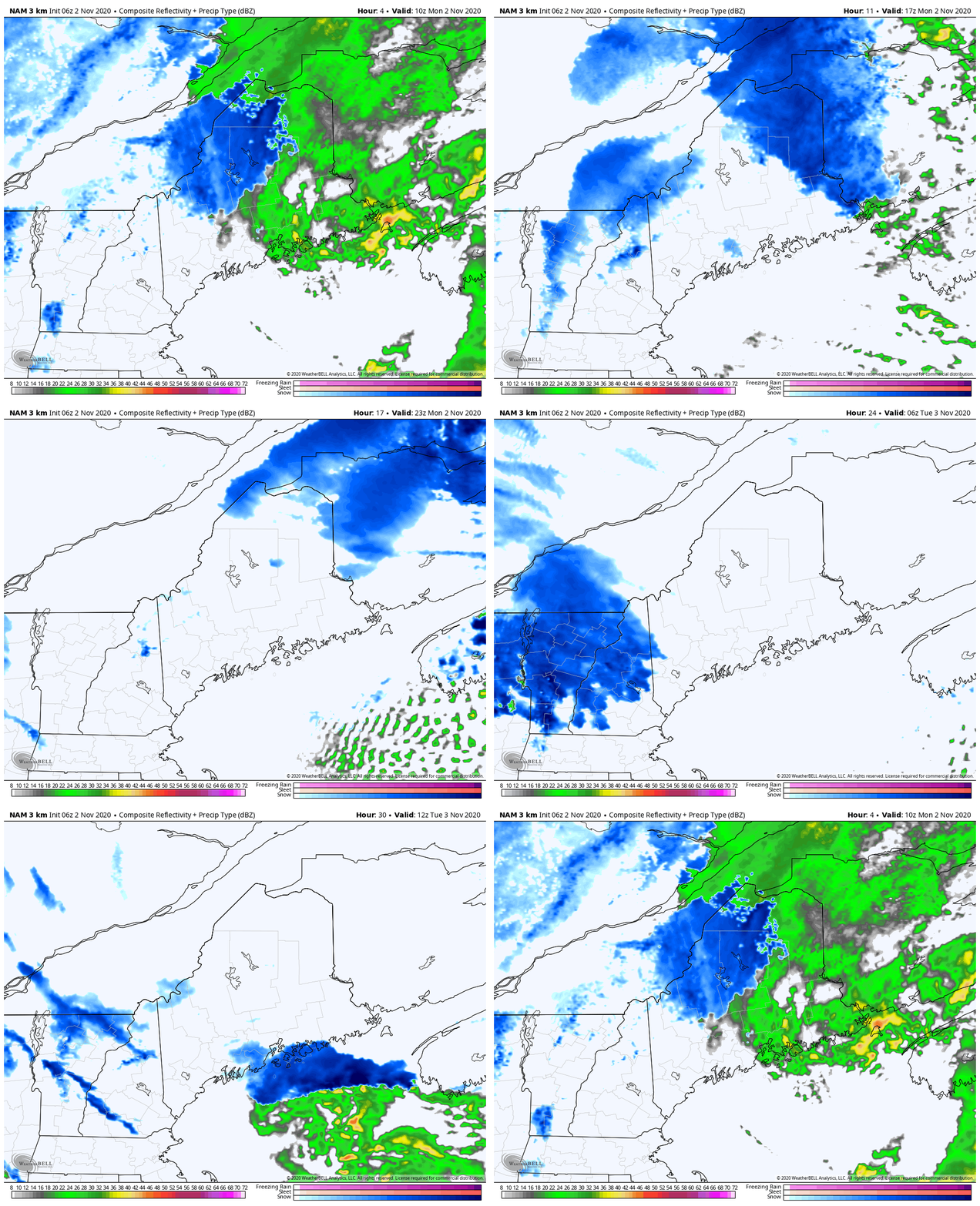
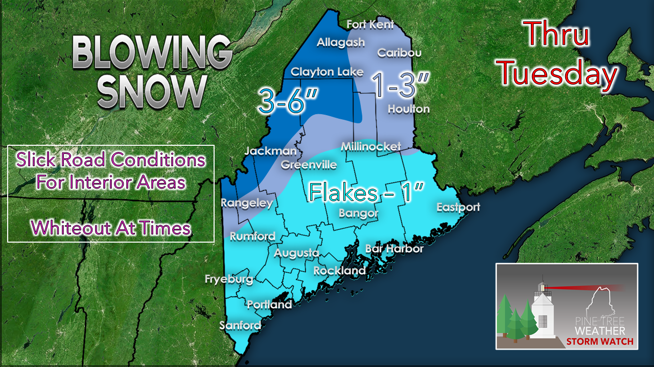
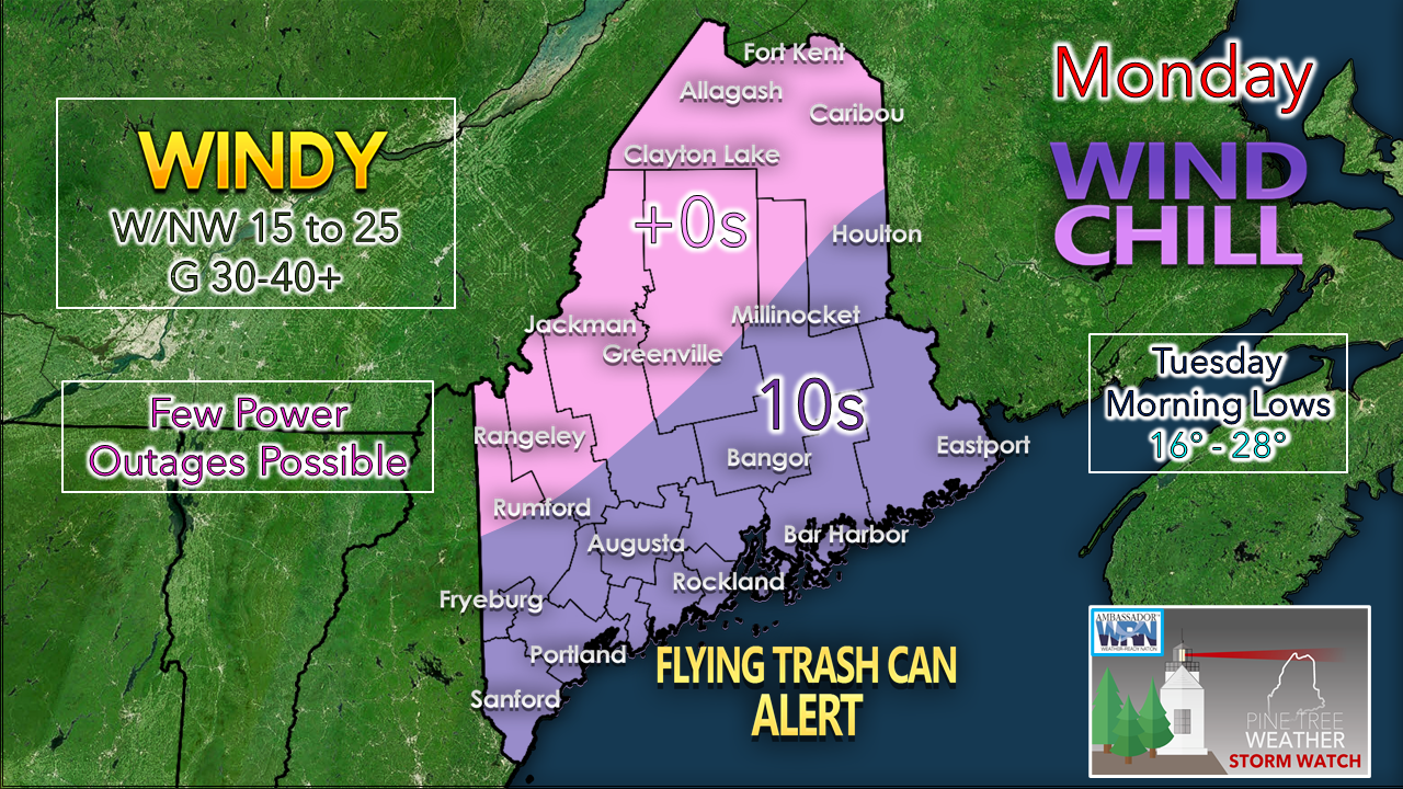
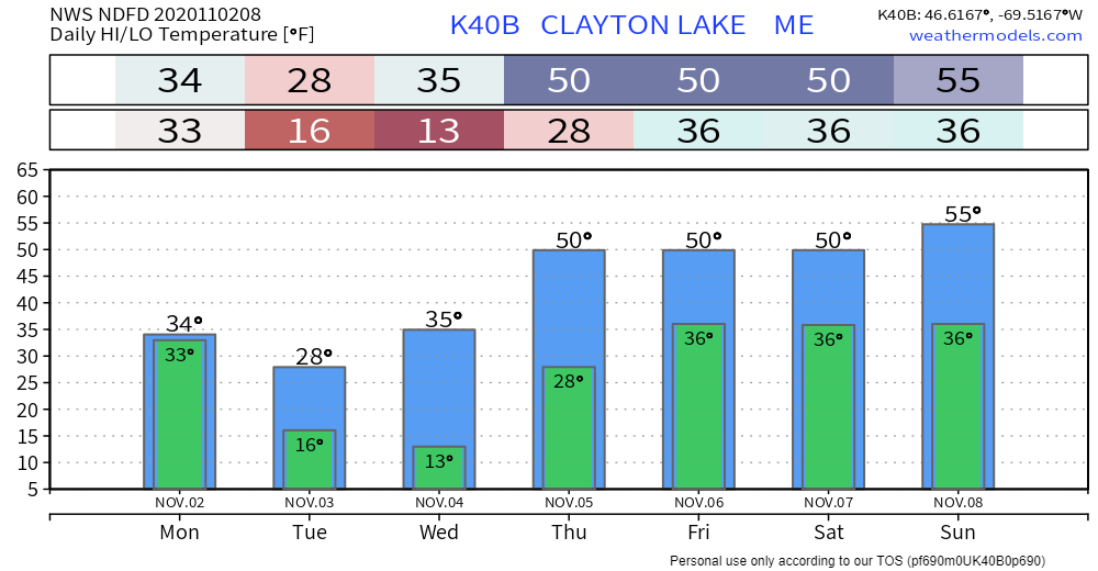
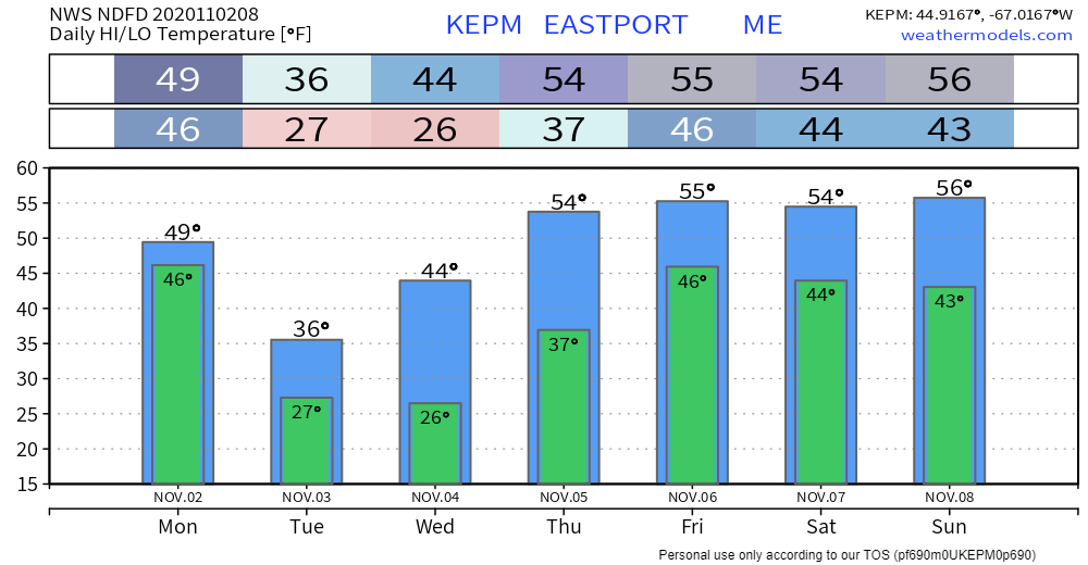
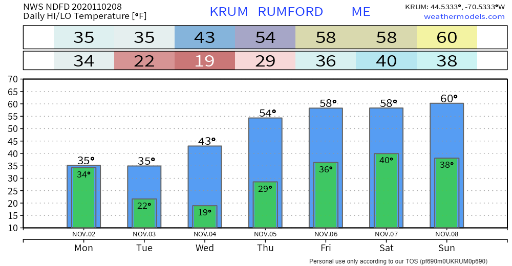
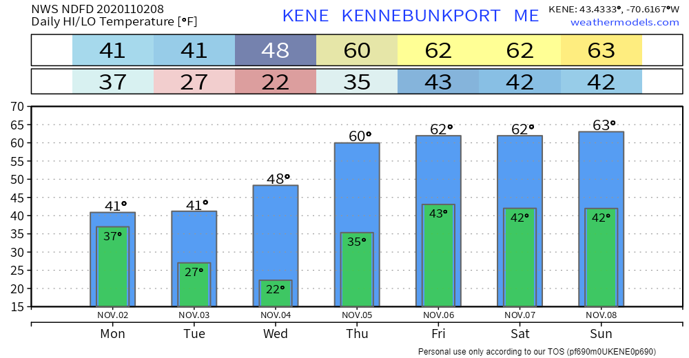
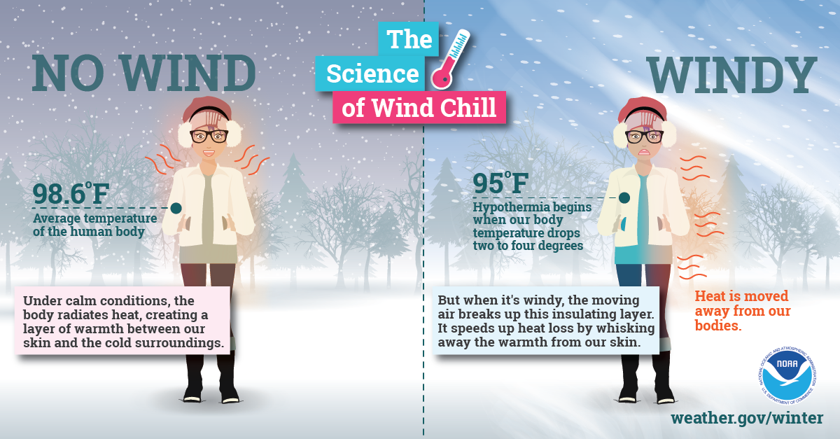
Rain changes to snow for the northMost of the precipitation action for the day is in the north. Low pressure over the Bay of Fundy is intensifying as it is moving northeast. The storm is hauling down bitter cold air from Quebec. Any areas seeing rain will see it change to snow this morning as atmospheric temperatures fall. Precipitation tapers off in the north country by early evening. A weak disturbance passes through southern, western, and MidCoast areas early Tuesday morning, and appears to clear out by mid-morning. The most snow falls along the international border with Quebec and the higher peaks, with lesser amounts toward the coast. Windy conditions will be the main concern for the region. Gusty conditions over southern areas may be strong enough to cause some spotty power outages. As the wind increases, wind chill values drop. Indices shown here of what the air could feel like this afternoon. Bundle up! Temperature outlook through SundayThe region appears to stay mainly dry after the current round of weather departs. Northern areas may get some light rain or snow shower activity Wednesday as a warm front moves in. Temperatures rise to well above normal levels with 50s and 60s for highs for the weekend. The science of wind chillWith little wind, your body is able to maintain a thin layer of warmer air between your skin and colder air surrounding you. However, higher winds can eliminate that thin layer, and your body can begin to cool at a dangerously fast rate. Visit weather.gov/safety/cold for more winter science! Be prepared to receive alerts and stay updated!
For more information, please follow Pine Tree Weather on Facebook and Twitter.
** FUNDING NEEDED FOR 2021 ** Thank you for supporting this community based weather information source that is funded by your financial contributions. Stay updated, stay on alert, and stay safe! - Mike |
Mike Haggett
|

