
A bit damp to do the civic duty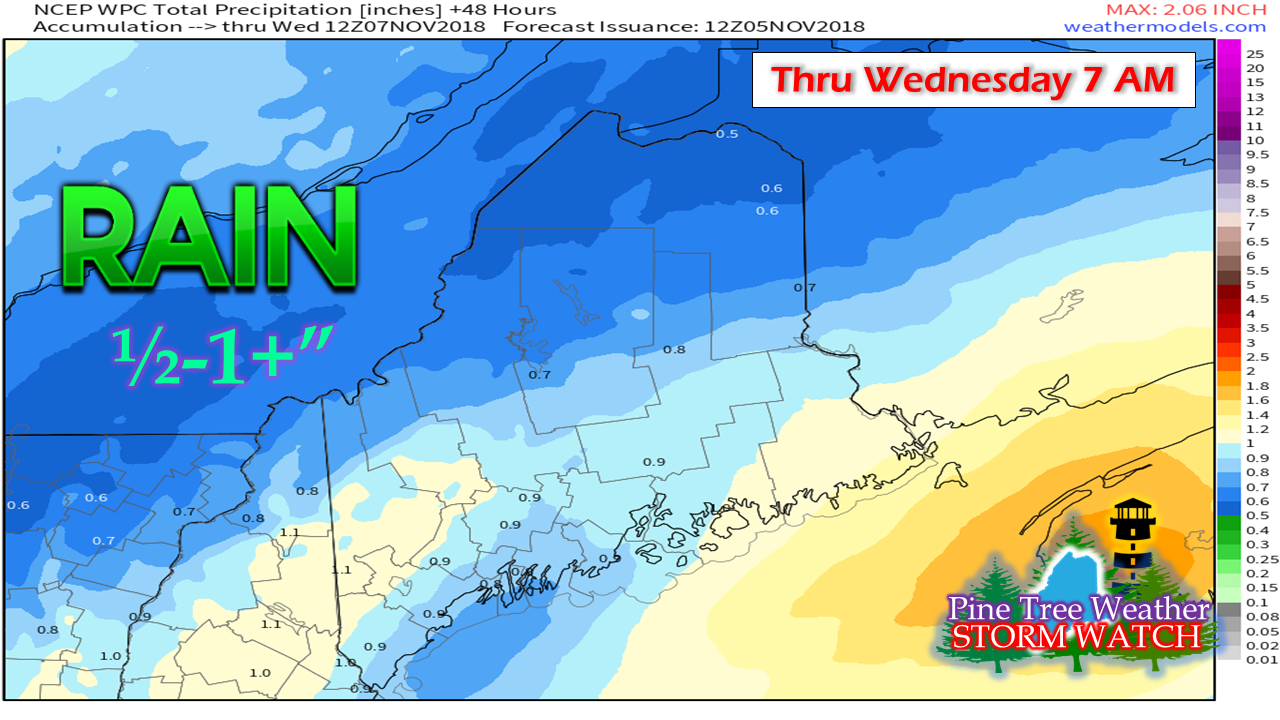 While it will be on the raw and nasty side, I hope that all of you will get out and do your part on Election Day. I keep away from politics on this website and my other social media because I am tired of the things that divide us. At the end of the day, we are human beings trying to make the most of the situations we are in. This community was started back in 2011 with the idea of bringing people together to help one another during the rough times. Many of you long timers know of my own personal struggles and issues I've had in my life. Some of you have shared yours with me. I can't help people if I am too busy with dividing and alienating them over political opinion. I take it and leave it at the ballot box, where it belongs. I hope you will do the same.  It will be showery for most of the day with some dry pockets here and there as the day unfolds. Most areas appear to get one half to a full inch of rain out of this. A bit of a breezy along with temperatures in the 30s north to 40s south will make it rather unpleasant, but it's easy to shovel... this time. Late week system could get the plows out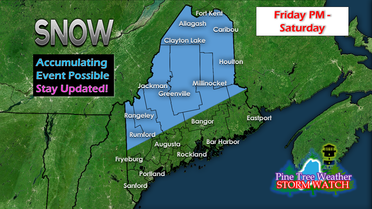 I mentioned this on Facebook Monday morning and the idea is still on the table. Models are differing on details, but the idea is there. I am already noticing some concern with the latest "upgrades" done to modeling in regards to cold air. Those issues aren't anything new, but it is just trying to see what has changed and what "improvements" were made. 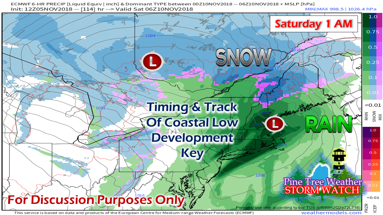 My hunch is guidance is running warm with this one, which sets up the question of where the rain/snow line sets up. The wildcard in all of this is the timing and track of the coastal low. Closer to the coast sets up potential for the snow line to be more inland, further away from the coast, snow possibilities come closer to the shorelines. For now, the mountains, northern foothills in western areas along with the north is a good place to start. We'll see how it unfolds and fine tune it as the weekend approaches. Outlook Through Saturday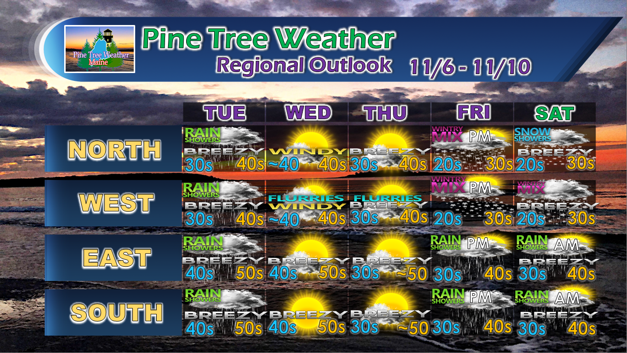 The forecast for late week is the best idea for now. Stay tuned.
For the latest official forecasts, bulletins and advisories, please check in with the National Weather Service in Gray for western and southern areas, or Caribou for northern and eastern parts of Maine. For more information from me, please follow the Pine Tree Weather Facebook page and my Twitter feed. Please consider making a donation to keep Pine Tree Weather going through the year ahead. My data cost expense is increasing. The operation is 70% funded and needs your help to get through the winter. You can set up a monthly pledge on my Patreon page or send me a message from the Facebook page or direct message on Twitter to get my address to mail a check or set up bill pay. Always stay weather aware, and thank you for your support! - Mike |

Mike Haggett
|


