|
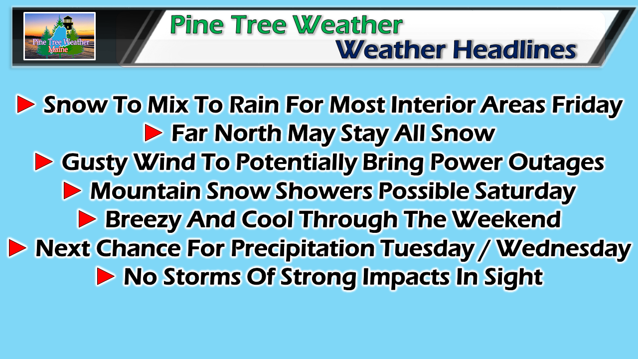
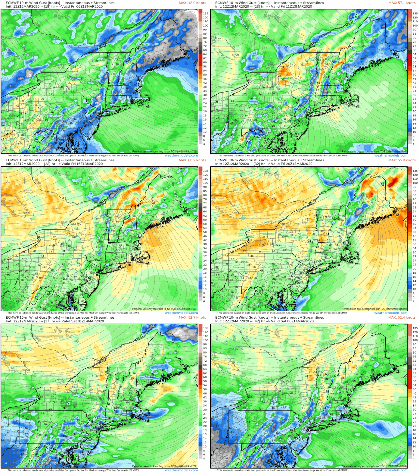
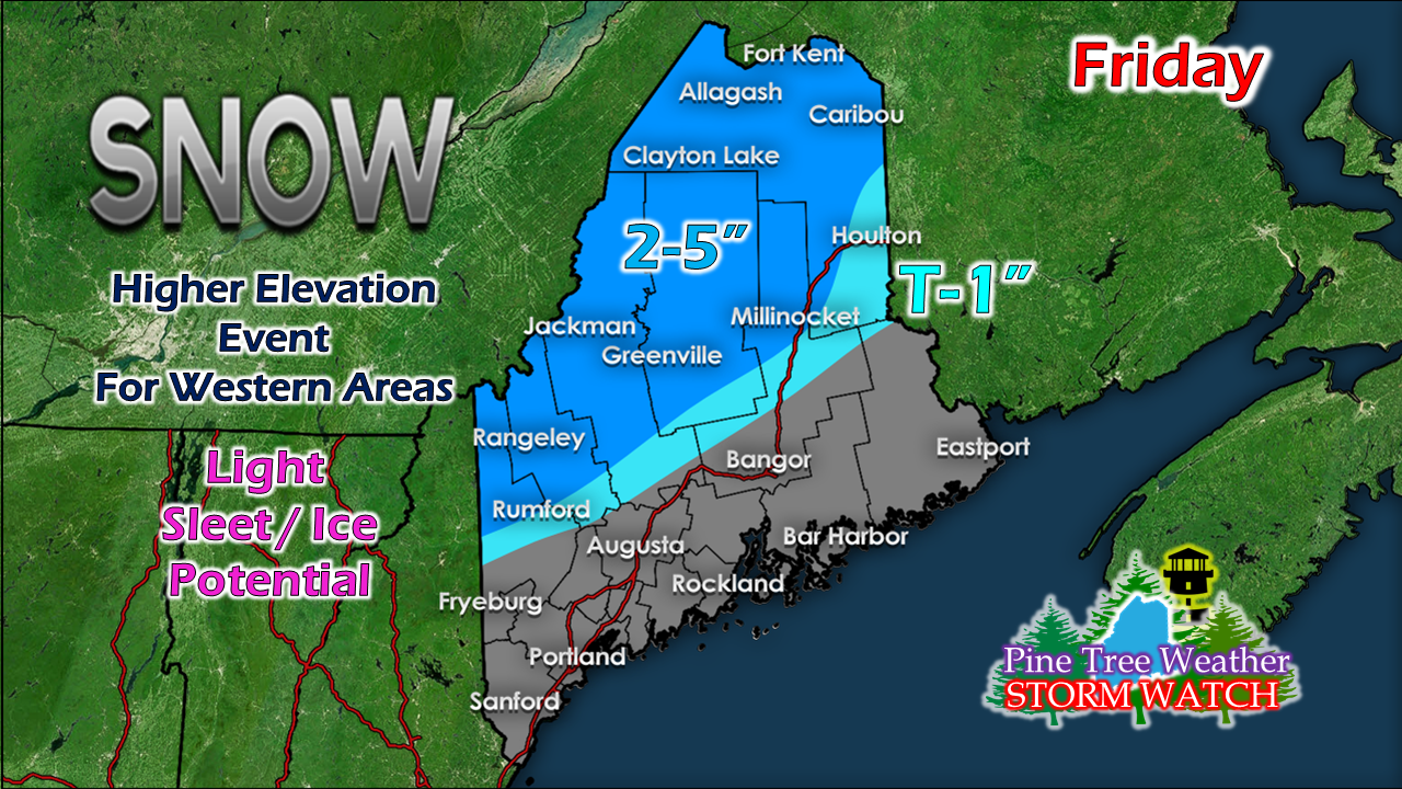
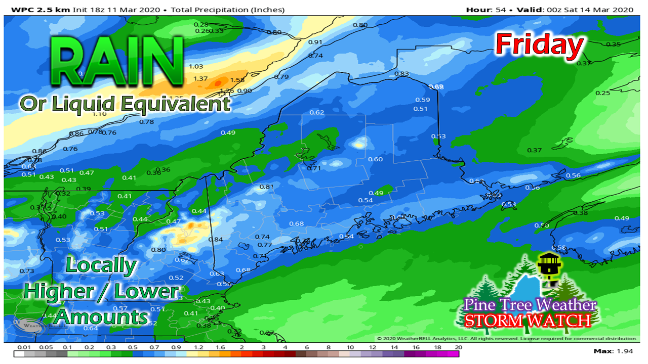
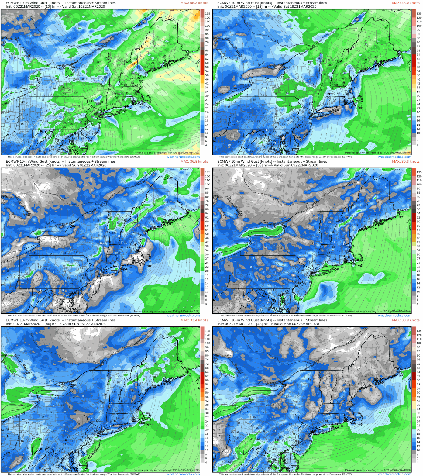
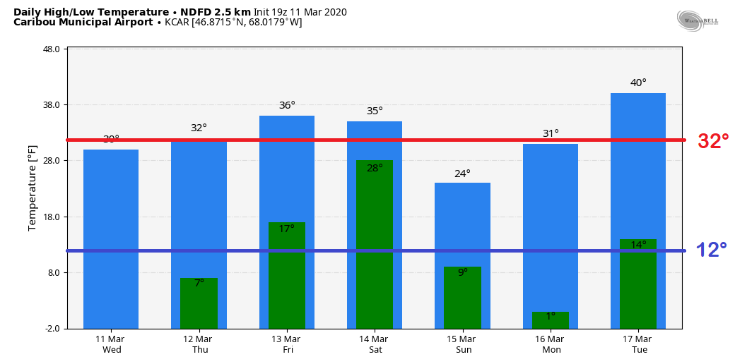
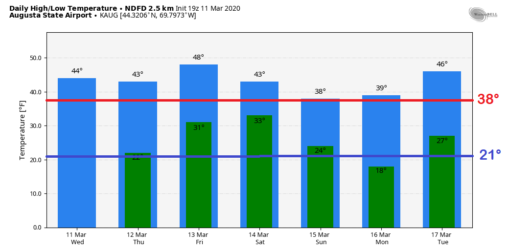
The calendar is heading into mid-March and the pattern resembles early April with temperatures and precipitation type. Above normal conditions appear to continue for the foreseeable future. Looking longer term, April and May may be a bit cooler and damp than normal, but as I was reminded by one astute Twitter follower, our springs of late always appear that way. I am still not quite ready to declare winter over for the coast of Maine just yet, but with each passing day, it grows less likely of a snow event of any impact, for now. My seasonal benchmark points of St. Patrick's Day and April Fools Day remain in the forefront of my mind. Looks like we'll clear the Irish holiday with a light snow/rain event, and we'll see if the annual April Fools storm comes along to bring a surprise. Quick mover to blow through the regionExpect a few greasy spots over the western mountains and foothills Friday morning. The snow starts piling up over northern areas by mid-morning. As a secondary low forms along the warm front, that brings in the mix and then rain to end over western areas Friday afternoon. Northern areas see the last of the flakes depart by roughly 9-11 PM Friday night. Snow showers are expected to fire up Saturday morning for the mountains and continue through Saturday evening. No real changes to thinking here. This appears to be a wet slop for most. Higher elevations in western areas are likely to get accumulating snow. The valleys, not so much. Best chance for precipitation to stay all snow is over the rooftop of the state. Any mixing is likely to be short lived and does not appear to cause any additional impacts than the wet snow already on the ground. For the coastal plain, it's fair to expect ½-1" of rain out of this through Friday evening. Wind a concern for higher elevations and shorelinesFriday will be a windy day on top of the precipitation on the way. Gusts from the southeast could reach 30-40+ mph for the shorelines and higher elevations before the wind shifts to the northwest behind the low Friday afternoon. This wind may be strong enough to cause some power outages in areas. The wind settles down somewhat Friday night, but expect breezy conditions to continue statewide through Sunday. Temperature outlook through TuesdayThe normal average continues to creep northward as we work closer to spring. Caribou here appears to run a few degrees above normal for the period, with Sunday being the chilly exception. For Augusta, at or above normal temperatures appear to be the rule through Tuesday, with a couple chances to reach the upper 40s.
Feel free to use the many pages available on this website for many types of forecasts on rainfall, snowfall, marine, longer range CPC outlooks and maps. ► ► For the latest official forecasts, bulletins and advisories, please check in with the National Weather Service in Gray for western and southern areas, or Caribou for northern and eastern parts of Maine. You can help keep Pine Tree Weather going into the future with a donation of ANY amount now through VENMO @PineTreeWeather, a monthly donation on Patreon or messaging me on Facebook or Twitter to send a check in the mail. Thank you for your support! Always stay weather aware! - Mike |
Mike Haggett
|

