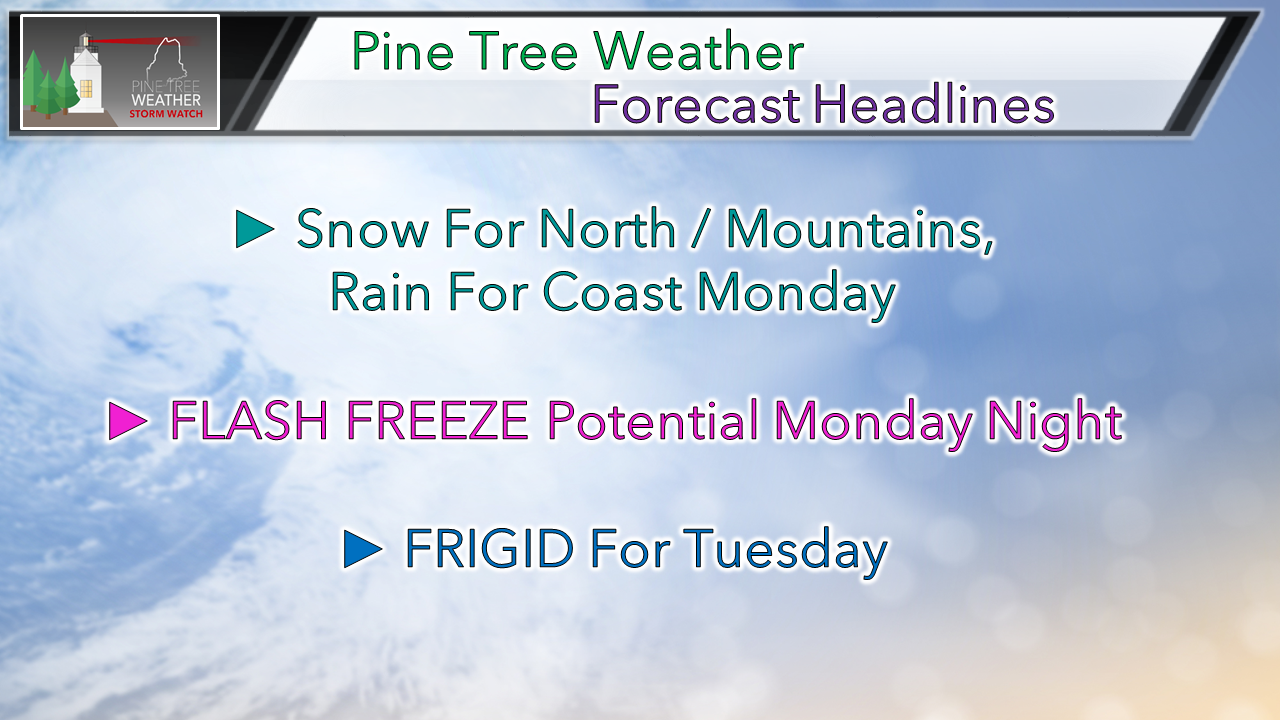
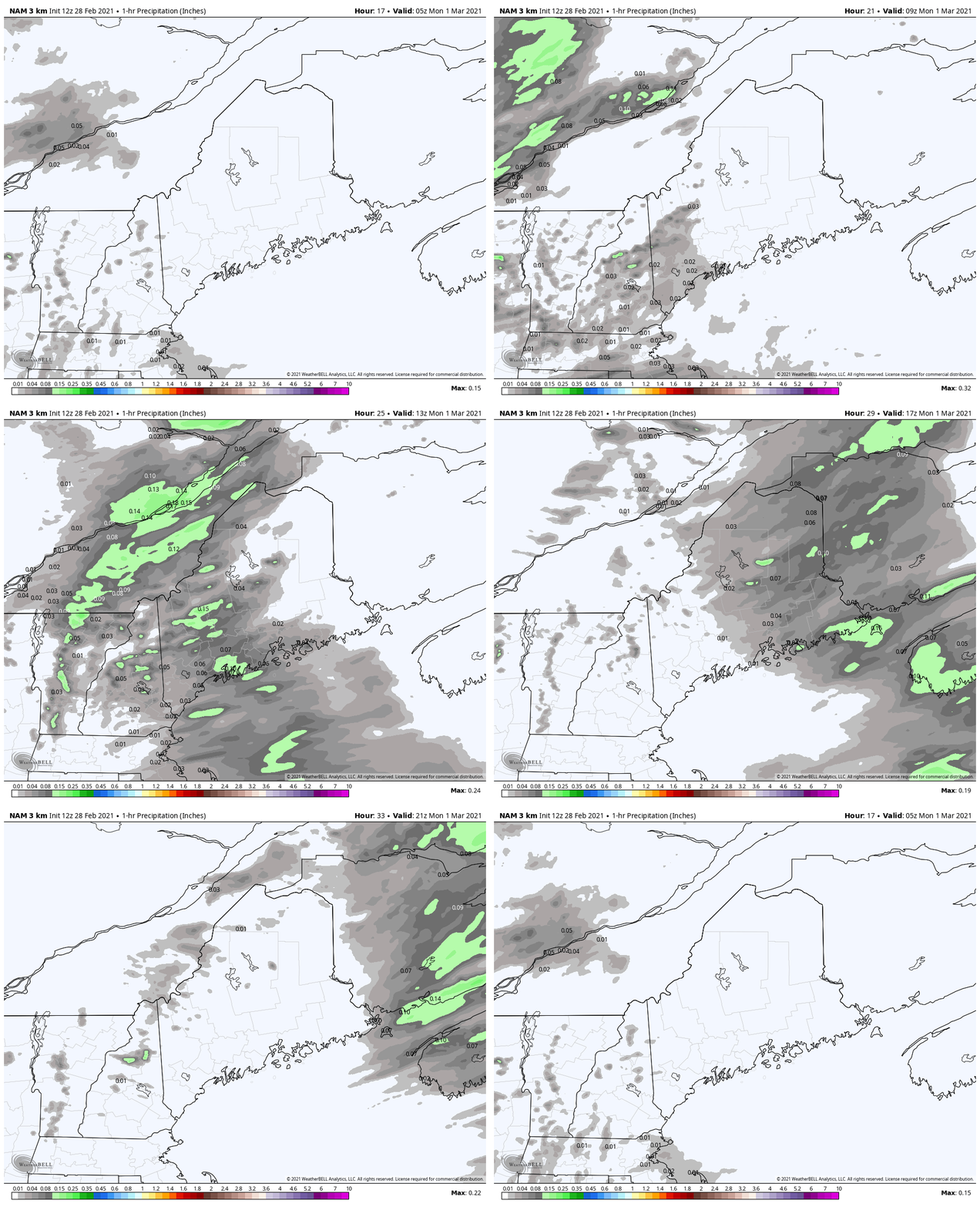
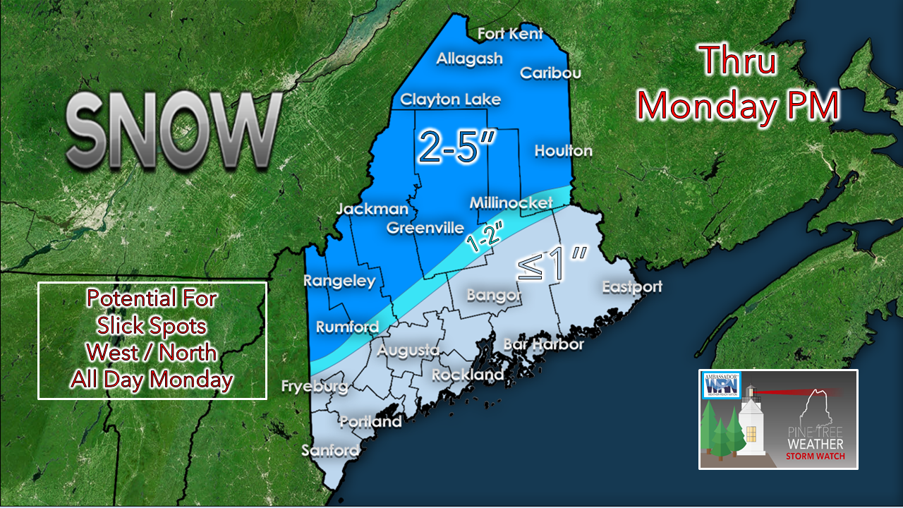
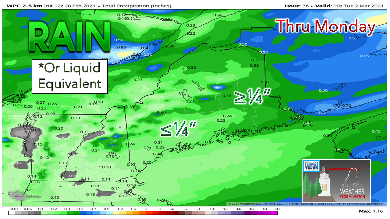
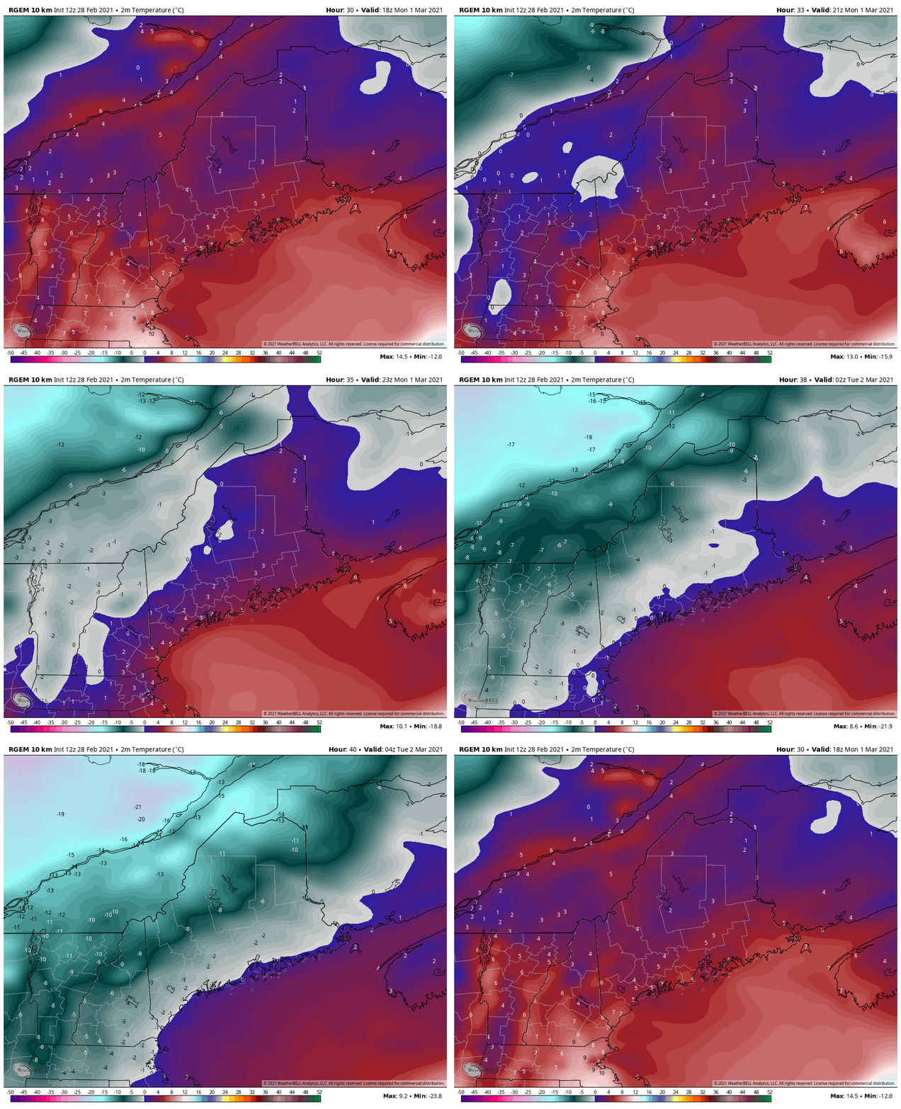
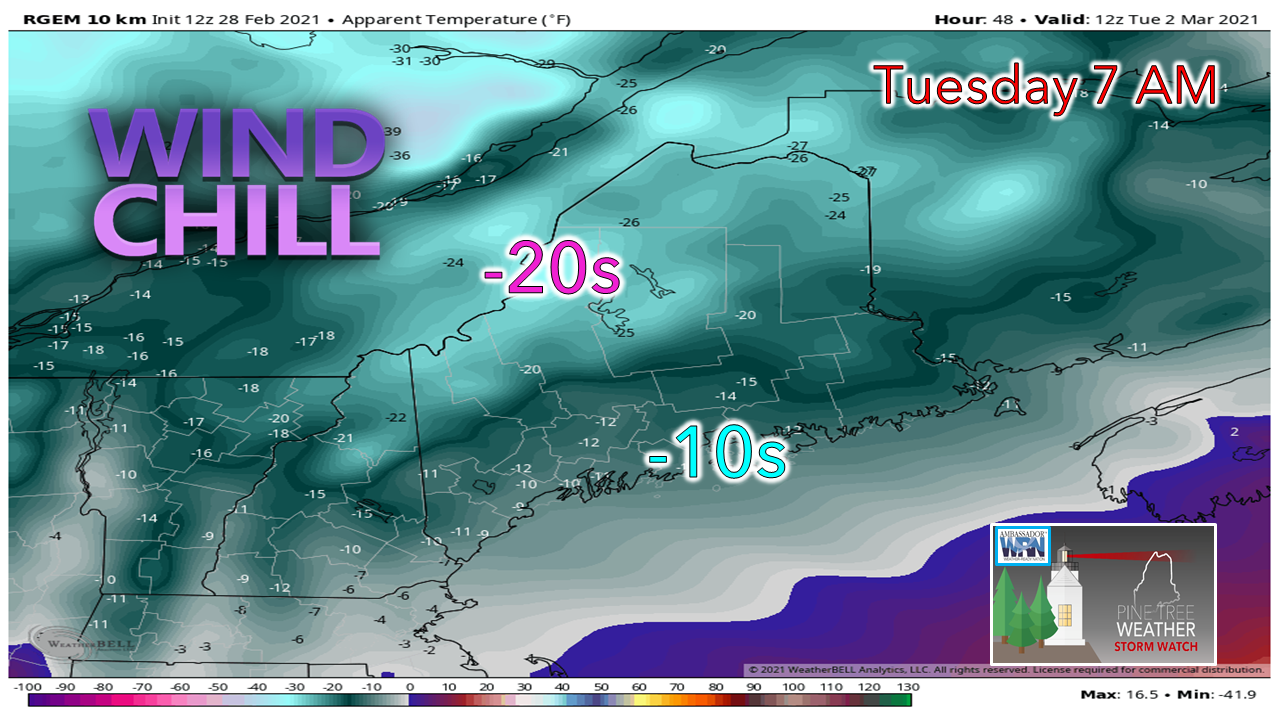
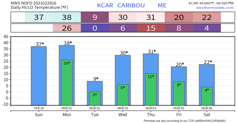
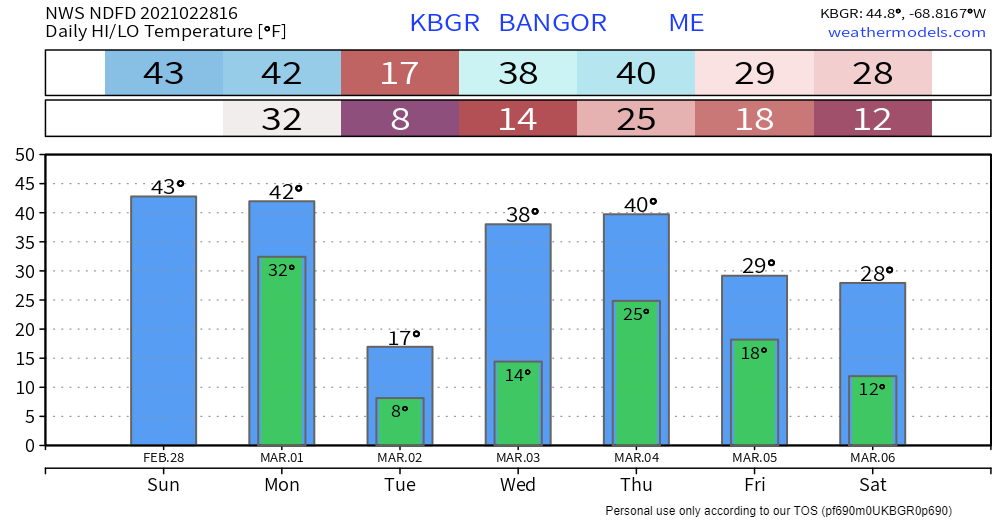
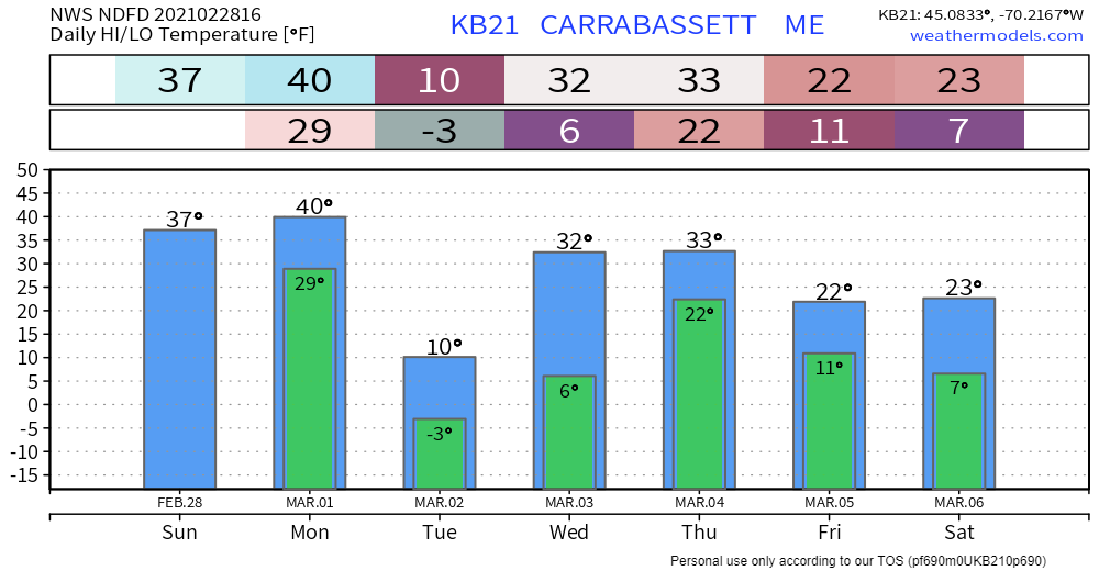
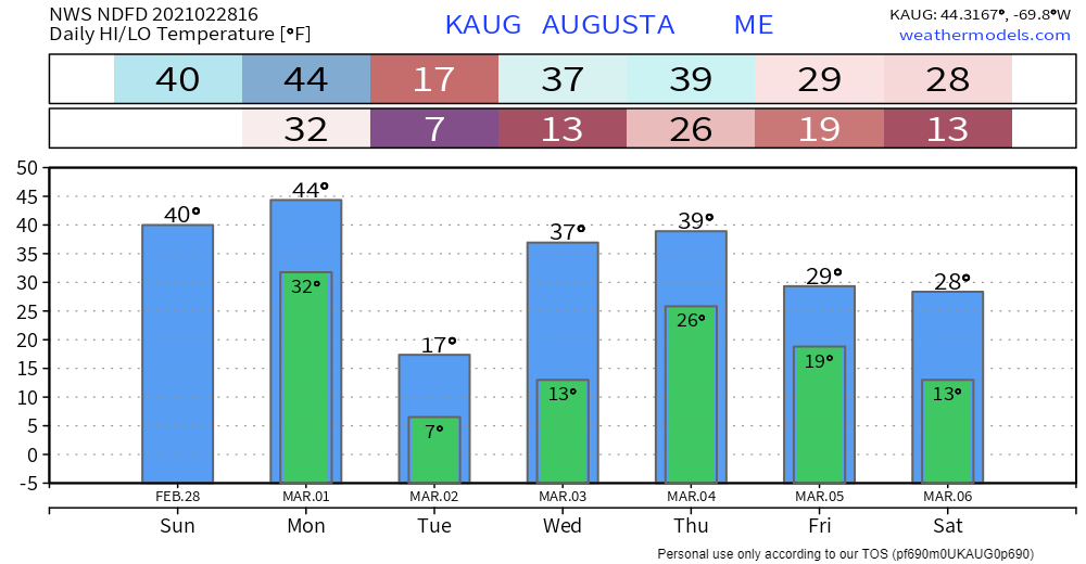
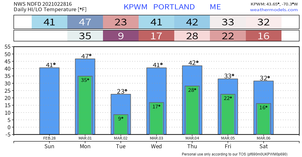
March roars inMarch 1st starts meteorological spring, which for us here in Maine kicks off silly season, where temperatures go crazy, and precipitation can go nuts also. To start the month, the thermometer will be the first to go berserk in the down direction. I am getting the chills just looking at guidance. Before we get to that, a bit of a mess to deal with on Monday. Timing and precipitation for MondayA strong area of low pressure cutting northeast across central Quebec drags a long wave frontal boundary with low pressure forming in the Gulf of Maine along that for Monday. By Monday morning 7 AM, western and southern areas will have precipitation of mainly snow for the mountains and rain for the coast. This moves to the north and east by around noon. Precipitation wraps up over southern and western areas by around the midday point, and over northern and eastern areas by late afternoon. Given the quick nature of the event, it won't give much time for accumulations of snow. Higher elevations get the higher amounts, as usual. A quick burst of snow is possible at times which may bring some brief whiteout conditions. Coastal areas may see a few flakes to start off with roughly an inch in spots, but this is a mainly rain event there. All in all, roughly ¼" of water associated with this, with higher amounts possible for the southern facing mountain slopes where that could add a couple bonus inches of snow for the higher peaks. Wind is not any real cause for much concern with gusts mainly in the 20 mph range (30 mph taller ski hills) during the storm itself. The speeds will increase from the northwest as an arctic front zips through the region Monday night. Flash freeze concerns overnight into Tuesday I will preface this model loop to say that these temperatures are in Celsius as that helps better represent the freezing point. That could happen rather quickly for areas that have seen mainly water from the storm on Monday. Add melting from the rain and temperatures above freezing Monday afternoon, this sets up flash freeze potential as everything freezes up Monday night, with all areas below freezing by 1 AM Tuesday. Along with the arctic blast comes the risk for snow squalls, so be aware of that if you are travelling Monday night. Switching gears back to Fahrenheit and adding northwest wind speeds at 25-35 mph... Tuesday starts off like a slap in the face. The mountains could get a wind chill advisory or warning out of this. For coastal areas, it appear to be bitter one. January in March... the arrival of silly season, indeed. Outlook through SaturdayAfter a quick trip to the ice box Tuesday, temperature whiplash reverses itself Wednesday bringing slightly above normal temperatures back through Thursday. A cold front passes through Thursday night, which may bring some mountain snow showers and cooler temperatures to wrap up the week. No storms of any significance appear likely in the near future at this point. Be prepared to receive alerts and stay updated!
For more information in between posts, please follow Pine Tree Weather on Facebook and Twitter.
Thank you for supporting this community based weather information source which operates by reader supported financial contributions. Stay updated, stay on alert, and stay safe! Thank you as always for your support! - Mike |
Mike Haggett
|

