|
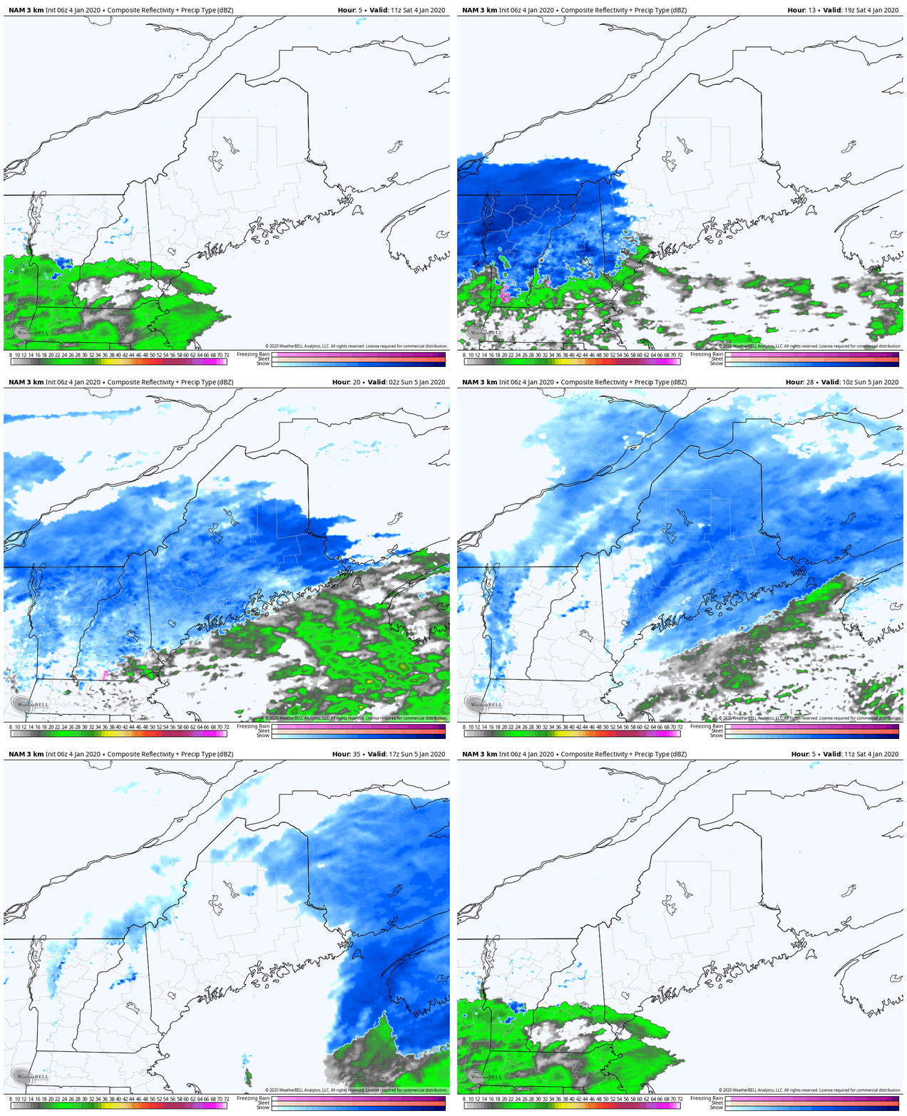
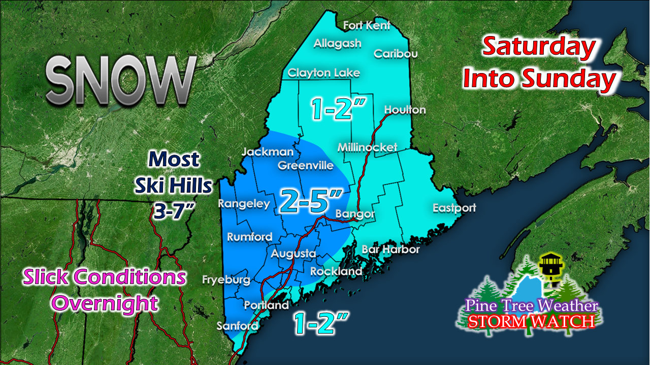
I've been quiet as I have been dealing with a stomach bug that has got me good. I have appreciated the messages, comments and tweets regarding my well-being. This thing can't pass fast enough. I am already tired of soup, crackers and Gatorade. Anyway, enough of that. Here's a quick update A nuisance event more than anythingA few rain showers are possible for southern areas Saturday morning with snow breaking out over western areas around midday. Precipitation spreads to the north and east through the remainder of the day. Snow continues overnight and tapers off from west to east early Sunday morning. This storm should have little impact on church services and any other Sunday daytime activities. The closer to the coast, the wetter the snow content is likely to be. Southwest coastal shorelines may get little to no accumulation. The further north, the fluffier the snow. Ski hills, this means you.
Since there is a rain/snow line involved here along with cold air damming over interior areas, I can't rule out the possibility of some patchy areas of freezing rain Saturday afternoon into early evening. I do expect all areas see snowflakes as the air cools and temperatures drop. Take it easy and allow for extra time to travel overnight into early Sunday morning. ► ► For the latest official forecasts, bulletins and advisories, please check in with the National Weather Service in Gray for western and southern areas, or Caribou for northern and eastern parts of Maine. I will update next when I can, which will hopefully be soon. - Mike |
Mike Haggett
|


