|
Before I get into the discussion I just want to say thanks to those who have passed along well wishes as I work through challenging times. The one thing I love about PTW is the community around it. While the main focus here is weather, I do share my life on occasion to keep everything real. School is going well overall, but it is challenging and demanding more of my time as our small class of ten are engaged in formulating forecast discussions for the city that we are forecasting for, along with discussing the situation ongoing, and post-mortem. I continue to learn a lot, which helps me here. Also, I am receiving a lot of interest from students at Penn State to work with me over the summer. I am excited about that. I'll have wonderful team that will work through the summer, and I will announce that over the coming weeks. I have some personal business in New Hampshire to take care of on Saturday. We do have a trailing storm behind this one on the way that rolls in Sunday night into Monday. I will try to post an update on that either here or on Facebook at some point over the weekend. Another snow / rain event Saturday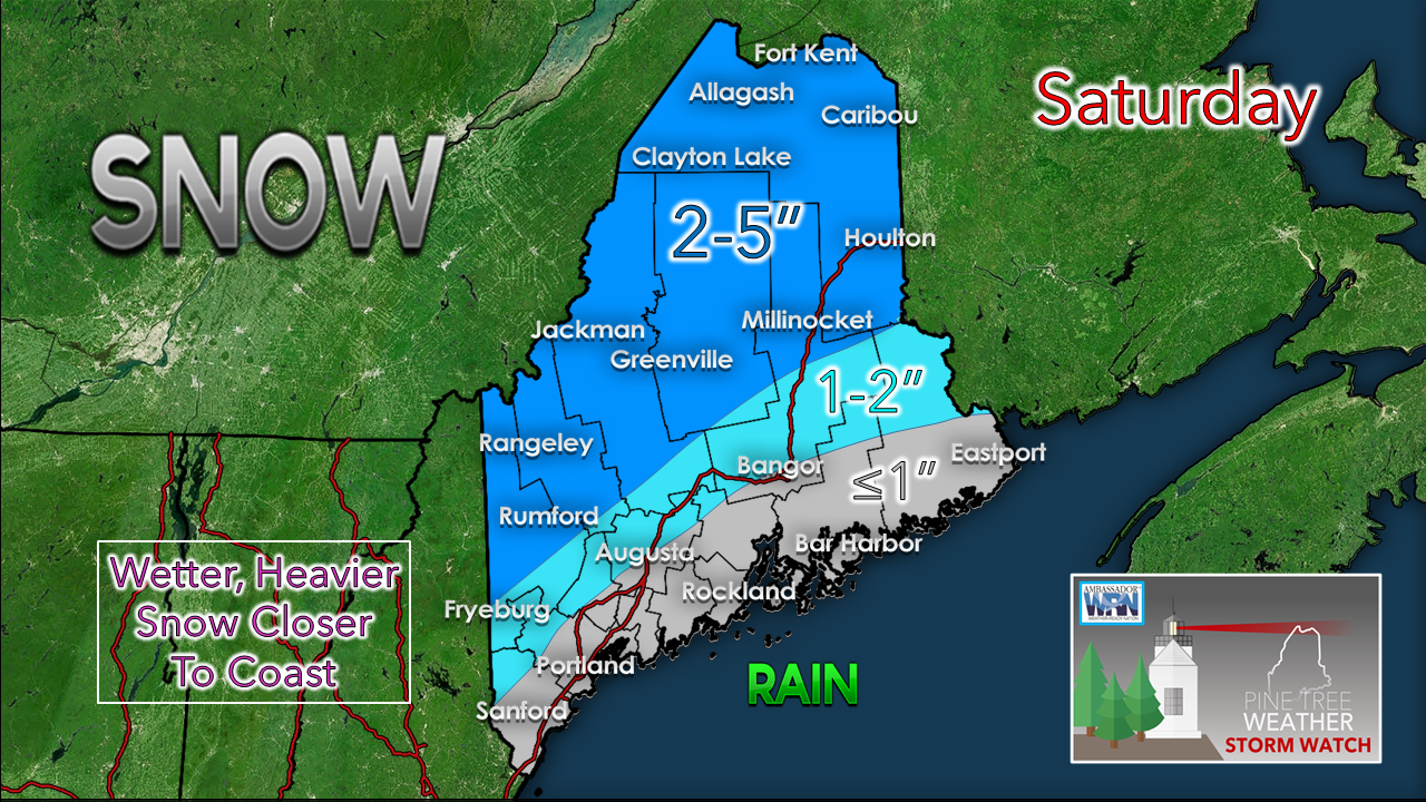 The good news here is this appears to be a storm of two types of precipitation as opposed to four. While I can't completely rule out a brief period of sleet or patchy freezing rain, that idea appears very low and short lived. Any snow that falls over the coastal plain on up into the foothills may be challenged to accumulate much due to high water content. This will be heavy, sloppy event, which may stick to trees and power lines from Fryeburg north into southern Aroostook. The further north, the drier the snow, and the higher amounts. Most of the ski hills will do well again with this event. The higher peaks could see 5-8" through Sunday as upslope snow showers generate on the backside of this. 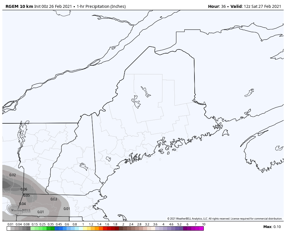 Looking at timing and the total precipitation picture shows the event starting over western and southern areas by around roughly 8-9 AM, ending in those areas by 5-7 PM. For eastern and northern areas, precipitation begins to fall around noon-1 PM and ends by 9-10 PM. 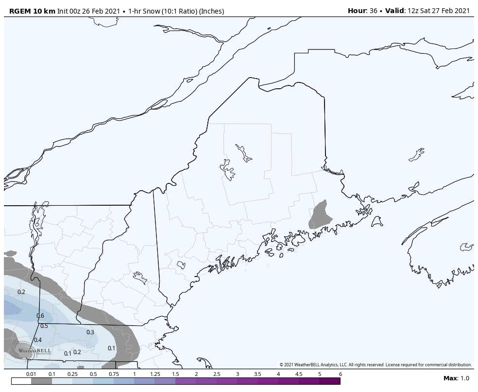 Looking at snow here, purples indicate potential for spurts of heavy snow where it could accumulate at over an inch or two in an hour. Given the fact the storm is a fast mover, the heavier bands that do set up won't last long. Where the bands do set up could bring rapid accumulation and grease up the roads, along with reduced visibility and perhaps brief white out conditions. Wind is not a big concern here as peak speeds may reach in the 20-25 mph range, with the top of the ski hills pushing 30 mph for a couple of hours in the afternoon. Play it again on Monday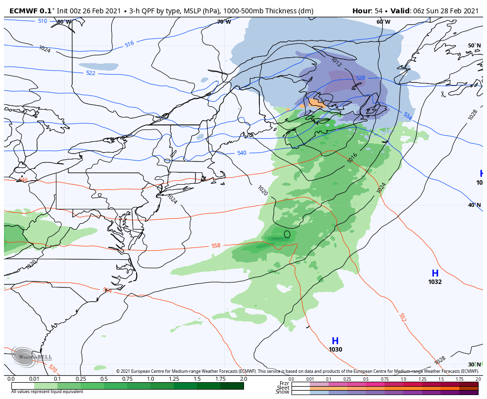 High pressure passes through the region on the heels of the storm for Sunday. Interior areas can expect another 2-5" snowfall Sunday night into Monday, as another quick hitter passes through, ending by mid to late morning. An upper level low brings an arctic front through Monday night, which could bring a couple inches to southern areas overnight into Tuesday morning. Another storm appears possible in the Wednesday / Thursday time frame next week.  Winter Injuries and Fatalities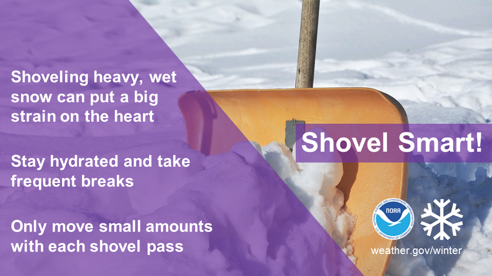 Slippery sidewalks and roads aren’t the only things to look out for in late winter and early spring snow storms. Shoveling snow can be a health risk as well. Remember to stay hydrated, take frequent breaks, and move only small amounts with each shovel pass. Learn more at weather.gov/winter Temperature outlook through ThursdayThe normal high and low for Caribou is 27° and 7°. For Portland, 37° and 19°. After the warmer conditions Sunday and Monday, Tuesday falls well below normal. A gradual warm up in on the way heading into late week. 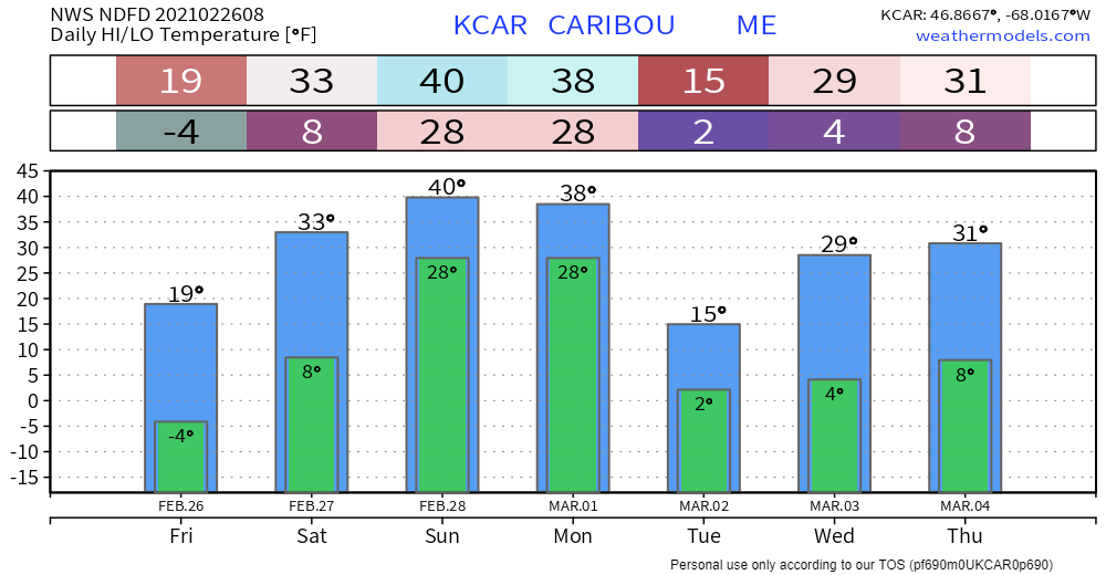 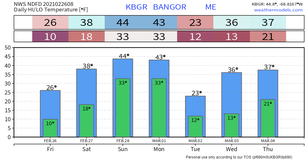 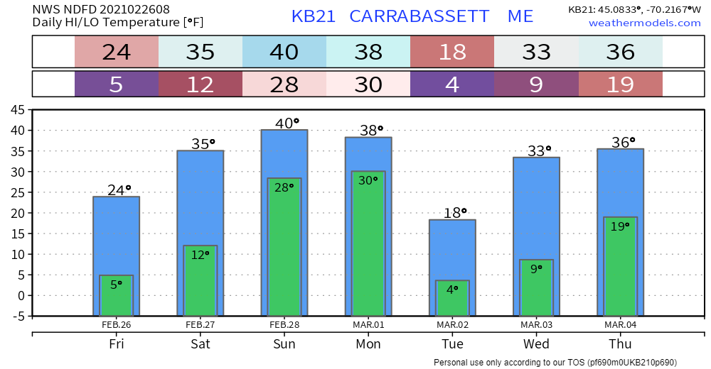 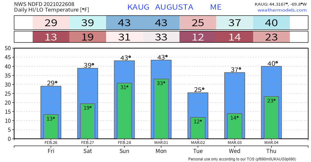 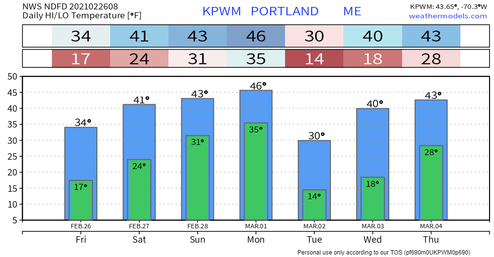 Be prepared to receive alerts and stay updated!
For more information in between posts, please follow Pine Tree Weather on Facebook and Twitter.
Thank you for supporting this community based weather information source which operates by reader supported financial contributions. Stay updated, stay on alert, and stay safe! Thank you as always for your support! - Mike |

Mike Haggett
|