
A garden variety snow event... for a change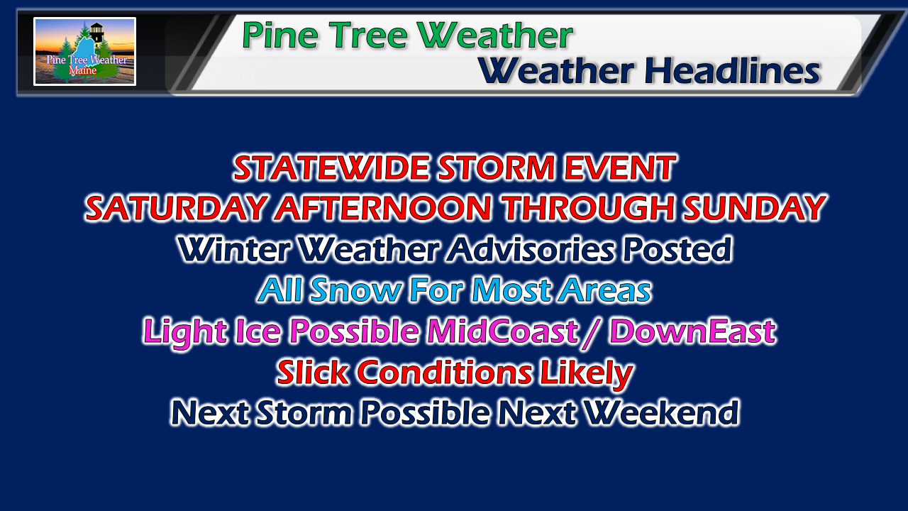 A colder track means a snowier one for southwest coastal areas, although I do suspect a coastal front will work in at the low levels of the atmosphere could bring a bit of ice for MidCoast and DownEast areas as a parting gift as the storm heads into the Canadian Maritimes. The storm will slick roads up in areas, especially the less traveled ones. The road crews should not have a difficult time with this one as this is a manageable event overall. Timing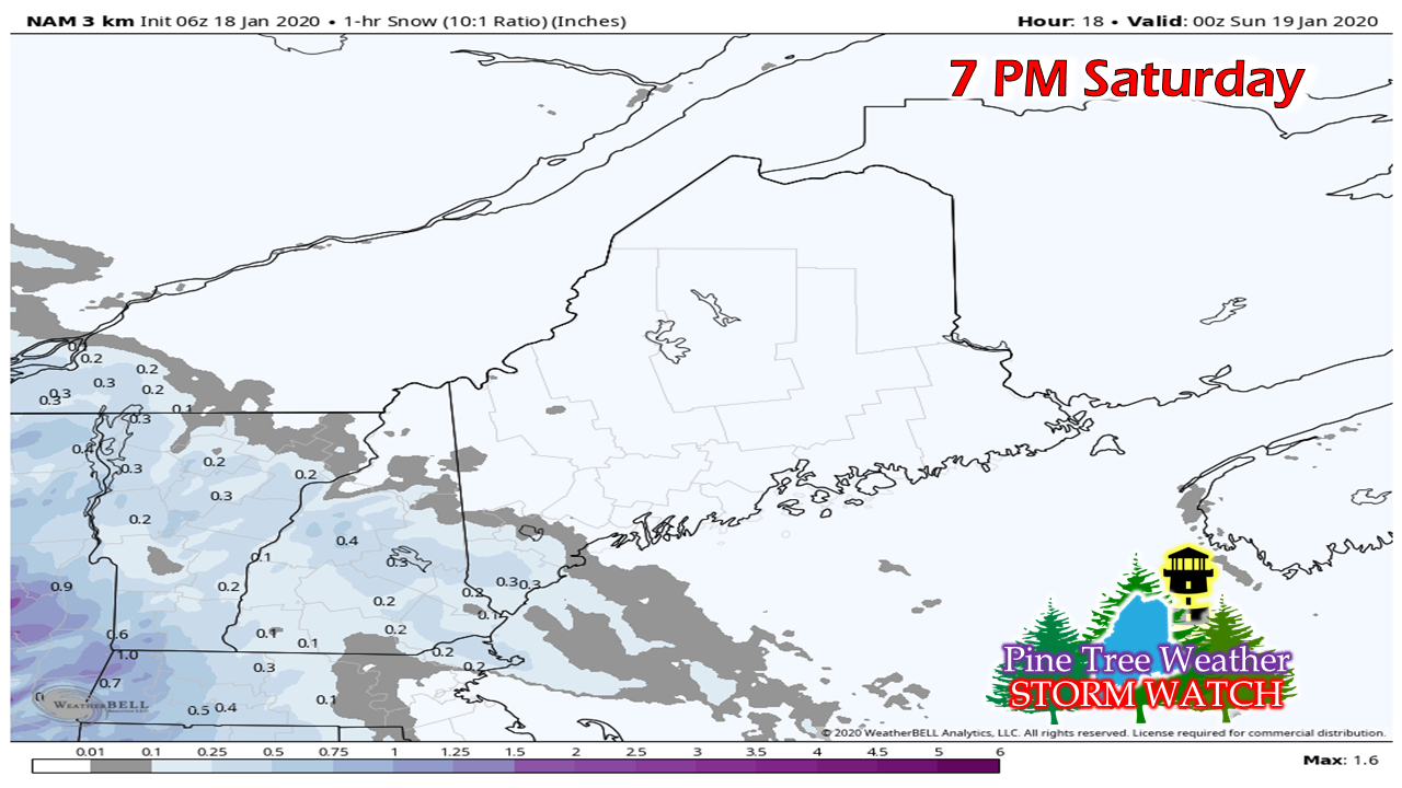 A lot of dry air around so accumulations may delay out of the gate. Some flakes may fly this afternoon over southern and western areas, but it may not pile up until early evening. 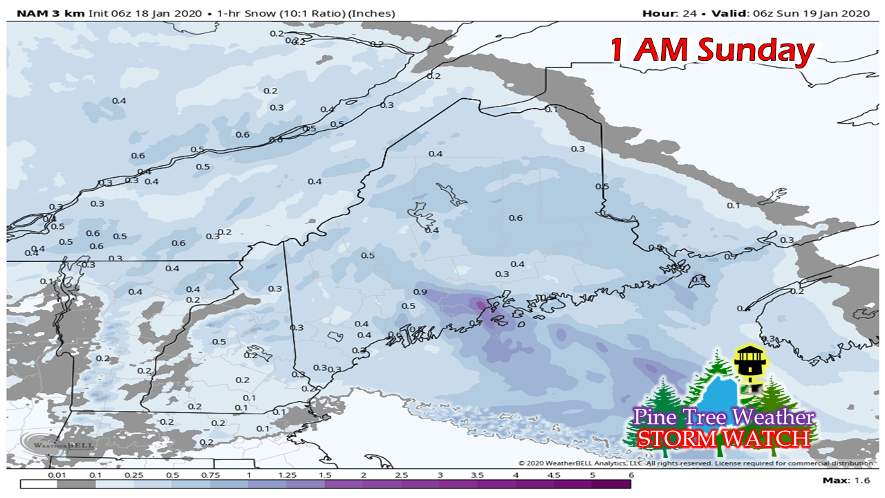 By 1 AM Sunday, most areas could have some snow on the ground. I mentioned on Facebook Friday afternoon the chance for a "thump" or banding to occur that could increase snowfall rates to around an inch an hour. That remains a possibility, and the short term models are focusing mainly on the coast for that to occur. 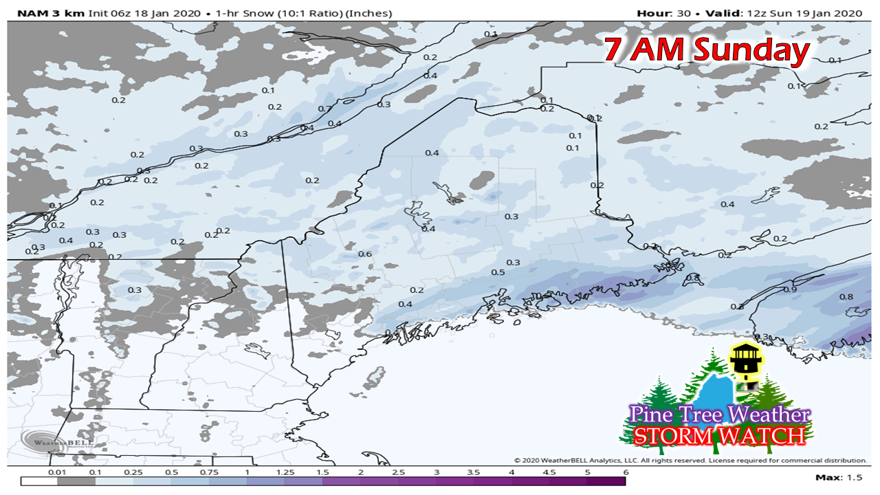 By 7 AM Sunday, southwestern areas wrapping up with the initial wave, while snow falls elsewhere. 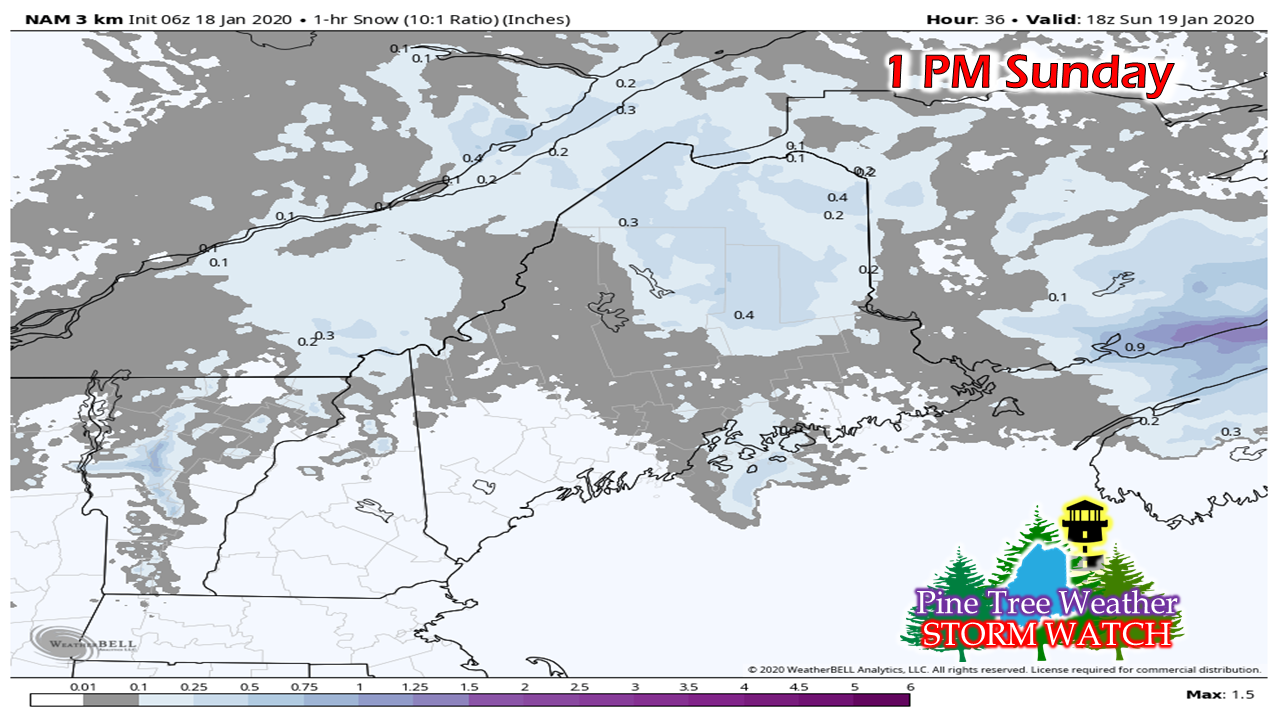 Heading into the afternoon, the transition from warm front to coastal low begins to form. Snowfall over southern and western areas has tapered, but it's not over yet. 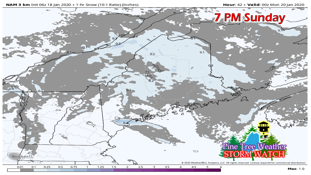 As the coastal low better organizes snow showers return to western and southern areas Sunday afternoon into early evening. Backside banding may bring an inch in spots. 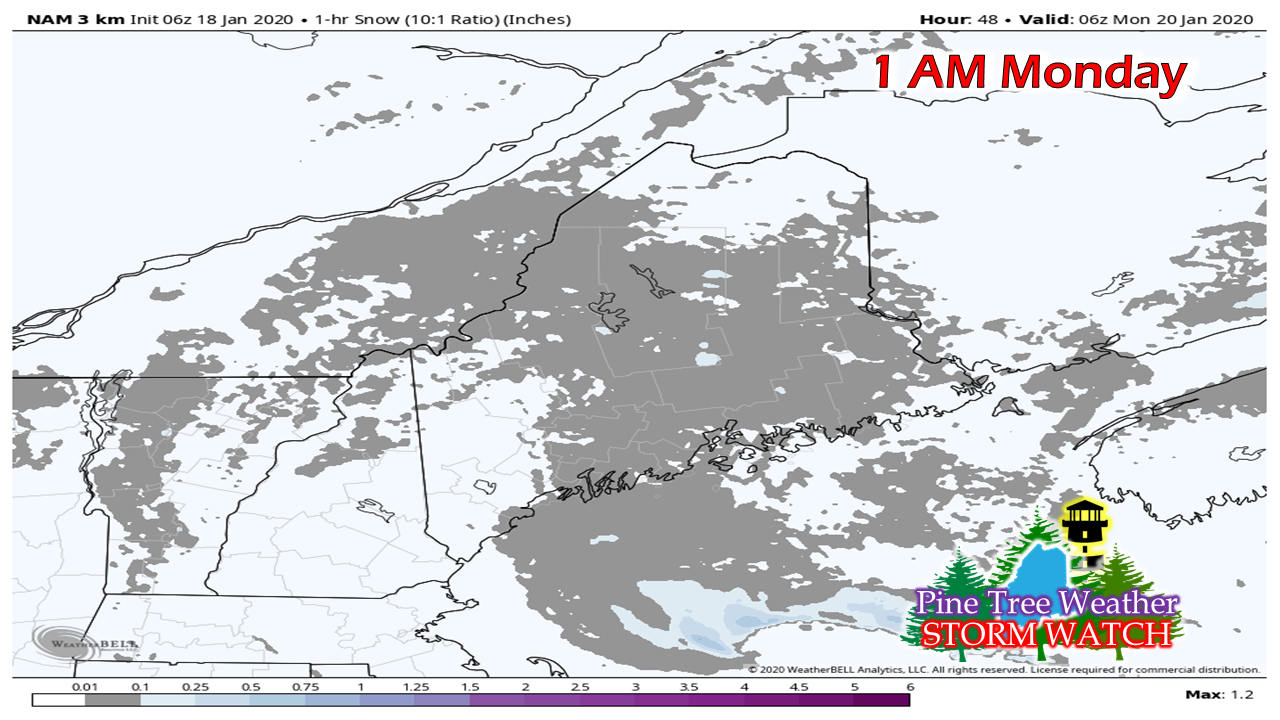 Steady snow tapers to snow showers by around midnight Monday. Most areas see snow end by daylight Monday morning, with Washington County seeing some snow showers ending soon after sunrise. Snow totals adjusted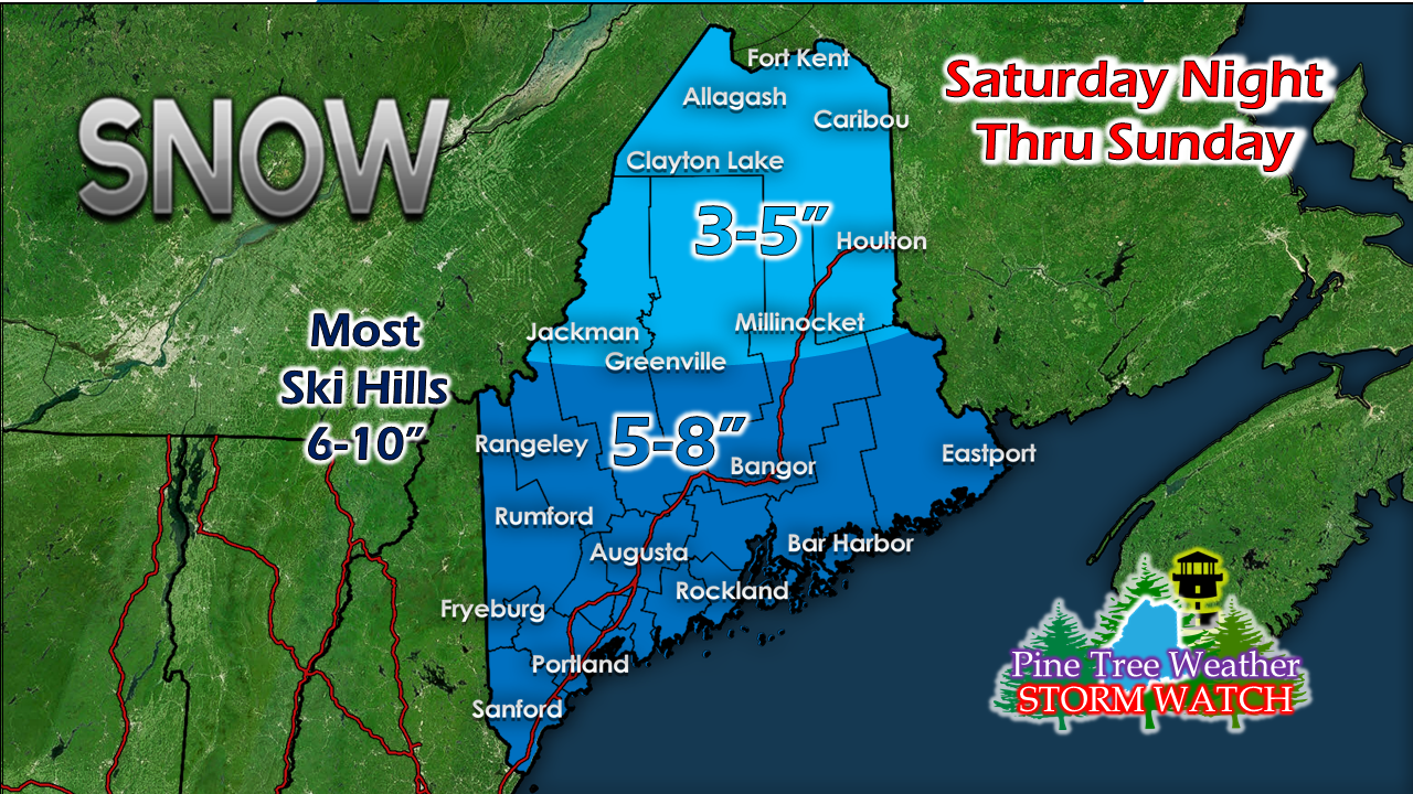 The further away from the coast, the fluffier the snow, not that I expect the snow that falls along the coast to be difficult to move. Rockland - Bar Harbor - Eastport may be on low end for totals pending on how the coastal front sets up and brings a chance for a glaze of ice.  A break until next weekend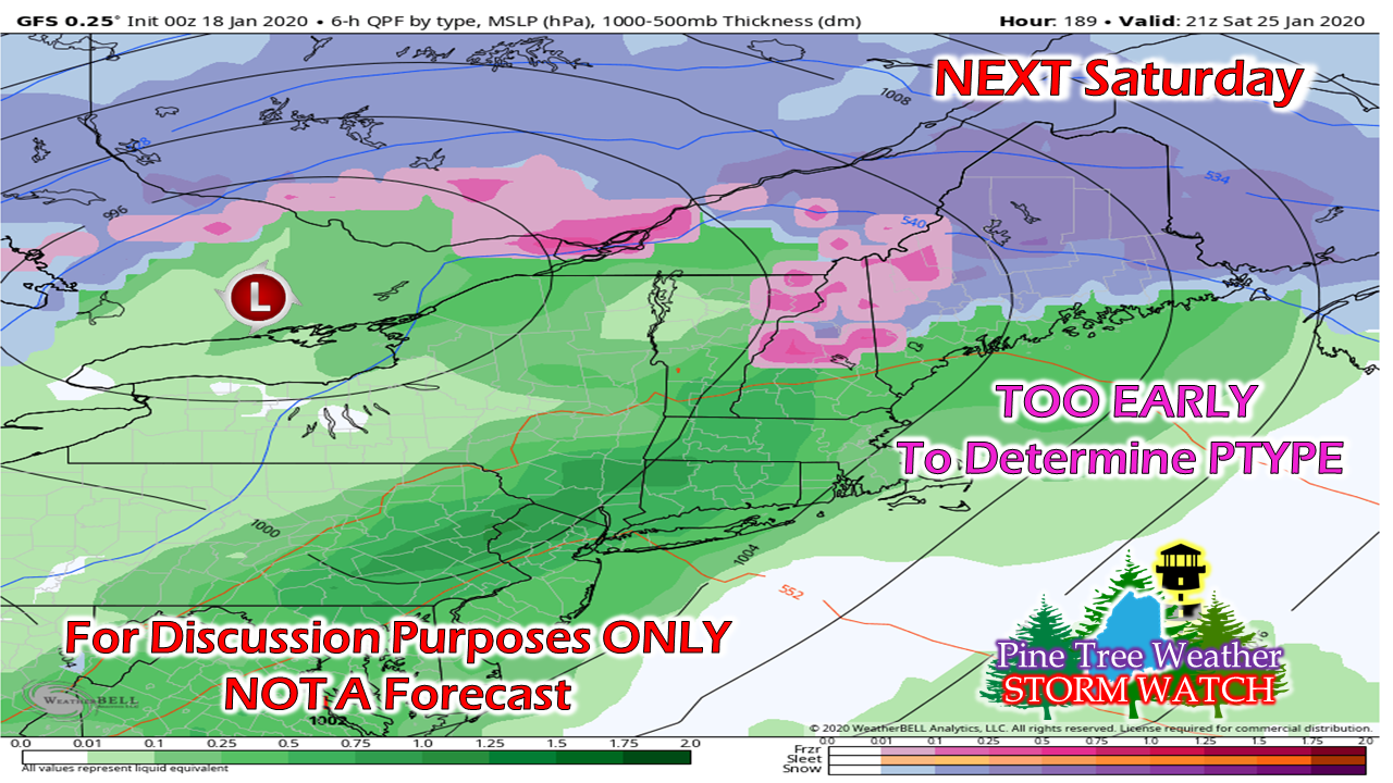 The week head appears quiet until we get to the weekend. It's too early to get into much detail on this one as far as timing, precipitation type and impacts. It's on the radar, and a week to watch it. ► ► For the latest official forecasts, bulletins and advisories, please check in with the National Weather Service in Gray for western and southern areas, or Caribou for northern and eastern parts of Maine. I would appreciate your help to wrap funding up! ► ► $60 shortfall for the year ahead! You can help keep Pine Tree Weather going with a donation of ANY amount now through VENMO @PineTreeWeather, a monthly donation on Patreon or messaging me on Facebook or Twitter to send a check in the mail. Thank you for your support!
For more information from me, please check the Pine Tree Weather Facebook page as well as my Twitter feed. Always stay weather aware! - Mike |

Mike Haggett
|


