Two systems come together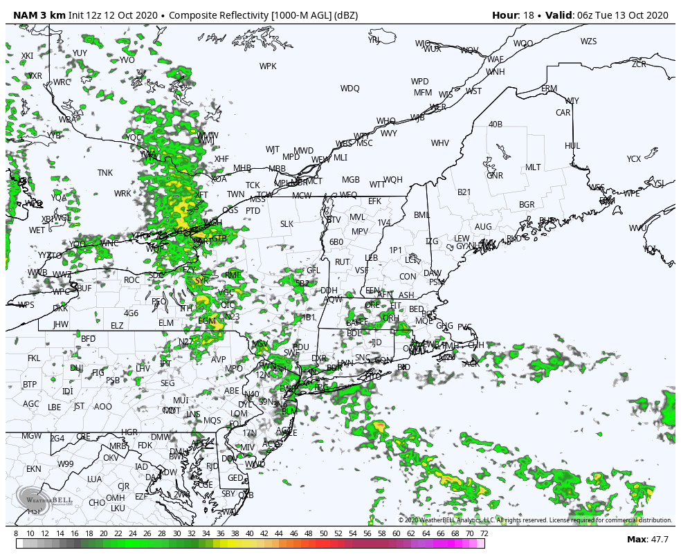 For a region that is parched for rain, this will be a welcomed event. It won't be a drought buster, but it's definitely a step in the right direction. Coming in from the west is a frontal boundary associated with strong low pressure that is tracking toward northern Quebec. To the south, remnants of Hurricane Delta. A weak area of low pressure from Delta taps into the frontal boundary as the two come together Tuesday morning. This is where the forecast gets interesting. 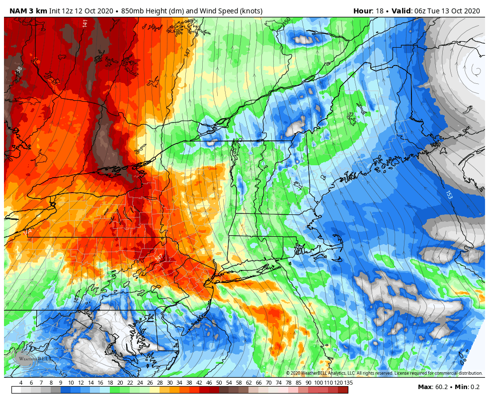 This is a loop of the wind field at 850 mb (roughly 5,000 feet). This creates a strong southerly flow from the south/southeast and drags moisture from what is left of Delta into the region. Combined with the frontal boundary, this could add more juice into the flow ahead of the boundary. For those who have followed along for awhile, we see this idea in winter. It's called frontogenesis, which is a meteorological process of tightening of horizontal temperature gradients to produce fronts. We see enhancement of snowfall in winter, sometimes it turns into a surprise. This situation applies in this case, and could bring additional rain amounts.  Narrowing in here on forecast radar for the region shows rainfall beginning over southern areas by around mid-day. Showers move into northern and central areas by mid-afternoon. Far eastern areas may stay dry, with showers breaking out there Tuesday evening. Rain tapers from west to east Tuesday night, ending around sunrise Wednesday over far eastern areas. 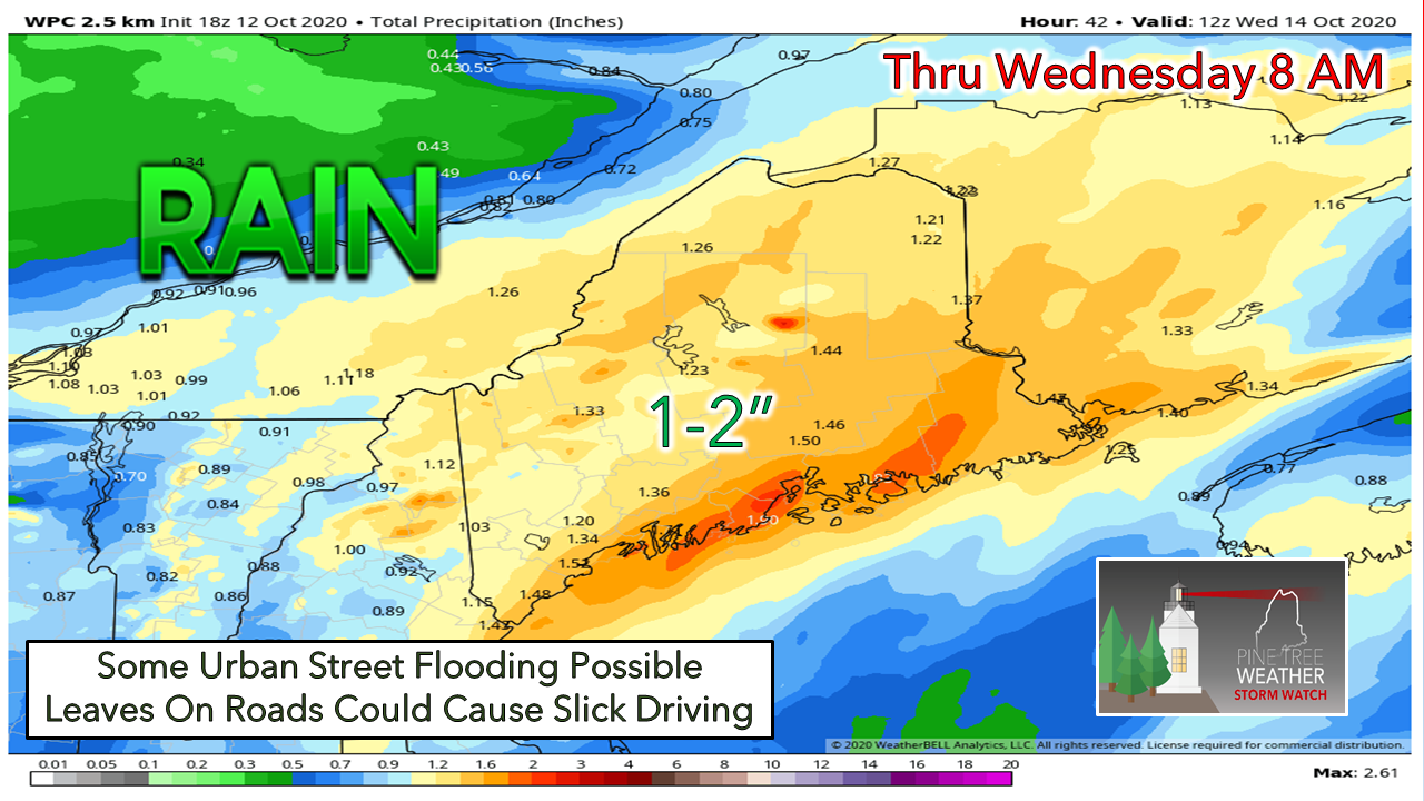 A good soak of 1-2" of rainfall is possible statewide. If the two systems come together a bit quicker, much of the region could see 2-3". If the two systems are delayed in joining up, western areas may see lesser amounts. Wind speeds from 5-15 mph with gusts 20-30 will take more leaves off the trees. This sets up potential for some greasy roads in areas, along with covering up storm drains which could cause ponding on urban roadways. Use caution as you travel around into Wednesday.  Next system arrives Friday into Saturday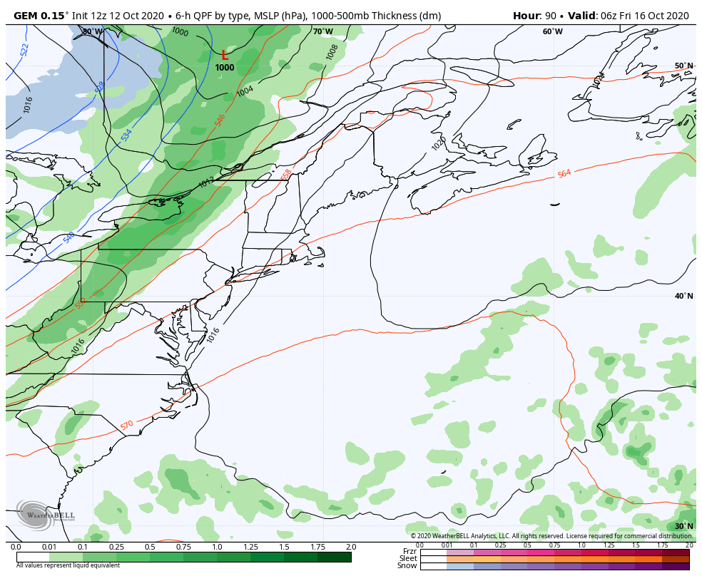 This storm system also brings the opportunity for another solid soaking, but it is a bit early to get into too many details just yet. Another frontal boundary spins off low pressure along it and appears to travel through the state towards northeastern Quebec. This solution hauls down cold air from western Quebec, and could bring a shot of snow for the higher elevations in upstate New York, Vermont, New Hampshire and potentially western Maine. Again it is a bit early for my snow loving followers to get excited about this for now, but something to watch through the rest of the week. Temperature outlook through SundayAfter below normal high temperatures Tuesday, the mercury climbs above normal to round out the week. The thermometer begins to cool off as we head into the weekend. 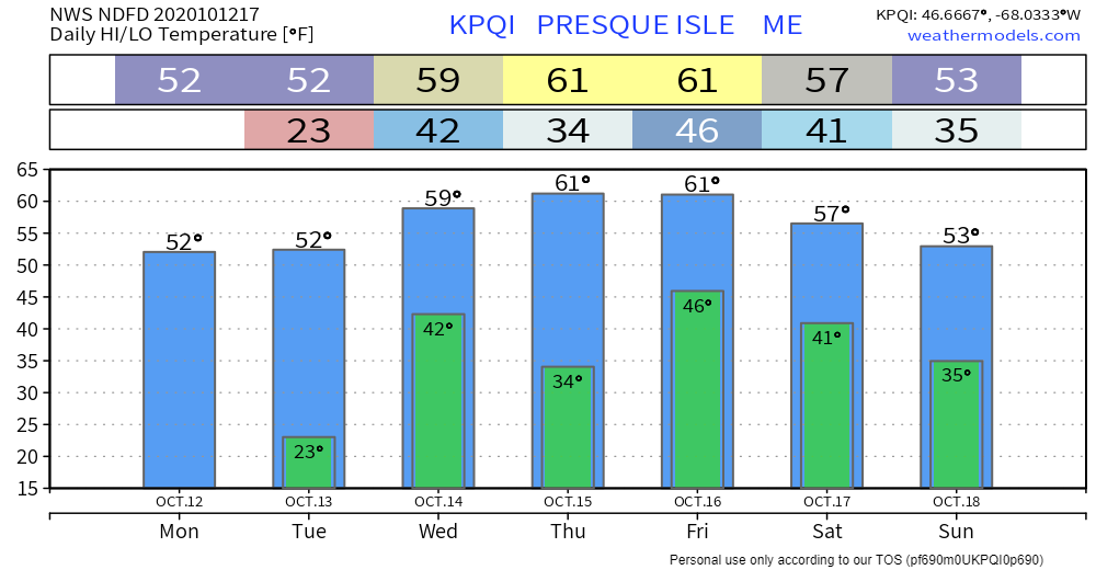 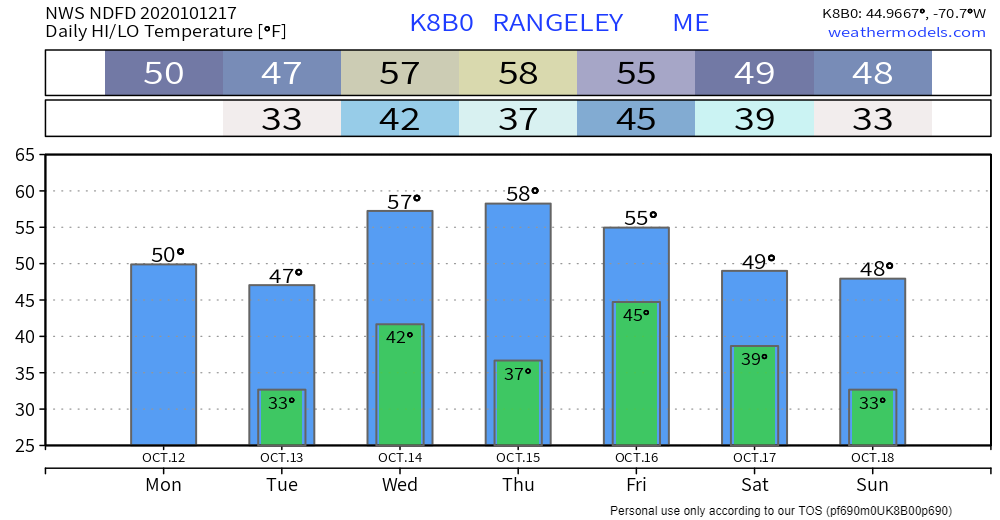 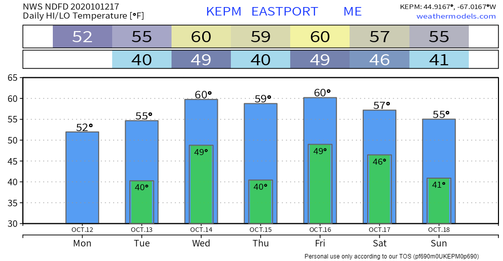 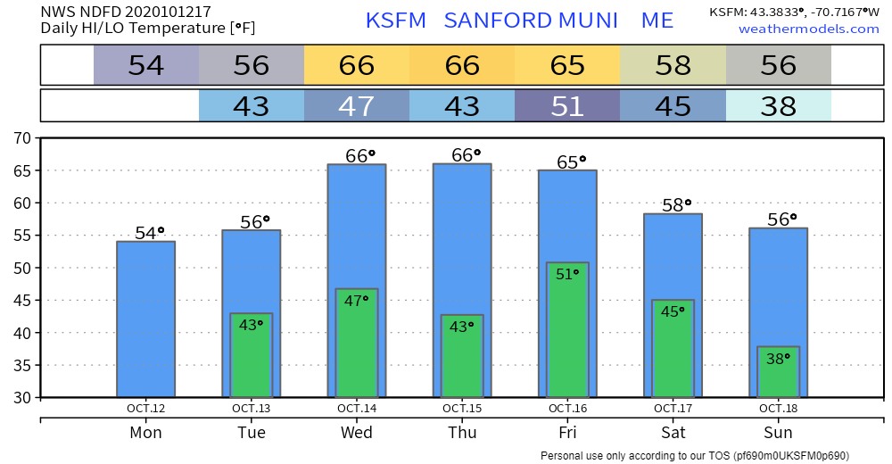 Winter SKYWARN Virtual Spotter Training in November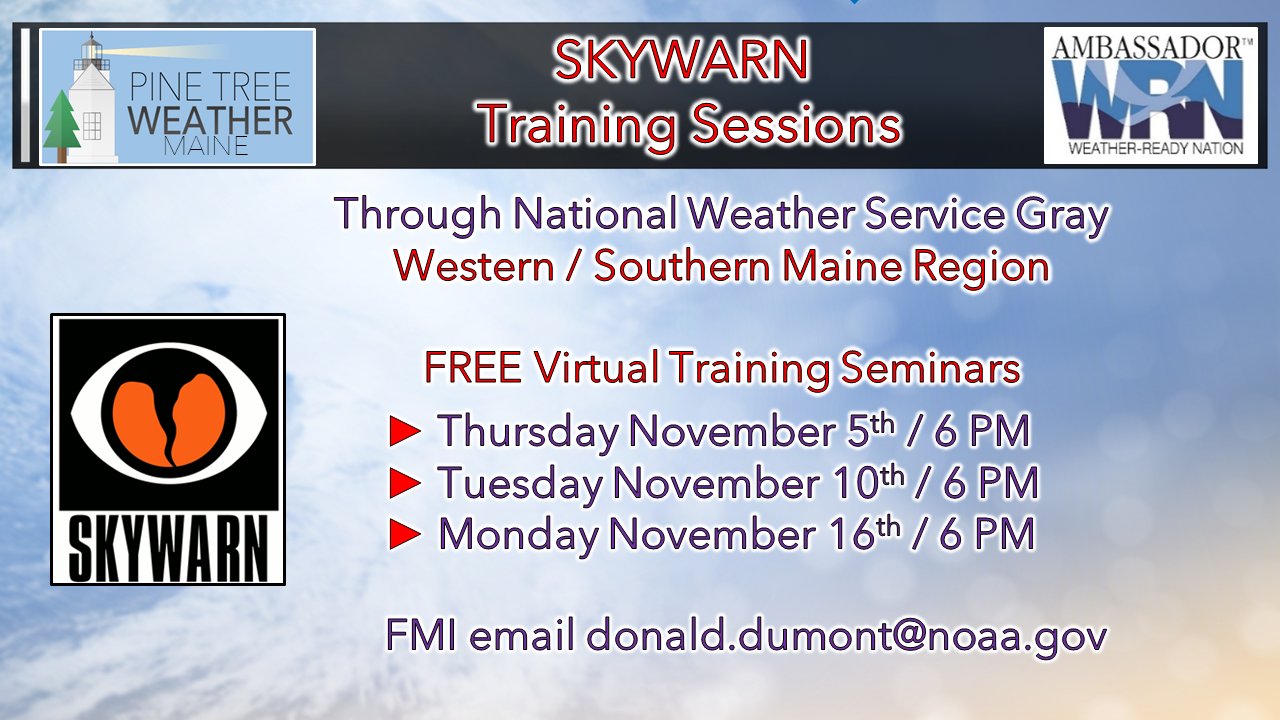 For those in Oxford, Franklin, Somerset, Kennebec, Lincoln, Knox, Waldo, Sagadahoc, Androscoggin, Cumberland and York Counties, here's your opportunity to get involved with the weather community. If you are interested in training for either of the above dates, please email Donald Dumont at the National Weather Service Gray office at [email protected] and tell him Mike at Pine Tree Weather sent you. He'll send you the Go To Webinar link to register for the time that works for you. No matter where you are, your reports are invaluable and helpful to the future of forecasting! Be prepared to receive alerts and stay updated!
For more information, please follow Pine Tree Weather on Facebook and Twitter.
** FUNDING NEEDED FOR 2021 ** Thank you for supporting this community based weather information source that is funded by your financial contributions. Stay updated, stay on alert, and stay safe! - Mike |

Mike Haggett
|