
A hint of winter possible in Crown areas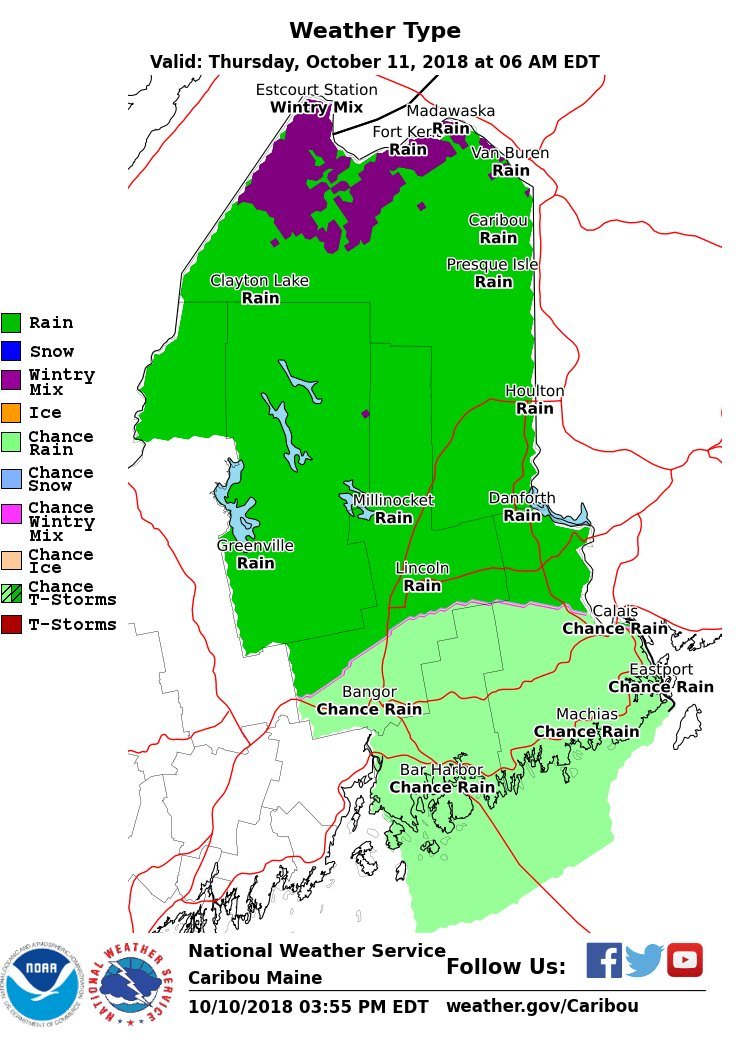 'Tis the season for chances of wintry precipitation for the north country, and the first chance comes in the wee hours of Thursday as the cold front presses south. This may not amount to a whole lot, or even be measurable, but there is the risk for some pings of sleet for the far north as we head into the day. It won't last long as temperatures will rise a few degrees and turn what may be granular into water soon after daylight. A wet Thursday, with Michael sliding by Friday Showers over night change over to steady rain as the day progresses. It appears to be a fairly decent soaking statewide with a half inch to an inch and a half of rain possible. As I mentioned in the previous update, Michael's remnants and track along a stalled front offshore will be one to keep tabs on as we head into Friday. The cold front approaching from the west is unsurprisingly a bit slower in arrival as I mentioned concern about. Coastal areas may see some shower activity and some breeze as what is left of Michael rushes off towards the North Atlantic. Expect some surf along the shorelines on Friday. 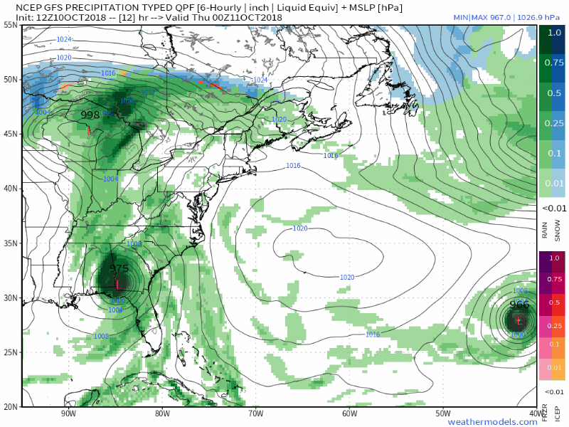 A wider view shows Michael's close proximity to the coastline as it slides past Atlantic Canada. A cooling high from Canada sets up over the region for the weekend. Guidance is hinting at the potential for some light snow for the mountains and north early next week from an approaching clipper system. It's a bit early to take that to the bank, but worthy to stay tuned for. Thermometer weirdness through Thursday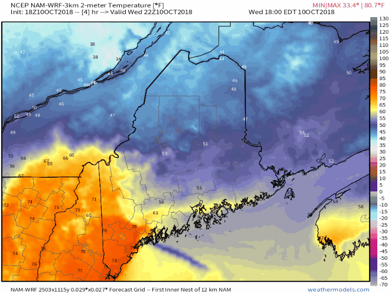 Given cold air damming taking over the state and with tropical moisture on the way, the thermometer may appear a bit odd as temperatures gradually climb through the day Thursday. This is one of those situations where the high temperature for the day may not occur until well into the evening on Thursday. A touch of humidity is likely to be noticeable along the coast on Friday as Michael slides by. Once that moisture and associated frontal boundary moves eastward, temperatures appear to crash into the 20s & 30s to start Saturday.
For the latest official forecasts, bulletins and advisories, please check in with the National Weather Service in Gray for western and southern areas, or Caribou for northern and eastern parts of Maine. For more information from me, please follow the Pine Tree Weather Facebook page and my Twitter feed. Thanks as always for your support! Please consider making a donation to keep Pine Tree Weather going. Check out the donate page on how to contribute. Always stay weather aware! - Mike |

Mike Haggett
|


