Rain could be heavy at times Thursday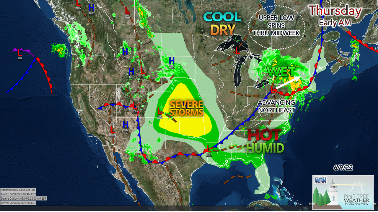 Low pressure enters the region from the southwest and brings another decent rainfall to the region. As that departs, a tandem of upper lows pinwheel through the region through the middle part of next week, keeping showers off and on in the forecast. The heat and humidity continues to be suppressed to the south for the near future, keeping dew points at mainly comfortable levels. 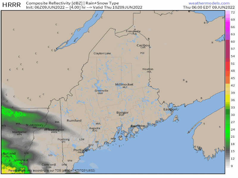 Thursday 6 AM to Friday Midnight - Another decent and needed rainfall is on tap for the day as low-pressure heads for the Gulf of St. Lawrence. Rain could be heavy at times as precipitable water values increase to 1-1½" in the air column. The low-level jet could aid in the release of heavy rain and bring downdraft wind along with it. Steady rain tapers to scattered showers and perhaps an isolated thunderstorm in the afternoon into Thursday evening as a cold front trails the low. 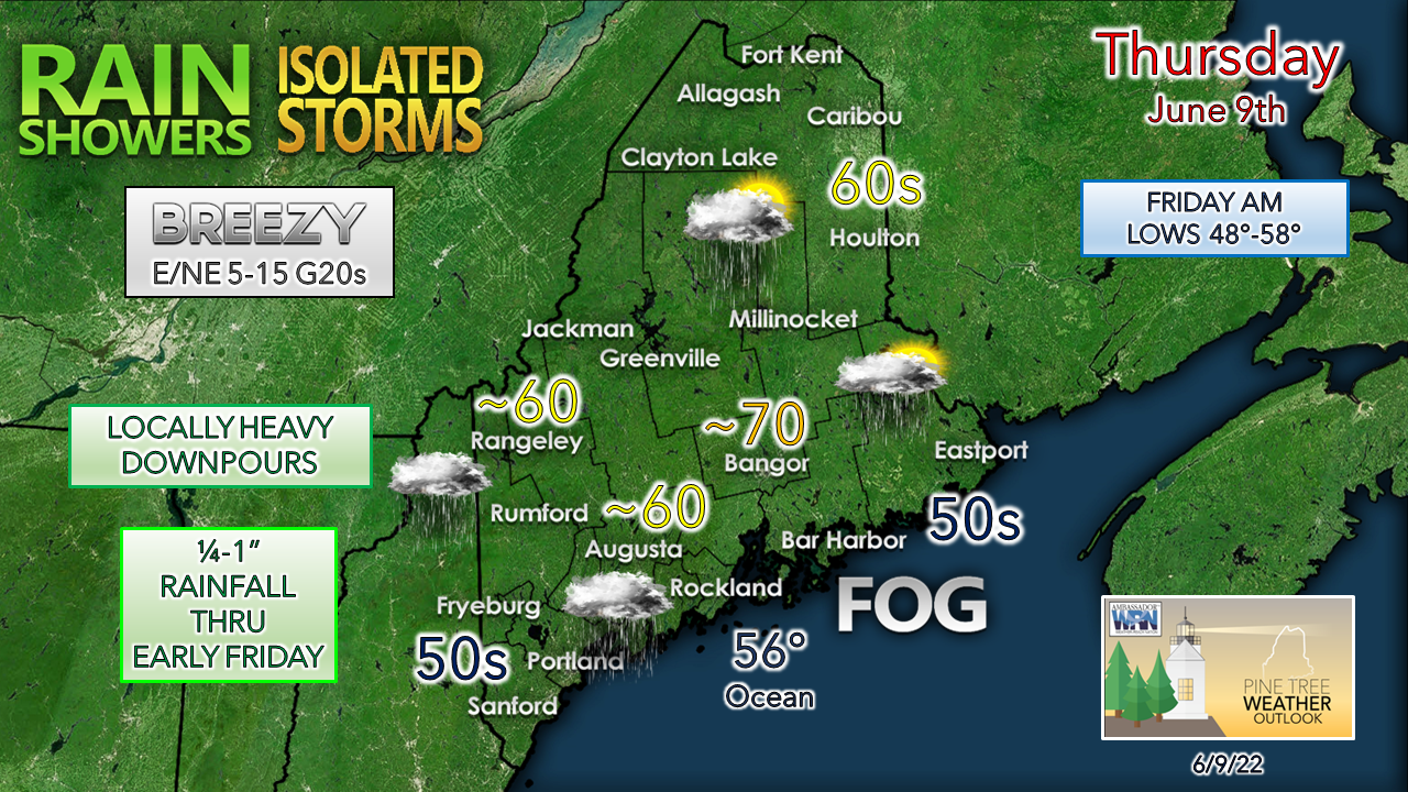 It appears to be a raw day for the coast. Daily highs in the 60s achieved early in the morning drop into the 50s for the southern areas thanks to the east /northeast wind off the ocean. Bangor could reach 70° before the rain arrives. Northern and interior eastern areas have the best chance for sun to start off before the rain arrives midday. MidCoast and DownEast areas dealing with dense fog to start off with may end up dealing with it in some capacity for most of the day. All areas can expect at least some pockets of fog around Thursday night into Friday morning before clearing of the ground stratus commences. Showers are possible for interior areas Friday as high pressure moves in. Outlook through the weekend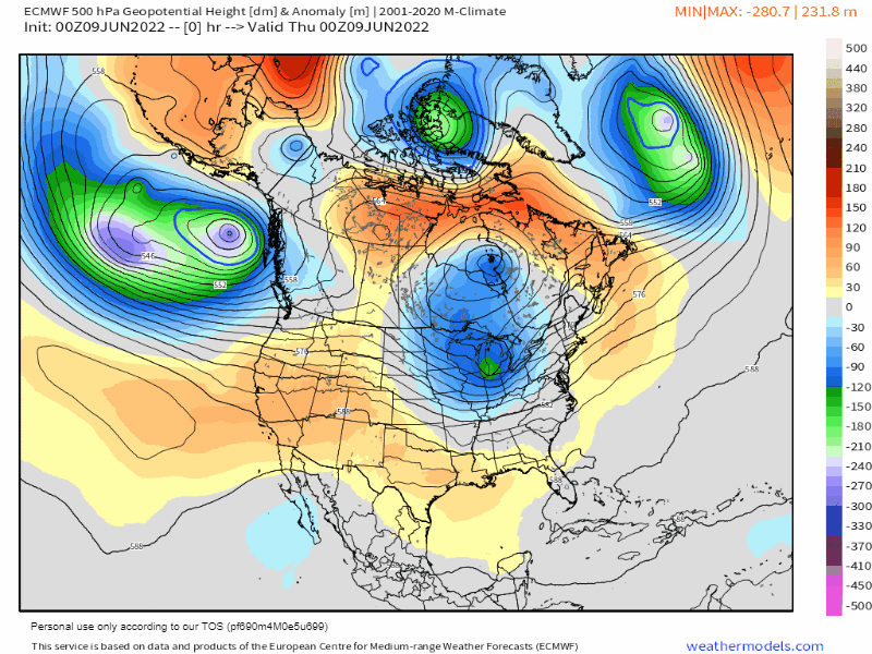 A look at the 500mb anomalous heights through Tuesday shows the troughing (blue/green) over the east and ridging (yellow / orange) in the west. Two upper-level lows rotate around each other over Quebec and the northeast over the weekend. With that, showers are possible at times over the next several days. Ridging appears to work in briefly later next week to bring the chance for a break in the scattered rain showers. 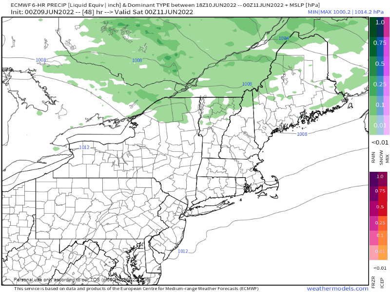 Friday 8 PM to Sunday 8 PM - Guidance has more or less come into agreement for the weekend. Saturday appears to be the drier of the two days, which is a flip from what it looked like earlier in the week, but with the upper lows doing their thing, widely scattered showers are possible for the mountains and north. As the trough sinks to the south, hit-or-miss showers are likely to be more widespread for the region Sunday afternoon. As waves of disturbances continue to work around the upper low, showers and thunder are possible for Monday, with showers once again possible for Tuesday and Wednesday. Temperature outlook through Tuesday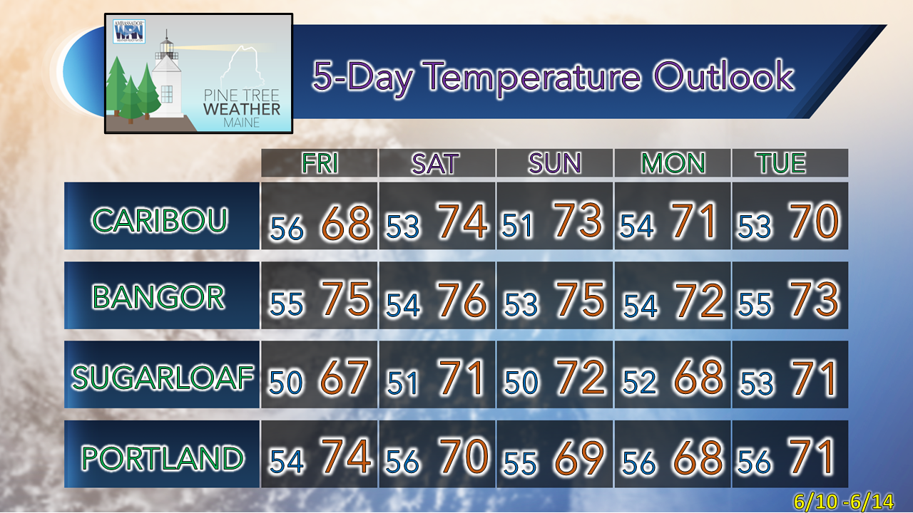 Be prepared to receive alerts and stay updated!
 For more information in between posts, please follow Pine Tree Weather on Facebook and Twitter. Thank you for supporting this community-based weather information source which operates by reader supported financial contributions. Thank you as always for your support! - Mike NOTE: The forecast information depicted on this platform is for general information purposes only for the public and is not designed or intended for commercial use. For those seeking pinpoint weather information for business operations, you should use a private sector source. For information about where to find commercial forecasters to assist your business, please message me and I will be happy to help you. |

Mike Haggett
|