Winter storm warning across much of the state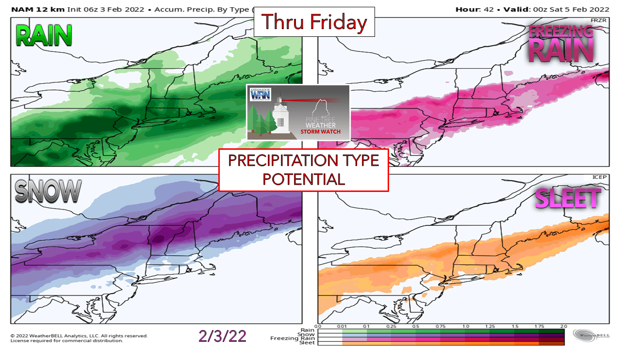 For areas away from the coast, this is another decent snow event. For the coast, all four precipitation food groups are in play. There is plenty of moisture to work with, and travel impacts are the major concern for this event. The precursor to the event starts Thursday. Another day of melting across the state, with a few rain showers mixing in. Highs in the 30s north and 40s across the coastal plain. All this melting and rain shower activity helps clear the salt from the roadways. As the cold front works its way through the region, temperatures drop below freezing. What melted during the day freezes up. Along with copious amounts of some type of frozen and/or about to freeze precipitation on top of that, the result is hazardous, if not impassable driving conditions through Friday morning. If you have a choice, it will be a good day to stay home. If you have to drive, it could be an adventure. Timing / precipitation type Thursday 6 PM to Friday 6 AM - Temperatures begin to fall over northern areas Thursday morning falling below freezing there late morning / early afternoon. For the mountains, the mercury falls in mid-afternoon appears to be below freezing by around 7 PM. The thermometer continues the downward progression towards the coast by around 3 AM Friday where all areas are expected to be below the 32° mark. Warm air riding along the front does not go down without a fight, and the battleground area is the coastal plain. By 6 AM Friday, upwards of 6-10" of snow appears to have fallen over the interior, with a full-on sleet storm with potential for freezing rain mixing in over southern areas along the coast. 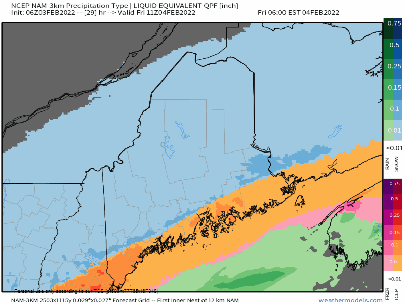 Friday 6 AM to Saturday Midnight - The frontal boundary slowly skirts to the southeast along with a weak area of low pressure riding along it. Sleet and freezing rain flips to snow along the coast as a parting gift as mess moves southeast. Steady snow changes to snow showers through the afternoon and ends over the north and east by late evening. 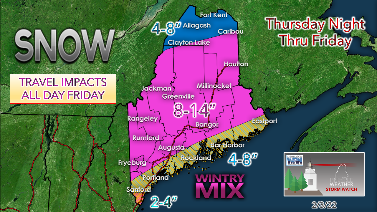 For much of the interior, snow is the rule here. The snow type appears to be more in the way of a powder event, which is a much-improved outlook from earlier in the week. The coast is going to be a real challenge. 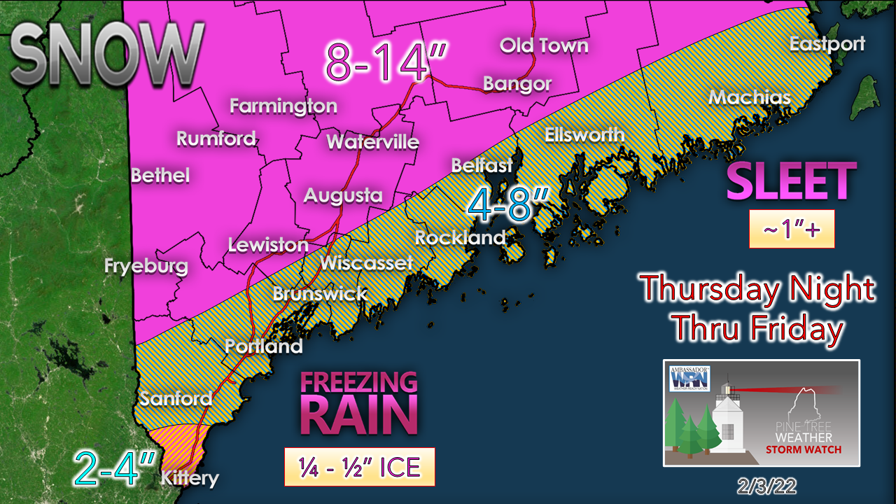 I will be upfront here and say that there is likely to be an extra sharp cut off gradient from snow to the wintry mix. Areas such as Fryeburg, Lewiston and Augusta could see a bit of sleet which may cut down total snow amounts there. The closer to the coast, the higher risk of snowfall bust potential due to the sleet factor. DownEast coastal areas are likely to deal with precipitation type more in the way of sleet, with the threat of freezing rain mixing further to the south. The overall threat of power loss appears isolated, which is also an improvement over ideas earlier in the week. Coastal areas may receive a smattering of wet snow, but it appears amounts of that are minimal for now. The amount of liquid equivalent precipitation (water) in this system is in the 1-2" range for much of the state, with the high end for the coast. That is a lot of something in what precipitation types fall. Stay tuned. Please use mPING to report precipitation type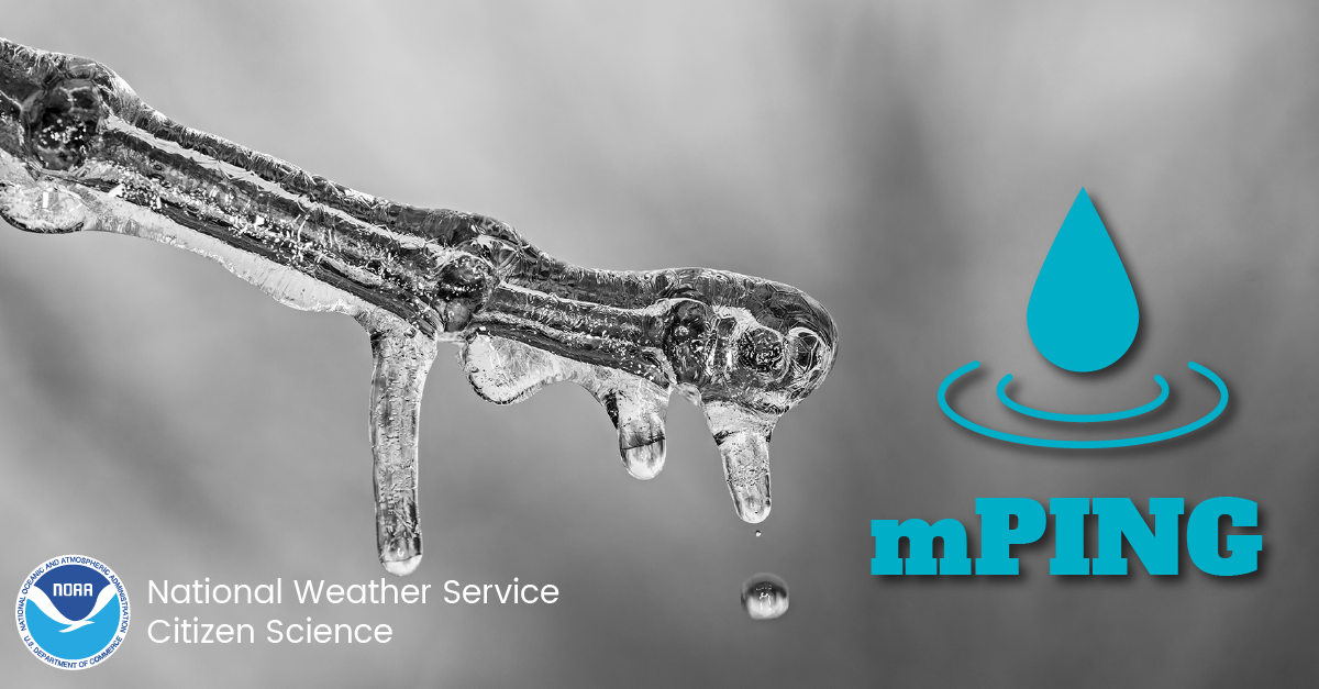 Check out the mPING (Meteorological Phenomena Identification Near the Ground) project. Weird name, cool app! You can report the type of precipitation you see where you are. No need to measure! Use the free mobile app to send reports anonymously. Reports are automatically recorded into a database, which improves weather computer models. The information is even used by road maintenance operations and the aviation industry to diagnose areas of icing. mping.nssl.noaa.gov #CitizenScience  Temperatures and outlook through TuesdayAfter the storm exits the region Friday, a sun filled weekend is on tap, but on the chilly side. Temperatures begin to warm up starting Sunday. A chance for a light amount of precipitation is possible for Tuesday. No storms of any impact are expected through next week as this point.  Winter Precipitation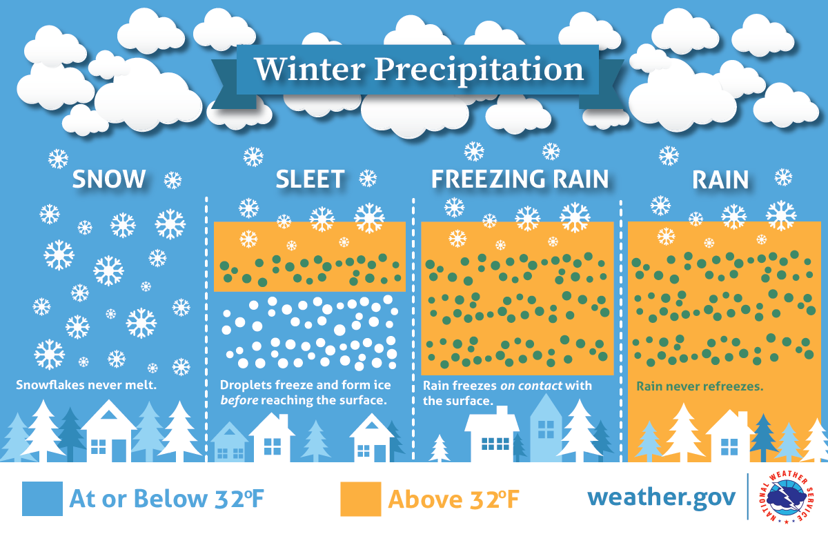 Will there be rain, ice, or snow? This graphic explains how having different layers of warm and cold air between the clouds and the ground determines the type of precipitation that hits the ground. nssl.noaa.gov/education/svrwx101/winter/types/ LIVE UPDATES ON TWITTERBe prepared to receive alerts and stay updated!
 For more information in between posts, please follow Pine Tree Weather on Facebook and Twitter. Thank you for supporting this community-based weather information source which operates by reader supported financial contributions. Thank you as always for your support! - Mike NOTE: The forecast information depicted on this platform is for general information purposes only for the public and is not designed or intended for commercial use. For those seeking pinpoint weather information for business operations should use a private sector source. For information about where to find commercial forecasters to assist your business, please message me and I will be happy to help you. |

Mike Haggett
|