
Slight revision of the forecast map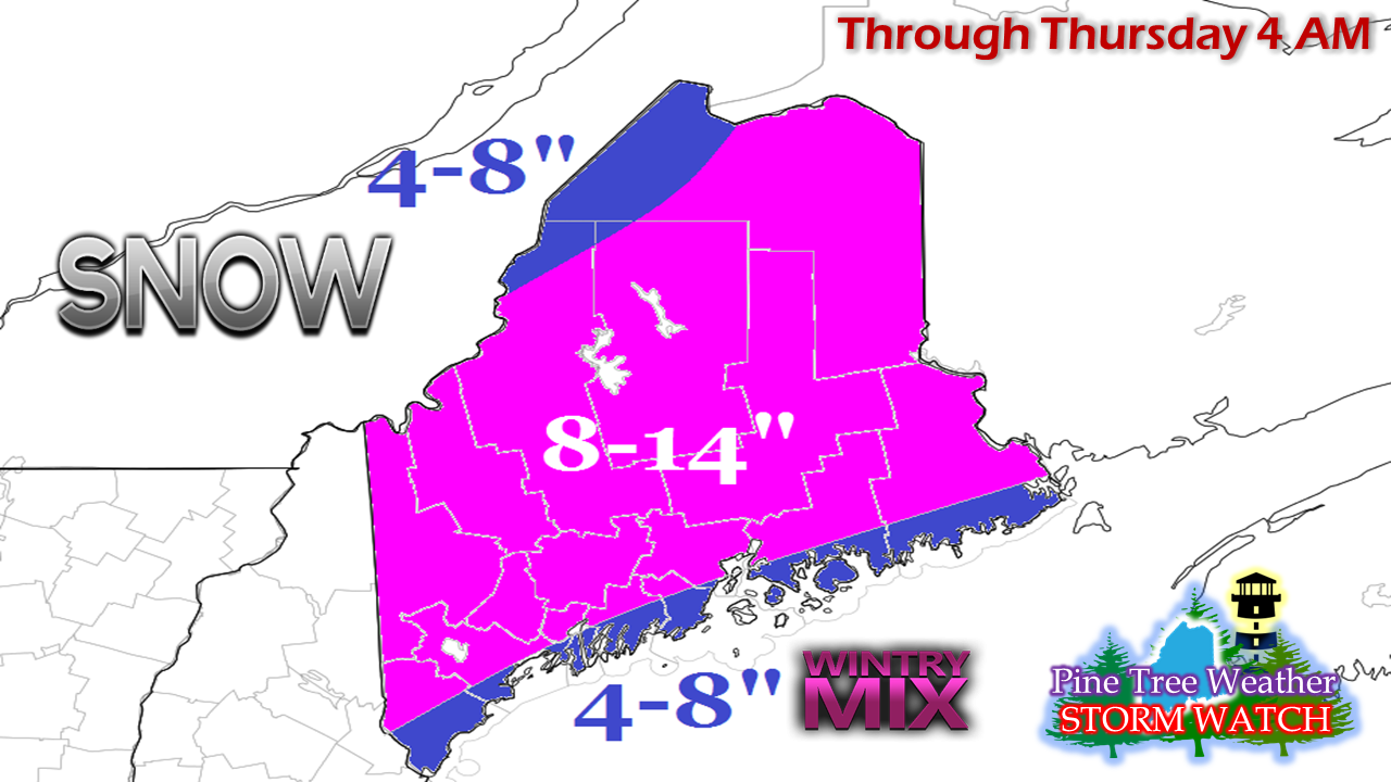 Just a slight tweak to the map I posted here yesterday as a coastal front is likely to impact the coast. The southwest coast may see a touch of ice before all is said and done, but this is a predominantly a snow event.
Snowfall rates in the 1-2+" per hour along with wind gusts in the 20-30 mph range are likely to make travel difficult heading into the evening commute. Snow ends from southwest to northeast Wednesday evening into early Thursday morning. Word the wise, get to where you are going by early to mid-afternoon and stay there. Plow crews may have a tough time keeping up with this one for a few hours until the snow tapers off overnight. Everything else posted yesterday remains on track. - Mike |

Mike Haggett
|


