
Welcome to spring Astronomical winter is now over, and spring is officially here. With early spring comes the chance for snow and that is what we appear to deal with to start the week. Whether you are a snow lover or snow hater, time is running out for the flakes to fly. With above normal temperatures continuing, what comes won't stay for long. A breezy and cool weekend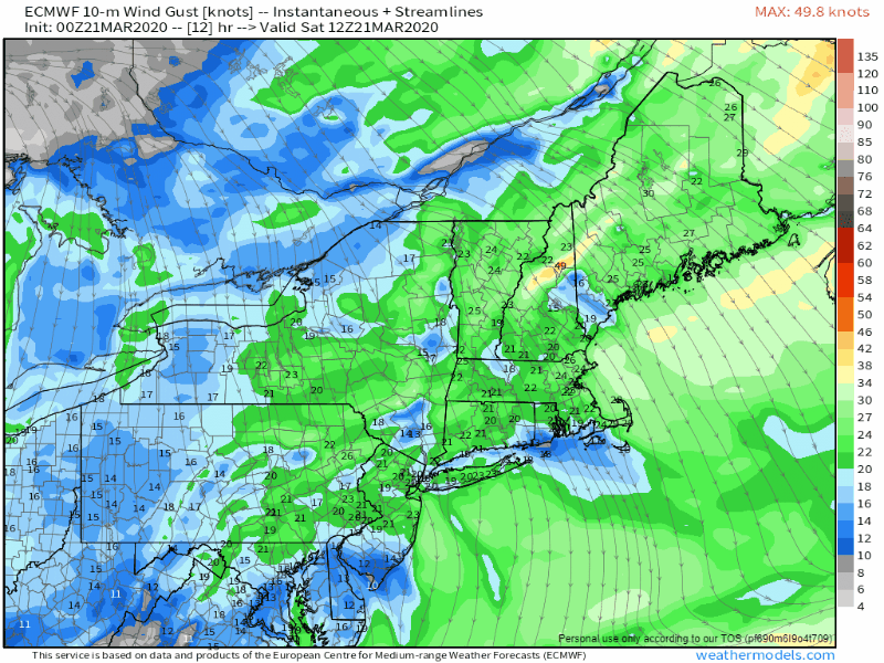 While on the breezy and cool side, it will be virtually cloud free. Our departing storm slowly moves into the Canadian Maritimes and high pressure moves in behind it. Saturday will be the breezier of the two days. Downsloping winds keeps the mountains cool and the shorelines warmer. The wind settles into Sunday, albeit briefly. High pressure moves eastward, and changes the flow from the north/northwest to the southwest as we head into Monday. A quick moving snow event Monday night into Tuesday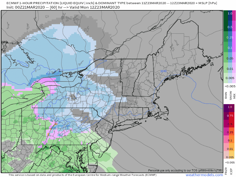 One thing that has been missing for much of the the winter are NorEasters. We have one here. An upper level low negatively tilts and sets up low pressure off the New Jersey shoreline. With the cold air in place from the weekend, this appears to be mainly snow event. The track of the storm for now appears just inside the 40°N / 70°W benchmark point. Monday sees increasing clouds with snow developing over western and southern areas by the evening commute. It will overspread the state Monday night. Precipitation ends in western and southern areas around daylight Tuesday, and most of the rest of the region by around noon. Folks in far eastern areas see the last of snow or rain shower activity end by mid-afternoon. 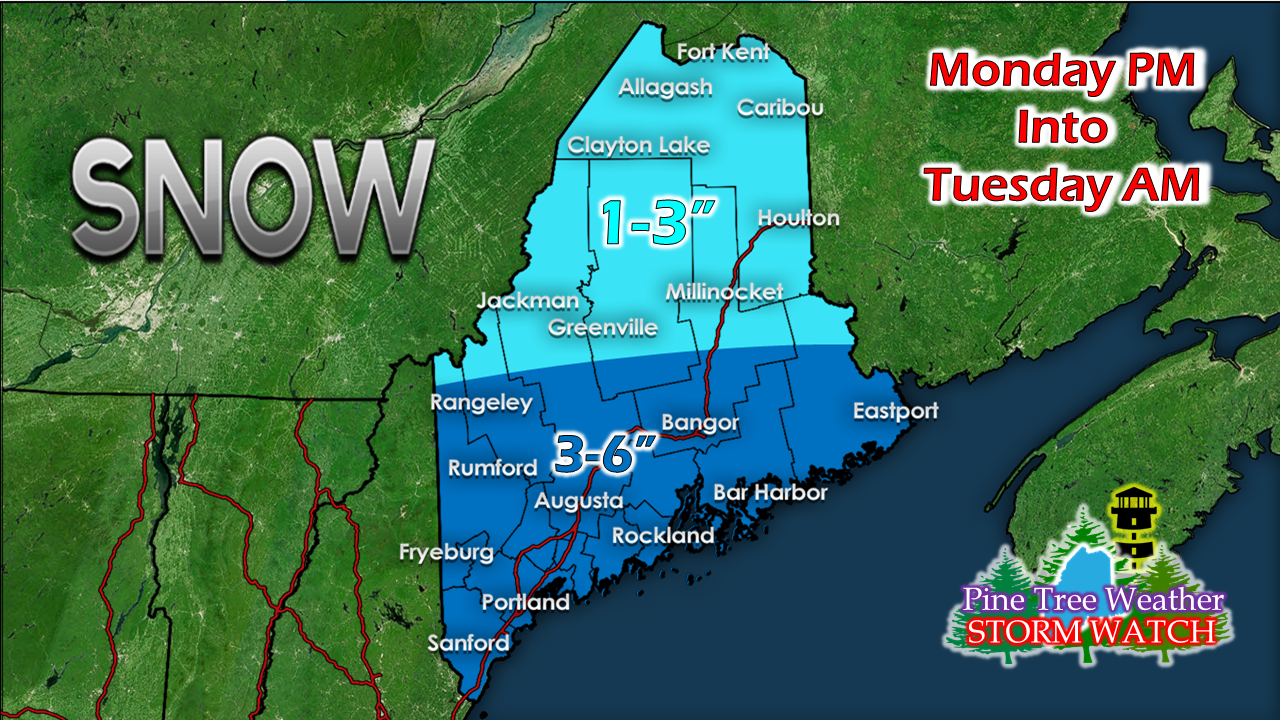 Coastal interior areas have the best chance for 6" of snow from this event, with lesser amounts elsewhere. With above freezing temperatures and higher sun angle, Mother Nature will do her job and clean up the mess she left behind as the rest of the week unfolds. Get out and make a snowman! 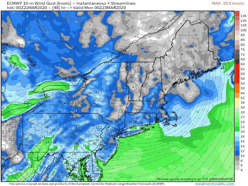 The wind picks back up Monday as the storm works through the region. With the snow being a sticky affair, I can't rule out potential for some isolated power outages, but at this point I don't see more than that. With the melting of the day Tuesday, the threat reduces quickly. Temperature outlook through the weekAfter a cool start to the week, temperatures rise Tuesday. Daily highs run above freezing through the remainder of the forecast period. 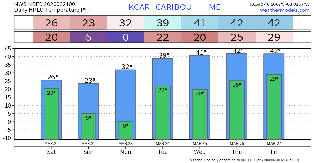 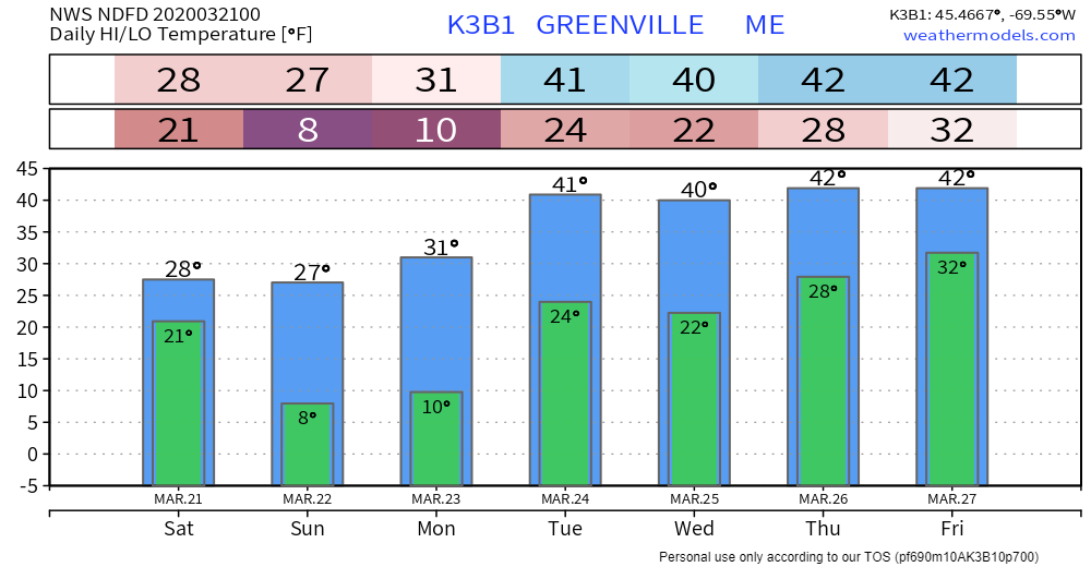 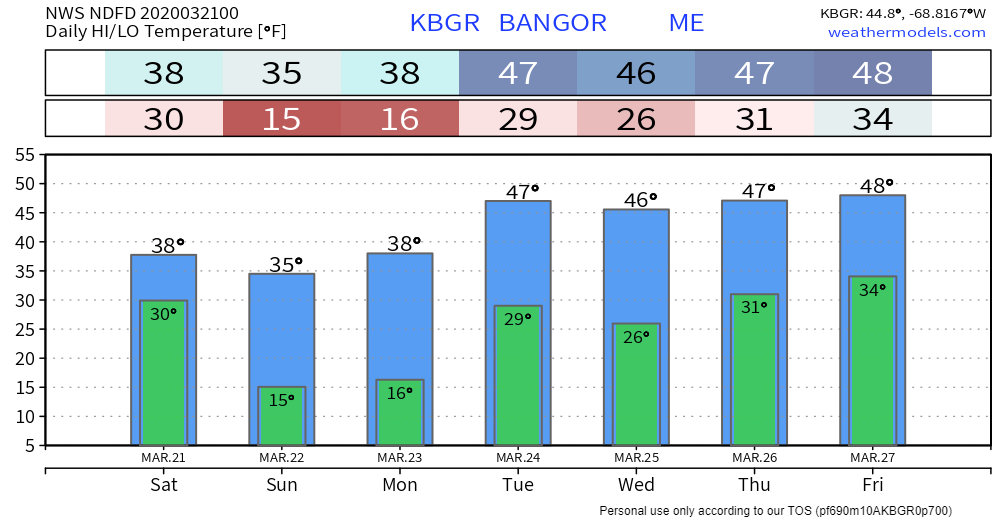 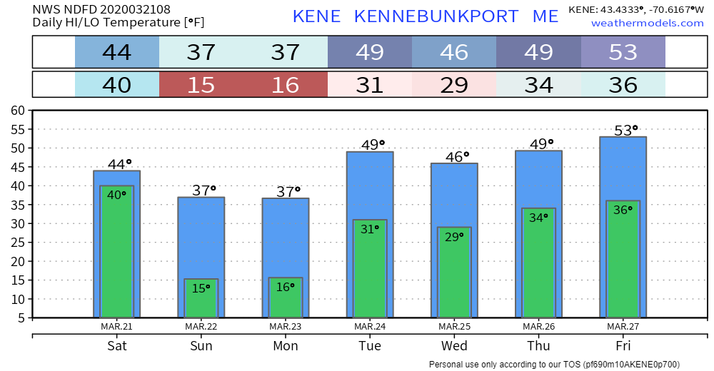 Feel free to use the many pages available on this website for many types of forecasts on rainfall, snowfall, marine, longer range CPC outlooks and maps.
Thank you as always for your support! ► ► For the latest official forecasts, bulletins and advisories, please check in with the National Weather Service in Gray for western and southern areas, or Caribou for northern and eastern parts of Maine. Always stay weather aware! - Mike |

Mike Haggett
|


