|
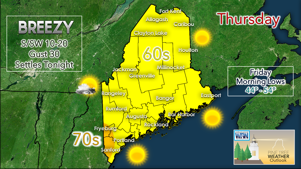
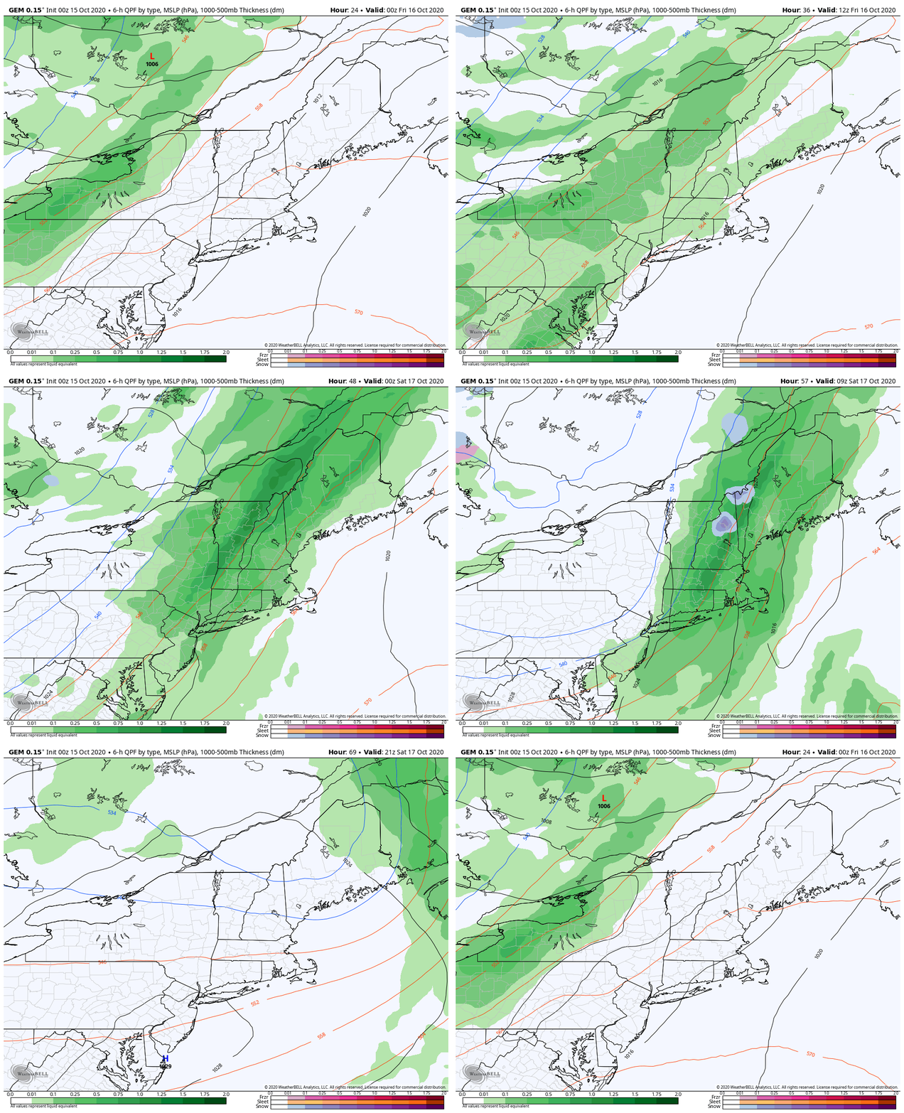
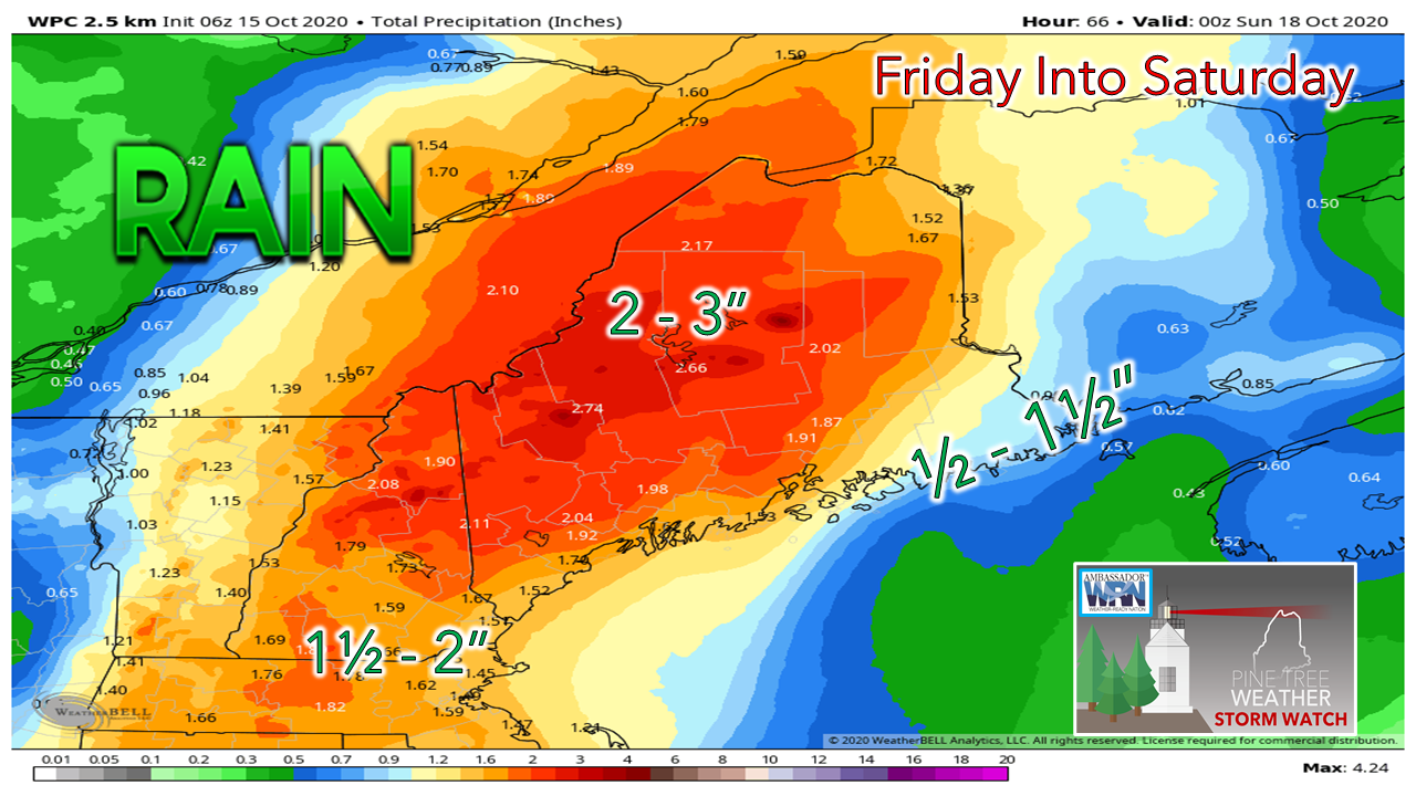
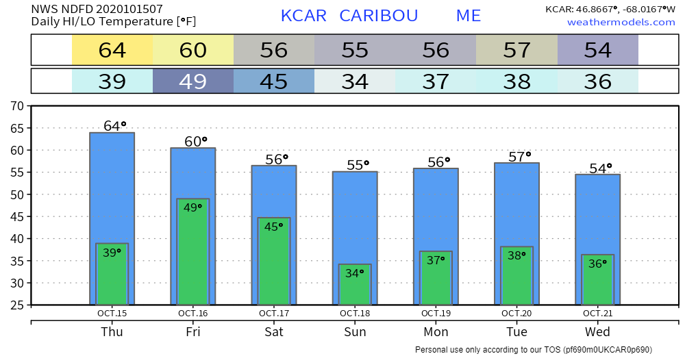
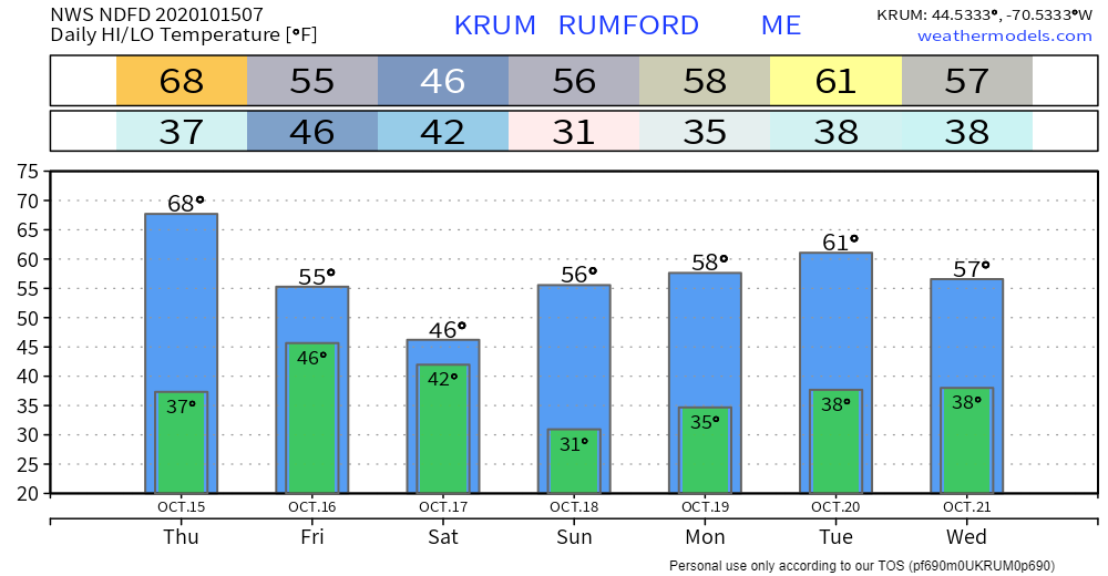
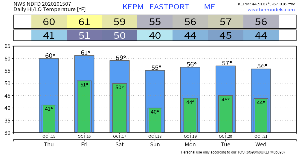
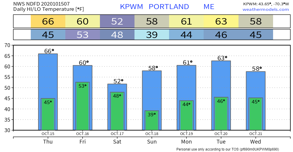
Before I get into the discussion, a couple of things... First, thank you to those who have sent donations via VENMO or signed up for a monthly donation on Patreon. I am grateful and honored to have your support. Any amount helps if you can. This is labor of love here. I will continue to do this so long as the bills get paid, and that depends on people like you. Second, I will pause updates over the next couple of days as I will be out of town taking care of some personal business. The next update from me appears to be Sunday. For mid-October, it's not too shabbyAny day in October where temperatures have a chance to climb to the mid-60s to low 70s is bonus. Temperatures are typically 10-15° cooler than these forecast numbers based on average for this time of the year. It will be a bit on the breezy side as high pressure moves east and a south/southwest flow develops ahead of the front on the way for Friday. Clouds will be on the increase tonight and overnight lows stay on the warm side with mid-40s to mid-50s the starting point for Friday morning. Another needed soaker on the way to start the weekendHigh pressure that moves east of Maine Thursday is the key feature to watch in how the Friday / Saturday event plays out. It slows down its progression, and thus slows the passage of the front. Along the front, the trough begins to become negatively tilted, which will spin up an area of low pressure along it. The question at this point is when the low forms and how strong it becomes. If it gets its act together early, precipitation amounts will go up. If it is a bit slower in development, it may lower amounts somewhat, but given the hose attached and slow moving nature of the front, it may not affect forecast amounts a whole lot. Organization and timing of it will be key for eastern areas, especially Way DownEast. Guidance is has settled on the idea of a solid 1-3" rain event for much of the region otherwise. Another factor in organization and timing will be for potential snow in the mountains. A better organized low that begins to rapidly intensify could drag down cold air from Quebec and bring accumulations to the higher peaks above 2500 feet. Temperature outlook through WednesdayAfter the Friday / Saturday system, guidance is scattered on what happens next. There is a lot of model noise on different scenarios for tropical development, which is affecting the upstream solutions. I will say the next chance for showers appears to be around Tuesday, and see what happens. Temperatures will generally be above normal through the middle part of next week. Wireless Emergency Alerts (WEA)WEA are emergency messages sent by authorized government alerting authorities through your mobile carrier. America’s wireless industry is helping to build a Weather-Ready Nation through this nationwide text emergency alert system. weather.gov/wrn/wea Be prepared to receive alerts and stay updated!
For more information, please follow Pine Tree Weather on Facebook and Twitter.
** FUNDING NEEDED FOR 2021 ** Thank you for supporting this community based weather information source that is funded by your financial contributions. Stay updated, stay on alert, and stay safe! - Mike |
Mike Haggett
|

