
Synopsis Outlook As of Monday evening, winter storm watches for Wednesday have been posted for the mountains and north with winter weather advisories posted for Tuesday for much of the rest of the region. Roads will be slick in the north country for several days between the actual snowfall followed with blowing snow after that. It will be a messy start for the coastal plain Tuesday morning, but conditions should improve as snow changes to rain showers in the afternoon. Once the coastal low forms and pulls away, Wednesday evening is likely to be a challenge as temperatures drop, snow showers return and everything freezes back up. Timing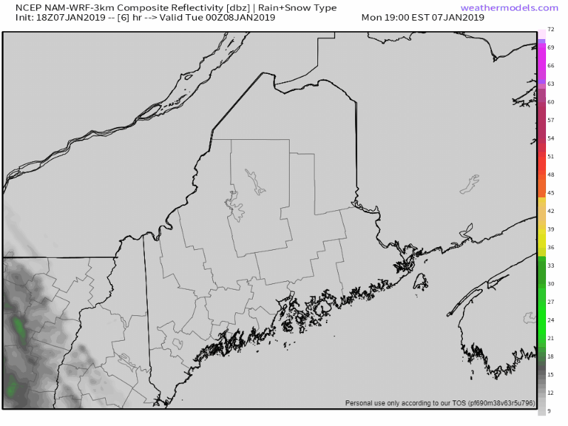 A warm front moves into the region Tuesday morning bringing snow everywhere to start off, and changes to mix/rain over the shorelines and coastal interior up into the foothills as the day turns into evening. As the simulated radar loop indicates, there will be a bit of a dry period as the front moves into the Canadian Maritimes. An upper level low drops into the region,and a new surface low forms along the coast and intensifies, bringing heavier snow to the interior Tuesday night into Wednesday. As the storm pulls away, it drags cold air down from Quebec behind it, bringing light snow and/or snow showers back to the coast Wednesday afternoon and evening. Upper level energy behind the storm moves slowly eastward, bringing an arctic front with snow showers with additional accumulations for the mountains and north for Thursday. Snow fully tapers by Thursday evening. Snow accumulation breakdown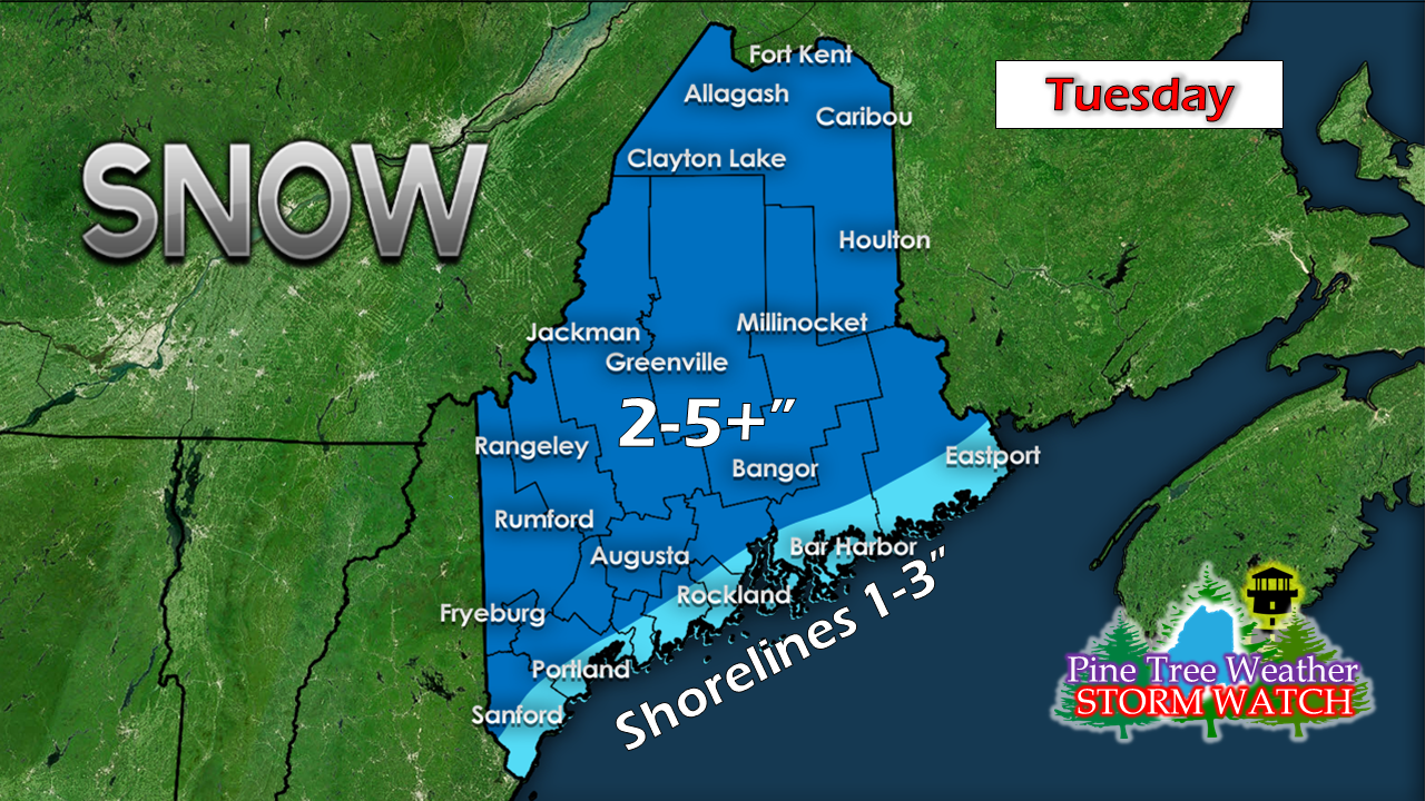 The time frame here is midnight Tuesday to midnight Wednesday, the first leg of the storm. Higher amounts for the higher elevations. 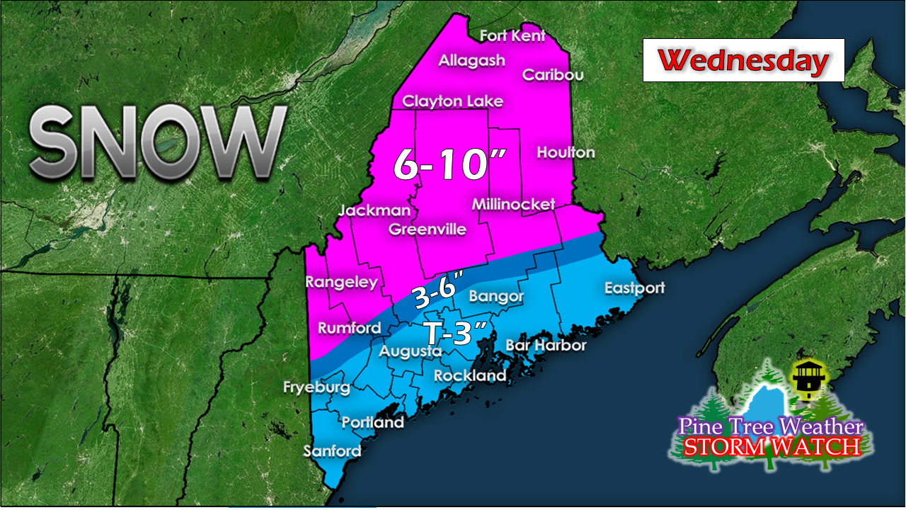 The time frame here is midnight Wednesday to midnight Thursday. A solid snow event for the interior areas, which always benefits greatly from coastal hugger systems with cold air around. 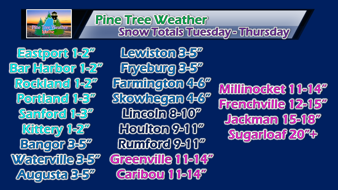 Again, the main hit of snow for the coastal plain will be Tuesday. The big accumulations for the interior comes Wednesday, with bonus inches coming midnight to late afternoon on Thursday. Due to mixing and rain, I expect a sharp gradient in snow amounts over the western foothills over to interior Washington County. There is always surprises with these bigger snow events. Some areas will over perform, others will under perform due to banding and potential from dry slotting due to rapid intensification. Snow will be a higher ratio the further away from the coast, which brings the fluff factor and brings higher totals as a result. This is my best idea for now. After the snow comes the chill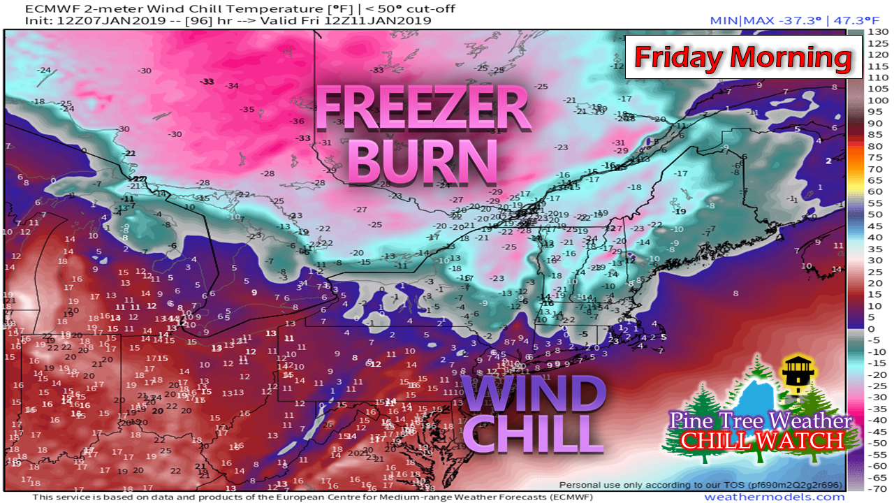 Behind the arctic front comes the coldest weather of the season thus far which is right on schedule for January. Double digit below zero wind chill values will be likely in the interior through Friday and into Saturday. 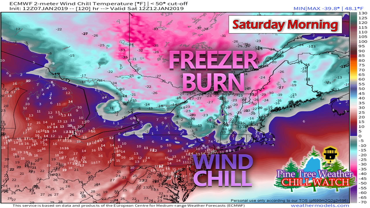 With the wind comes blowing snow which will cause drifting and brief whiteout conditions. For those headed north to enjoy the fresh snow, bundle up, allow for plenty of time to reach your destination, and be safe. Outlook through Saturday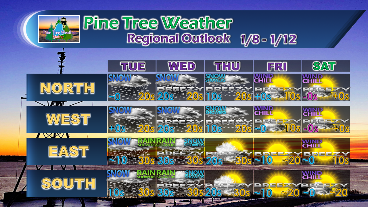 Beyond Saturday, some models are toying with a potential storm to round out the weekend, but confidence is low for now. I will keep watch and update as the week unfolds.
For the latest official forecasts, bulletins and advisories, please check in with the National Weather Service in Gray for western and southern areas, or Caribou for northern and eastern parts of Maine. For more information from me, please follow the Pine Tree Weather Facebook page and my Twitter feed. Your financial donations are much appreciated to keep this site funded and for further development. I sincerely appreciate your support. Always stay weather aware! - Mike |

Mike Haggett
|


