
A solid spring storm Many times this winter I was asked when we would get a NorEaster. After a winter of inside runners, spring kicks off with a classic NorEaster. This one will be a wet one from Fort Kent to Kittery, and all points in between. Timing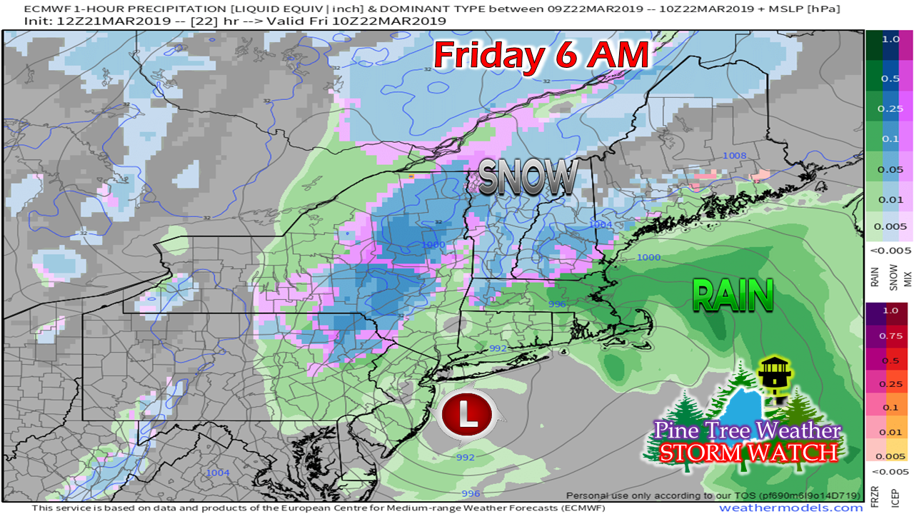 The Friday morning commute may be a greasy one in areas, but the colors on the model map here may be a bit deceiving. Higher elevations and the north are likely to see some accumulation, with a either rain and/or some soggy wet snow flakes could be falling from the sky. 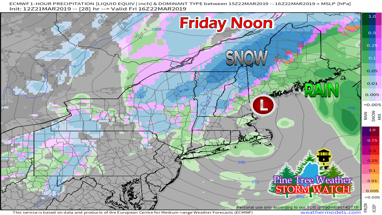 By the Friday lunch hour, snow is likely to be piling up over higher elevations in western areas and over northwestern Aroostook County. It will be a rainy morning over southern and eastern areas. With cold lurking to the north and west, don't be surprised if you see a flash and a rumble of thunder. 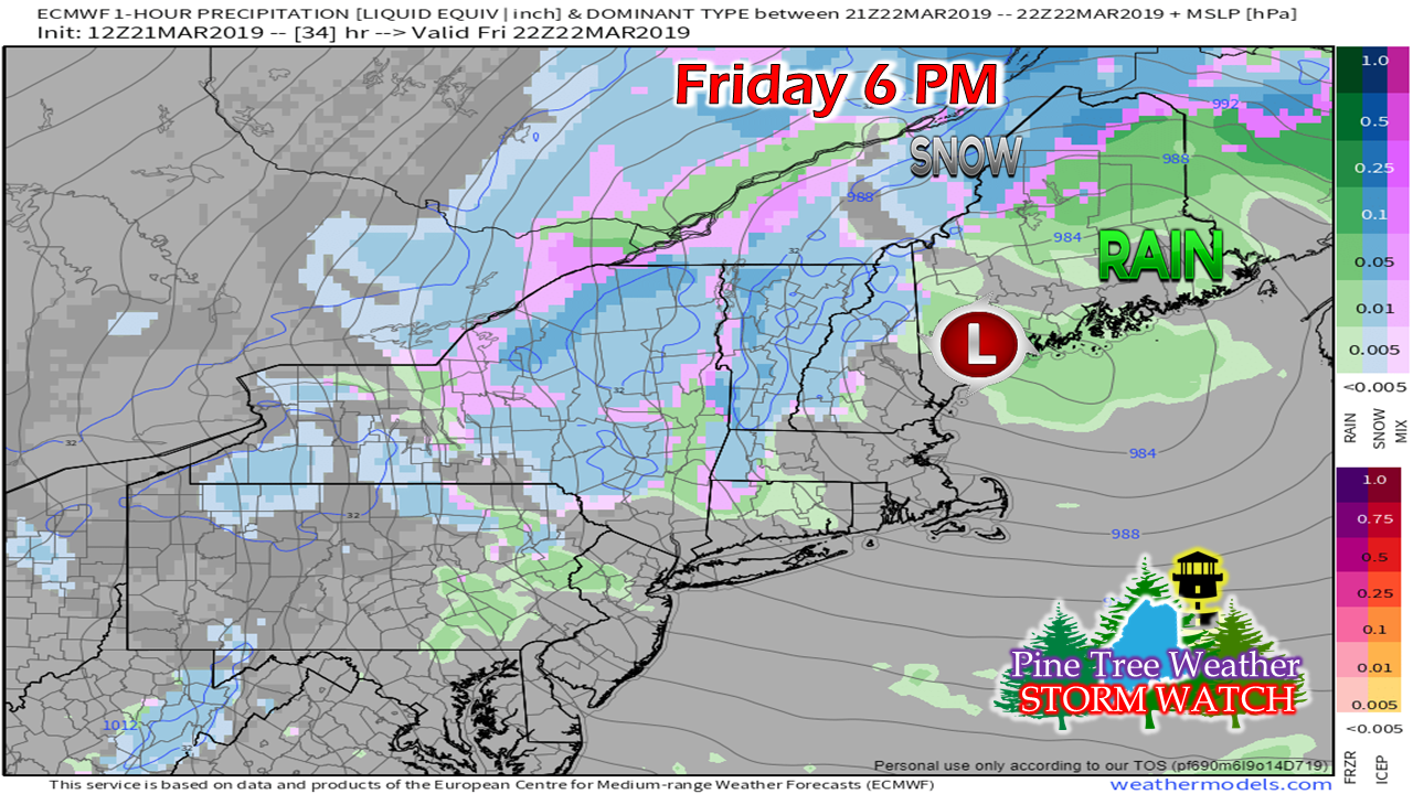 By Friday evening, the low hasn't moved to far. This is the period where the TROWAL (TRough Of Warm Air aLoft) works into the storm. By this point, most areas will have seen rain, with the possible exception of the Allagash region. 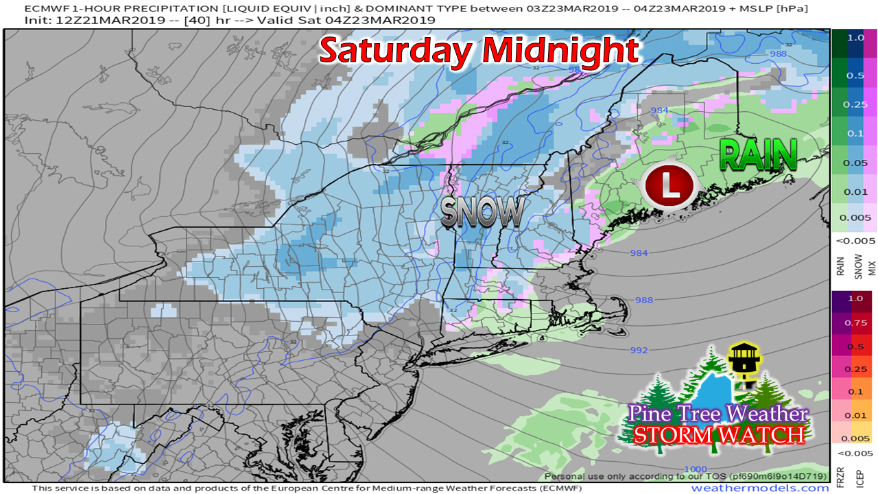 By midnight Saturday. the center of the storm appears to wobble over the Penobscot Bay / Bangor region. Cold air starts to filter in behind it, bringing snow back into the picture for southern and eastern areas. 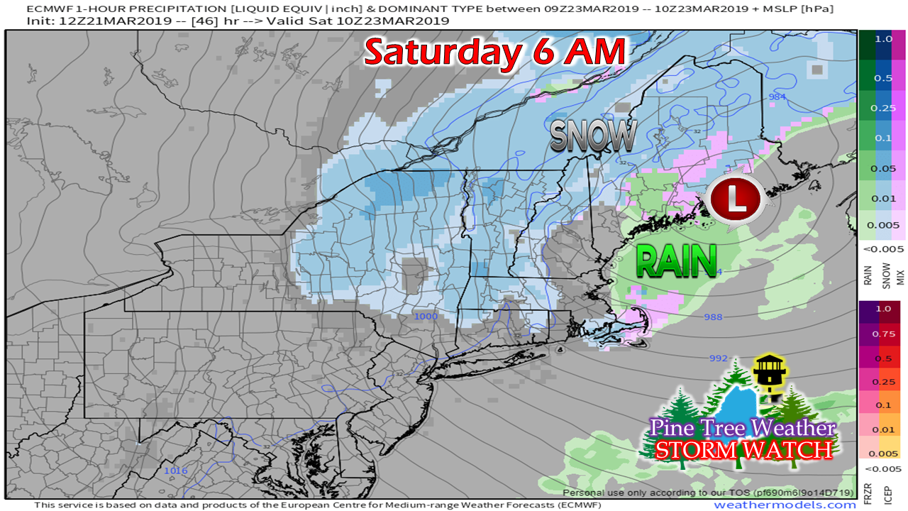 By daylight Saturday, the storm starts to move eastward. Snow redevelops over northern and western areas between midnight and 6 AM, so don't be surprised if there is a sloppy inch or two on the ground at this point. 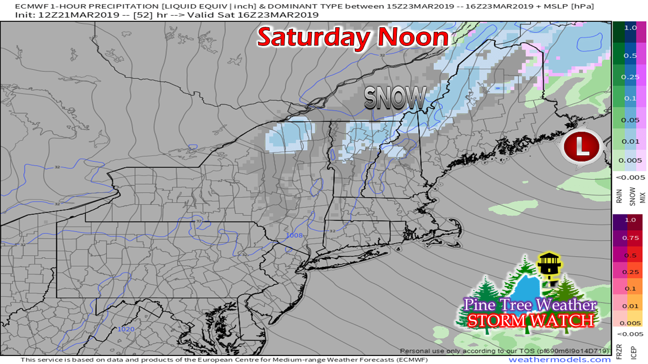 By Saturday noon, upper level energy captures the surface low and moves it along into the Bay of Fundy. Snow / snow showers continue for the mountains and north. It will be dry and windy, with a few pokes of sun for southern and eastern areas as we head into the afternoon. 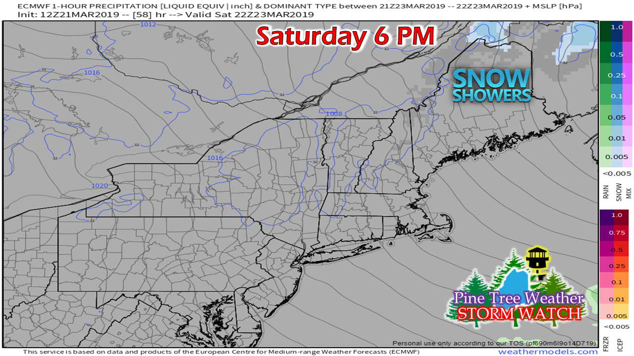 By the dinner hour Saturday night, most of the precipitation appears over. The it will be a breezy and cold night as we head into Sunday. Windy times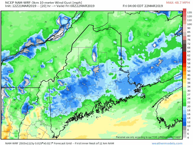 The loop shows the center of the low exceptionally with the white and gray colors. It will definitely be a breezy day for the coast until the low settles over the area. DownEast areas can expect windy conditions Friday afternoon. As the storm moves into the Canadian Maritimes, it will drag down cold air from the northwest Saturday afternoon and evening. For those that get heavy wet snow, you should be concerned for potential power outages Saturday into Sunday. Rain and snow amounts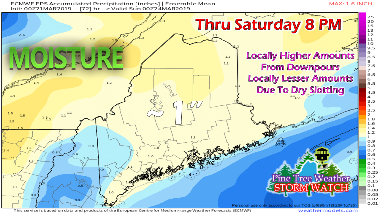 No changes here. Most everyone gets an inch of water out of this. This does not mean the form of all this is all rain, but the total of rain and snow combined. As far as river, stream and brook flooding goes, that will likely be determined once the storm gets underway. Again, if you live, work or travel near an ice covered or ice jammed tributary, you need to watch the levels closely. If you come across a flooded roadway, TURN AROUND DON'T DROWN. Stay in touch with the National Weather Service for bulletins associated with this storm. 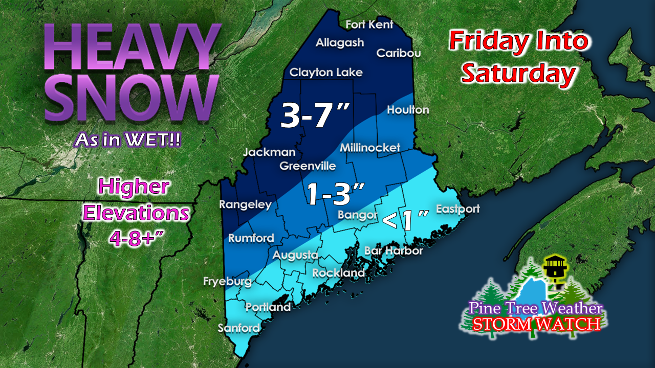 Anytime we have wet snow, it's a bit of a challenge to to get accumulations right, but this my best estimate. I can't stress this enough... this is a HIGHER ELEVATION snow event. What may be happening on top of a hill may be different as to what is going on at the bottom of it. The warm nose at the low level may bring rain or a mixed wet snow and rain situation at times. Also, since this is a higher elevation event, it would not surprise me if Sugarloaf gets a foot of snow out of this by the time this is over. Congratulations to ski country for an exceptional year! Feel free to leave this forecaster a tip for his efforts keeping you informed this year. Coastal flood concerns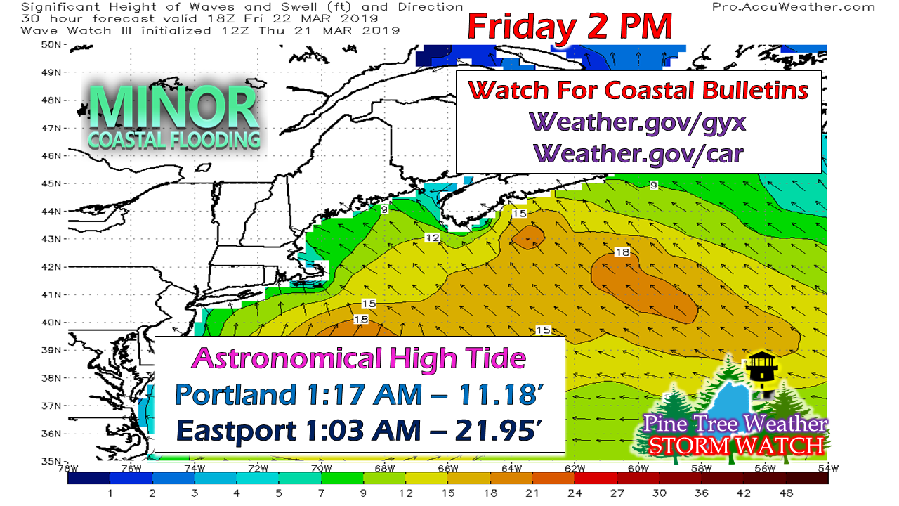 The shorelines may escape this one without too much issue. There are Coastal Flood Advisories and statements posted for the entire coastline. The National Weather Service is expecting storm surge to be around a foot at high tide Friday afternoon, so at the very least there will be splash over and some minor flooding in the typical spots. Regional outlook through Tuesday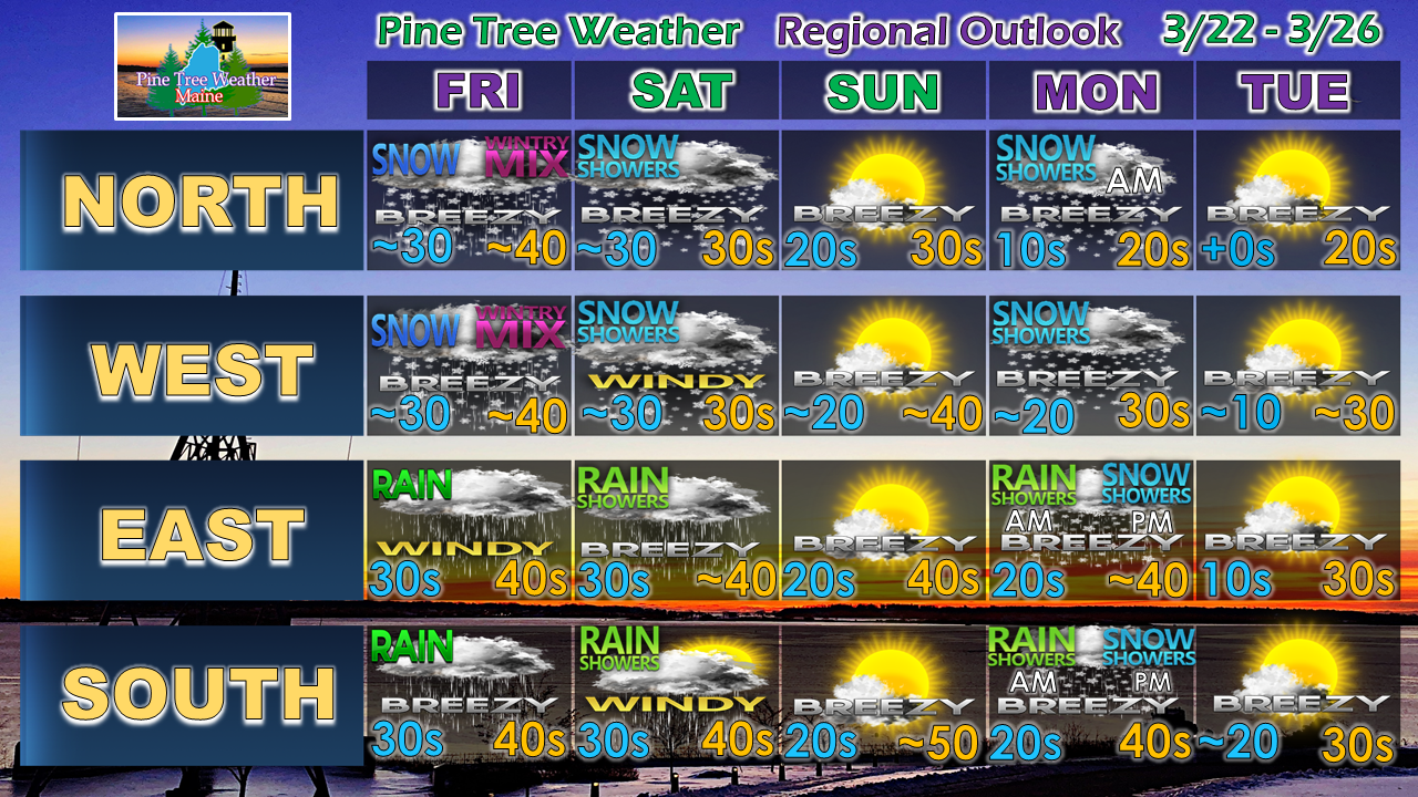 After all of this, we have a cold front working through the region on Monday which will bring rain and snow showers back to the region. We chill down below normal as we head into the middle part of next week.
Stay tuned to my Twitter feed and Facebook for updates from me on this storm. ► ► For the latest official forecasts, bulletins and advisories, please check in with the National Weather Service in Gray for western and southern areas, or Caribou for northern and eastern parts of Maine. ► ► Your financial donations are much appreciated to keep this site funded and for further development. I sincerely appreciate your support not only financially, but also in sharing my efforts with others. Always stay weather aware! - Mike |

Mike Haggett
|


