
One more storm to get through before a break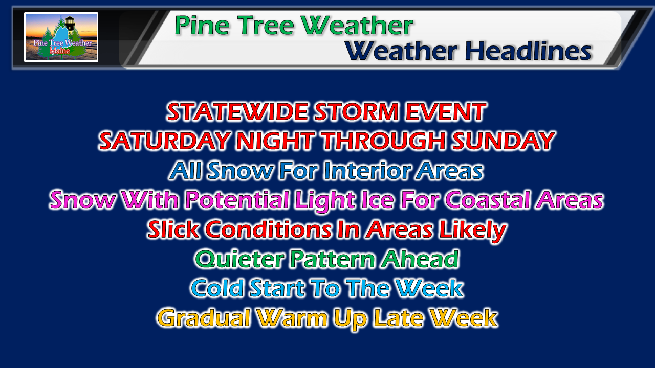 Through Saturday morning, it's just nasty cold. This cold air sets up the precipitation type for our next storm that will begin to impact the region Saturday night, which appears to start off as snow everywhere. Expect slick travel whether by vehicle or by foot into Sunday. Mainly snow for most, some ice for the coast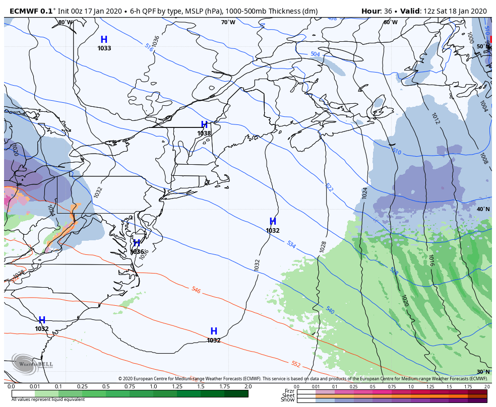 We've seen this movie quite a bit this winter with the Colorado/Great Lakes low spinning off a coastal low and transfering that energy into it as it heads off the the Canadian Maritimes. In past storms, it's brought the four precipitation food groups and frustration for forecasters as well as inhabitants who had to deal with it. This one is more straightforward. With the deep cold in place as Thursday's storm implodes over the northwest Atlantic, the approaching warm front runs into that wall of cold and as a result most of the precipitation will be frozen. The storm begins to have impact over western and southern areas Saturday night, and spreads to northern and eastern areas overnight into the wee hours of Sunday. Steady precipitation yields to snow showers for interior western areas Sunday morning. Freezing drizzle and/or rain is possible for shoreline areas through Sunday afternoon. The bulk of the remaining precipitation ends late afternoon for northern and eastern areas, but snow showers are expected to continue into Monday. 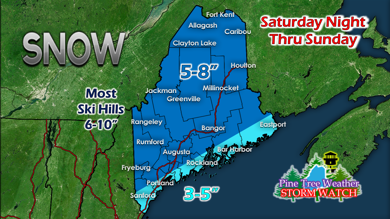 Factoring in the potential for a coastal front due to the close proximity of the developing ocean storm, shoreline regions are on the lighter end for accumulations. The ski hills continue to build their bases with another solid snow event. Below normal temperatures to start the week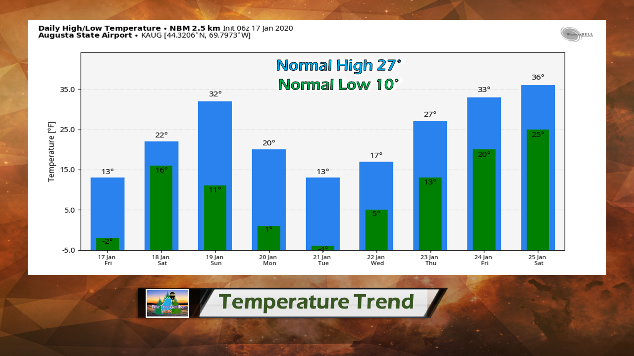 Overnight lows could be flirting with 0° for a couple of mornings to start the workweek, so keep the stoves going and the wood ready to burn. Outside of some light precipitation possible later in the week as slightly warmer air moves in, there is no major storms in sight, for now. ► ► For the latest official forecasts, bulletins and advisories, please check in with the National Weather Service in Gray for western and southern areas, or Caribou for northern and eastern parts of Maine. Please help me get fully funded! ► ► $65 shortfall for the year ahead! You can help keep Pine Tree Weather going with a donation of ANY amount now through VENMO @PineTreeWeather, a monthly donation on Patreon or messaging me on Facebook or Twitter to send a check in the mail. Thank you for your support!
For more information from me, please check the Pine Tree Weather Facebook page as well as my Twitter feed. Always stay weather aware! - Mike |

Mike Haggett
|


