
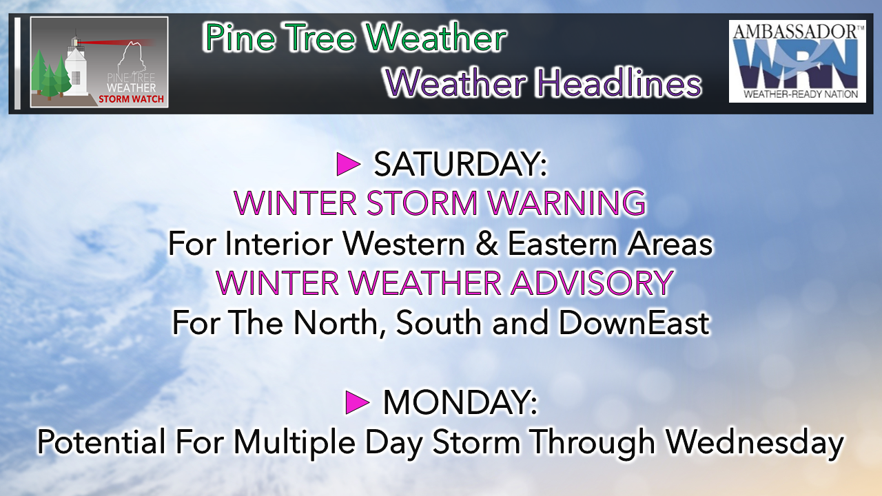
 Welcome to 2021, and congratulations for surviving 2020. I say it often that I appreciate your support, because it means a great deal to me. It's amazing to see how much this has grown over the years, and for the mainly positive feedback we get from you folks. Pine Tree Weather is almost fully funded for 2021, and I want to thank everyone who has chipped in on that. I don't mind doing this as long as I have the support of followers to pay the bills. Details on how to contribute is on the banner below. Important information here... I mentioned on Wednesday that a new world record for high pressure was recorded in Mongolia. A new record low for extra-tropical cyclone was recorded in the Aleutian Islands on Thursday. While all of that is roughly half a world away, those events are going to have a ripple effect across the entire Northern Hemisphere for the next couple of months, at least. La Niña is very strong right now. The sum of all of this means a more active storm pattern. Keep your storm supplies stocked. Keep the shovels ready. Stay updated on the forecast, expect changes, a chance for surprises, and stay aware. A mainly snow event for most for Saturday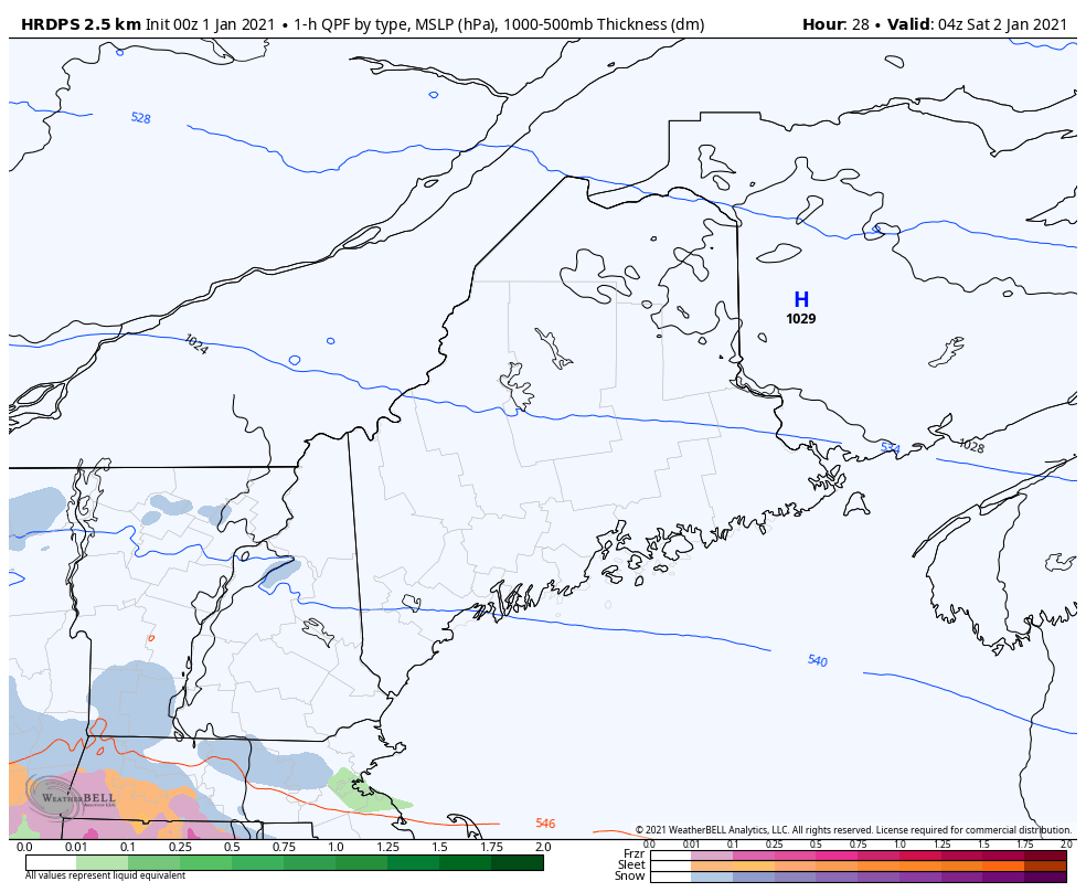 The storm appears to work into the region rather flat, then intensifies as it departs to the east. Precipitation starts in the wee hours of Saturday over western and southern areas and overspreads the rest of the state by morning. Precipitation is expected to taper off over the west and south by early afternoon, north and east by late afternoon. 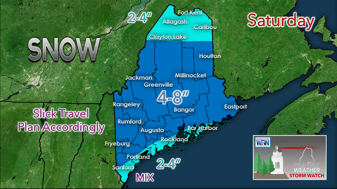 The trend with this storm continues to get colder as it gets closer. This will be a good storm for the ski hills where 6-10" is a fair bet there. Where there is bust potential is the far north which is on the fringe, and for the southwest coast where a sleet / freezing rain / rain mix may occur. If the trend continues to get cooler, 3-6" is possible for Portland. Further south into York County it may only amount to a slushy inch or less along the shoreline. All kinds of intrigue to start next week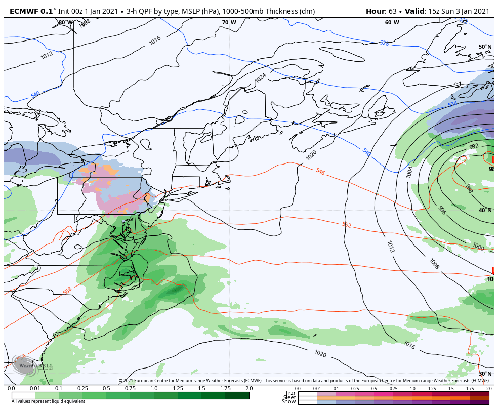 NOTE that this loop is for entertainment purposes only at this point and is by no means a forecast. The purpose of this is to show the idea of low pressure ejecting off the DelMarVa Sunday afternoon and moves to the northeast. There is all kinds of ideas as to what happens from that point. The European deterministic idea here keeps the storm to the south of the benchmark 40°N/70°W and hangs to the south of Nova Scotia until late Wednesday. I've seen ideas where the storm tracks closer to Maine, stalls out and could bring a foot or more of snow. I've also seen ideas of a Fujiwhara effect situation may throw a wrench into this as well, and the tail end of the European loop here indicates that. At this point, think a potential plowable snow for Monday. The duration and overall impact is still to be determined, but this could be a two or three day event for at least some parts of the state.  How to properly measure snow and sleet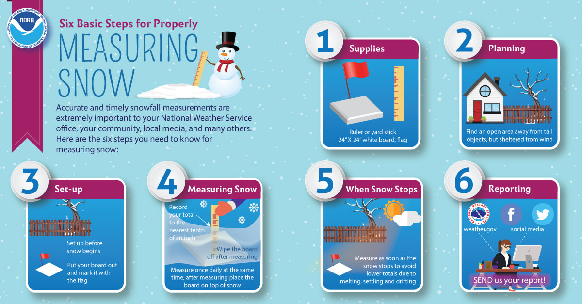 Sleet and snow depth are measured the same way. You will need a ruler, and possibly a piece of paper and a pen. 1. Locate a surface that is solid, level and in the open. Avoid measuring snow and sleet depth under trees or directly next to buildings. 2. Slide the ruler directly downward into the sleet until it reaches the ground. 3. Read the value on the ruler to the nearest tenth of an inch, if possible. 4. Record this value on your piece of paper. 5. Repeat steps 2 through 4 in several locations around the immediate area. 6. Calculate the average snow and/or sleet depth for your area by first adding all of the measurement values together, and then dividing the resulting sum by the number of measurements taken. The average is what you will report to the National Weather Service. Temperature outlook through ThursdayI hesitate to even share these temperature ideas because my confidence in anything beyond Sunday is extremely low. It would not surprise me to see the forecast go cooler. At any rate, temperatures appear to be generally above normal statewide. Normal highs and lows: Caribou is 22° / 4° Bangor 29° / 9° Augusta 29° / 13° Portland 33° / 15° 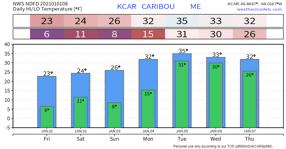 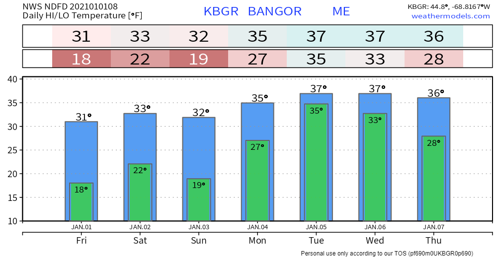 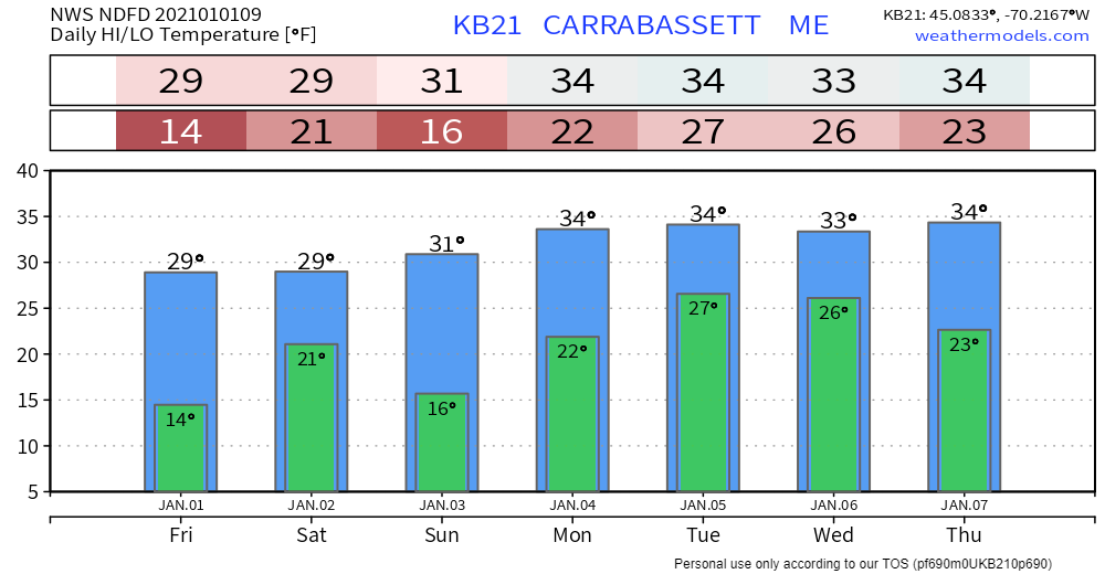 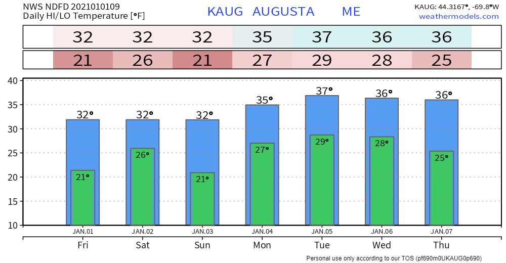 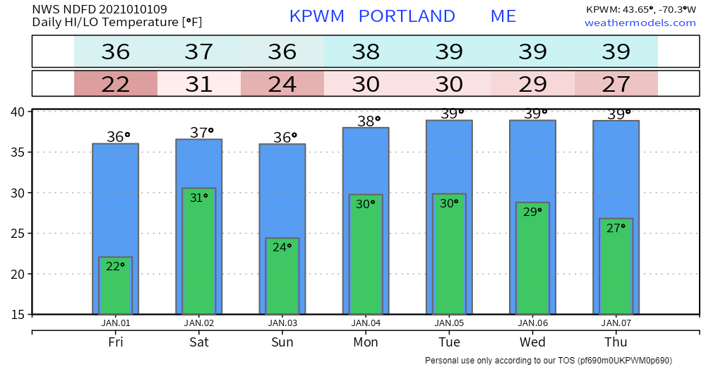 Be prepared to receive alerts and stay updated!
For more information, please follow Pine Tree Weather on Facebook and Twitter.
** FUNDING NEEDED FOR 2021 ** Thank you for supporting this community based weather information source that is funded by your financial contributions. Stay updated, stay on alert, and stay safe! - Mike |

Mike Haggett
|


