
A salute to Veterans Day 2022 A moment to start off here to thank the veterans for their service to our country. My late father served in Vietnam and worked on the former Naval Air Station Brunswick base up until he was diagnosed with pancreatic cancer, which would claim his life after a three-year battle against it in March 2006. I spent this past Monday with a group of wounded combat veterans in a golf tournament in Middleton, Massachusetts, which I do a couple times a year to keep life in perspective and to say thank you. PTW is done in honor of my father's memory. He was an avid outdoorsman who fished and hunt. Weather forecast information was critical information to him. The 6 o'clock news was appointment television, along with his NOAA weather radio, and his barometer. I think of him every day I do this, and it helps me with the healing process of his loss at the age of 62. For those that served, and for the spouses and children of those that served, thank you for your sacrifice. All the pieces begin to come together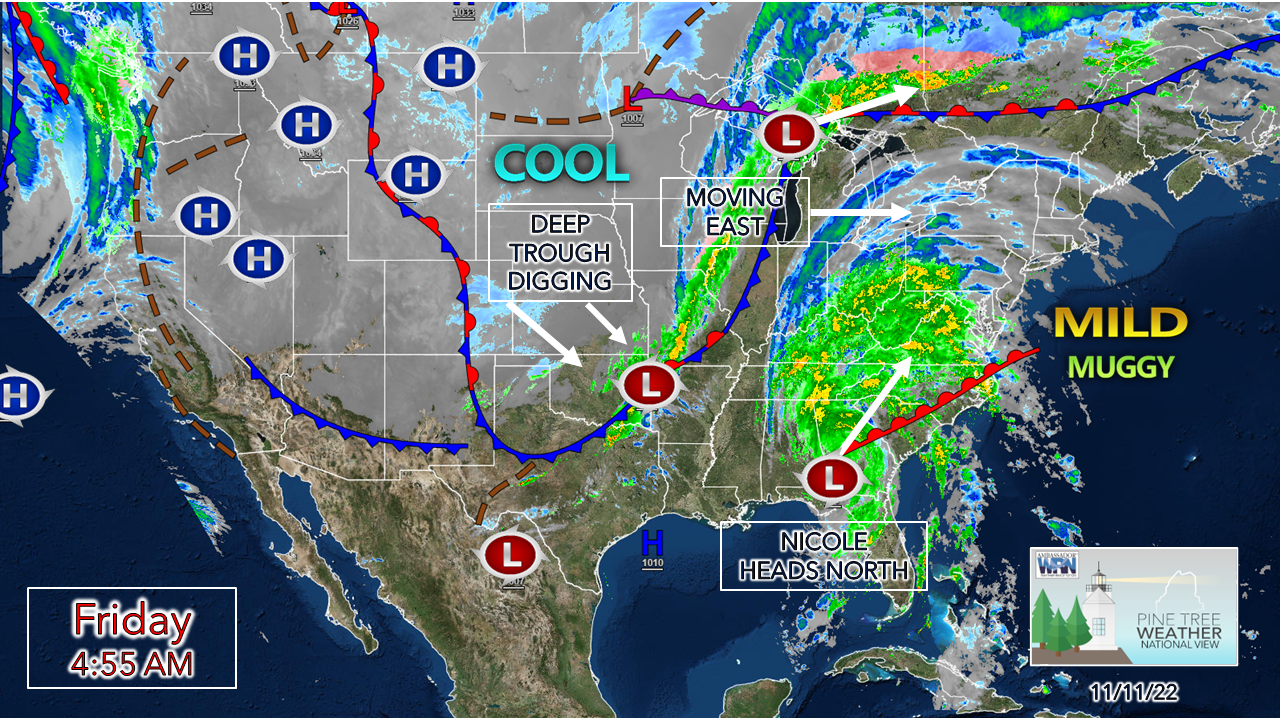 Low pressure responsible for a blizzard over the northern Plains moves through the Great Lakes and heads toward Maine. What is left of Nicole moves northeast along a frontal boundary that will bring cool temperatures to the entire country through next week. 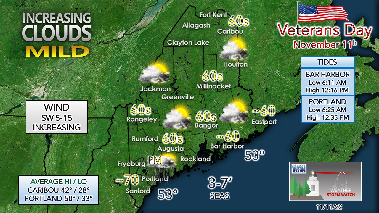 The region stay dry for most of the day with showers moving in over southern areas late in the afternoon. Pending on cloud cover, 70-degree readings are possible from Fryeburg / Portland south. Most of the region tops out in the 60s. Dew points will be on the rise as the tropical moisture streams north. By Saturday morning, July level humidity will be prevalent everywhere. Forecast holding true for the most part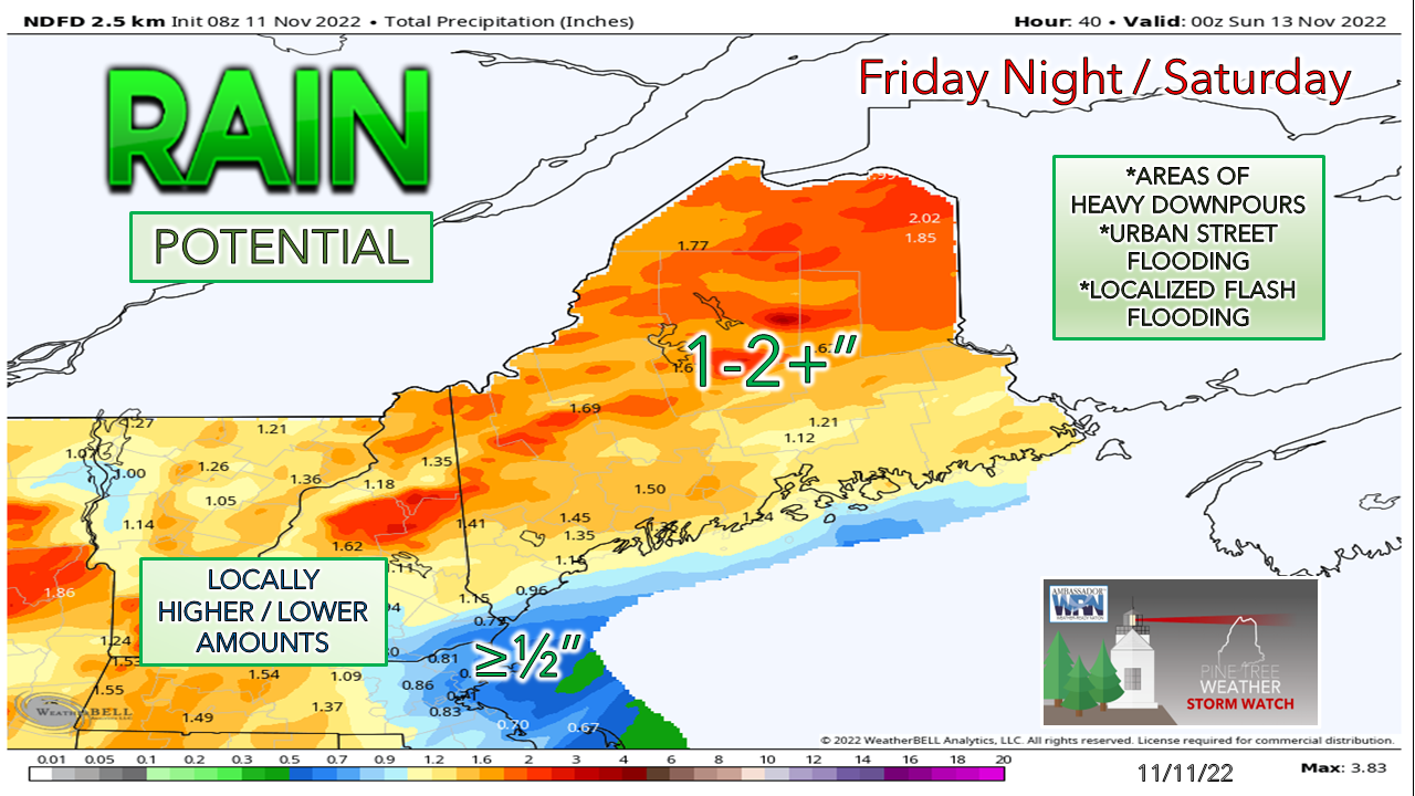 Timing of rain is holding serve. Showers are expected to develop late afternoon over the southwest and expand northeast across the region Friday night. A dry slot comes in ahead of the frontal boundary that moves through the area on Saturday. Showers end from west to east midday to mid-afternoon. The south and west have a decent chance of sun in the afternoon. This is a tropical system, surprises can happen. There is a risk of thunderstorms, and if they do materialize, they could be potent, with an isolated severe storm possible with damaging wind. High humidity brings downpours. Localized flash flooding is possible. The mountains should watch the small rivers, brooks, and streams for flood potential there. 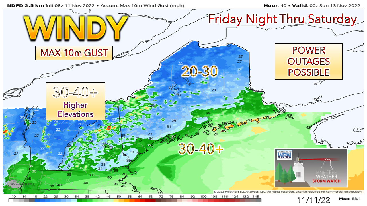 The wind increases during Friday and gets gusty overnight into Saturday. Once the frontal boundary passes on Saturday, the wind shifts to the west / northwest and settles down Saturday night. Gusts could be strong enough to cause some power outages. 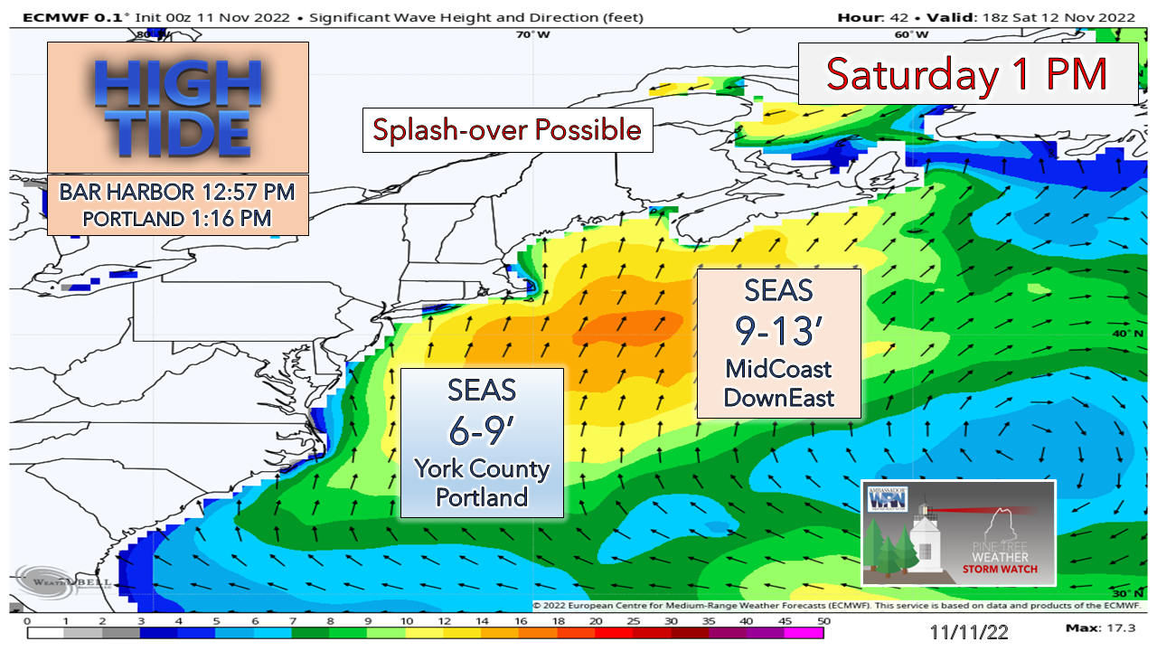 High tide along the shorelines Saturday around 1 PM could bring some splash-over, perhaps some minor flooding and a bit of beach erosion. DownEast areas see the higher waves. Stay tuned for any potential bulletins from the National Weather Service. The future of Pine Tree Weather depends on you!  Snow potential next week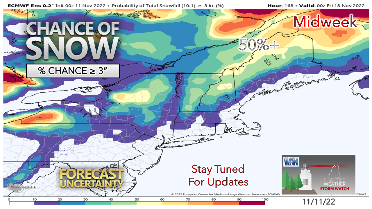 Operational models are floating the idea of wintry event in the Wednesday / Thursday time frame. Ensemble ideas are on it to a certain extent, but there are more questions than answers at this point. One thing working for the idea to happen is the amount of cold air around. The mountains certainly have a better chance at this point because of it. There will be a better idea on this by the first of the week. Below normal temperatures are on the way next week. 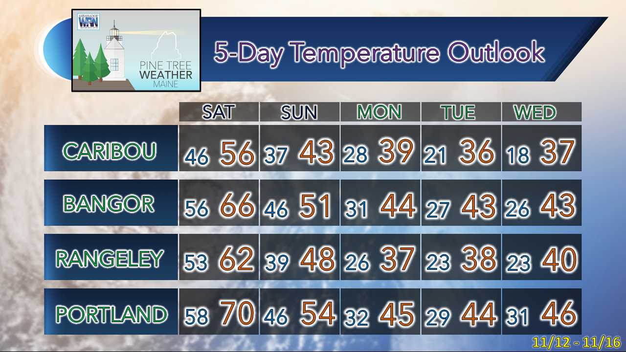 NOTE: The forecast information depicted on this platform is for general information purposes only for the public and is not designed or intended for commercial use. For those seeking pinpoint weather information for business operations, you should use a private sector source. For information about where to find commercial forecasters to assist your business, please message me and I will be happy to help you |

Mike Haggett
|


