Tuesday storms could pack a punch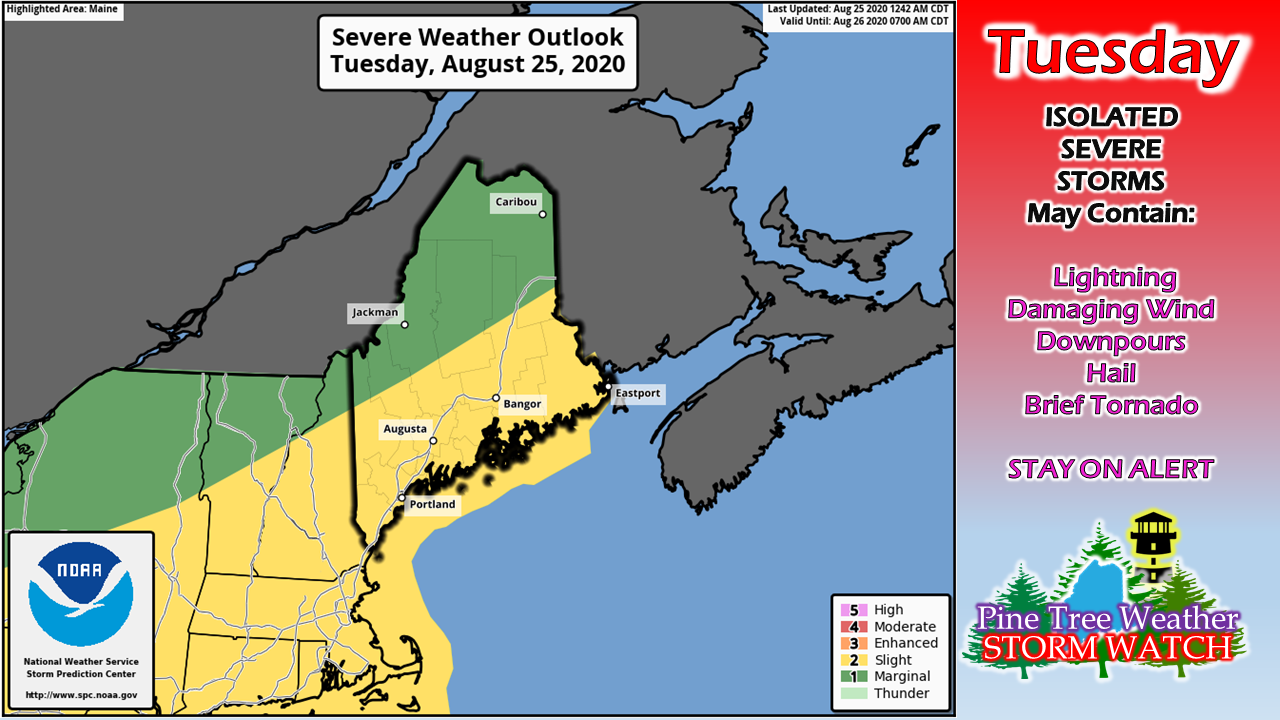 The storms that passed through on Monday over southern and western areas brought hail and damaging wind reports. Radar indicated potential tornadoes with a few cells. While none were reported, what is important to take out of that is the amount of spin in the atmosphere. With this strong cold front approaching, there is plenty of spin to cause strong to severe storms that could get nasty. 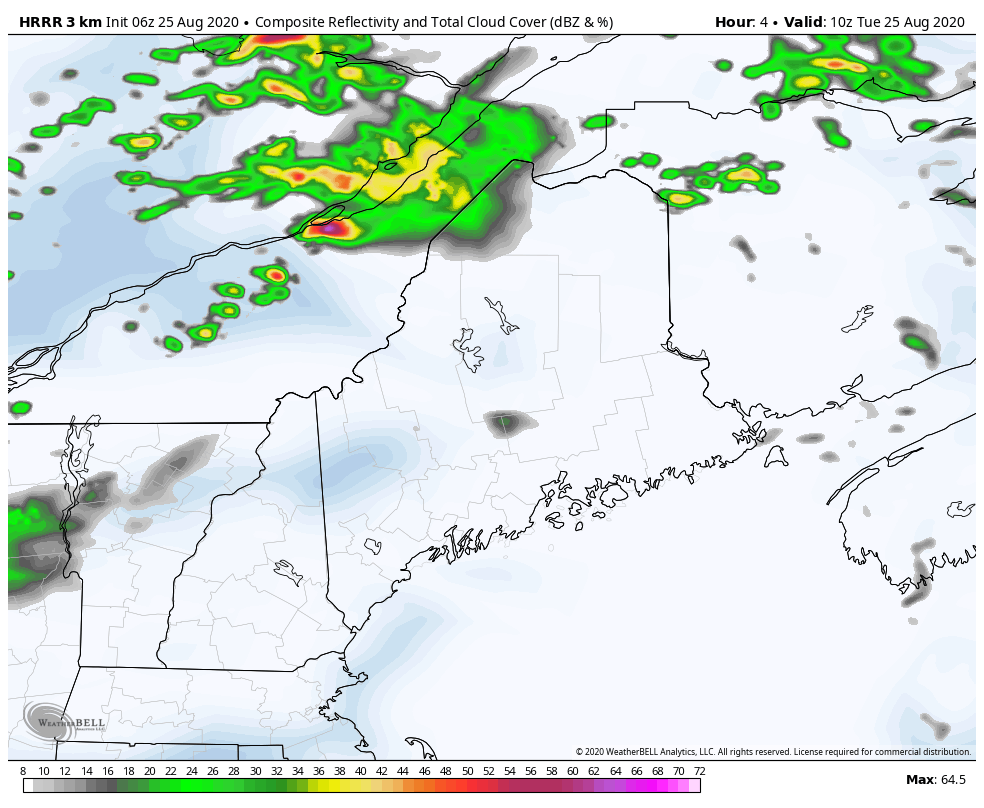 The front is a quick mover. Showers and storms associated with the front touch off mid-morning across the western mountains and north, and then head southeast through the afternoon. The last of the activity exits DownEast areas by early Tuesday evening. As mentioned here yesterday, the strength and severity of the storms will depend on the amount of cloud cover around. For coastal locations, the marine boundary (read: sea breeze front) and any fog that hangs on, diminishes the threat. 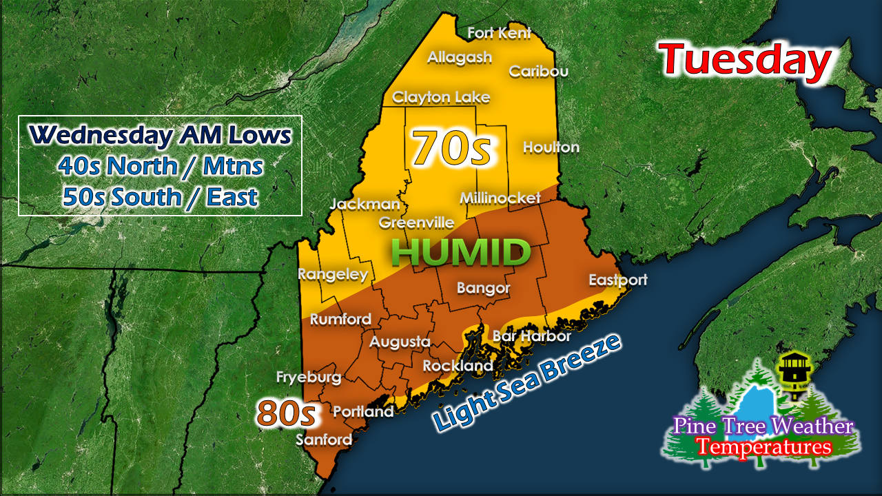 With the amount of humidity around, there is plenty of fuel for storms. Add the spin in the atmosphere from the approaching front, there is cause for concern when storms initiate. With the quick moving nature of the front, relief from the humidity behind the front comes briskly. 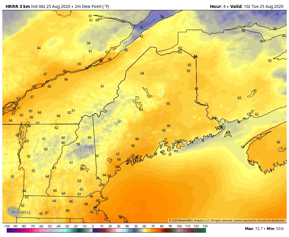 While the dew points may reach to around 70° in areas ahead of the front, the moist air will be quickly replaced by dry air. It will be a night to open windows and turn off the air conditioner. It will be a bit breezy, however. Wednesday a breezy one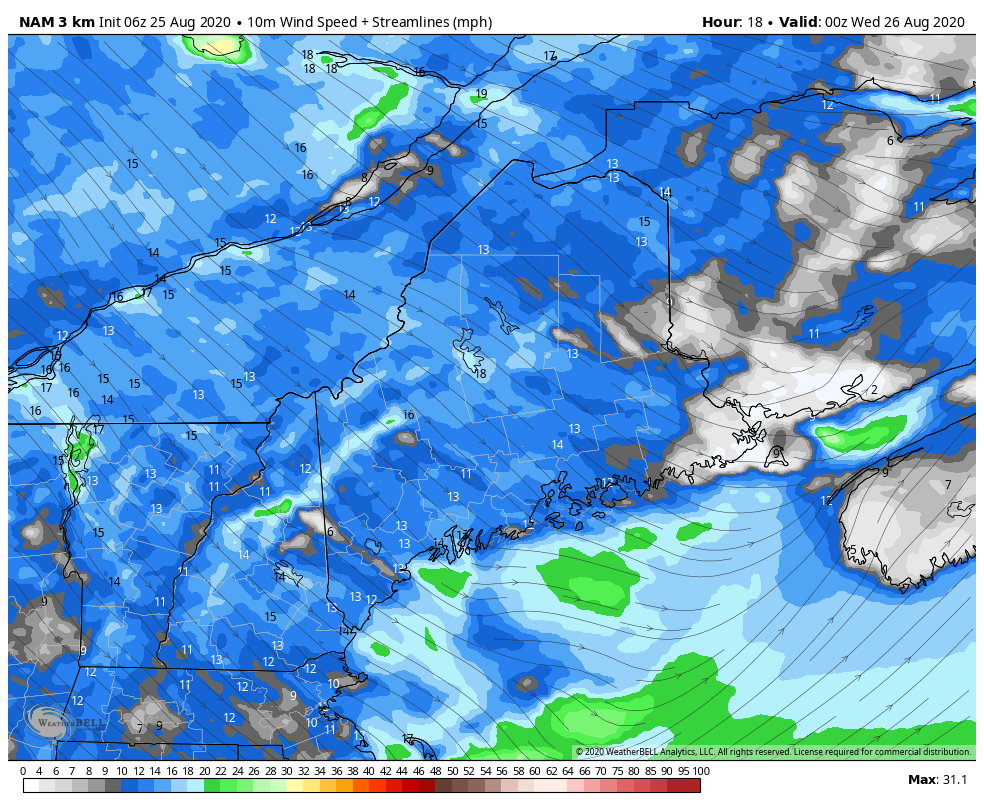 Tuesday night, the northwest breeze kicks up and it will continue through Wednesday and into early Thursday, settling from west to east Thursday morning. With the breeze, low humidity from the drier air mass, that sets up wildfire concerns. Folks need to use caution dealing with campfires and open flame as any fire could get out of control quickly. 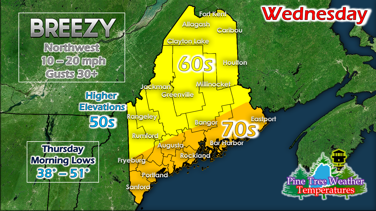 Temperatures will be much more comfortable. The northwest breeze keeps the mountains and north on the lower end of temperature range. The coastal plain has the best chance to reach the low 70s. If not for the breeze, there would be a concern for frost for the interior protected valleys, but there should be just enough of it to keep the temperatures above freezing. Outlook into the weekend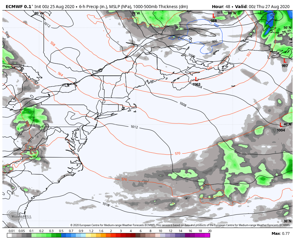 A weak area of low pressure moves southeast from Ontario Thursday and could bring some shower activity to southwestern areas for the day. Northern and eastern areas stay dry. 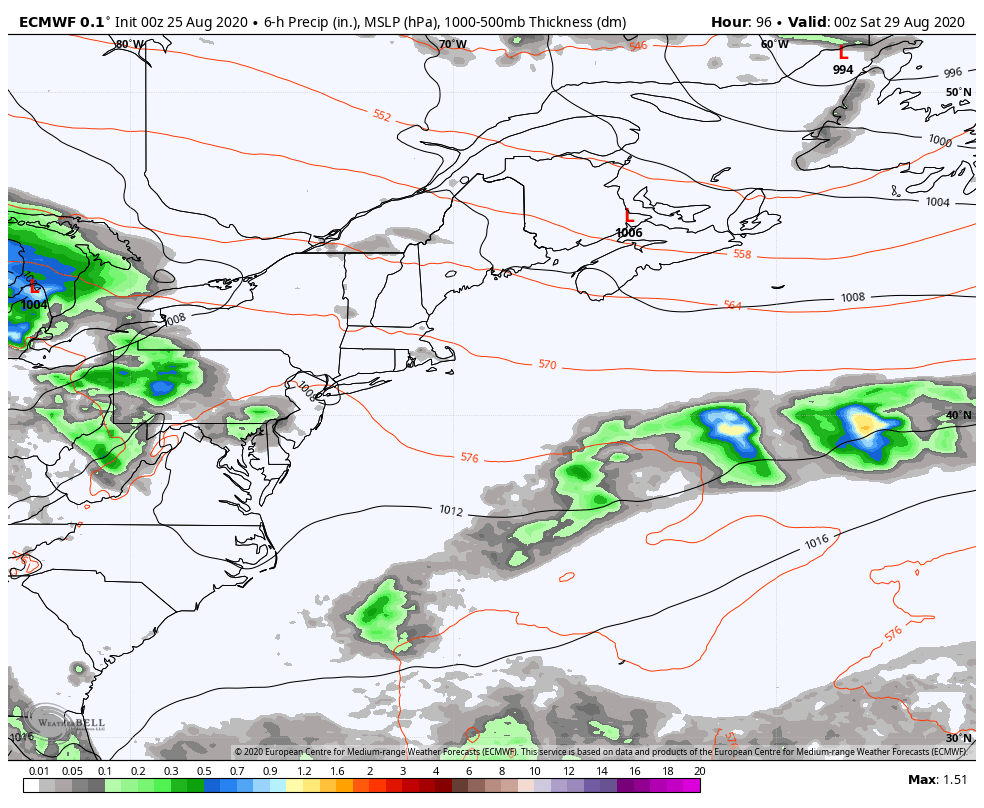 What could be our best chance for a widespread rain event is growing more likely for Saturday. There is a reasonable idea for much of the state to pick up a half inch of much needed rain out of this. The remnants of Laura appear to pass by well to our south on Sunday and heads for Newfoundland Monday. 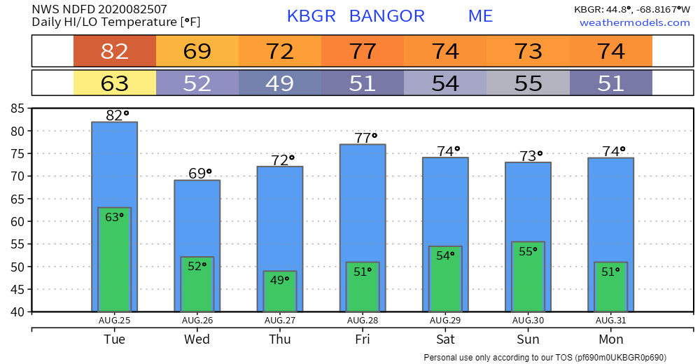 Temperatures appear comfortable with many areas in the 70s with lows in the upper 40s to low 50s pending on region through early next week.  Stay updated and report your weather!
For more information, please follow Pine Tree Weather on Facebook and Twitter.
Thank you for supporting this community based weather information source that is funded by your financial contributions. Stay updated, stay on alert, and stay safe! - Mike |

Mike Haggett
|