
A bit warmer to wrap up the week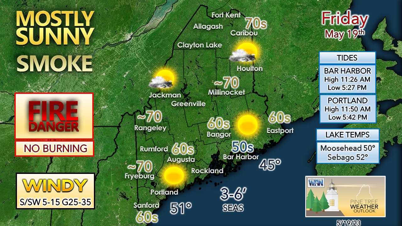 After another chilly start, temperatures climb fairly quickly. A south/southwest wind develops and increases during the day, which will keep the coastal plain cool. The far north may end up being the warm spot for the state this afternoon. It is yet another day to remain cautious with flammable materials, grills, and fire pits. If you head to the beach or seaside trails for a walk or hike today, bundle up. 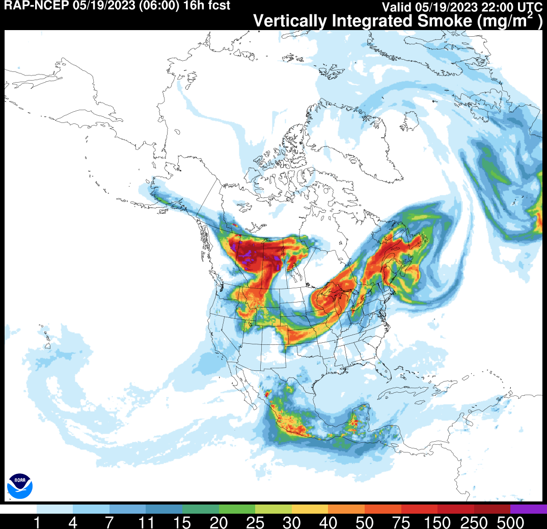 With a mainly clear sky, smoke from the Alberta wildfires will dim the sun at times through the day, and may set up a vivid sunset in areas Friday evening. Much needed rainfall on the way Saturday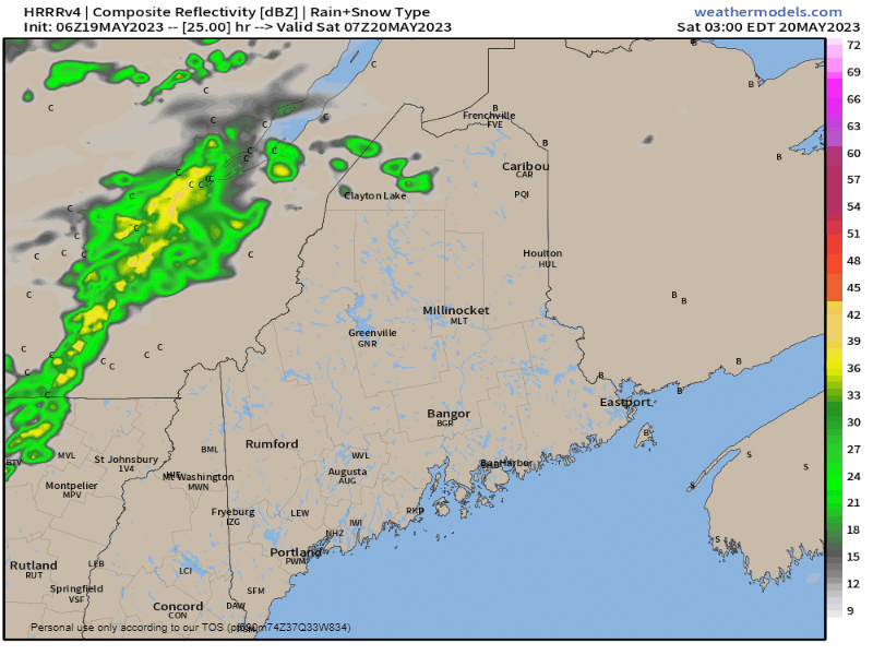 Saturday 3 AM to Sunday 2 AM - There is a fair amount of discrepancy on the timing of the arrival of rain. I see ideas that are a bit more progressive and start the rain earlier, and some later. This HRRR idea is roughly a blend of those ideas. The main debate with guidance has to do with high pressure to the east, its strength and influence on the approaching front. Northern areas may get an early morning shower. Showers enter into the state from the southwest in the afternoon, reaching Bangor by around the dinner hour, and into northern areas by mid-evening. Rain tapers from southwest to northeast overnight heading into Sunday morning. Given the tropical hose attached to this front, there is a chance for some rumbles of thunder. Northern areas may deal with a few showers as the storm heads for Newfoundland Sunday morning. 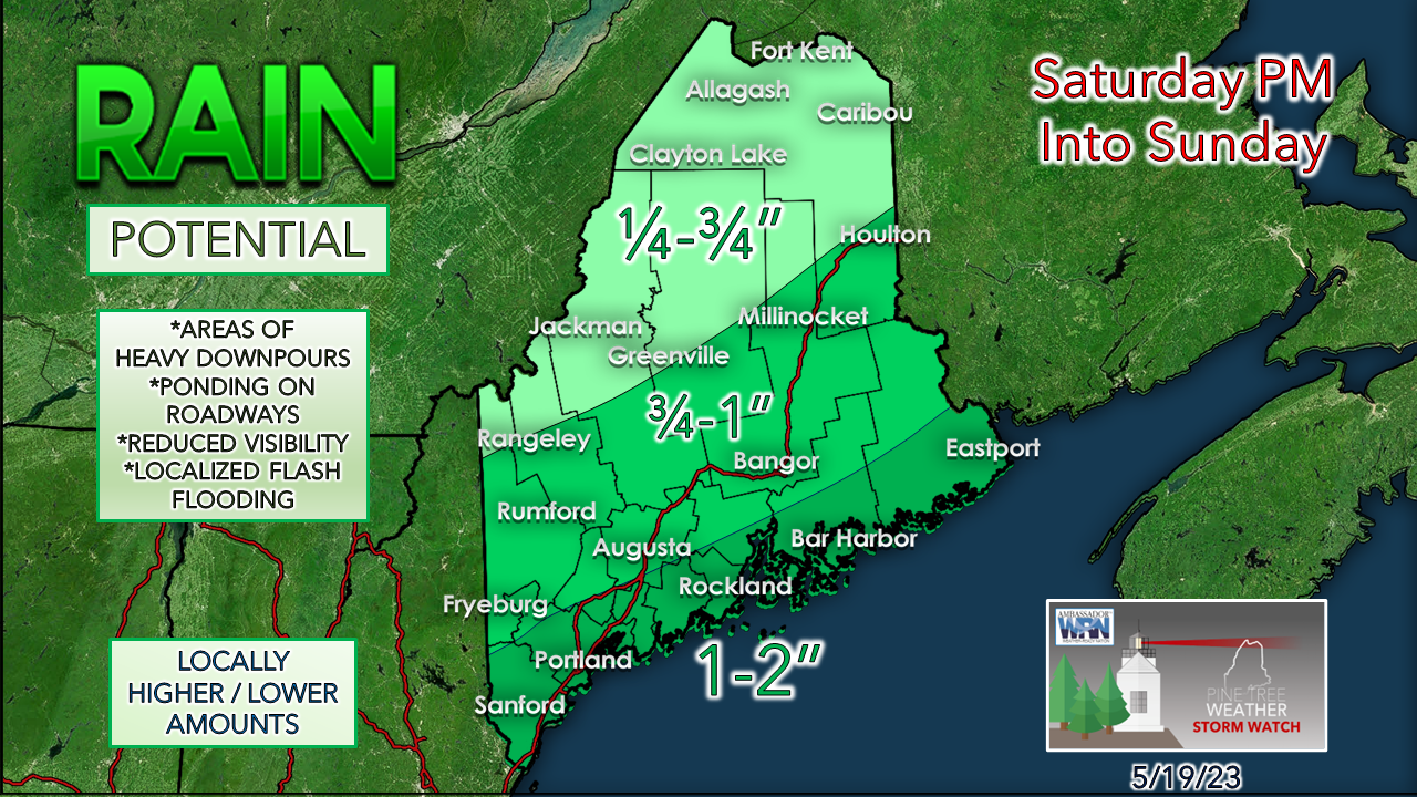 Coastal areas are likely to see the higher amounts, with MidCoast / Penobscot Bay areas likely to see the higher end totals. While river flooding is unlikely, some localized flash flooding is possible in areas of downpours. Important to note here that this rain may be the last we see of any value for a while as dry times return. 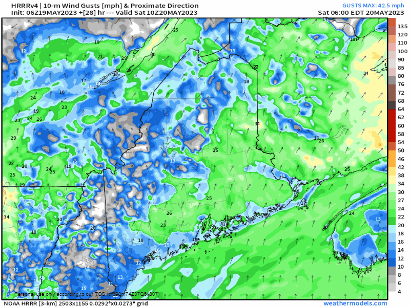 Saturday 6 AM to Sunday 2 AM - Not only will the coast get the bulk of rainfall, but it will also deal with the windiest conditions. Wind gusts may reach 30-40 mph from the south/ southeast for the shorelines, with 25-35 mph possible over interior areas. A dry cold front passes through on Sunday, shifting the wind direction to the northwest in the afternoon. We may get a break from this persistent breeze early next week. Temperature outlook through WednesdayWeak frontal boundaries passing through will be the rule through the middle part of next week. For those looking for summer heat, you may get your wish by next weekend as a strong ridge builds in heading into Memorial Day weekend. 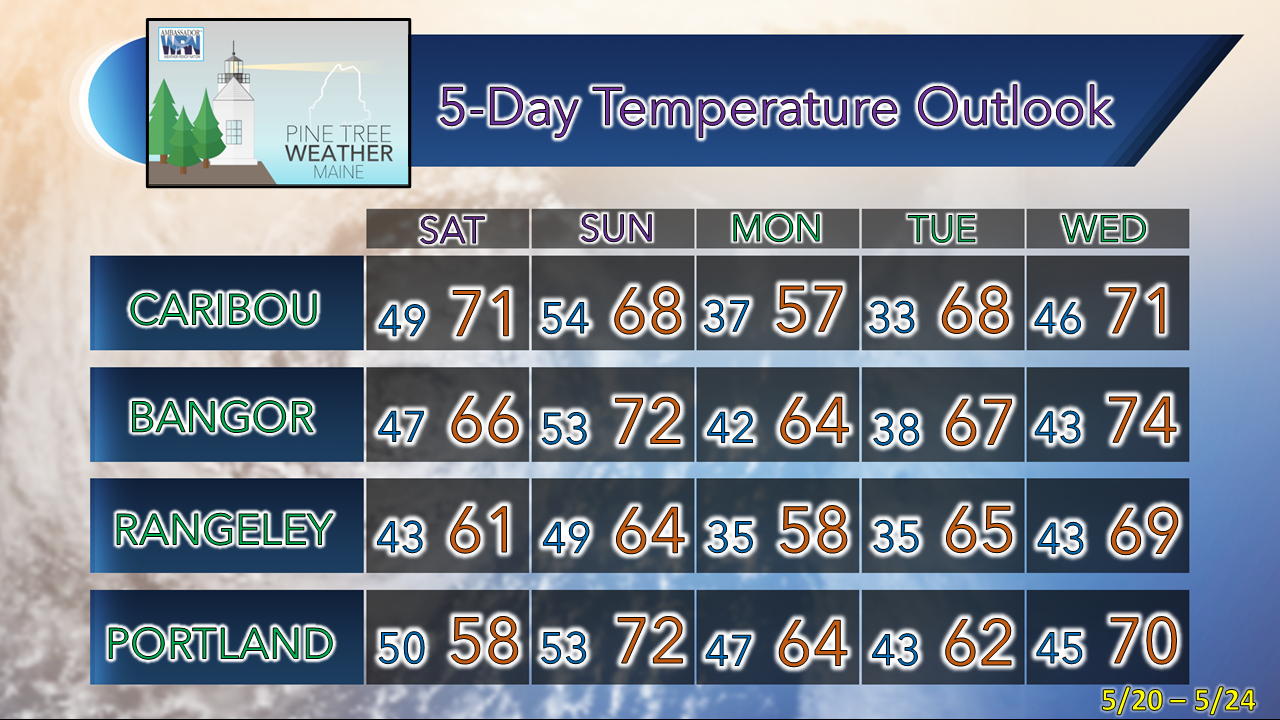 Pine Tree Weather is funded from followers like you. I would appreciate your financial support. Click here for how you can contribute. You may not like the weather, but I hope you like what I do! Please hit the like button on Twitter and Facebook, and share! I sincerely appreciate your support! Stay updated, stay on alert, and stay safe! - Mike NOTE: The forecast information depicted on this platform is for general information purposes only for the public and is not designed or intended for commercial use. For those seeking pinpoint weather information for business operations, you should use a private sector source. For information about where to find commercial forecasters to assist your business, please message me and I will be happy to help you.
|

Mike Haggett
|


