Enjoy the sunshine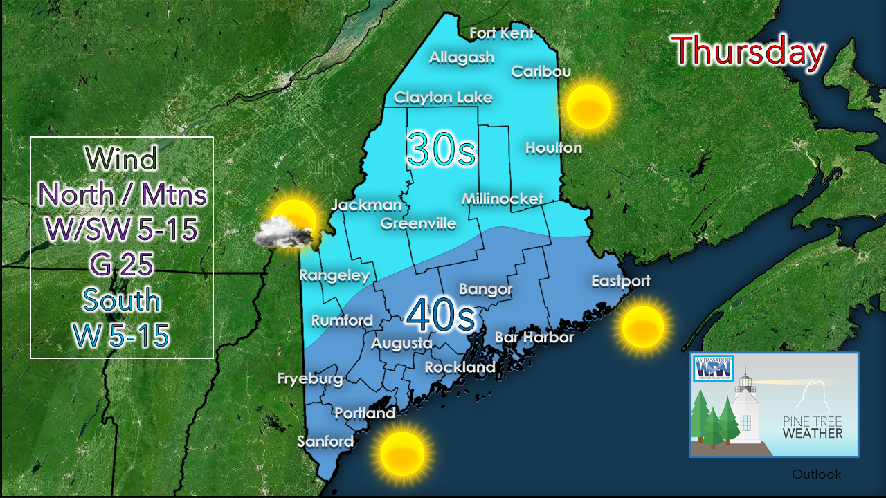 The region has been going through a cloudy and stormy period over the past week and sunshine has been at a premium. Enjoy what you get today. For the north and mountains, it may be late next week before there is sun of any quantity. For eastern areas, it may be Wednesday, and for southern areas, Monday. Our stormy weather pattern continues over the weekend. NorEaster potential still "up in the air"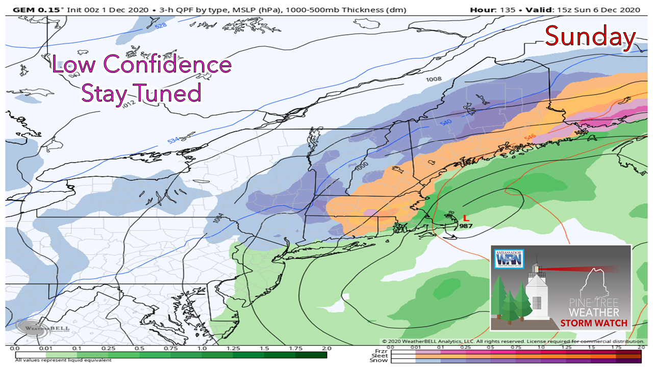 A couple days ago I shared this image here. At the time I had a gut instinct that this sort of scenario would be a good possibility. Guidance is still having a bit of rough time figuring out the when the phasing occurs, and consequently, the timing of intensification and impacts associated with it. As I said here yesterday, I like consistency. On that point, I like some sort of agreement from at least one other idea, but that isn't happening yet. Given there is little time before the storm arrives, I am going with my gut. 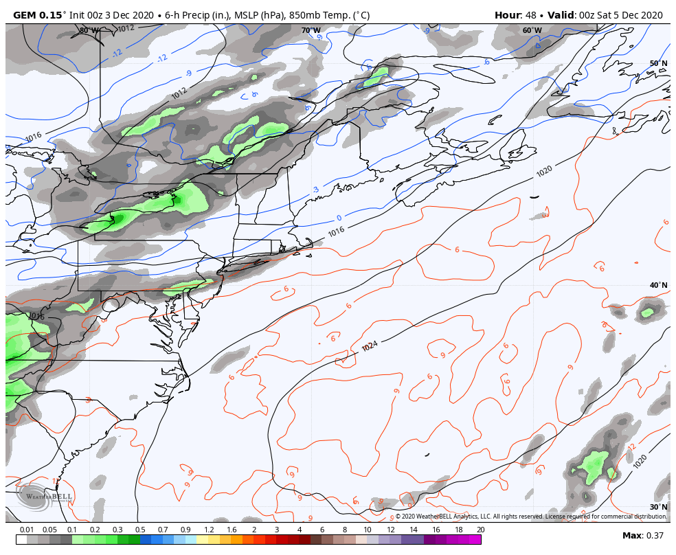 Canadian model idea from 7 PM Friday to 7 PM Monday I suspect at this point clouds will be on the increase Saturday with precipitation starting over southwestern areas Saturday afternoon. This will spread to the north and east Saturday night. Sunday will be mess for western, eastern and northern areas as the storm tracks into the Bay of Fundy. The storm reaches the Gulf of St. Lawrence by Monday, where it will slow down and slowly spin eastward toward Newfoundland heading into Monday night. For those running errands over the weekend, it would be wise to get them done either Friday night or Saturday morning. 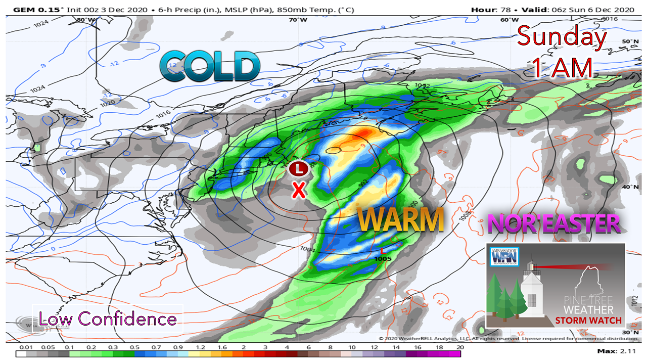 Since this is a NorEaster scenario figuring out precipitation types, location of the track is key. The red "X" indicates the benchmark 40° N / 70° W point, which gives a rather solid clue what the precipitation type(s) could be to the north or south of that point. In this case here, the track is north near Nantucket. This is an indicator of a potential mixed bag of precipitation. 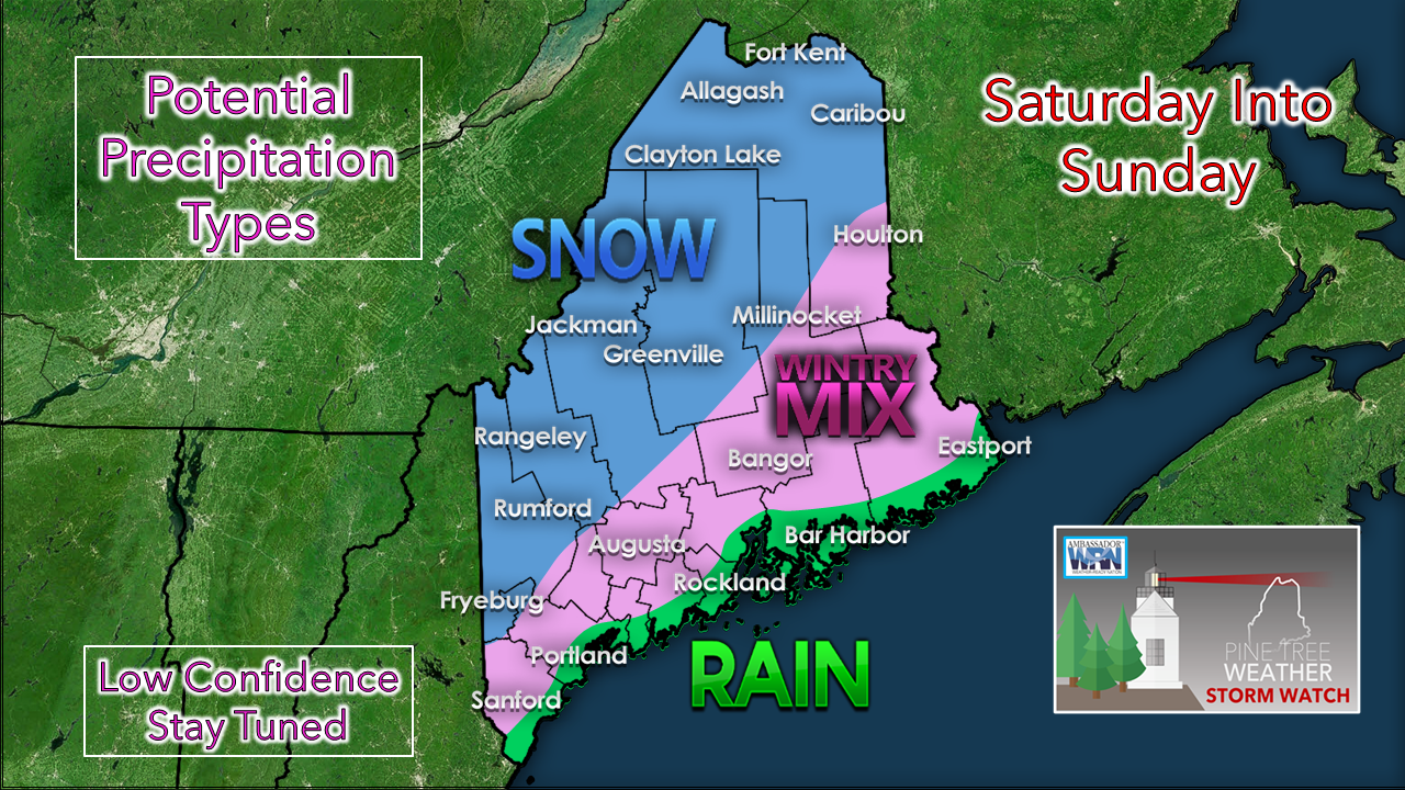 I think at this point the shovels come out for most of the region away from the shorelines. For western and northern areas, snow is good bet at this point. A mix of snow, sleet and rain is reasonable outcome for coastal plain on up into eastern Maine. A cold rain which may end as snow for the coast is track dependent. Any deviation of the path closer to the benchmark point brings the mix to the shorelines. This is where the fine tuning in the forecast will come Friday into Saturday. As the storm moves into the Gulf of St. Lawrence Monday, northern areas are likely to see snow showers continue through the afternoon. 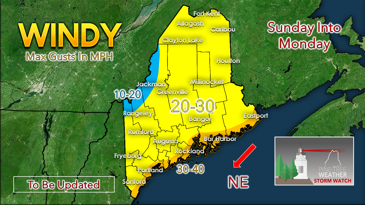 Since we're talking NorEaster, wind is a feature in this also. Coastal areas get the strongest gusts, which is typical. The position where rapid intensification occurs, along with track, will dictate the outcome of how strong the wind gusts will be and for how long. The situation on this storm on timing, precipitation and impacts remains fluid. This is my best idea for now. Stay tuned. Temperature outlook through Wednesday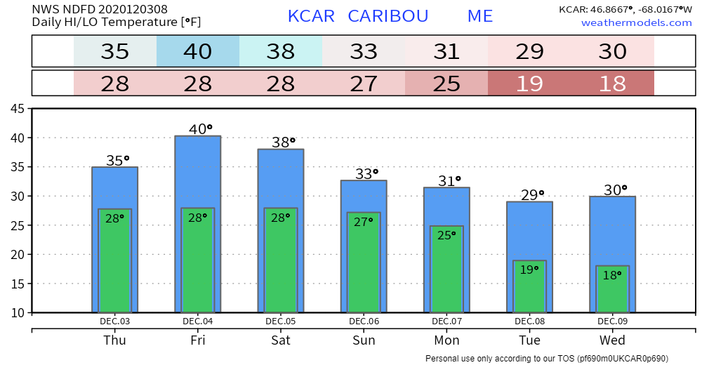 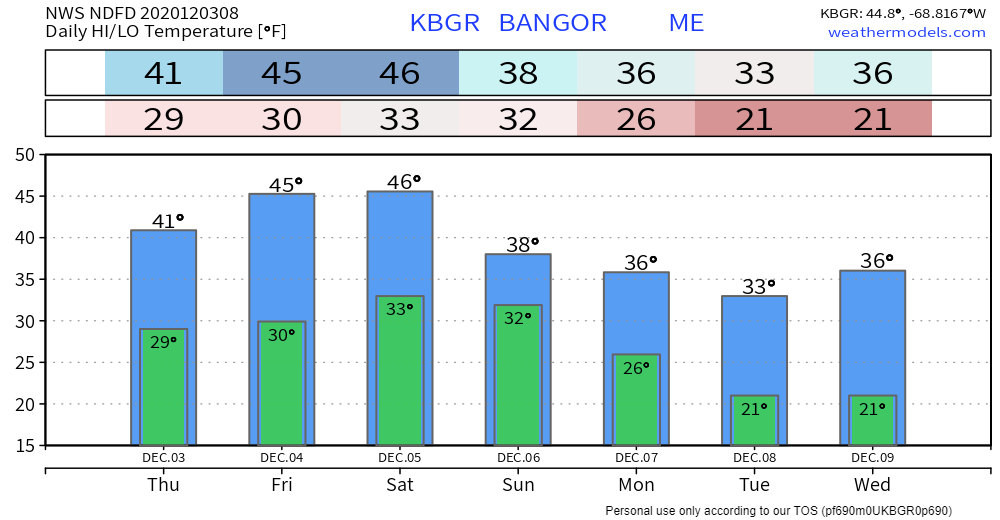 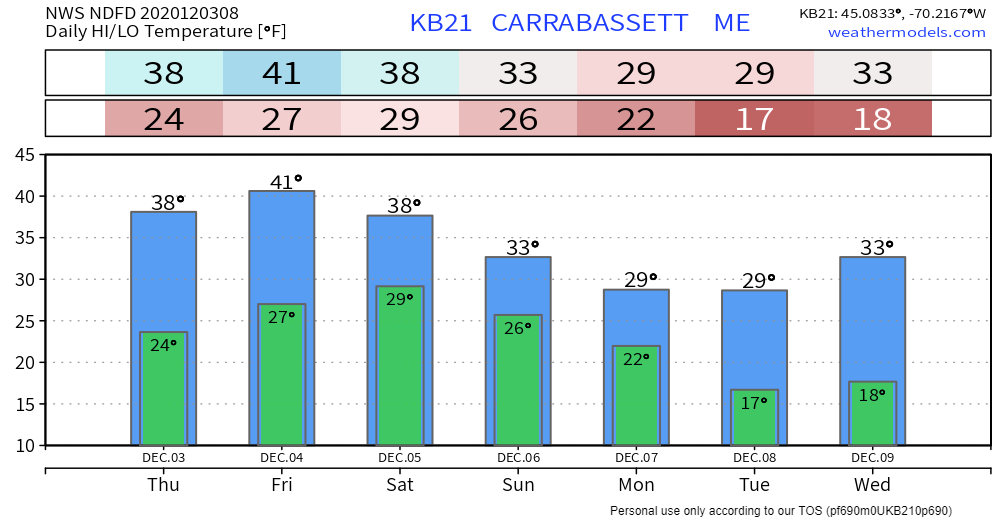 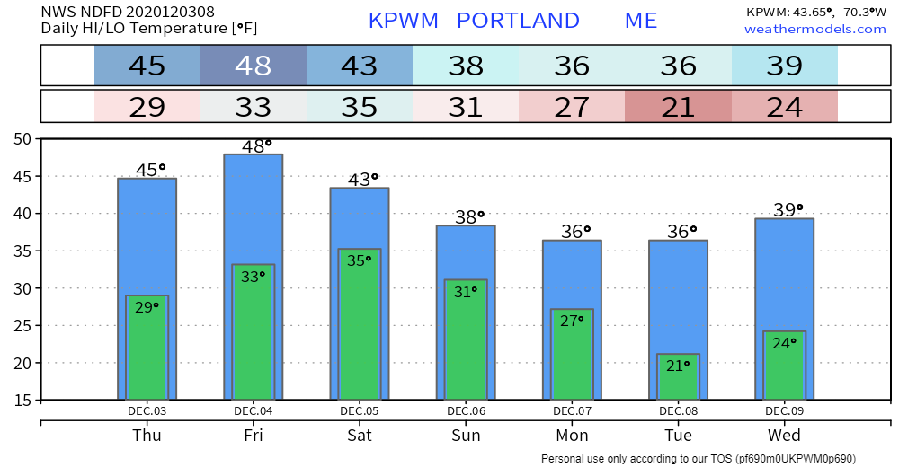 Nor’easter Safety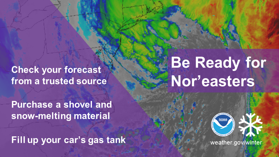 Nor’easters impact millions of people in the eastern U.S. with heavy snow and strong winds. What will you do if one approaches your region? weather.gov/safety/winter-noreaster Be prepared to receive alerts and stay updated!
For more information, please follow Pine Tree Weather on Facebook and Twitter.
** FUNDING NEEDED FOR 2021 ** Thank you for supporting this community based weather information source that is funded by your financial contributions. Stay updated, stay on alert, and stay safe! - Mike |

Mike Haggett
|