
A toasty day ahead for much of the state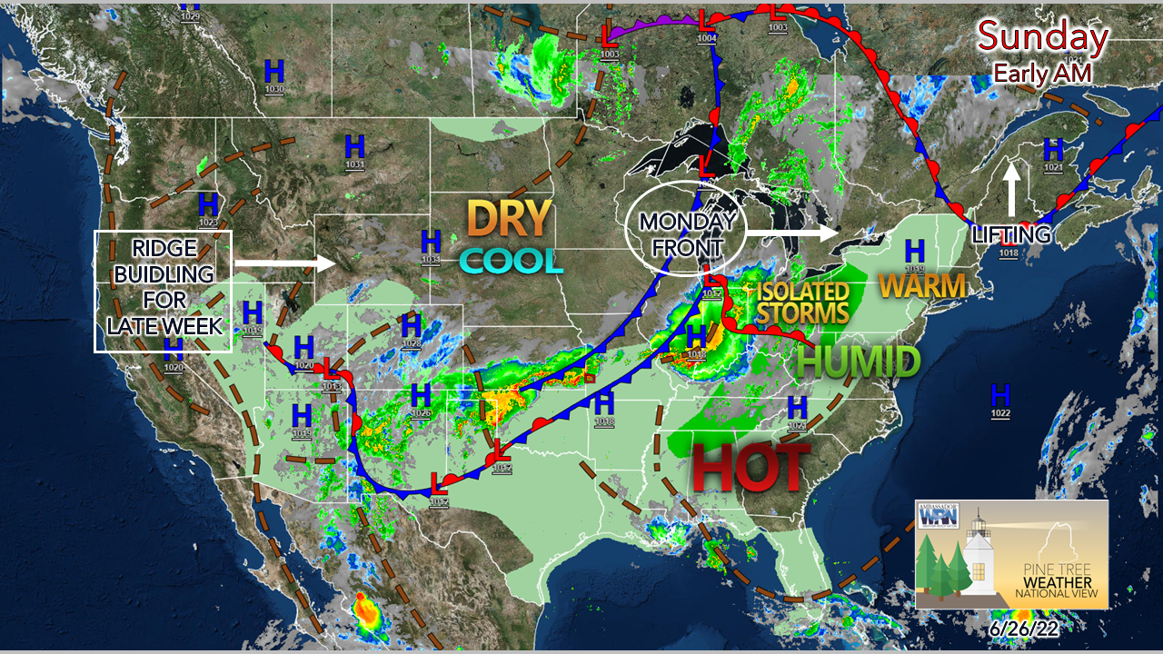 The backdoor cold front that dipped south into the region Saturday lifts northward during the morning. As a result, warm and muggy air filters in through the state. Sunday will be the warmest of the weekend. Monday is expected to be the most humid as a cold front approaches the area. 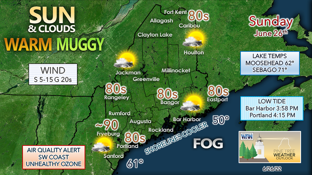 Expect the beaches and parks of the lakes and oceans to be popular destinations. DownEast shoreline areas could be dealing with fog, perhaps some drizzle, and much cooler temperatures than the rest of the state. A southerly breeze picks up and brings some relief for the shorelines for MidCoast and southwest coastal areas. With the rise of dew points through the day, unhealthy air quality for the southwest coastal areas is a concern for those with respiratory conditions from 11 AM to 11 PM. Showers around for Monday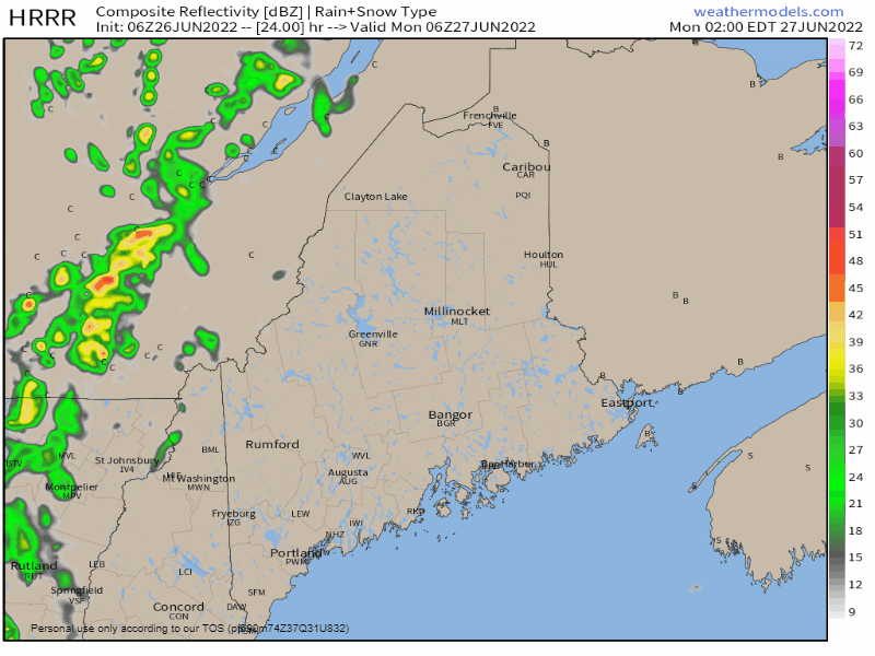 Monday 2 AM to Tuesday 2 AM - A cold front advances eastward to clear out the heat during the day. Scattered showers in the morning become more widespread heading into the afternoon. There is a chance for an embedded thunderstorm within the line as it passes through the region through mid-evening. Given the parameters, the threat for severe storms is very low given cloud cover. The main concern with this is localized areas of downpours given the high precipitable water levels, which could cause spot flooding, risk of ponding on roadways, reduced visibility, and hydroplaning on the highways. Some areas could see an inch or more of rain where it falls heavily, other areas may not get much where activity is limited. There could be some gusty wind that comes with the downpours. It would be a good idea to tidy up the yard or campsite ahead of time, secure any loose objects and cover anything that needs to stay dry. Expect Monday to be an "air-you-can-wear" day as dew points reach the mid to upper 60s. Once showers end, natural air conditioning from a northwest breeze enters in Monday night. Folks in western and northern areas can open the windows and enjoy the dry and cooler air overnight into Tuesday. Outlook through the week aheadAfter the passage of the cold front, expect a breezy day on Tuesday as a northwest wind clears out this round of heat and humidity. There is a slight risk of a light shower for the mountains and north as a weak clipper passes through in the afternoon. A weak trough passes through Wednesday night which may bring a shower in spots heading into Thursday morning. The risk for showers increases Friday into Saturday. 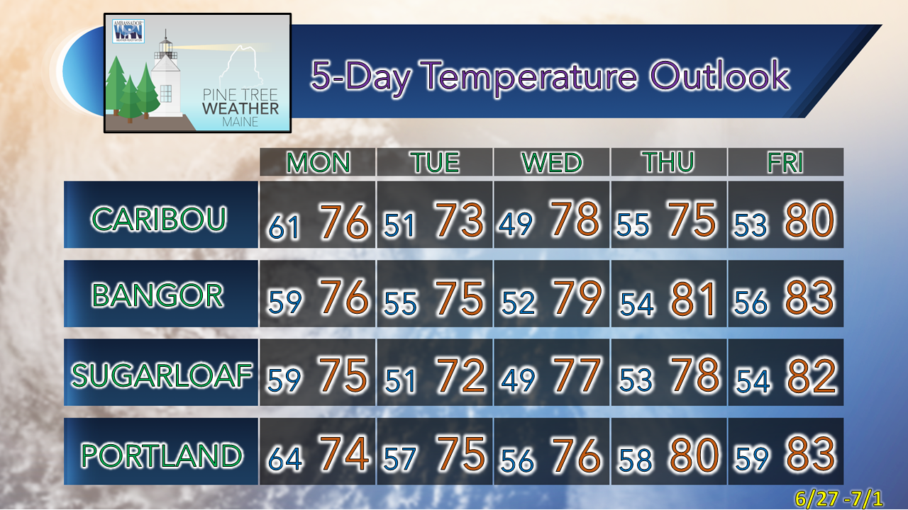 Thank you for supporting this community-based weather information source which operates by financial contributions from people like you. Stay updated, stay on alert, and stay safe! Have a great day! - Mike NOTE: The forecast information depicted on this platform is for general information purposes only for the public and is not designed or intended for commercial use. For those seeking pinpoint weather information for business operations, you should use a private sector source. For information about where to find commercial forecasters to assist your business, please message me and I will be happy to help you. |

Mike Haggett
|


