|
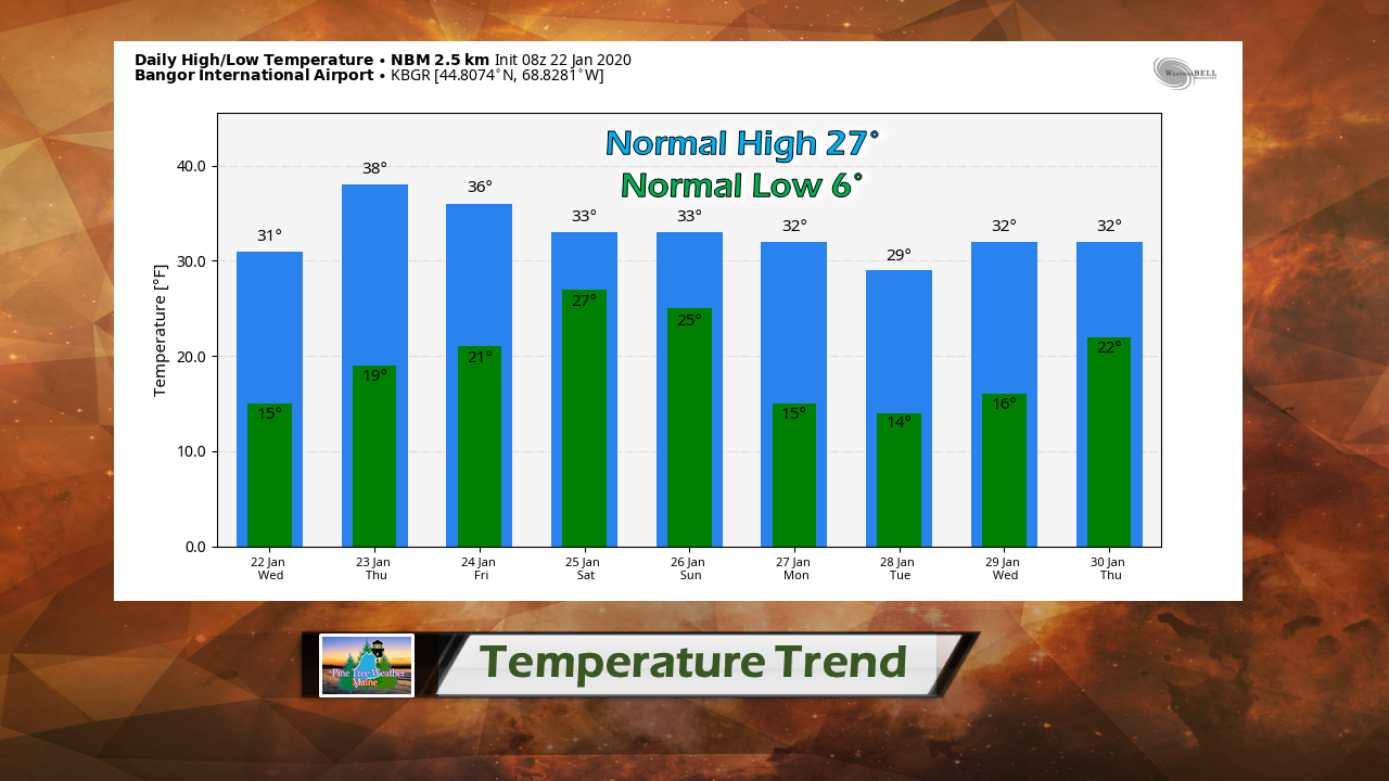
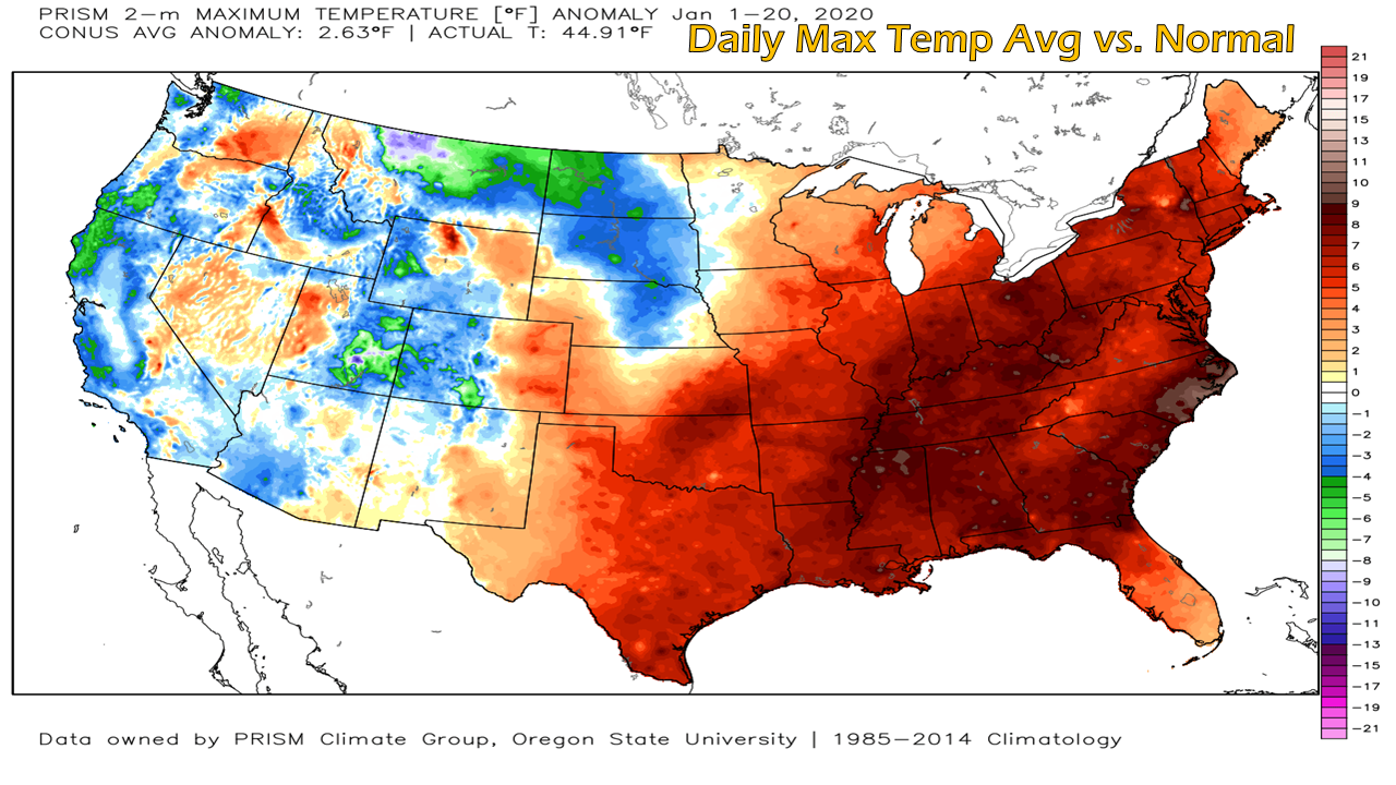
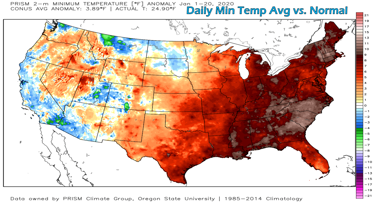
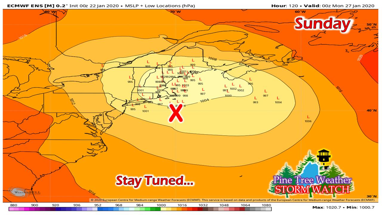
For those who did not catch my Facebook post on Tuesday, I made it known that I have started my online forecast certification course through the Penn State World Campus program. I am only one lesson into it, and I absolutely love it. I am glad it has been quiet this week to allow me to get set up and going with that. The course is rather rigorous, which is exactly what I am looking for. Outside of some tutelage of a few broadcast meteorologists and private sector folks, I have self taught myself over the past 8 years. Knowing that I needed to "connect-the-dots" on certain things, I decided in the fall that now is the right time to for me to do it. This will take four semesters for me to complete, which I plan on working on it straight through May of 2021. This may cut into some of what I do here pending on how life evolves, but it may not be noticable. The fun part for me is I can continue to take my new found knowledge and pass it along in my forecasting and discussions immediately. This here is my working lab project. This is not a cheap investment I am making here. While my bills are almost paid for 2020, I could still use some financial assistance above and beyond my $3000 operating budget. Any help from you would be sincerely appreciated. A look at climatological dataThis is the temperature outlook for Bangor as we head into the late part of January. This is typically our coldest point of the year. While we've had a couple shots of bitter cold weather, this month has been mild for much of the region, and that trend will continue. Looking under the hood of climatological data, our days have run a bit above normal, but nothing too crazy. Most parts of Maine are running within a handful of degrees above normal for high temperatures. At the time of this post, Caribou's daily high is 24° versus the average of 19.9°. Where it is most noticeable is our nights. Caribou is warmer than average by almost 6°. Bangor and Augusta are a shade over 5°. Portland is running just over 9° above average. The month-to-date mean average temperatures look this way: Caribou 15.8° 9th warmest (10.5° normal) Bangor 22.2° 15th warmest (18.1° normal) Augusta 24.1° 10th warmest (19.9° normal) Portland 28.7° 5th warmest (22° normal) If you aren't burning as much wood or oil this year, this is likely why. Thoughts on SundayI've been keeping tabs on this since the first of the week, and the most recent trend is a coastal hugger scenario. The track at this point appears north of benchmark 40° N / 70° W (X), which sets up the chance for a mix for the coastline. This system appears to have a tropical hose attached to it, so it could have plenty of moisture to work with. What could throw a wrench into the outcome is this does not appear to be a vertically stacked storm, meaning the surface low and areas of low pressure in the atmosphere do not line up. If that remains the case, it could be a tricky one to figure out precipitation type and amounts. Stay tuned for more on this. ► ► Due to a revised budget there is a $135 shortfall for the year ahead! You can help keep Pine Tree Weather going with a donation of ANY amount now through VENMO @PineTreeWeather, a monthly donation on Patreon or messaging me on Facebook or Twitter to send a check in the mail. Thank you for your support!
For more information from me, please check the Pine Tree Weather Facebook page as well as my Twitter feed. Always stay weather aware! - Mike |
Mike Haggett
|


