Cold retreats later in the week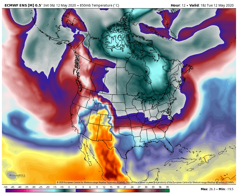 European ensemble model 850mb (5000 ft ASL) temps from 2 PM Tuesday to 8 PM Sunday Cold temperatures and snow have been the weather story for the region for May, but that trend is about to end. The 850mb temperatures in Celsius shown here in this 6-hour loop are an important indicator for what is to come. With temperatures below freezing at ~5000 feet above sea level, this is where the frost threat comes into play. We'll be dealing with that through Thursday morning. Most areas escape it after that, except for northern Maine Saturday as a backdoor cold front drops down for a parting kiss before heading out. For those holding off gardening, this will be your green light to plant. Tropics showing a potential flare up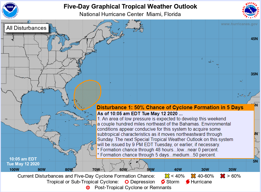 National Hurricane Center Guidance has been hinting at some sort of tropical mischief in the past few days. It's no real surprise since we are in mid-May. Hurricane season starts formally in just a couple of weeks on June 1st. It is somewhat rare for May tropical cyclones to form due to the unfavorable conditions of wind pattern and cooler water temperatures. Back in 2012, there were two named storms in May with Alberto and Beryl, so the idea isn't completely out of the box. If the storm organizes itself, it does not appear to bring any impact other than potential surf to the coastline of the continent at this point. 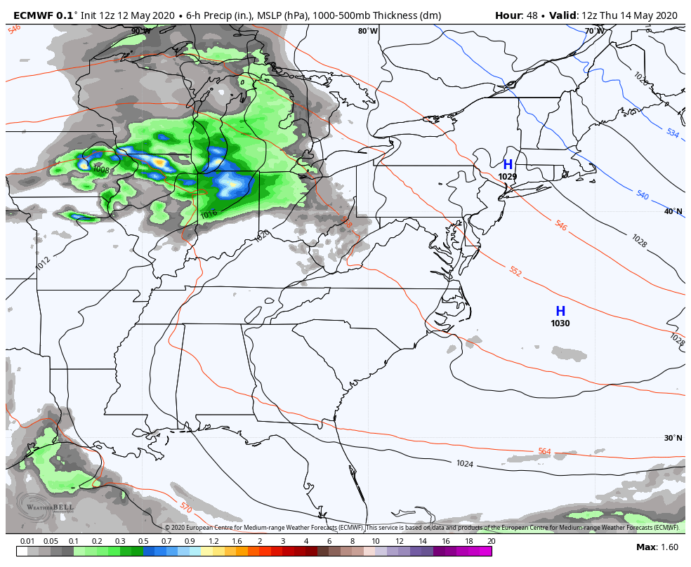 European model precipitation, sea level pressure and thickness from 8 AM Thursday to 8 PM Tuesday. Looking at forecast ideas through early next week shows the ridge building over the east with a frontal boundary which could bring rain to our area Friday into early Saturday. To the south, the hybrid (subtropical) disturbance appears to organize itself over the Bahamas over the weekend. Low pressure riding over the ridge that could bring rain to close out the weekend over Maine picks up the storm to the south and takes it out to sea, well away from the coast and out of harms way. For the latest forecast information on the tropics, check with the National Hurricane Center. These two chances for rain Thursday into Friday and Sunday into Monday for Maine is what can be expected between now and early next week. With warmer weather working north, we may have potential for severe storms. Please keep this in mind as you plan outdoor activities, and stay updated with the forecast. From the freezer to the furnace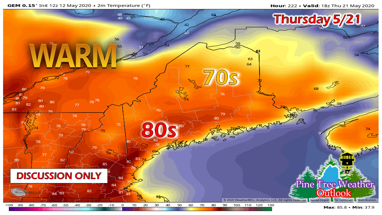 I don't normally post long range ideas due to the bust factor, but with all of the recent snow over interior areas and cold the region has experienced, I wanted to let you folks know warmer times are coming. I wouldn't so be cruel to tease you given the pandemic and this lousy pattern we've been in for the past six weeks; this idea does have some support. This could make for a nice start to Memorial Day weekend. Temperature outlook by region through Sunday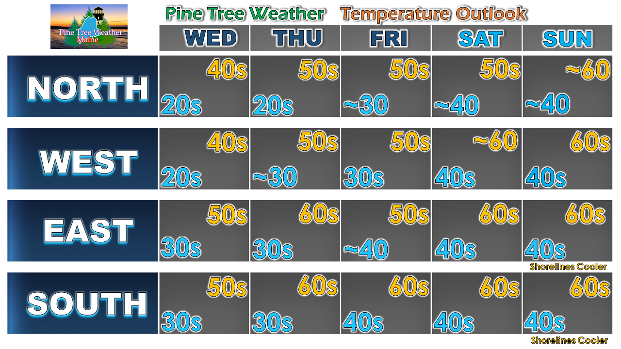 Stay on alert for frost potential until the weekend!
For more information, please follow Pine Tree Weather on Facebook and Twitter.
Thank you for supporting this community based weather information source that is funded by your financial contributions. Stay on alert, stay updated, and stay safe! - Mike |

Mike Haggett
|