|
Before I get into the discussion, I want to thank those donors for hanging in there with me. The balance of family (what little I have left), day job demands that are hard to predict, and time to care for myself all continue to be a juggling act. Since I am running solo this summer, I am doing the best I can to update as often as possible. Twitter and Facebook are the places to look for information if this source happens to be idle. I appreciate your support and understanding throughout this period as I work to be as consistent as possible. A solid soaker over the next couple of days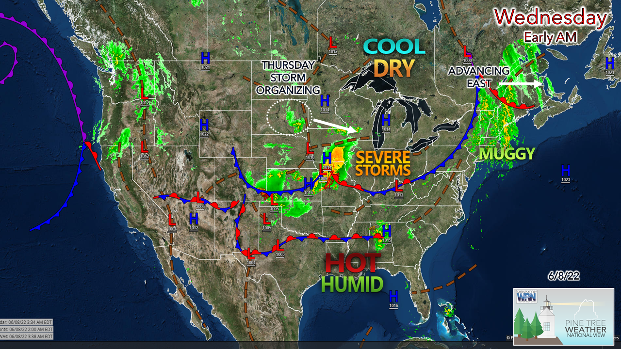 The wide-angle view of the country shows the recent and future pattern quite well. Upper-level lows continue to dominate our pattern over Maine, keeping the heat and humidity to the south. Ridging in the west causes troughing in the east. For those that love a "Maine summer" with low humidity and comfortable temperatures, this is what you can expect through the middle part of the month, at least. I see no steamy weather in the longer range, but I do see more of a damp pattern as the upper lows pinwheel through the region bringing chances for showers and storms at times, along with short spurts of muggy conditions. 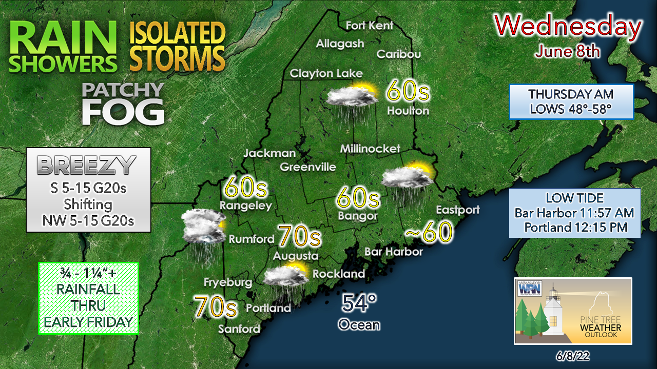 Interior southwestern areas are expected to be the warmest of the region for the day. The shorelines and The County are likely to be the coolest. The breeze out of the south shifts to the northwest after a cold front passes through later in the day. 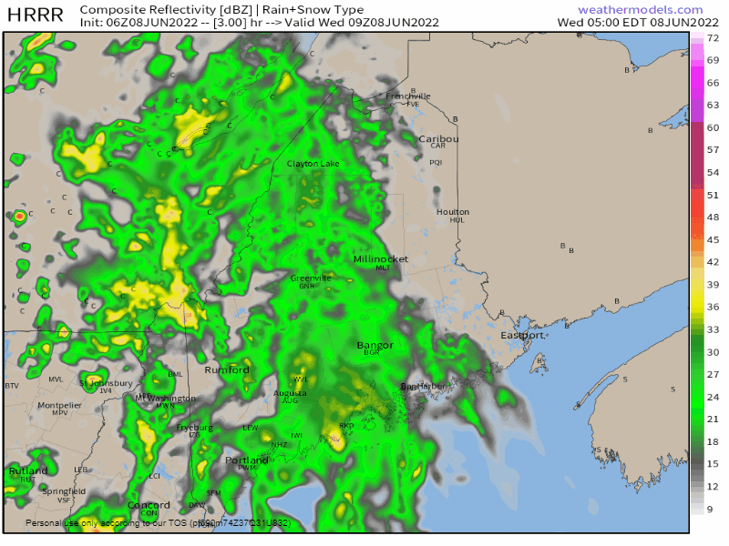 Wednesday 5 AM to Thursday Midnight - Rain could be heavy at times thanks to increased precipitable water values in the air column as moisture streams in from the southwest. This may cause reduced visibility, ponding on roadways, and potential for hydroplaning on the speedier roadways. Fog may be stubborn for MidCoast and DownEast areas until the front passes through. Once drier air works in, it will negate the marine layer and clear out any ground stratus heading into tonight. While the bulk of shower activity ends from west to east, widely scattered showers and perhaps a thunderstorm is possible through late day into early evening. Expect a quick downpour, gusty wind and perhaps some small hail in any storm that forms. We'll get a break in rainfall overnight, before our next system arrives Thursday. 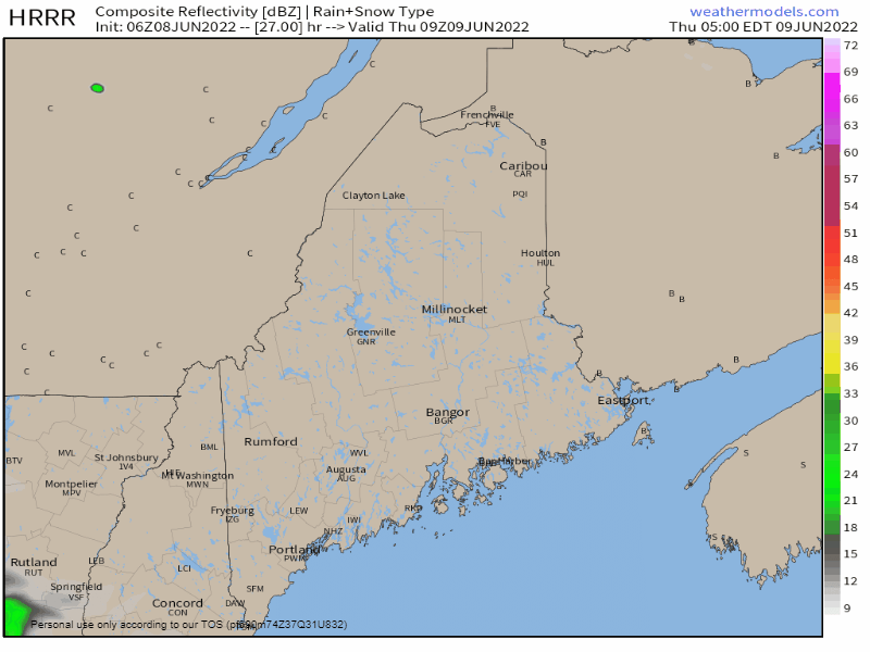 Thursday 5 AM to Friday 2 AM - Low pressure forms off the MidAtlantic coast and races into the Gulf of Maine for Thursday, Expect another round of steady to heavy rainfall at times as this system tracks into the Canadian Maritimes by Friday. Showers are expected to remain in the forecast along the Quebec border and north through the morning, tapering off by Friday afternoon. By the time all is said and done, between ¾-1¼" of total rainfall for the three-day period is expected as general idea. Some areas along the coast and the mountains may see 2"+, along with any localized downpours. Weekend and temperature outlook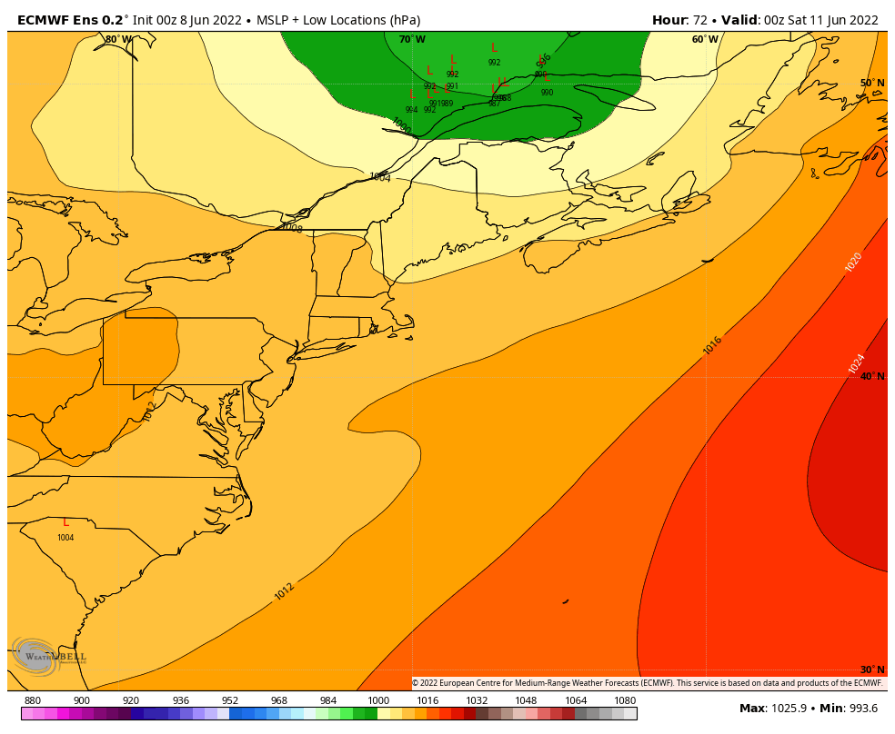 Friday 8 PM to Sunday 8 PM - I feel like operational model ideas are acting like a used car salesman at this point, so I present the ensemble spread of areas of low pressure to highlight the uncertainty of the forecast. Operational models were hot on the idea of another soaker for Saturday but have backed off for now. As I have seen many times over the years, the energy associated with storms hits a black hole over the Pacific where radiosondes (weather balloons) are unable to sample it to get a reading of how it may interact with the atmosphere as it moves east. I expect that by Thursday afternoon the energy will have entered the continent to get a fair assessment and plug into model ideas to see how it will play out. For now, I am going with the idea of showers possible for both days until it can be proven otherwise. Stay tuned. Looking into the first of next week, showers are also possible for Monday as yet another system could potentially track in from the west. 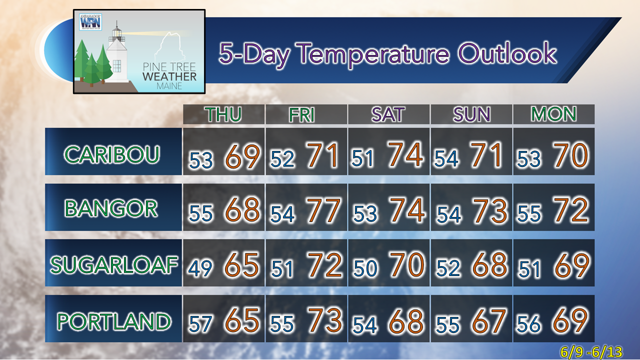 The normal high and low for Caribou for June 8th is 70 and 48. For Portland, 71 and 53. Forecast temperatures appear to run a couple of degrees above or below average through the first of the week. Be prepared to receive alerts and stay updated!
 For more information in between posts, please follow Pine Tree Weather on Facebook and Twitter. Thank you for supporting this community-based weather information source which operates by reader supported financial contributions. Thank you as always for your support! - Mike NOTE: The forecast information depicted on this platform is for general information purposes only for the public and is not designed or intended for commercial use. For those seeking pinpoint weather information for business operations, you should use a private sector source. For information about where to find commercial forecasters to assist your business, please message me and I will be happy to help you. |

Mike Haggett
|