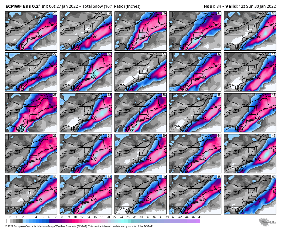
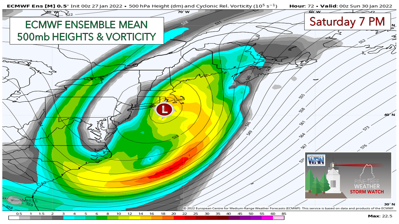
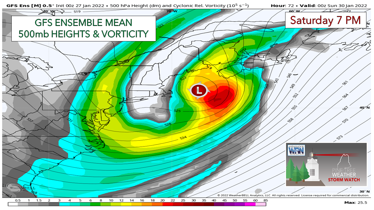
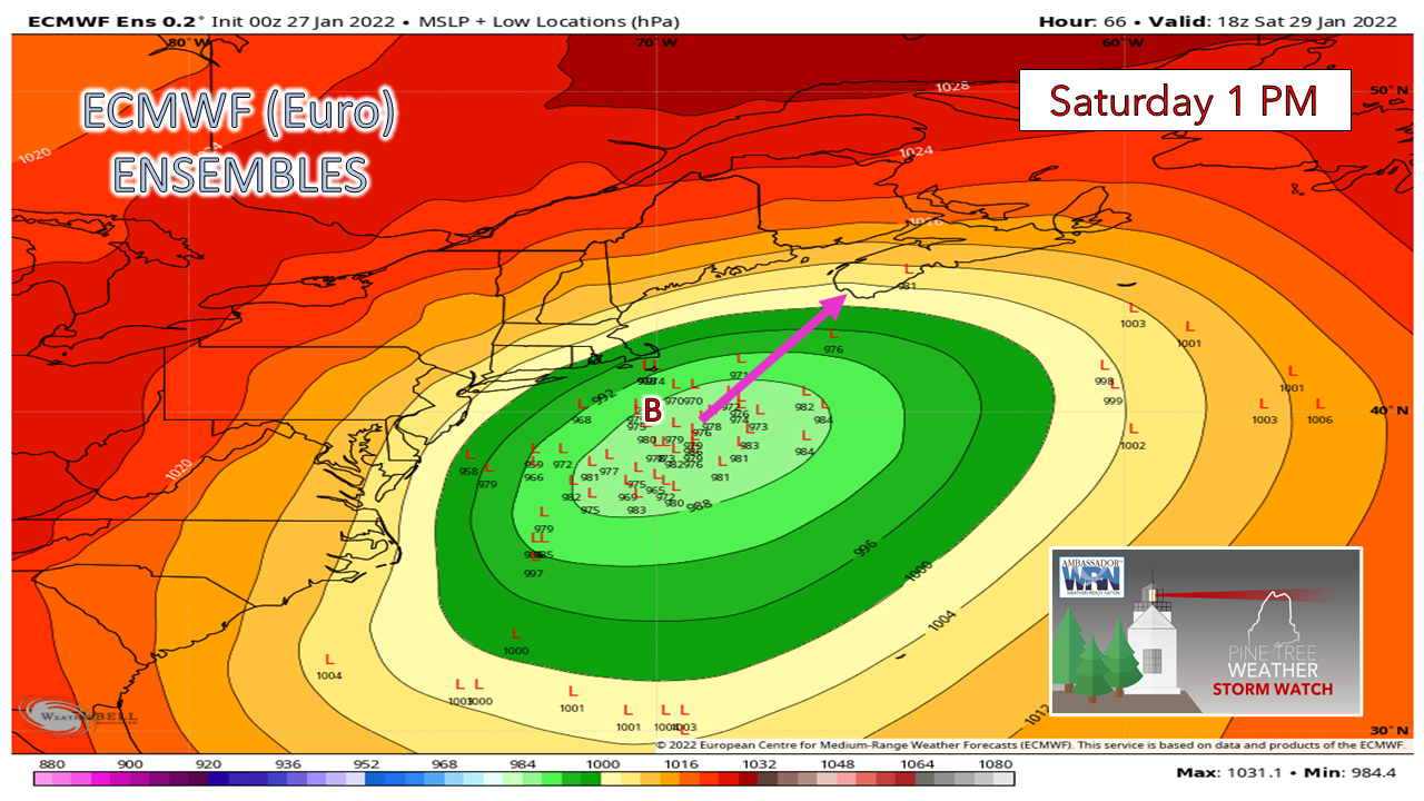
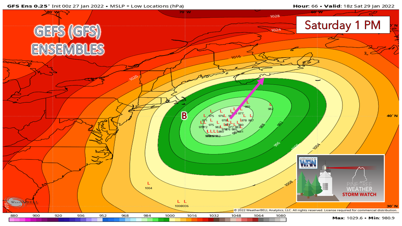
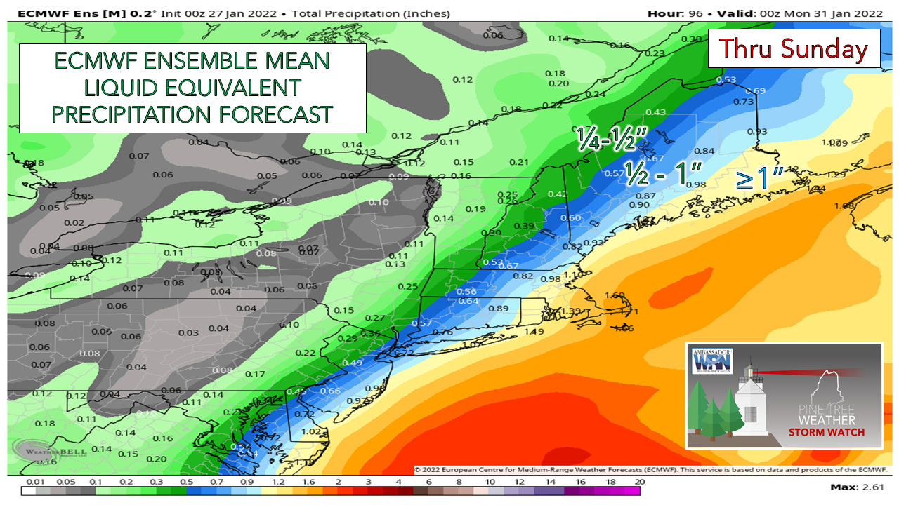
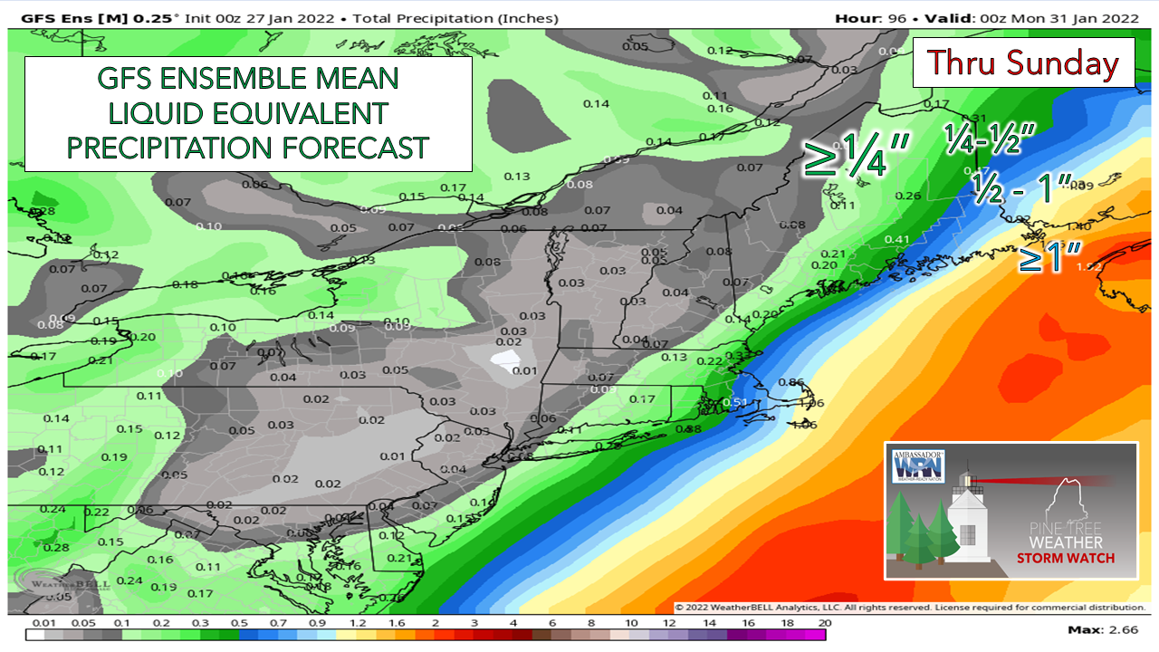
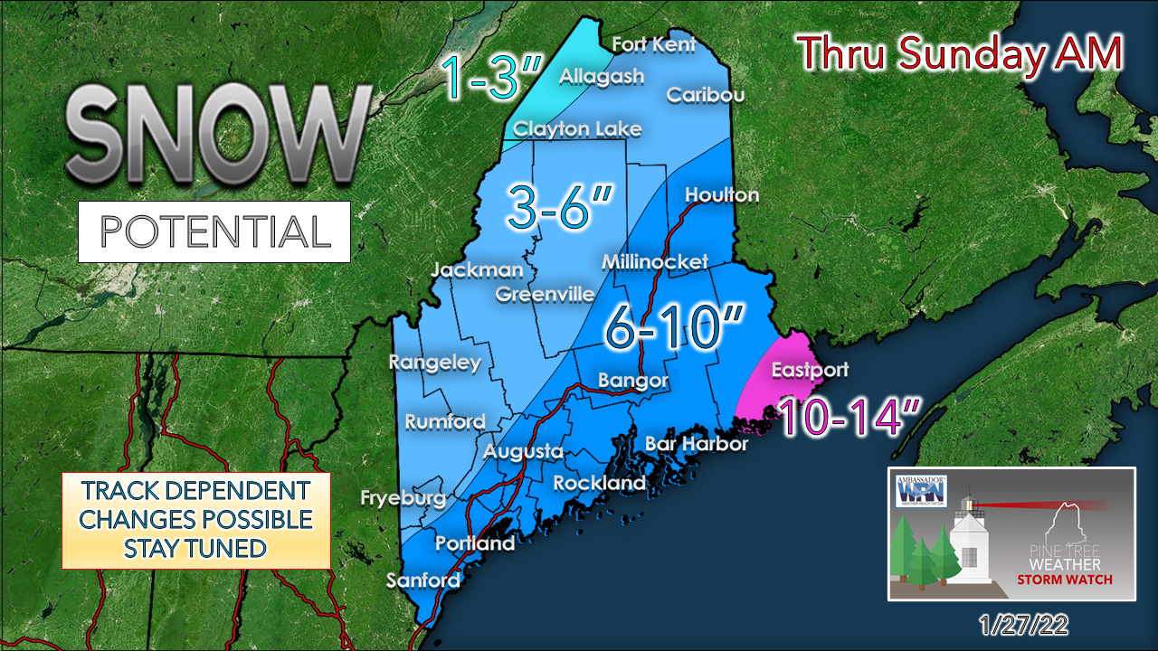
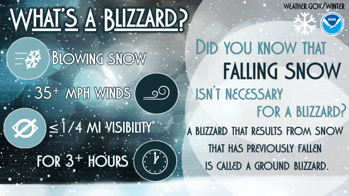
Still many questions on how this plays outI guess I should not be surprised at how difficult this forecast is as I anticipated that it would be Friday before the pieces come together. Guidance is -really- struggling with this storm, which explains why the forecasts you see elsewhere are all over the place along with the sharp changes going on with them. I can rest assure you, no one in the local forecasting circle is happy about not providing answers to questions with any level of confidence this close to an event. Much of forecasting depends on trends in observations and guidance. The ensembles have been the only thing remotely dependable, which is why I continue to share those ideas. Operational ideas continue to be scattered and, in some cases, extreme. While the forecast is a challenge as they always are to a certain degree, this one is more so. Your local TV folks aren't getting much sleep, and neither am I. Any storm of this potential is one a forecaster wants to get as close to right as possible. Where the discrepancies lie and what they meanI am going to show you the main differences in ideas without getting too technical and how each affects the outcome. I am going to use the ECMWF and GFS ensemble ideas for simplicity's sake. The first place that needs to be looked at is the 500mb steering level at 18,289 feet above sea level. There remains a big difference in the location of the closing off of the 500mb low between these two model ideas, which is in part due to timing of the merge of the northern and southern streams offshore of the Carolinas Friday night. Why is this important? This is what will steer the surface low either closer to Maine or further away. The European idea (above) has the system slowing down and closing off near Block Island late Saturday afternoon. The GFS (below), to its known fault and bias, is more progressive in its idea and closes it off further east The results of what happens to the surface low, the track of it, and the impacts which it could deliver is based on where the upper low closes off. Unsurprisingly, the European ensemble ideas shifted back to the west overnight in windshield wiper fashion. The difference this time around due to the adjustment in the steering level is most ensemble ideas are now south and east of benchmark (40° N / 70°W), but with the position of the upper low closing off allows the potential to steer the storm into the nose of Nova Scotia. The GFS with its more progressive positioning keeps all its ensembles to the south and east of benchmark and as the low continues to negatively tilt, steers the surface low towards Halifax. The results of these two ideas are much different with impacts. The European with a more west track brings more precipitation. The timing of it leads to concerns for minor to moderate coastal flooding issues with the Saturday evening high tide. There is more snow and potential mix for the DownEast shorelines, along with more wind impacts from blowing and drifting of snow, near blizzard or blizzard like conditions, and potential for scattered power outages. The GFS with the track farther east brings much less of an impact. A glancing blow for western and southern areas, a decent storm to eastern areas with a foot of snow and blizzard conditions for Washington County. Less impact to the coast and less wind over much of the region, along with an all snow event. Regardless of either outcome, areas west of Penobscot Bay up to Danforth to Eastport are likely to get the brunt of this. Looking over these two ideas and looking at others and watching the pattern, this is my starting point for accumulations. This won't be an easy storm to measure given the potential for drifting. I am conservative here since I don't trust what I am seeing for discrepancies. The low end looks fair to me at this point. How high it goes depends on timing and track, which unfortunately is too early to call given the widespread differences. Stay tuned. What's a Blizzard?Did you know not all blizzards involve falling snow? By definition, a blizzard includes 35+ mph winds that cause blowing snow, reducing visibility to 1/4 mile or less for at least 3 hours. If the visibility reduction comes from snow that has already fallen, it is called a ground blizzard. Whether or not snow falls during the time of the blizzard, dangerous conditions can result. Make sure you’re prepared! weather.gov/winter Be prepared to receive alerts and stay updated!
For more information in between posts, please follow Pine Tree Weather on Facebook and Twitter. Thank you for supporting this community-based weather information source which operates by reader supported financial contributions. Thank you as always for your support! - Mike NOTE: The forecast information depicted on this platform is for general information purposes only for the public and is not designed or intended for commercial use. For those seeking pinpoint weather information for business operations should use a private sector source. For information about where to find commercial forecasters to assist your business, please message me and I will be happy to help you. |
Mike Haggett
|

