
|
First off, a special thank you to my Patreon monthly supporters who continue to have my back as I continue to make progress in the rehabilitation of the rheumatoid arthritis in my thumbs. My new normal is much different, which is why my updates have been rather infrequent. My priorities are eating right, exercise, and rest. This also includes laying off the keyboard and the smart phone with social media. I apologize for my lack of responding to comments and tweets. My plan for now is to update here at least 3 days a week, pending on my work life and the pattern. I can't predict my future health, but I do like the progress I am making. I hope to have some help this summer with college interns to assist taking the edge off. A windy Friday and breezy Saturday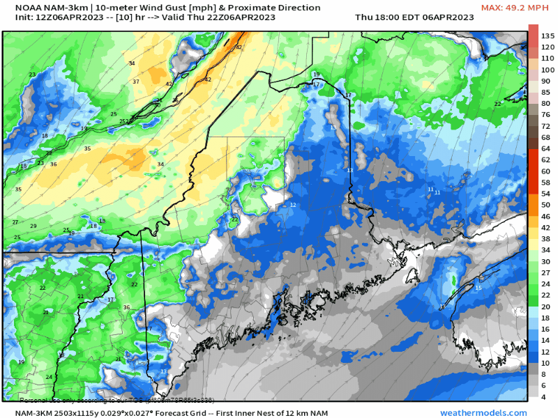 Thursday 6 PM to Saturday 8 PM - A cold front passes through the region Thursday night. A strong Canadian high works into the region and brings a gusty wind to the region for Friday. Wind gusts are likely to exceed 30 mph across the entire region, with 40-50 mph gusts possible for the higher elevation. Some scattered power outages are possible. The wind slowly begins to subside Friday night into Saturday but will remain breezy with gusts 20-30 mph through the day and settling down Saturday night. Wind chills range in the teens to low 20s across the mountains and north on Friday, with 30s to low 40s for the south and east. By Saturday morning, the apparent temperatures fall to around 0° for the mountains, single digits above for the north, with teens elsewhere by Saturday morning. The mountains and north will deal with wind chill in the teens once again on Saturday. Pattern outlook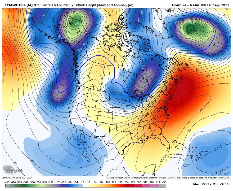 Thursday 8 PM to Monday 8 AM - After the visit of polar air over the weekend, a strong ridge is expected to build in from the south heading into next week. By midweek, the ridge gets a bit more reinforcement and brings well above normal temperatures Wednesday into Thursday. The ridge relaxes heading into next weekend, but temperatures are expected to stay above normal on the high and low end into the following week. Dry times through mid-month at least With the strong ridge moving in over the eastern part of the continent, this will keep the risk for precipitation minimal over the next couple of weeks, and storm threat minimal. With the warmer temperatures on the way, mud season may not be as bad in years past given the absence of rainfall. With warmer temperatures, it's time to watch the rivers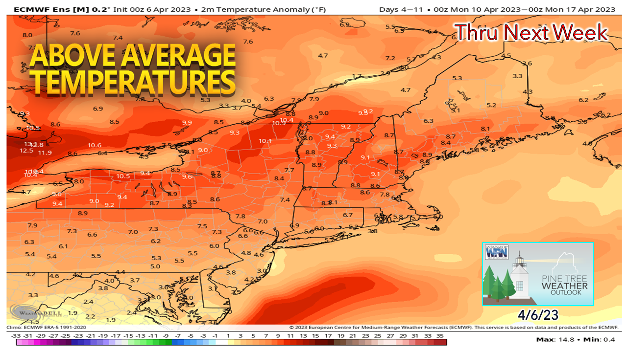 A report issued Thursday by the National Weather Service Gray office indicates above normal flood threat for the foothills and mountains through the rest of the month (click here to read the full report). Given the amount of snowpack and expected period of above freezing temperatures starting Monday, expect the brooks, streams, and rivers to begin to fill up. Folks in northern areas won't see the 60s and 70s that are expected to the south by midweek, but the melting process will begin there as well as temperatures are expected to run in the 50s during the day and mid-30s at night. It is a safe bet at this point to put the shovel and snow removal equipment away for the coast and foothills. Time will tell if the mountains and north will get a late season surprise. Temperatures are expected to cool down closer to average over school vacation week. Drought update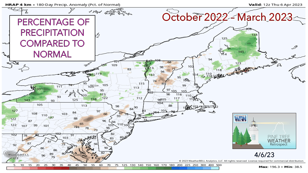 For the first time in a couple of years the region starts spring drought free. Since October, precipitation amounts have been around normal to slightly above average for the north. The only possible exception is Penobscot Bay and Mount Desert Island. The long-term ideas do indicate a dry stretch overall through the start of May. Temperature outlook through TuesdayThe average high and low temperatures for Caribou for April 6th are 43° and 25°. For Portland, 50° and 32°. After this shot of cold for the weekend, temperatures rise well above normal midweek. 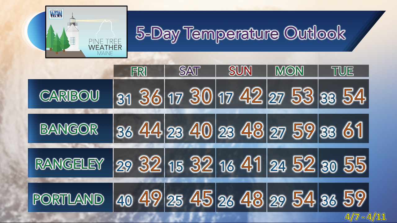  Pine Tree Weather is funded from followers like you. I would appreciate your financial support. Click here for how you can contribute. You may not like the weather, but I hope you like what I do! Please hit the like button on Twitter and Facebook, and share! Stay updated, stay on alert, and stay safe! - Mike NOTE: The forecast information depicted on this platform is for general information purposes only for the public and is not designed or intended for commercial use. For those seeking pinpoint weather information for business operations, you should use a private sector source. For information about where to find commercial forecasters to assist your business, please message me and I will be happy to help you. |

Mike Haggett
|


