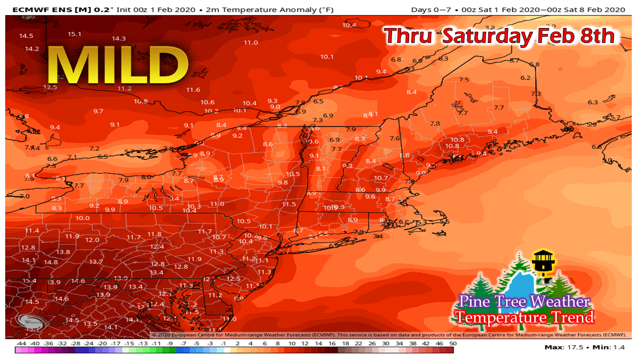
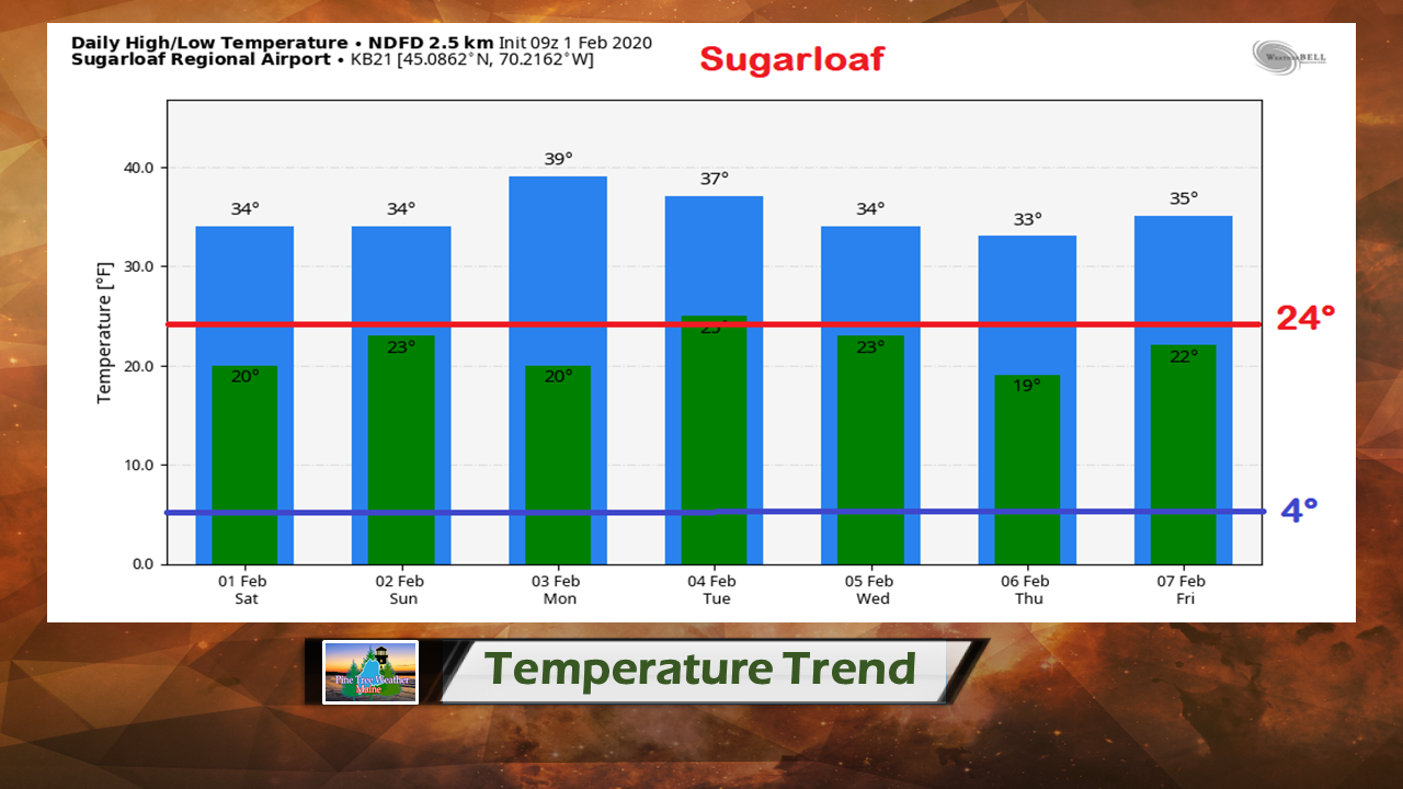
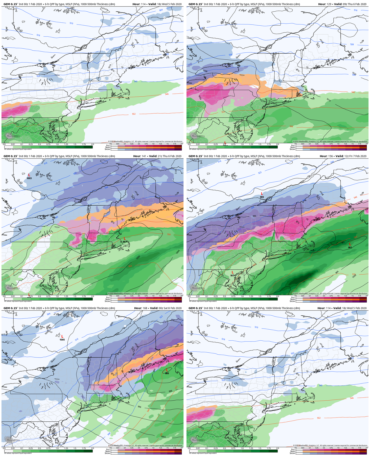
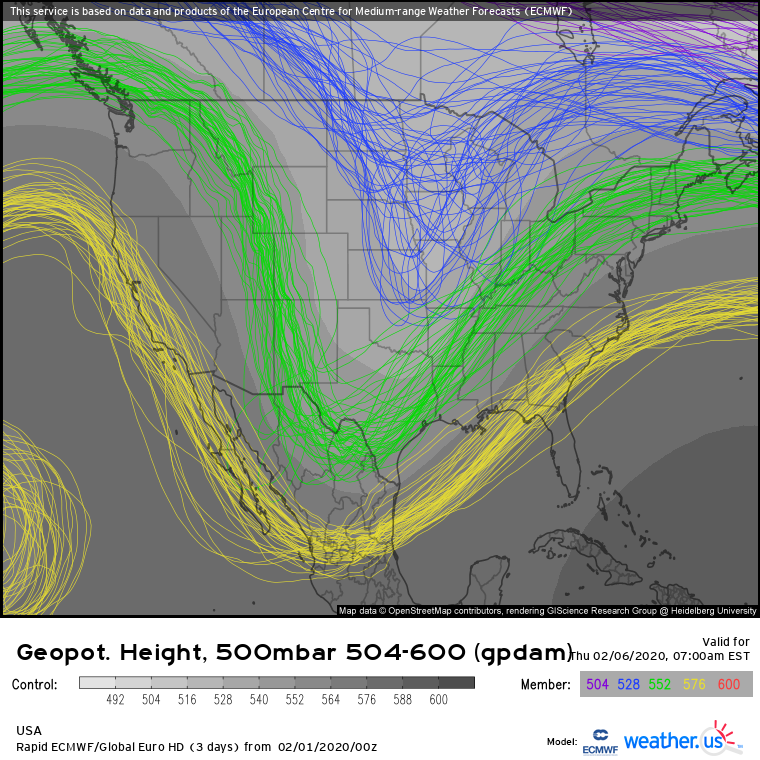
The main story of winter continuesJanuary is over, and the monthly averages have been compiled. Portland was 4th warmest overall with mean temperature of 29.8°. Augusta was 5th at 25.6°. Bangor was 8th at 23.4°. Millinocket was 7th at 22.° Caribou was 9th at 16.5°. For the first seven days of February based on the model idea above, mild temperatures are expected to continue. Sifting through a bunch of sites, this the one graph that really grabbed my attention. The normal values that I added to the chart are the normal highs and lows for Millinocket. I used that data as Sugarloaf is the closest to them in latitude that has any sort of long term data reference. Most of the overnight low come close to what should be the daily high for the day. If you are looking for comfortable conditions to ski, this is your week. The trend makes it easier on the heat bills, but not good for those areas depending on snow for their income. Mainly quiet until late in the weekOutside of some hit or miss snow showers for the mountains and north through Monday, there is not a whole lot going on. With a ridge building over the Pacific northwest and a trough dropping down into the midwest, a long wave front develops. For now, guidance is in agreement that the boundary could stall over the east coast, and potentially bring a couple of messy days to wrap up the work week. For now, the forecast for the mixed bag is just a possibility. Given model performance mid-range as of late, it's simply an idea for now. This chart above here reminds me why I flunked coloring in kindergarten. What this means is there is plenty of room for changes at this point.
Given the temperature trend, the pattern models are depicting appears to fit. Mountains and north appear snowier, the foothills into the central highlands appear in the crosshairs of a mix, and coastal areas appear warm enough for rain. For late week, it all depends on how it lines up, but this storm pattern looks a lot more like late March / early April than it does February from my vantage point. Stay tuned. ► ► For the latest official forecasts, bulletins and advisories, please check in with the National Weather Service in Gray for western and southern areas, or Caribou for northern and eastern parts of Maine. ► ► Due to a revised budget there is a $125 shortfall for the year ahead! You can help keep Pine Tree Weather going with a donation of ANY amount now through VENMO @PineTreeWeather, a monthly donation on Patreon or messaging me on Facebook or Twitter to send a check in the mail. Thank you for your support! For more information from me, please check the Pine Tree Weather Facebook page as well as my Twitter feed. Always stay weather aware! - Mike |
Mike Haggett
|


