Pine Tree Weather
  • DISCUSSIONS
  • MAPS
  • BRIEFINGS
  • SATRAD
  • MARINE
  • RAIN OUTLOOK
  • SNOW / ICE OUTLOOK
  • CPC OUTLOOK
  • Kennebunk
  • Weather Geekdom
  • Who We Are
  • DONATE
  • My Photography
  • DISCUSSIONS
  • MAPS
  • BRIEFINGS
  • SATRAD
  • MARINE
  • RAIN OUTLOOK
  • SNOW / ICE OUTLOOK
  • CPC OUTLOOK
  • Kennebunk
  • Weather Geekdom
  • Who We Are
  • DONATE
  • My Photography

Active pattern turns colder as the week evolves

11/4/2019

Comments


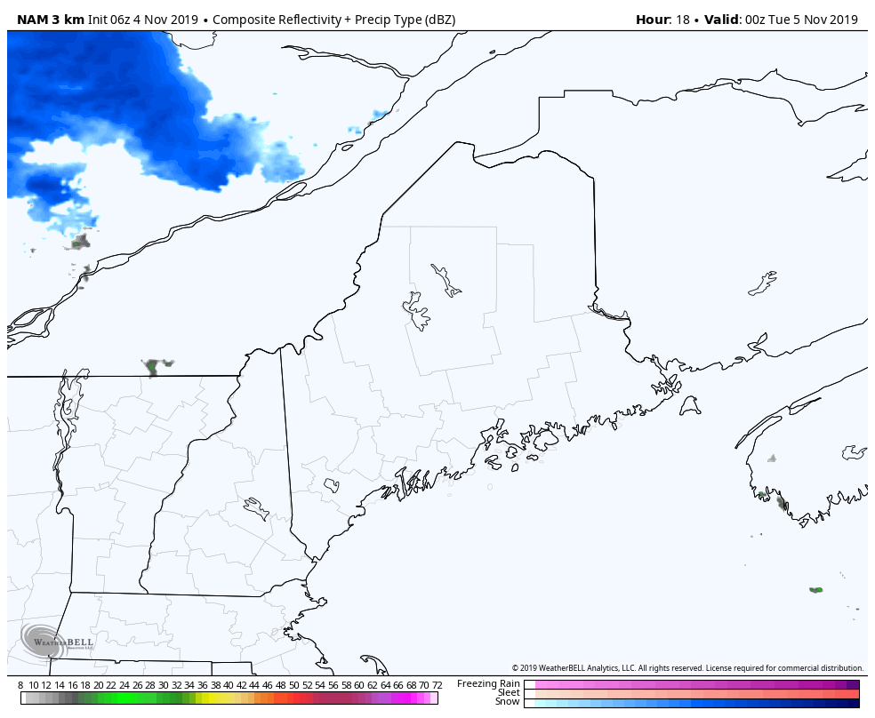
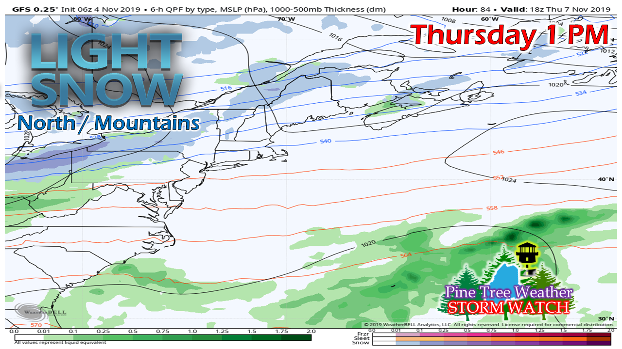
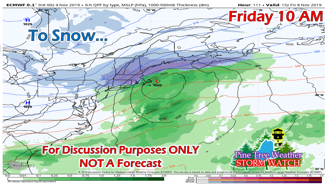
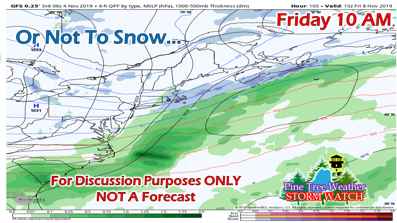
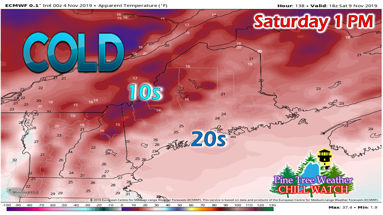
Get ready for winter

Picture
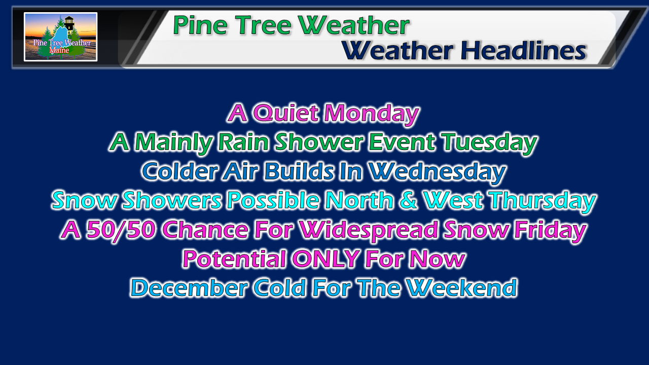
For those still without power from the previous storm, hang in there. The weather conditions continue to be favorable for restoration efforts. This is the week to finish up outdoor clean up projects, get snow tires put on, stock up on emergency supplies and other storm related necessities. The pattern continues to be fairly active, and with the cold working its way into the area, the threats for snow will be in the forecast as winter continues to roll in,

After a quiet Monday,
​shower activity returns for Tuesday

Picture
A few snow showers may fire up in the mountains Monday night into early Tuesday as a warm front races in from the southwest. With the rise in temperature, any light snow changes to rain as the storm passes through during the warm point of the day. Rain may be a bit heavier for MidCoast and DownEast areas as low pressure begins to form along the front. Rain showers end by Tuesday evening, and a few light snow showers on the back side are possible for the mountains and north Tuesday night.

Colder air works in behind the front, and begins to set the table for the rest of the week.

Another cold front for Thursday

Picture
Another reinforcing shot of cold air works into the state on Thursday, This moisture starved boundary may touch off some snow showers for the north and mountains. At this point, accumulations appear light.

With the deeper cold coming in behind the front, this sets up the potential for snow to end the week.

50/50 chance for snow Friday

Picture
This forecast will be a challenge, and will likely remain uncertain until Wednesday. The question is if energy from the west can make it eastward in time to join upper level energy from the north and spin up a coastal low. Guidance will likely flip-flop on ideas until the event until midweek once it can begin to solve where the split-flow of energy comes together.
Picture
It's all a timing game at this point. If the right ingredients come together at the right time, snow shovels, brooms and perhaps plows will be necessary to deal with this one. I think there is a solid case the cold air will be in place for this. Whether or not everything else comes together to make frozen precipitation come is yet to be seen.

​Stay tuned!

Saturday to feel like December

Picture
Regardless if shovels are required for Friday, Saturday just looks cold. This is "apparent temperature from the European model which also factors in wind chill. 

Now that all of this has your attention, there is another potential snow/mix storm possible to wrap up the weekend. 

Get your snow tires on!

► ► For the latest official forecasts, bulletins and advisories, please check in with the National Weather Service in Gray for western and southern areas, or Caribou for northern and eastern parts of Maine.

► ► DONATION DRIVE UPDATE - $840 shortfall for the year ahead! You can help keep Pine Tree Weather going with a donation of any amount now through VENMO @PineTreeWeather, a monthly donation on Patreon or messaging me on Facebook or Twitter to send a check in the mail. Thank you for your support!

For more information from me, please check the Pine Tree Weather Facebook page as well as my Twitter feed. 

Always stay weather aware!

​- Mike

Comments
    Picture

    Mike Haggett
    Kennebunk, ME

    Penn State
    Weather Forecast Certification '21.
    AMS / NWA
    Weather-Ready Nation 
    ​SKYWARN-CWOP

    Picture

    Alex Hatfield
    Wakefield,MA


    Penn State
    Meteorology and Atmospheric Science ‘21
    PSUBAMS
    Campus Weather Service
    PSU Storm Chase Team
    PSU College of Earth &  Mineral Sciences Ambassador

    Picture

    Kaitlyn Lardeo
    ​Syracuse, NY

    SUNY Oswego
    Atmospheric Science
    Lake Effect Storm Prediction and Research Center
    Northeastern Storm Conference Contributor

    DONATE
    Picture

    Archives

    January 2021
    December 2020
    November 2020
    October 2020
    September 2020
    August 2020
    July 2020
    June 2020
    May 2020
    April 2020
    March 2020
    February 2020
    January 2020
    December 2019
    November 2019
    October 2019
    September 2019
    August 2019
    July 2019
    June 2019
    May 2019
    April 2019
    March 2019
    February 2019
    January 2019
    December 2018
    November 2018
    October 2018
    September 2018
    August 2018
    July 2018
    June 2018
    May 2018
    April 2018
    March 2018
    February 2018
    January 2018
    December 2017
    November 2017
    October 2017

    Categories

    All
    Maine Weather
    Pine Tree Weather

    RSS Feed

Proudly powered by Weebly