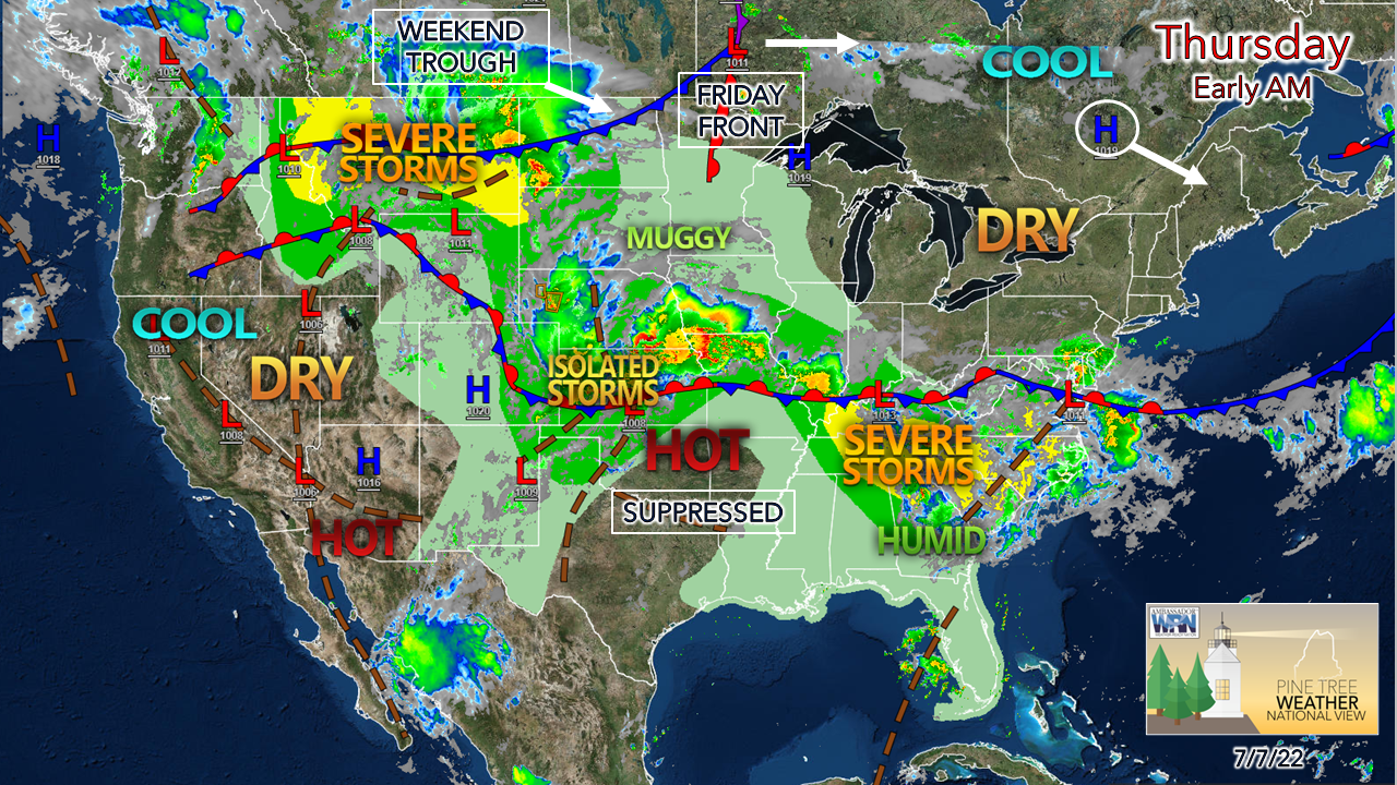
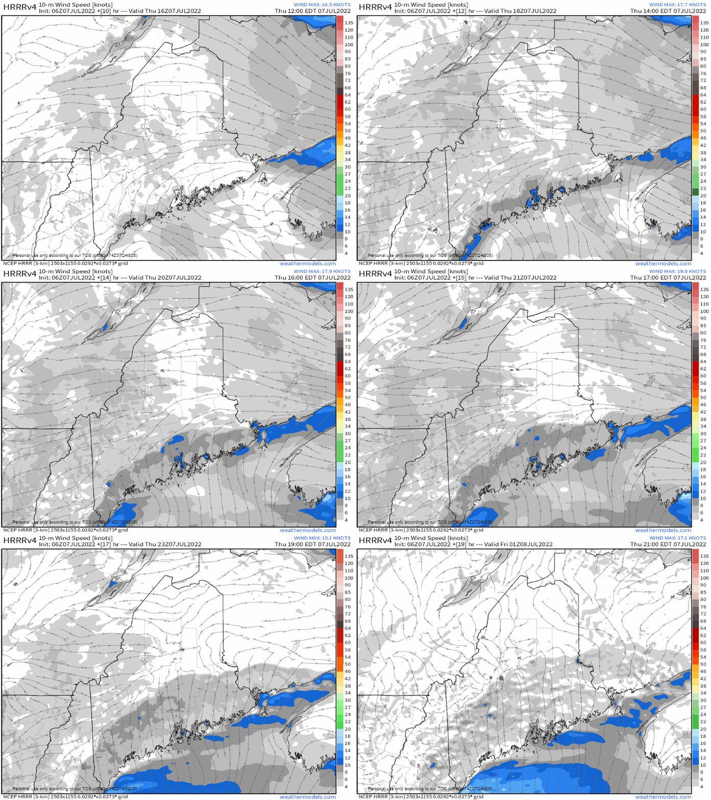
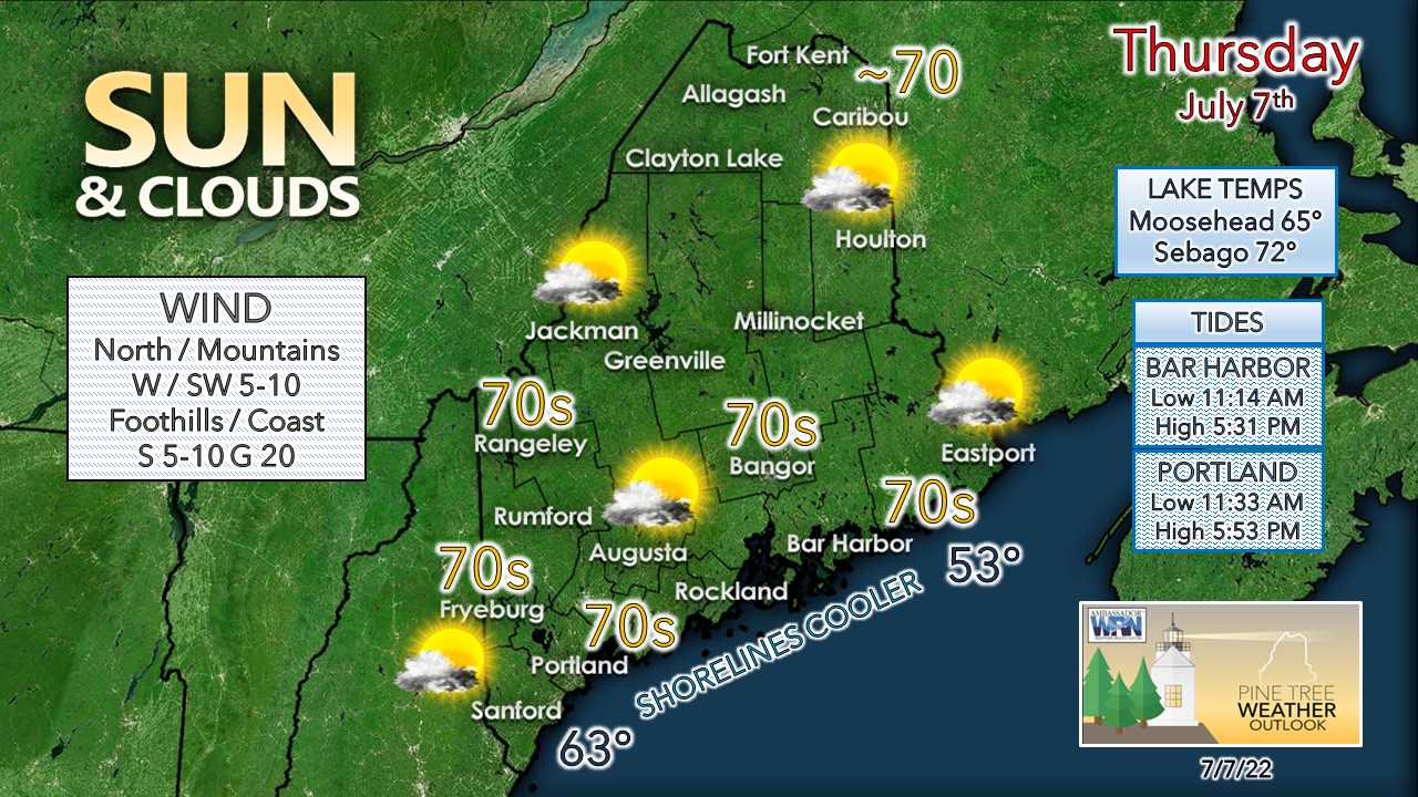
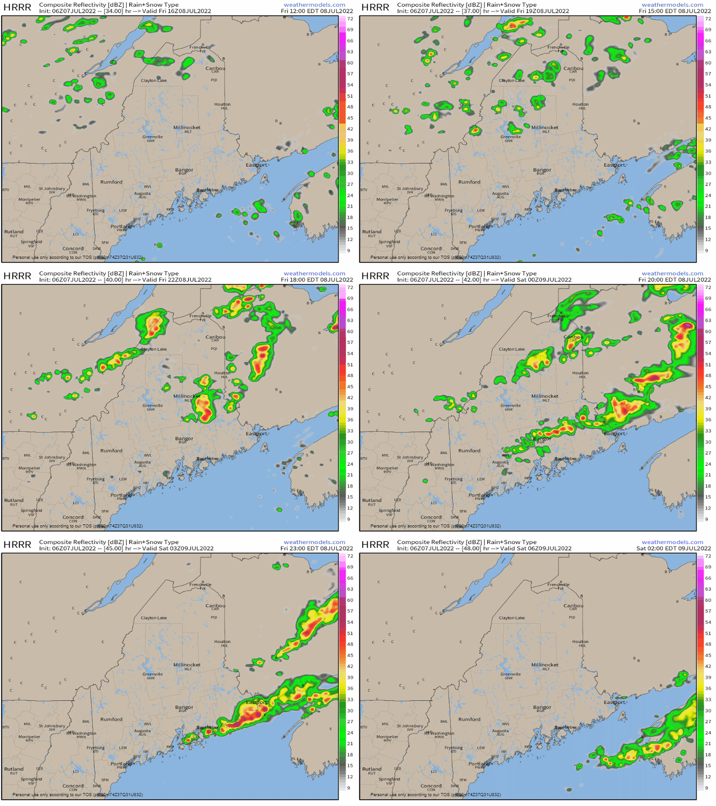
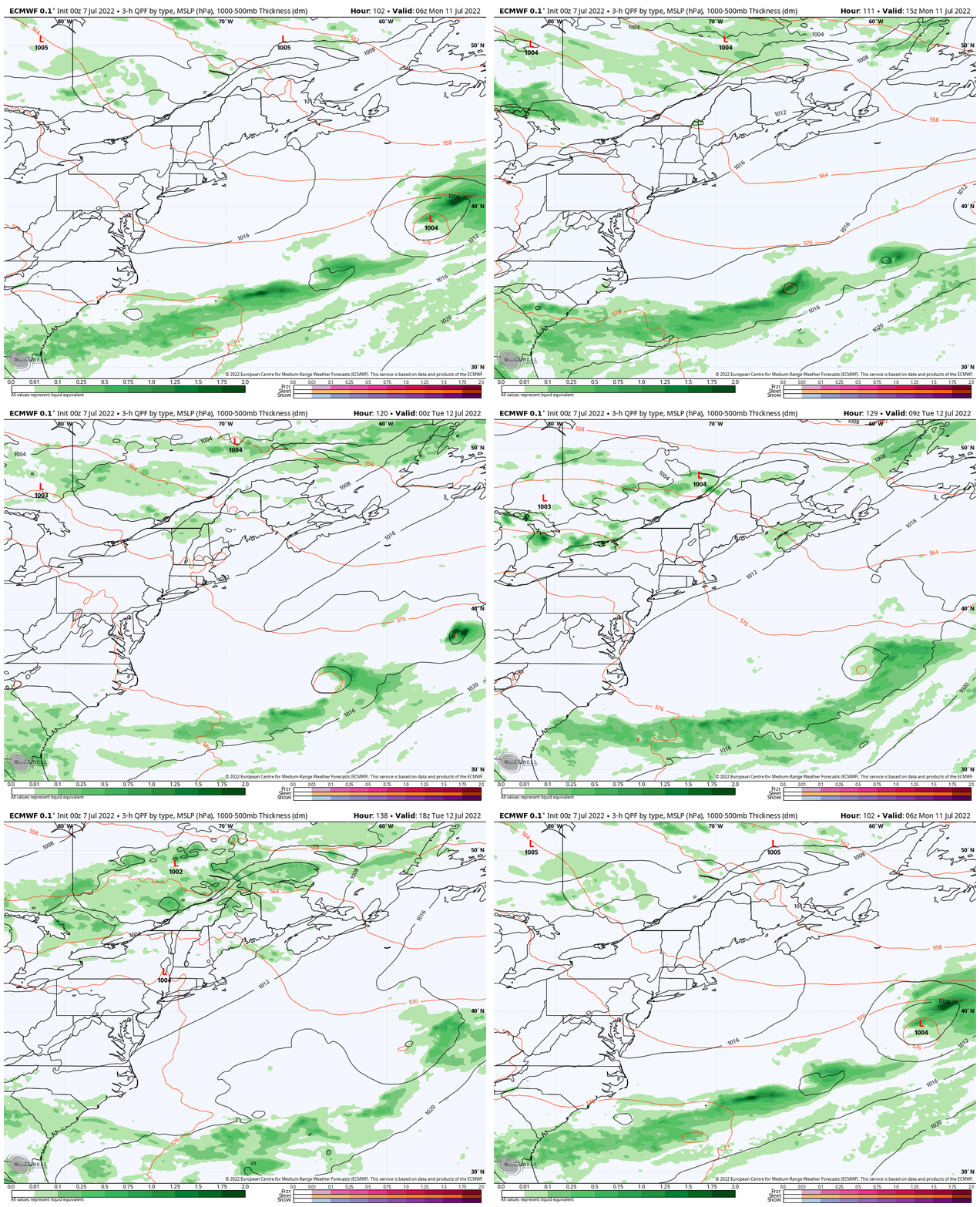
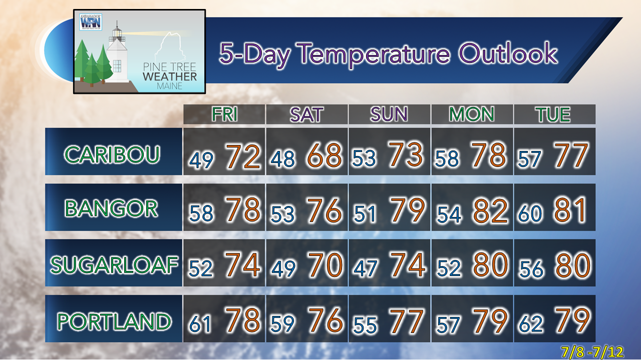
High pressure controls the dayFor those looking for rain of any benefit, the outlook is not good. The region is in potluck shower season, meaning if you happen to get one, consider yourself lucky. The pattern continues to keep the moisture to the south through the middle part of the month. Northern areas have the best chance for meaningful rain through early next week. Drought parched regions along the MidCoast over to Bar Harbor with points north to Greenville may get some localized relief from isolated showers and storms Friday, but that is about the best that can be expected for now. Thursday Noon to 9 PM - This is a neat feature that doesn't happen all that often. As high-pressure slides to the southeast, it initiates a sea breeze that moves into the coastal plain and into the western foothills and Danforth region. It could be a bit gusty at times through the early evening as the southerly breeze may reach 20 mph, a bit higher for the shorelines. While the sea breeze moves inland, temperatures away from the shorelines won't modify all that much. Beachgoers can expect cooling temperatures in the afternoon as the tide rolls in, with many seaside locales seeing temperatures fall to the upper 60s. Showers and storms around FridayFriday Noon to Saturday 2 AM - Interior areas may pick up a morning spot shower as a cold front approaches the region. Humidity levels nudge up as a southwest flow develops as the front passes through the region. Pending on the amount of sun, temperatures could spike up into the 80s in areas where the sun pokes out. The parameters for storms aren't great given the lack of moisture and dry air around, but as the HRRR model indicates, there is a chance for the dynamics to come together. If any storms form, some hail and gusty wind is possible, along with a quick hit of rain. Eastern areas have the best chance to see showers and storms form Friday evening. Humidity returns to the region early next weekMonday 2 AM to Tuesday 8 PM - Saturday and Sunday are expected to be dry, with slightly cooler than normal temperatures and comfortable humidity levels. A ridge is expected to move into the region Monday which brings a southwesterly wind flow and increase dew points Tuesday into Wednesday. A weak cold front may bring showers to northern areas Monday. A warm front may bring an overnight shower to interior areas Monday night. Expect heat and humidity to build and hang around through the rest of the week, along with the threat of showers and thunderstorms. Temperature outlook through TuesdayThank you for supporting this community-based weather information source which operates by financial contributions from people like you. Stay updated, stay on alert, and stay safe! - Mike NOTE: The forecast information depicted on this platform is for general information purposes only for the public and is not designed or intended for commercial use. For those seeking pinpoint weather information for business operations, you should use a private sector source. For information about where to find commercial forecasters to assist your business, please message me and I will be happy to help you. |
Mike Haggett
|

