
Most of Thursday a dry one Hopefully everyone got the memo to cover up any plants of value as there is potential for a heavy frost statewide this evening. The sky will start off mostly sunny in all locales on Thursday, Clouds will thicken as the day progresses. There is a slight chance for a sprinkle or a light shower over western and southern areas Thursday afternoon, but the steadier rain appears to hold off until Thursday night into early Friday morning. Showers will continue through the day on Friday, ending from west to east Friday evening into early Saturday morning. 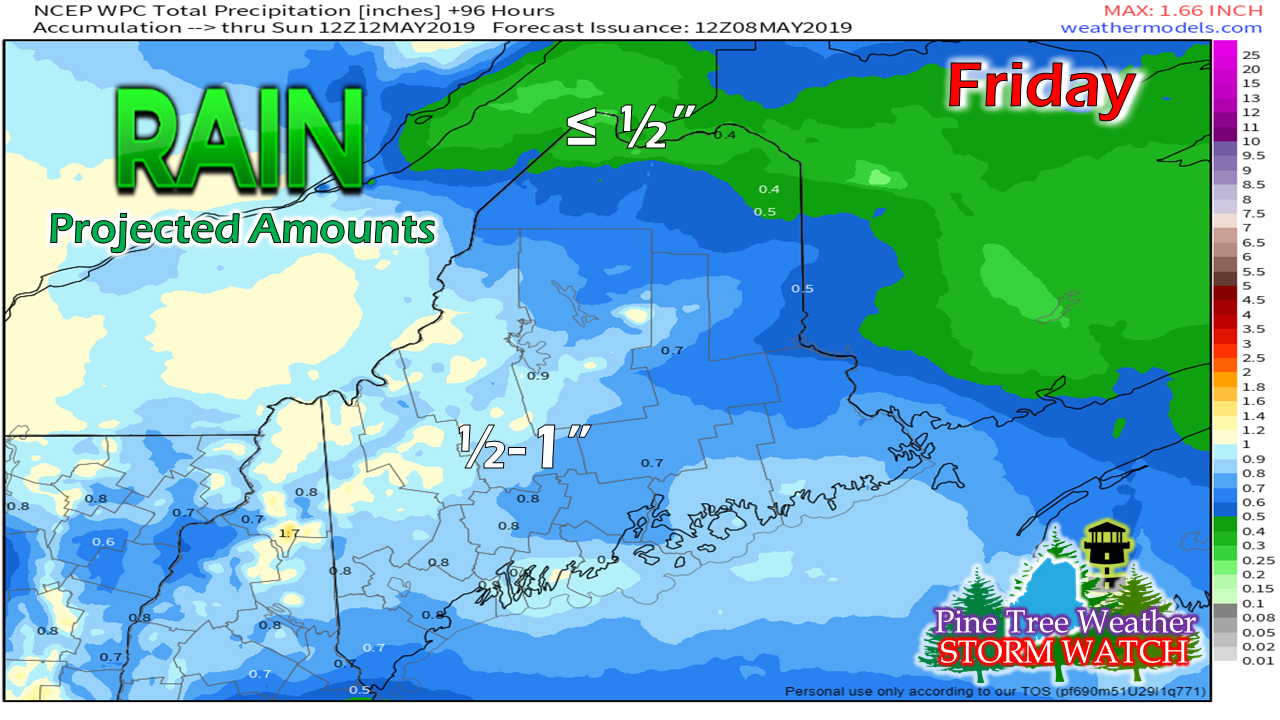 All in all, most areas can expect roughly ½" of rainfall from this event. The higher elevations could see as much as an inch. I don't expect any flooding issues of concern with this system. Regional outlook through Monday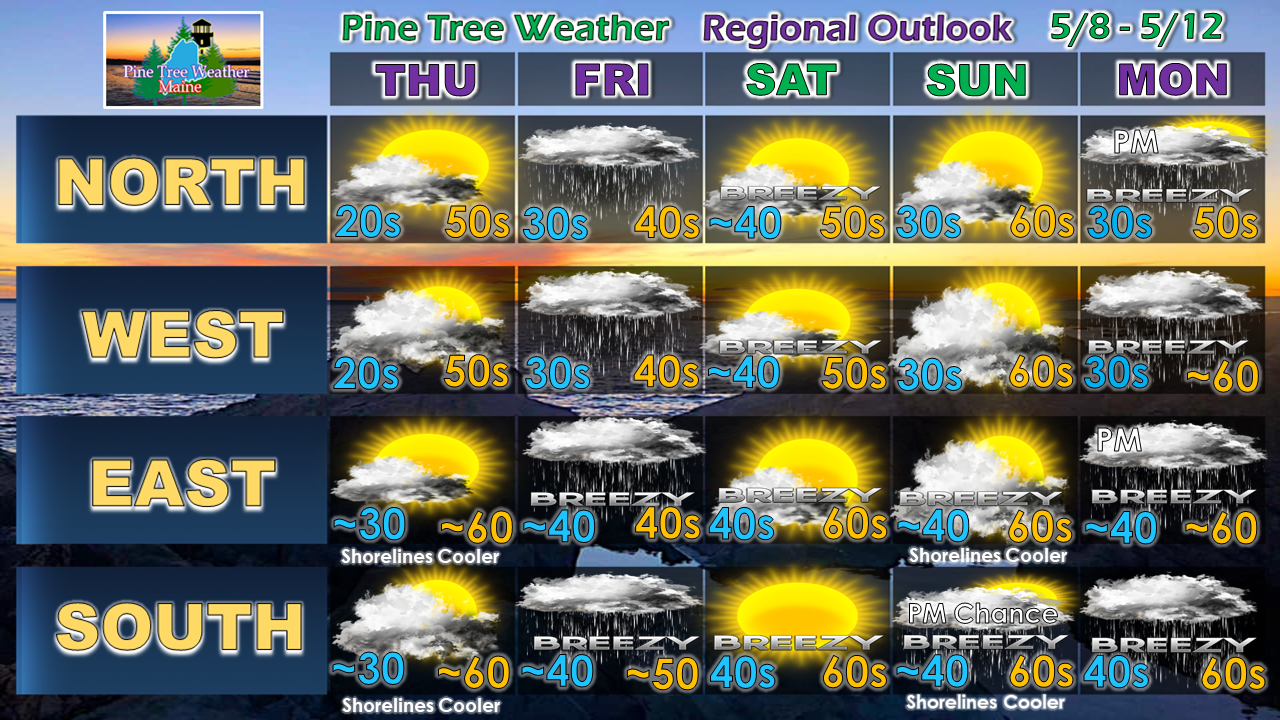 Skies clear out on Saturday. It'll be another breezy one as high pressure moves into the area during the day. That area of high pressure may be strong enough to keep an approaching system south of the region for most of Mother's Day. I can't rule out a chance for a shower over southern areas late in the day. High pressure moves eastward Sunday night and showers return Monday, and may linger into Tuesday.
► ► For the latest official forecasts, bulletins and advisories, please check in with the National Weather Service in Gray for western and southern areas, or Caribou for northern and eastern parts of Maine. ► ► Your financial donations are much appreciated to keep this site funded and for further development. I sincerely appreciate your support not only financially, but also in sharing my efforts with others. For more information from me, please check the Pine Tree Weather Facebook page as well as my Twitter feed. Always stay weather aware! - Mike |

Mike Haggett
|


