
A dry weekend that will feel like summer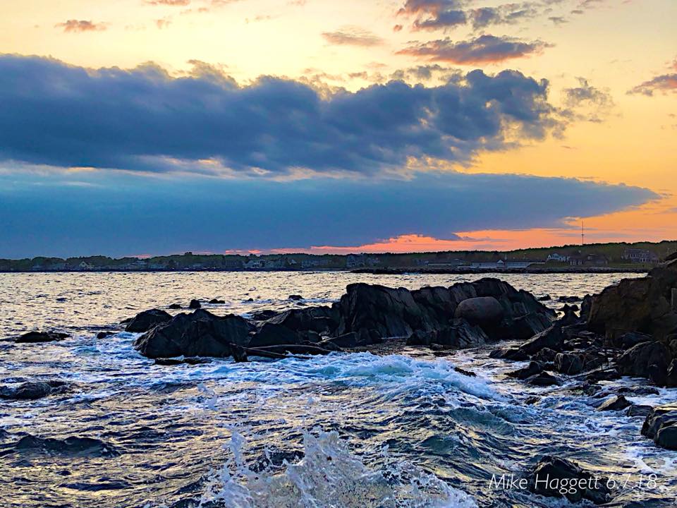 Friday starts off on the cool side, especially for the far northeastern areas of the state, but temperatures will rise steadily all weekend. It is shaping up to be a classic Maine summer weekend, with comfortable temperatures, dry conditions, and respectable humidity levels. If you're headed to the seaside beaches...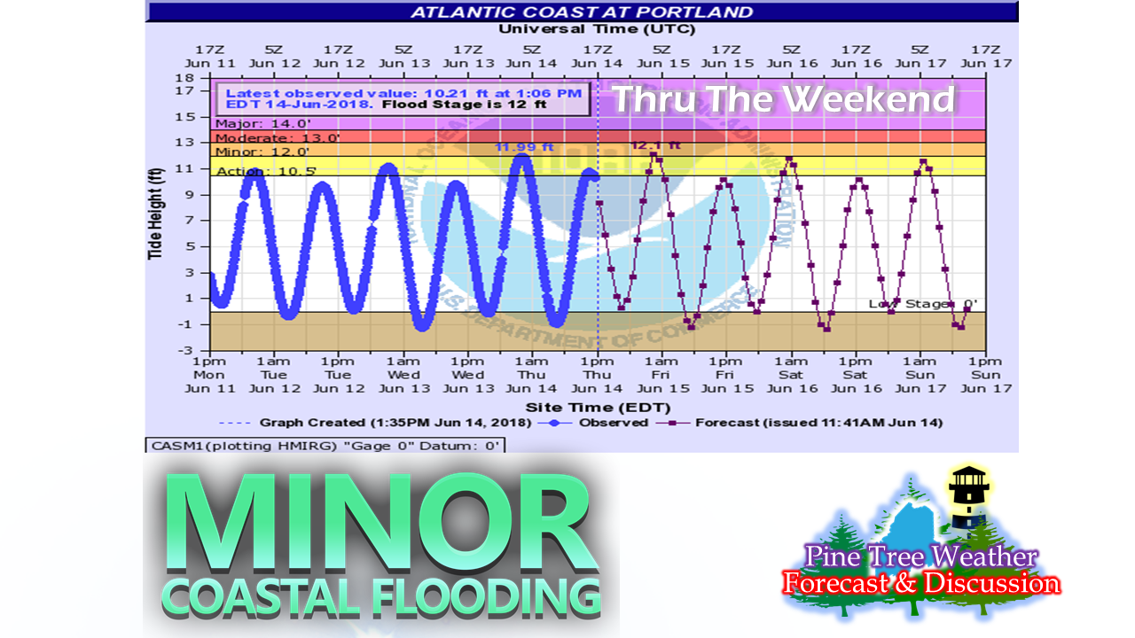 We're in the heart of the new moon phase, and astronomical tides are expected to bring some minor coastal flooding during the overnight high tide cycles. Daytime cycles are also running high, which may cramp on some real estate on the beaches in the afternoon over the next three days. Just be aware that the tide will be on the way in as the morning into early afternoon progresses, then will recede in the mid-afternoon and evening hours. Plan your spot accordingly. Latest Drought Monitor tells us the obvious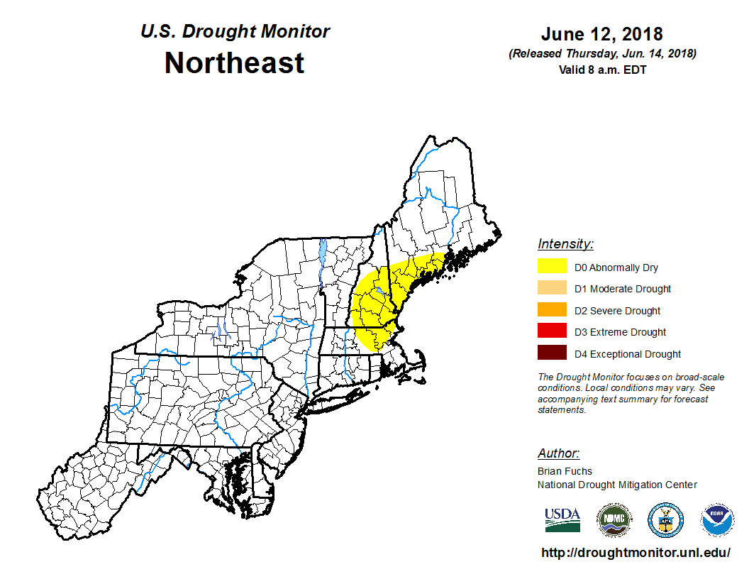 No real changes to this week's Drought Monitor report. The MidCoast and southwestern areas of the state are in "abnormally dry" conditions based on water table monitors in the region. As I have said in previous updates, conservation of ground water supplies should continue for the foreseeable future. Dry weekend increases fire danger This broken record keeps skipping on the turntable due to the dry conditions, but treat this as yet another public service reminder to check in with the Maine Forest Service, local fire departments and park rangers for burn permits and regulations through the weekend. Calls to fire departments and to the Forest Service for unattended camp fire burns and mulch fires from careless cigarette disposal are continuing on a steady basis. If you see some burning that is going on that may get out of hand, report it to the authorities to deal with it as soon as possible. Hikers and campers should make sure fires are completely extinguished when they are no longer necessary. Let's all do our part to protect the beauty of the state. Humidity rises later into the weekend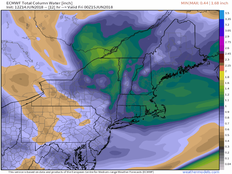 The browns and blues indicating a dry air column will be replaced with tropical moist yellows and reds by the time Monday arrives. This will be a reminder that summer weather does indeed exist and that the season is due to arrive later next week. This round will be short lived as a cold front sweeps the sultry air out of the state Monday into Tuesday. It will be that approaching front where there is cause for concern. Severe storm potential for Monday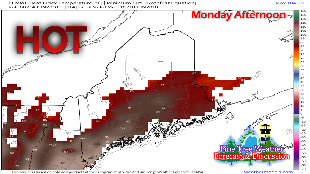 With the increase in air moisture comes with it the first round of "feels like" temperatures hitting well into the 90s and could tip the century mark in southern areas Monday afternoon. 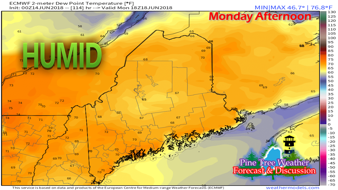 Regardless of where you may be in the Pine Tree State on Monday, it is very likely to be a sticky affair with dew points temperatures in the 60s to low 70s. This will make air quality poor, cause heat fatigue and oppressive temperatures.  Then, the front approaches in the afternoon... 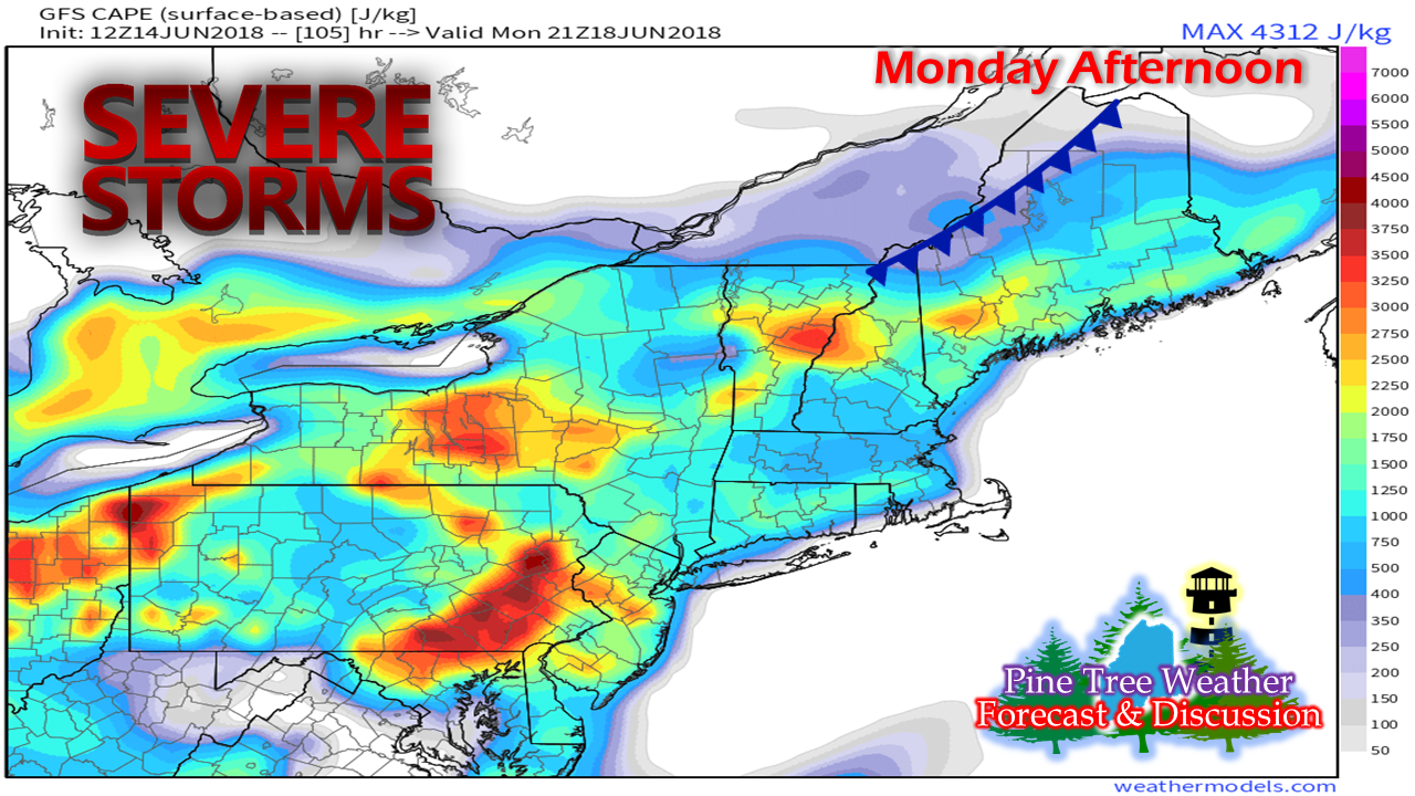 For now, it's a timing game for severe weather potential Monday afternoon. With the high heat and humidity, plenty of moisture, and gas for thunderstorms (Convective Available Potential Energy, shown above as CAPE) in place, all that is somewhat unknown is when the front descends through the region. At this point, it appears to be Monday afternoon. Western, eastern and southern areas appear at risk for severe storms as it appears for now. As the weekend progresses, guidance will get a better handle on the timing of the cold front. It would be wise to stay tuned to the forecast over the next few days. Regional Outlook through Tuesday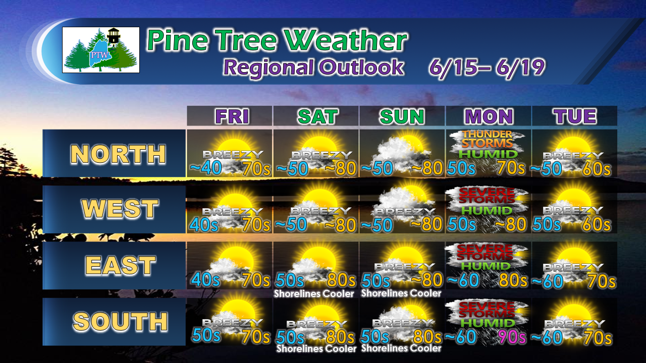 Again, it will be great weekend statewide. While the idea of severe weather on Monday is concerning, one upside of that is the potential for some much needed rainfall. Looking ahead, it appears to be a dry week ahead with very little rainfall expected until perhaps Friday / Saturday.
For the latest official forecasts, bulletins and advisories, please check in with the National Weather Service in Caribou for northern and eastern Maine, and Gray for western and southern areas. Thank you as always for your support! - Mike |

Mike Haggett
|


