
It's a bit complicated...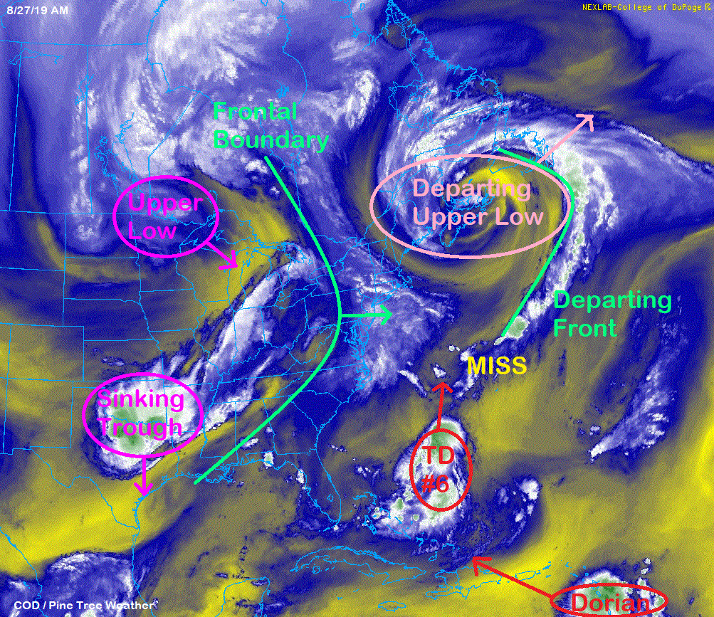 There are many moving parts in the atmosphere that are sorting themselves out. The upper low that has brought recent cool mornings is heading northeastward. A sinking trough over the southern part of the nation's midsection is opening a door for another upper low to drop southeast from the Canadian Prairies. In between all of this is a cold front that is moving eastward. Attached to the upper low over New England is a frontal boundary over the Atlantic. The frontal boundary appears to be just far east to miss the connection with Tropical Depression Six (TD#6). And then there is Tropical Storm Dorian over the Lesser Antilles, which I will touch on later in this post. Showers are in the forecast for Maine Wednesday night into Thursday. How much rain impacts the region is a bit of a question mark. Timing of frontal boundary and TD#6 key to rainfall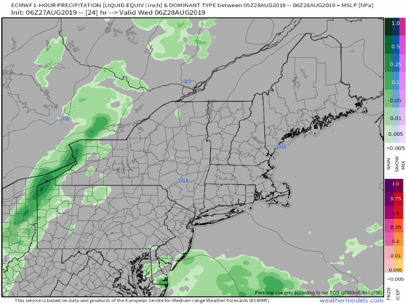 The loop runs in 1 hour increments from 2 AM Wednesday to midnight Friday. To the west, the approaching front. From the south, moisture from TD#6 moves northward. The idea over the past few days is that the frontal boundary will be a bit late in making the connection for western and southern parts of the region to get 1"+ rain totals. The idea has been that eastern areas of Maine and southern Aroostook County would likely see the most rain from this. 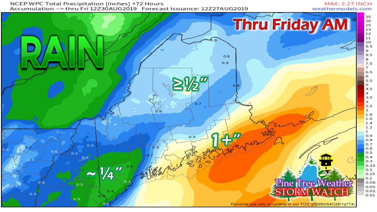 The Weather Prediction Center's idea posted Tuesday morning is more or less in line with that idea. That said, it is a close call. 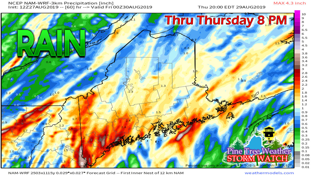 Tuesday morning's NAM-WRF run shows the rainfall amounts significantly higher, with some areas potential receiving 1-3+". The model clearly get the impression that the front will catch TD #6 in time to drag moisture into the western and southern parts of the state. If that is to occur, it would bring much needed rainfall over areas that are seeing drought conditions. Areas along the southwest coast could use a good soaker. At the very least, the state will get rain Wednesday night into Thursday. Stay tuned to see if the frontal boundary connection with TD#6 happens in time to bring widespread heavy rain. Tropical Storm Dorian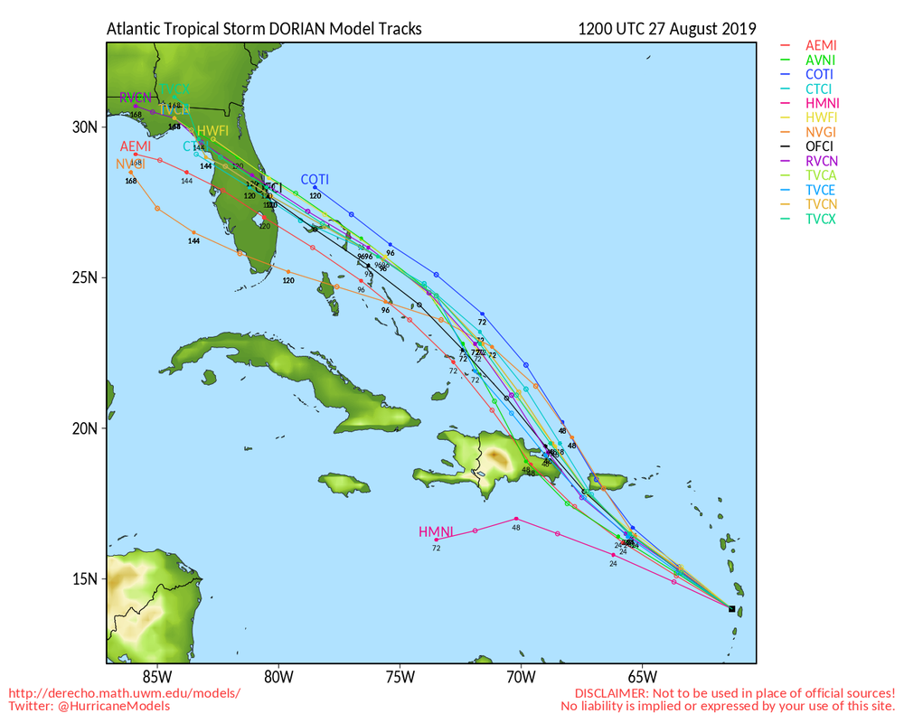 Dorian is certainly something to watch for southeastern areas of the country. It has some territory to cover before it gets to be great concern, however. The major hurdle that it has to get through is that of Hispaniola. The model track ideas have the storm splitting Puerto Rico and the Dominican Republic, but with any deviation to the west towards the mountainous regions of the two country island could knock the intensity out of it. Hispaniola does have the reputation of being a graveyard for tropical storms and hurricanes as it has neutralized many over the years. Regardless, it is certainly worth paying attention to. 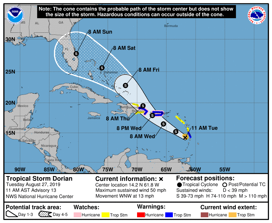 The official forecast track of Dorian shows potential impacts to Florida by later this weekend. As far as northeast and Maine interests go, a long wave frontal boundary appears to head eastward in the Sunday/Monday time frame that not only could bring showers for the second half of Labor Day Weekend, but may also keep Dorian from making a greater flood risk as the front catches the storm and takes it out to sea.
As always, please check in with the National Hurricane Center for official forecasts, bulletins, and other information. Stay tuned for more here on the website, Facebook and Twitter. ► ► For the latest official forecasts, bulletins and advisories, please check in with the National Weather Service in Gray for western and southern areas, or Caribou for northern and eastern parts of Maine. Please consider supporting Pine Tree Weather ► ► Your financial donations are much appreciated to keep this site funded and for further development. FUNDRAISING FOR 2020 BEGINS SOON! I sincerely appreciate your support not only financially, but also in sharing my efforts with others. For more information from me, please check the Pine Tree Weather Facebook page as well as my Twitter feed. Always stay weather aware! - Mike |

Mike Haggett
|


