
Storm track / timing still in question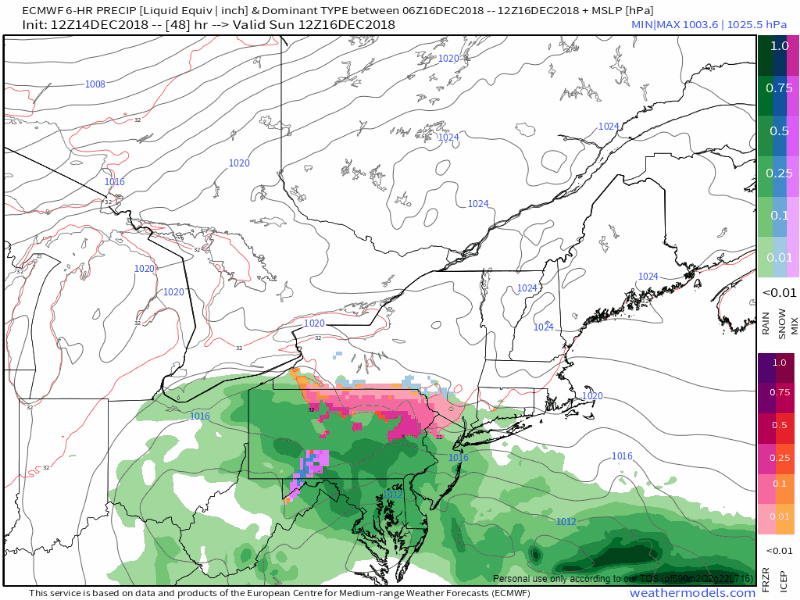 After a quiet day Saturday, Sunday starts off with high pressure exiting to the east and a southwest flow picks up. The region stays dry until late Sunday afternoon into the evening as low pressure advances up the coast. Far southern areas start off with potentially a mix of snow and/or freezing rain (rain along the immediate shorelines) and then precipitation evolves over the rest of the state overnight into Monday. We're playing a timing game here as a negatively tilted trough is going to intensify the storm as it passes through into the Canadian Maritimes. If the surface low slows, there is a chance for more precipitation. Track also plays a factor in amounts, which could mean less or more. For now, I am thinking anywhere between a dusting to about 4" of snow, with the higher amounts over eastern Maine. There is a good bet that the Monday morning commute could be greasy everywhere. I will update on this Saturday with finer details. Outlook through Wednesday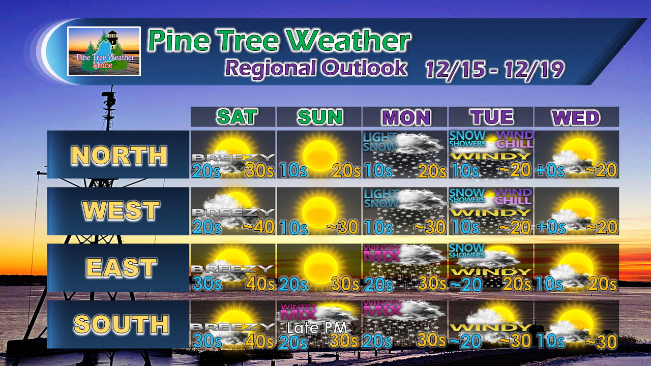 After the storm passes through on Monday, an arctic front passes through the region bringing snow showers / squalls and gusty wind on Tuesday. Below normal temperatures resume for Wednesday.
I apologize for the brief update... I will have a more detailed discussion Saturday. For the latest official forecasts, bulletins and advisories, please check in with the National Weather Service in Gray for western and southern areas, or Caribou for northern and eastern parts of Maine. Please consider making a donation to keep Pine Tree Weather going through the year ahead. My data cost expense is increasing. The operation is 90% funded and needs your help to get through the winter. You can set up a monthly pledge on my Patreon page or send me a message from the Facebook page or direct message on Twitter to get my address to mail a check. For more information from me, please follow the Pine Tree Weather Facebook page and my Twitter feed. Always stay weather aware, and thank you for your support! - Mike |

Mike Haggett
|


