
After a warm and dry Wednesday, humidity increases with a severe storm threat for Thursday7/20/2022 The bigger picture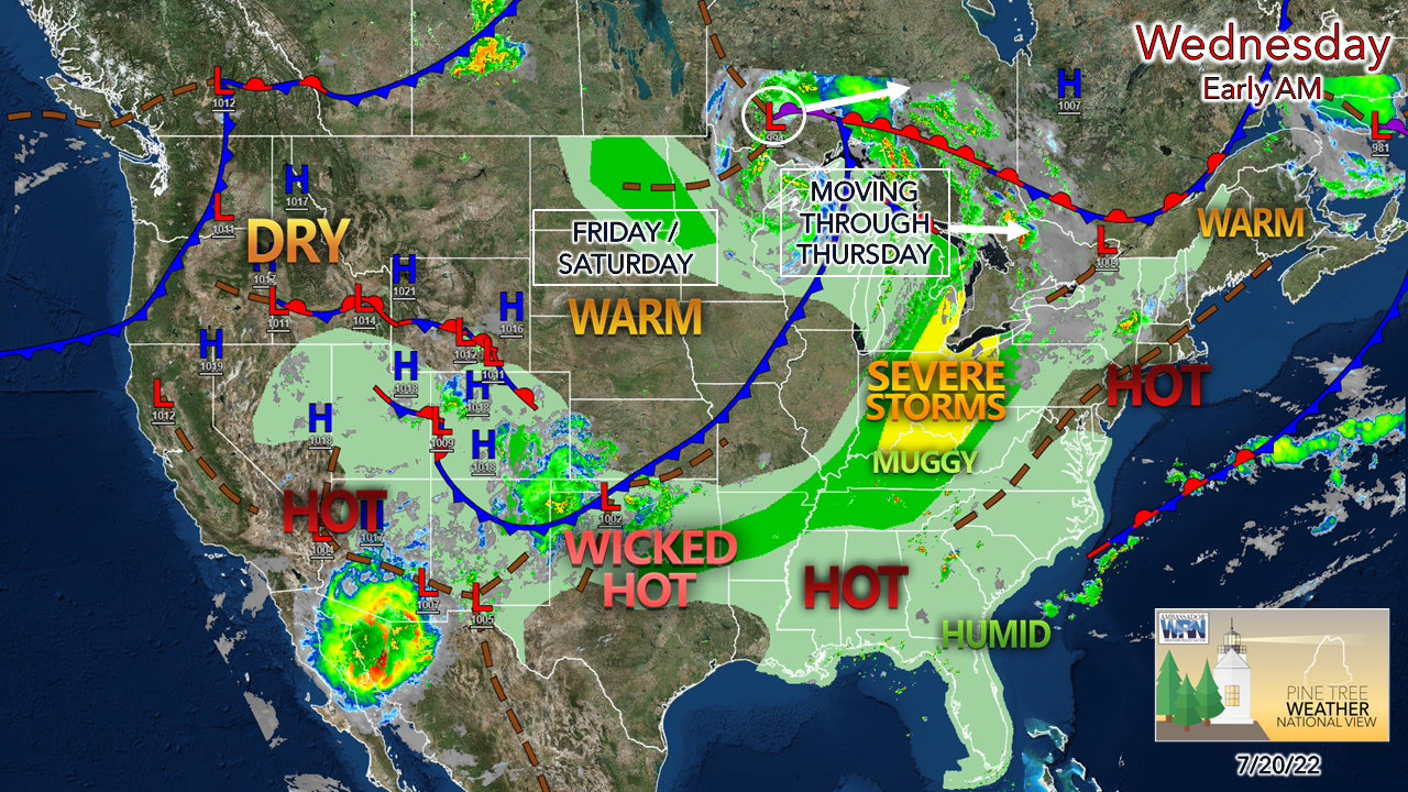 For those of us in northern New England as compared to the rest of the country, the warmth is tolerable for the day. Severe storms for the Ohio region head our way for Thursday. The incinerator blasts over the southern Plains and Texas where temperatures are likely to be in the triple digits through the rest of July, at least. That stays where it belongs, so be grateful for that. A fair Wednesday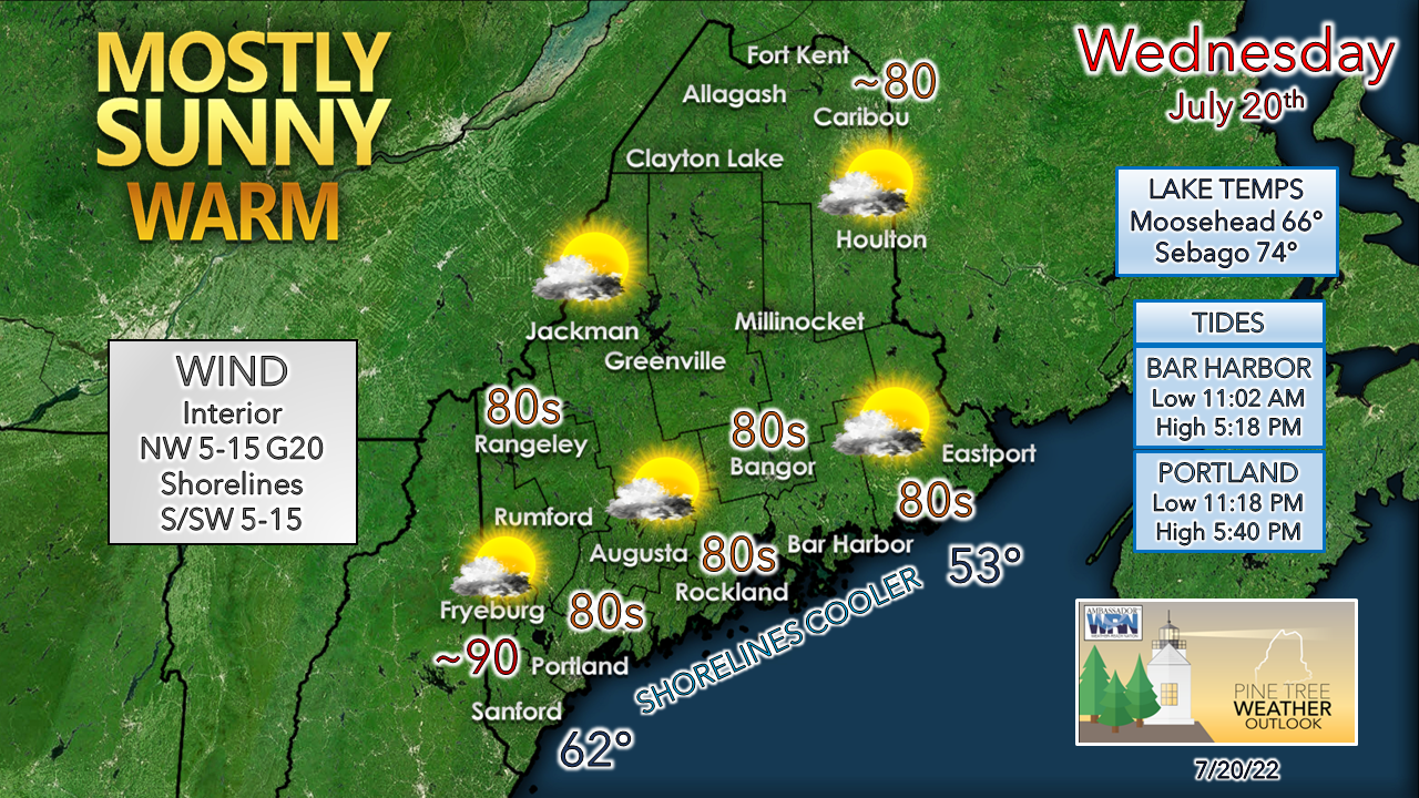 With the cold front that passed through Tuesday, dew points are at comfortable levels in the 50s over a good portion of the interior. That appears to hold serve for the day. Coastal areas feel a touch of humidity as the onshore flow holds dew points in the 60s there. There is an outside chance for a popup shower over western and southern areas in the afternoon along the sea breeze boundary, but other than that, the region stays dry for the day. As high pressure slips to the east, a southwest flow brings the dew points temperatures up, which introduces coastal fog back into the forecast overnight into Thursday. Severe threat possible for Thursday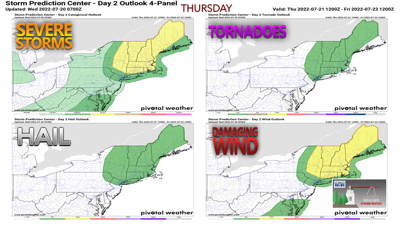 The Storm Prediction Center noted this threat for Thursday on Monday and is maintaining that idea. I piped up on Twitter that it is a rare occurrence that Maine is a focal point of concern that far out. What is fueling the threat in part is dew points potentially spiking into the low 70s, which is high octane atmospheric gasoline. An approaching upper-level trough supplies the trigger. Add ample wind shear to stir warm air into cold from a low-level jet stream, it sets up a powder keg with a short fuse. Add torrential rain which could cause localized flash flooding and frequent lightning into the impact potential. The key factor in this severe threat will be the timing of the frontal boundary. 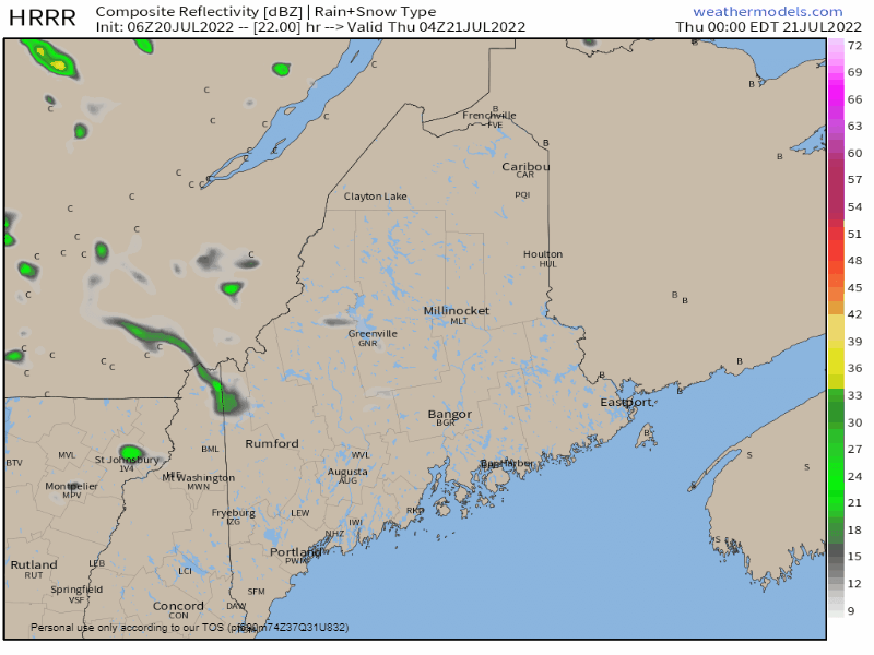 Thursday Midnight to Noon - Outflow ahead of the frontal boundary may bring a few showers and isolated storms to The County through midday. While this is going on, a southwesterly flow juices the atmosphere over the rest of the region as humidity reaches gross, if not disgusting levels heading into the afternoon. 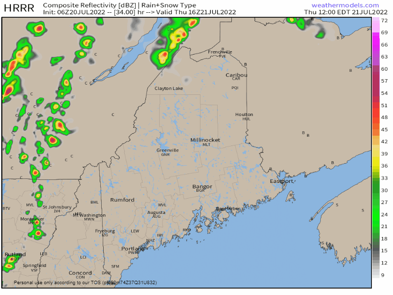 Thursday Noon to Friday Midnight - It's a fair bet at this point the interior southwest, western mountains and foothills, along with northern areas get hit with strong to severe storms in the afternoon and early evening. With the southwest flow, the marine layer stabilizes the atmosphere for the southwest coast, MidCoast and DownEast areas. That isn't to say rumbles won't be heard and downpours may accompany them in those areas, but the main threat for severe appears on a line from Portland-Bangor-Houlton west. I think it's also a fair bet that a severe thunderstorm watch will be posted. It will be an interesting day to see how this unfolds. It's definitely a head-on-a-swivel day as storms could form quickly. Temperature and outlook through early next week After the passage of front on Thursday night, temperatures are expected to stay on the hot side over southwestern interior areas. The humidity levels become drier from Friday into Saturday before increasing on Sunday. A frontal boundary brings the chance for showers and storms Sunday afternoon and evening, and with that, the humidity takes a break as we head into next week. Until then, it's shaping up to be a bona fide heatwave for southwest interior areas through Sunday.  Thank you for supporting this community-based weather information source which operates by financial contributions from people like you. Stay updated, stay on alert, and stay safe! NEXT UPDATE: THURSDAY - Mike NOTE: The forecast information depicted on this platform is for general information purposes only for the public and is not designed or intended for commercial use. For those seeking pinpoint weather information for business operations, you should use a private sector source. For information about where to find commercial forecasters to assist your business, please message me and I will be happy to help you. |

Mike Haggett
|


