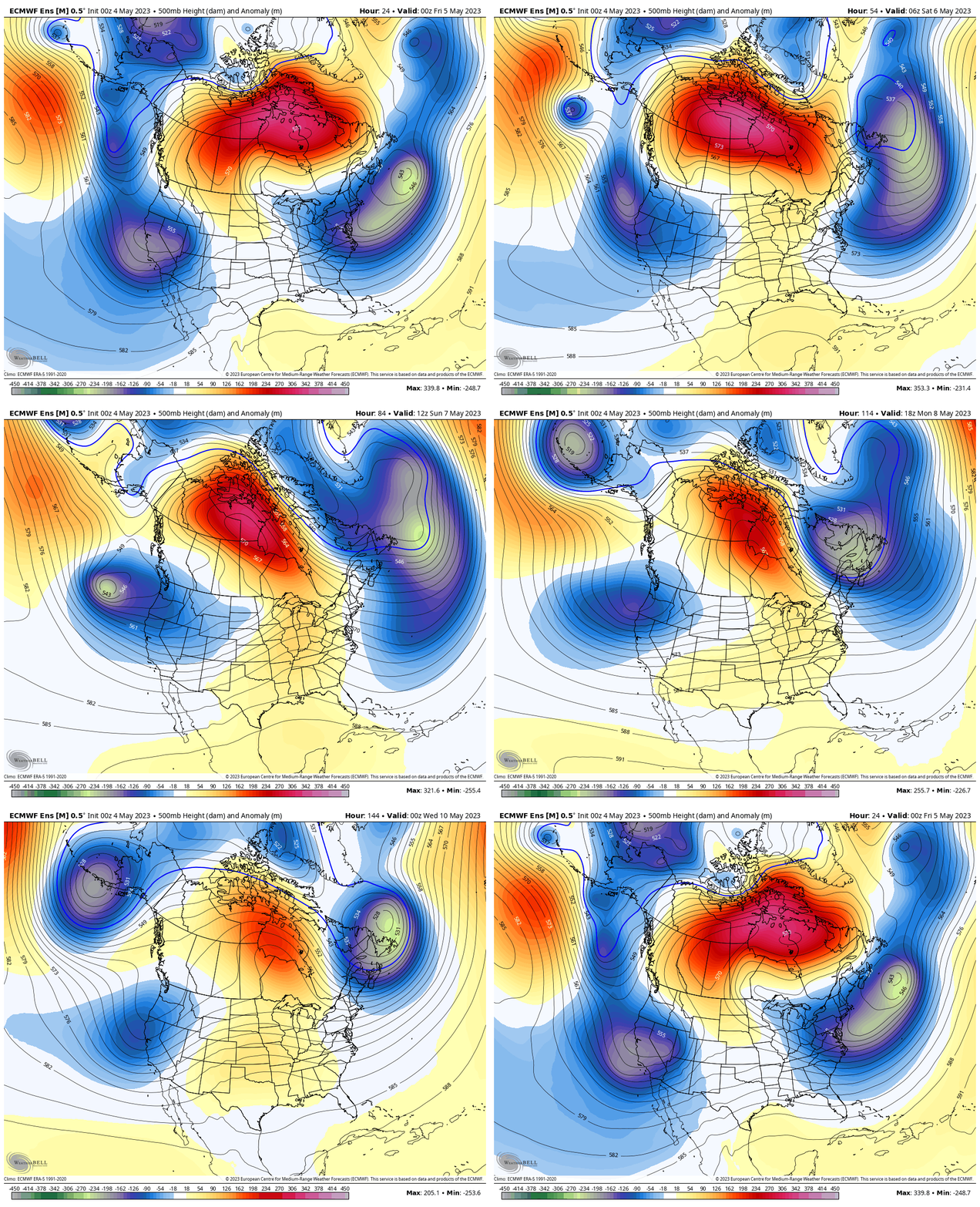
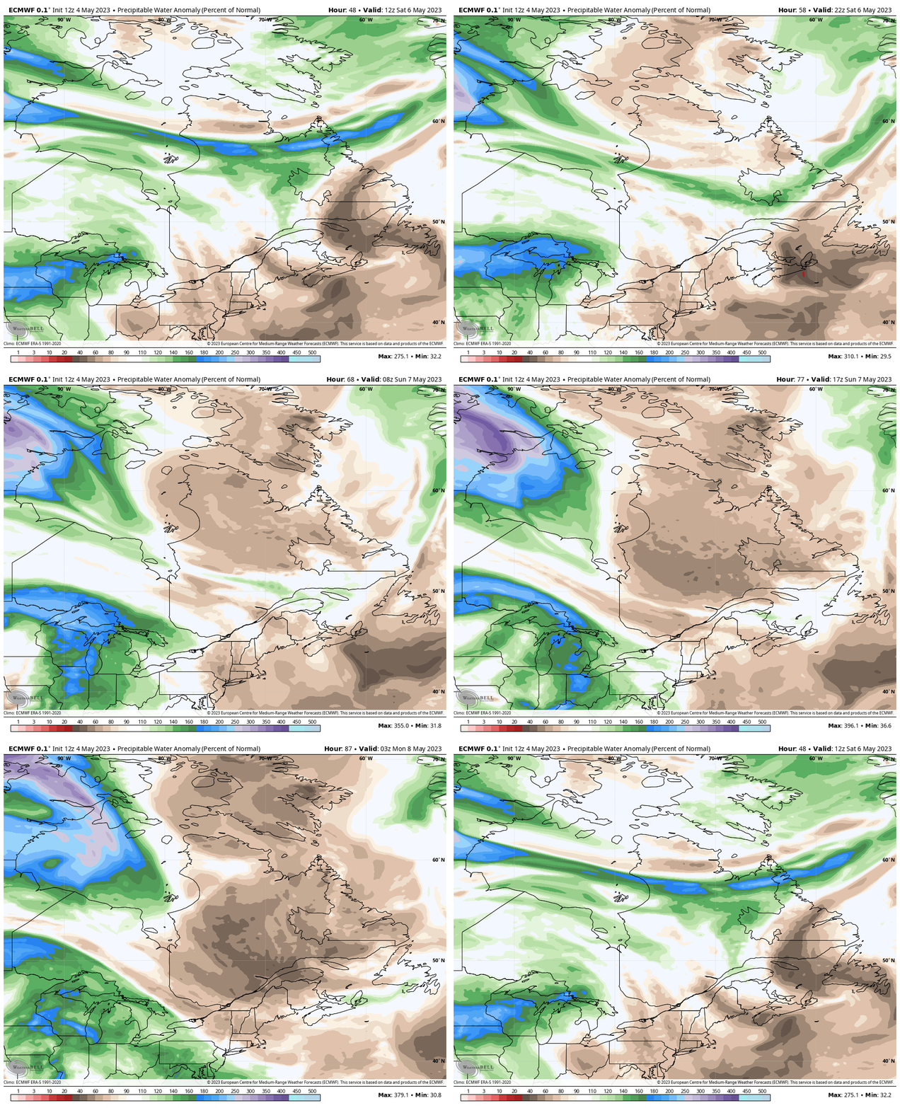
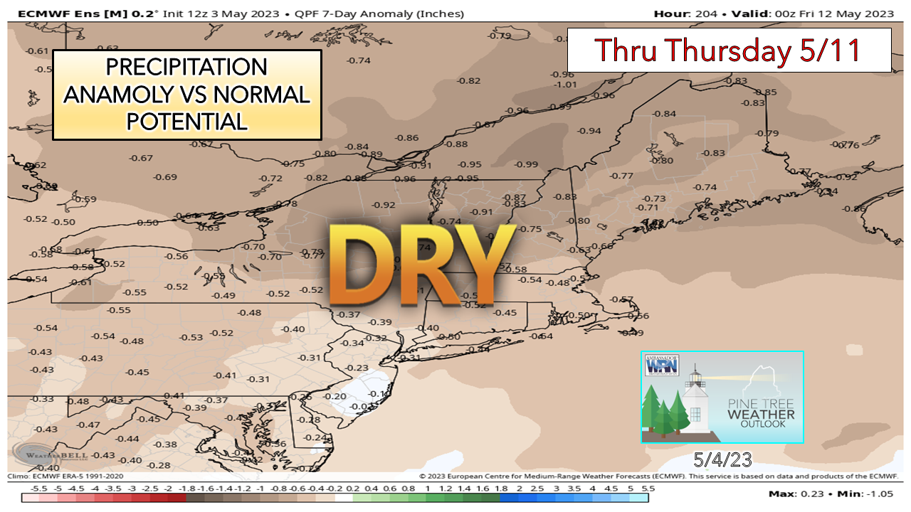
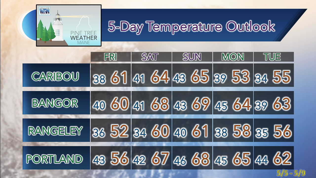
The upper low that has been a curse, turns into a blessingLooking at the anomalous heights of 500mb steering level of the atmosphere at the altimeter of 20,000 feet above sea level shows the upper low that has dogged the region all week departing on Friday into Saturday. It won't go too far, however. A strong block over Europe puts the brakes on it and steers it back over Newfoundland and Labrador and brings a backdoor cold front into Maine. The blocking over northern Canada and a building ridge from the west are held in check by the retrograding upper low. The blessing of the retrograding upper low is that it brings much needed dry air into the region. With the region to the south and west of it, that keeps moisture out of the area. The block caused by it hold the ridge over the Great Lakes. With the strength of the upper low holding on to start the week, the moisture to the west skirts underneath it, sending any potential rainfall impact well to the south and east. Saturday appears to be the best day for sun statewide. Clouds may be more numerous to the north and mountains. A northwesterly breeze ushering in the dry air brings warmer temperatures to the coast. With the proximity of the ridge to the trough caused by the upper low, the friction between the two brings some clouds, especially on Sunday. I expect a sea breeze to develop Sunday afternoon, which will cool the shorelines in the afternoon. After all the recent rain and flooding, this dry stretch is much needed. While relative humidity levels could be very low in the 25-35% range (dew points in the 20s and 30s) to start off next week, the wildfire threat appears minimal given the recent soaking. With the dew points that low, there is the risk of frost over the interior. For those who have planted early, keep that in mind. Temperatures are expected to be within a handful of degrees of normal on the high and low end throughout the period, cooling as we head into midweek. The normal high and low for Caribou is 58° and 38°, and for Portland 61° and 42° for this time of the year. The next chance for rain may come later in the week and may impact the weekend as another backdoor cold front approaches from the north. Enjoy the weekend! Pine Tree Weather is funded from followers like you. I would appreciate your financial support. Click here for how you can contribute. You may not like the weather, but I hope you like what I do! Please hit the like button on Twitter and Facebook, and share! I sincerely appreciate your support! Stay updated, stay on alert, and stay safe! - Mike NOTE: The forecast information depicted on this platform is for general information purposes only for the public and is not designed or intended for commercial use. For those seeking pinpoint weather information for business operations, you should use a private sector source. For information about where to find commercial forecasters to assist your business, please message me and I will be happy to help you. |
Mike Haggett
|


