A wet day for northern and eastern areas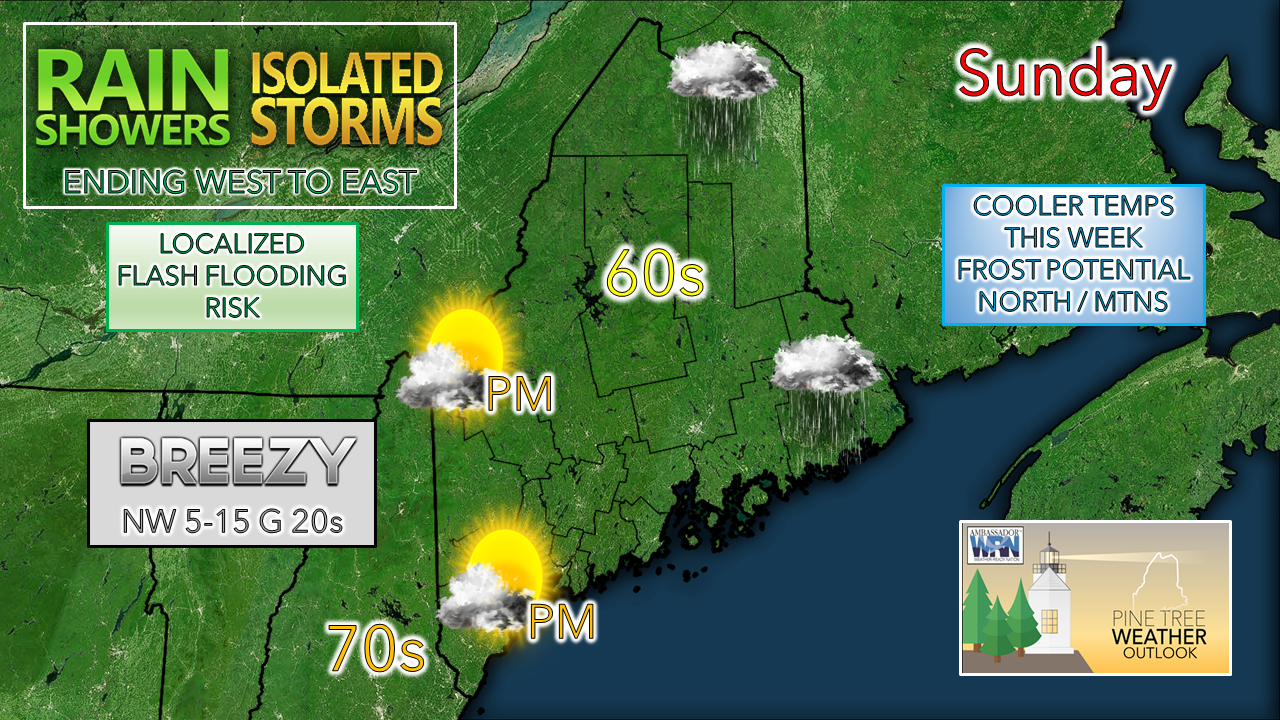 A quasi-stationary frontal boundary splitting the state from north to south is the main weather feature for the day. The front which has stalled over the area since early Saturday finally gets kicked out of the region. Before it heads out later in the day, areas of heavy rain and thunderstorms are possible mainly for central, northern, and eastern areas through the day. 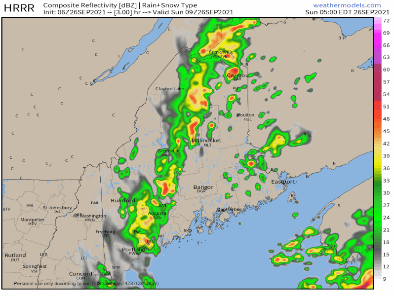 Sunday 5 AM - Midnight: An upper-level trough to the northwest becomes negatively tilted. This increases rain along the front, and finally moves it out the region. Rain ends from west to east during the day, wrapping up over far northern areas by around midnight. Localized flash flooding is possible in areas of downpours. As the front departs, a northwesterly wind picks up and brings drier air into the region. Southern and western areas can expect to see the sun heading into the afternoon. Eastern areas may be able to see the sun poke through toward evening and catch a sunset. Northern areas stay in the clouds and deal with showers through Sunday night. A few showers around Monday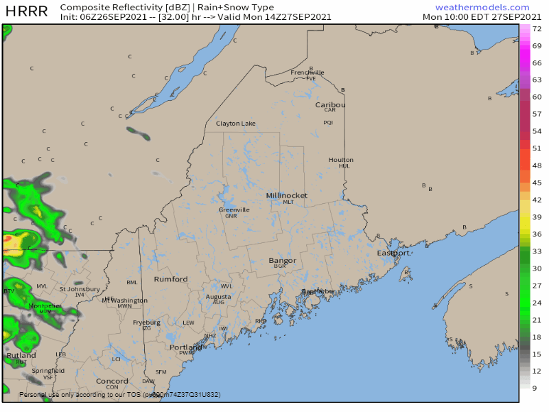 Monday 10 AM - Midnight: While the front departs, a cut-off upper-level low moves into the region and becomes the key weather feature for the week. The result for Monday comes in the form of various amounts of clouds and shower chances, primarily for western, eastern and northern areas, but an isolated shower over southern areas is possible. It will be another breezy day with south/southwest winds in the 5-15 mph range with gusts into the 20s possible in spots.  Trend in pattern through Friday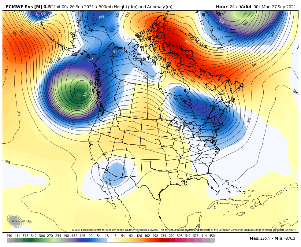 The aforementioned cut-off upper-level low keeps the region cool from Tuesday through the end of the week. A blocking ridge over the Midwest stretching into northern Canada controls the pattern through the period. To the northwest, winter kicks into high gear with big snow potential for Alaska and the western Rockies in British Columbia and southwestern Alberta at times through next weekend. On this side of the hemisphere, major Hurricane Sam will be a storm to watch and to monitor through the week. Wireless Emergency Alerts (WEA) WEA are emergency messages sent by authorized government alerting authorities through your mobile carrier. America’s wireless industry is helping to build a Weather-Ready Nation through this nationwide text emergency alert system. weather.gov/wrn/wea Temperature outlook through the work weekThe normal temperatures for Caribou are 63° for the high and 43° for the low. For Portland, the average high and low marks are 68° and 49°. Cooler is the trend for the week ahead. Pending on cloud cover associated from the cut-off upper-level low may dictate frost potential for the north and mountains later in the week. For those who like sweater weather, your time is about to arrive. 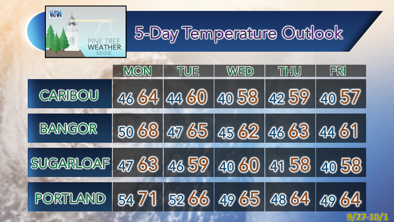 Be prepared to receive alerts and stay updated!
 For more information in between posts, please follow Pine Tree Weather on Facebook and Twitter.
Thank you for supporting this community-based weather information source which operates by reader supported financial contributions. Stay updated, stay on alert, and stay safe! - Mike |

Mike Haggett
|