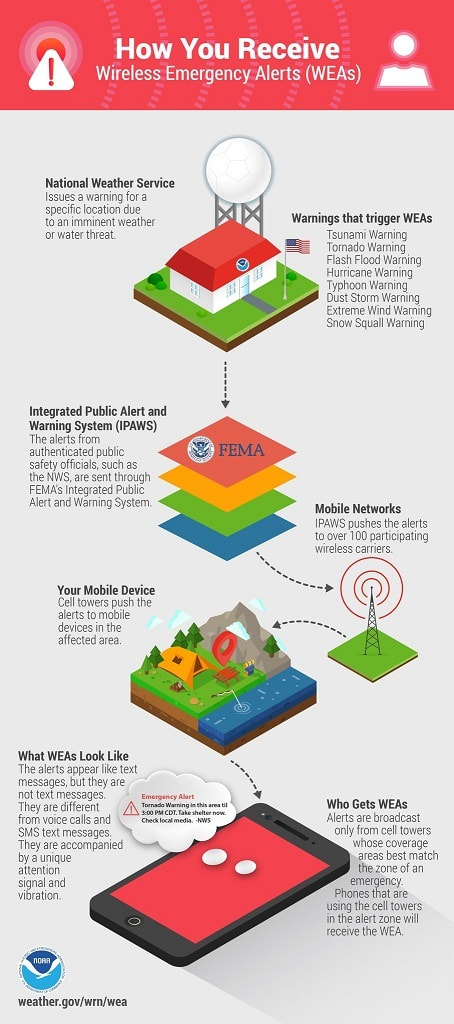
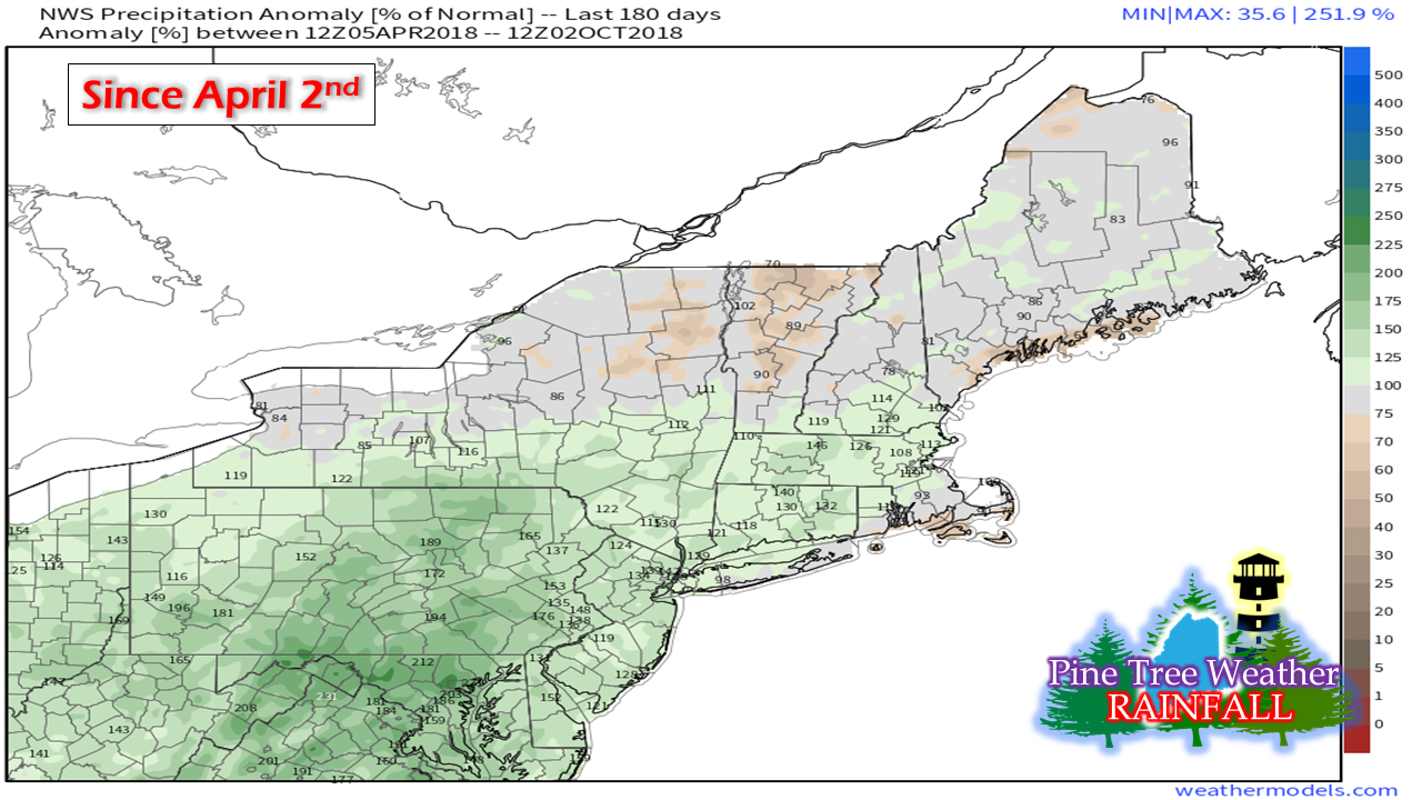
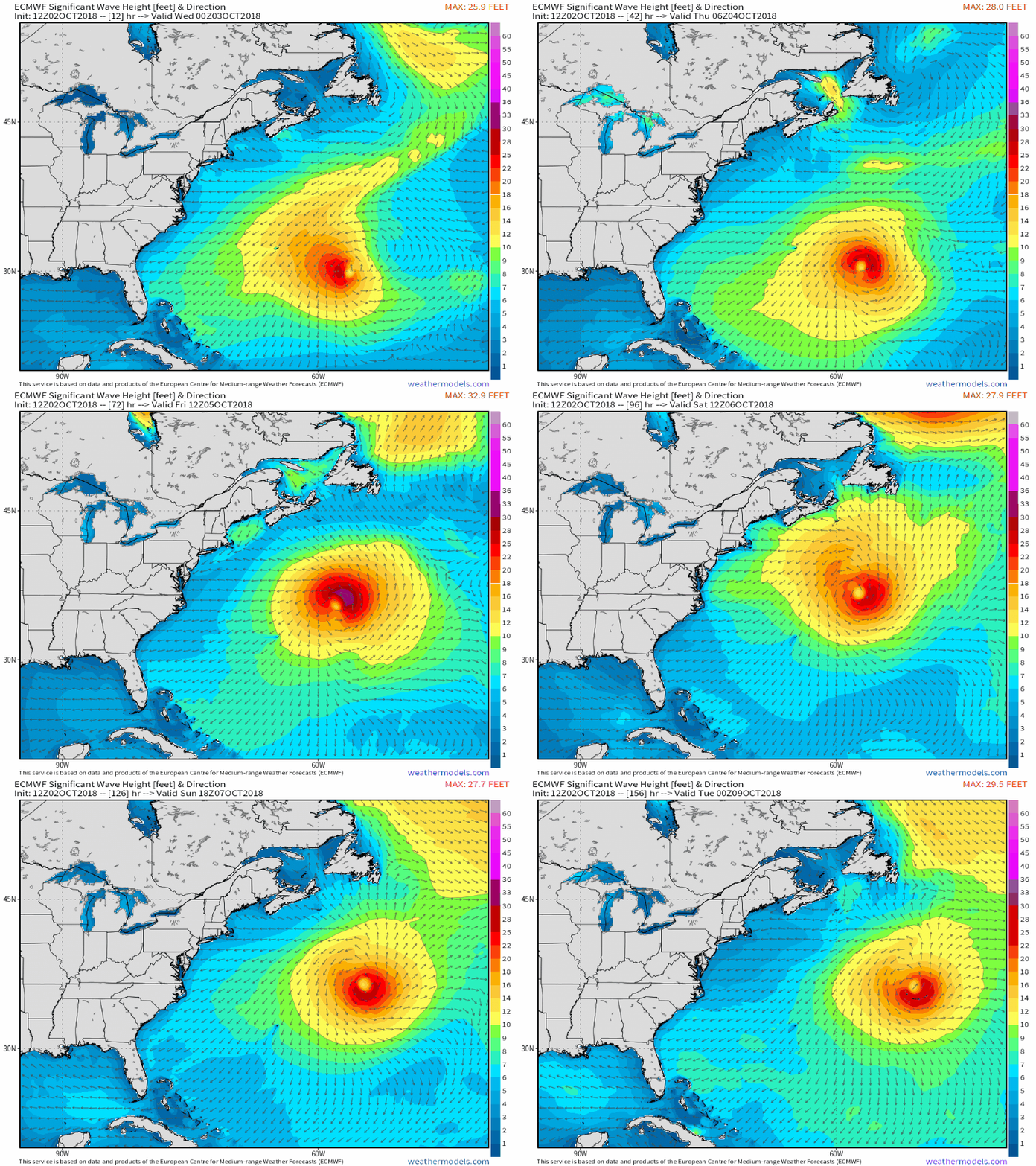
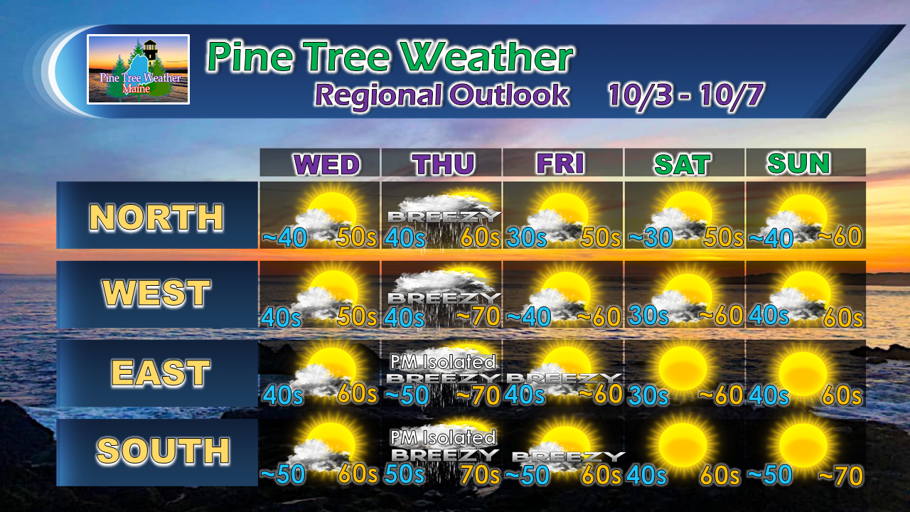
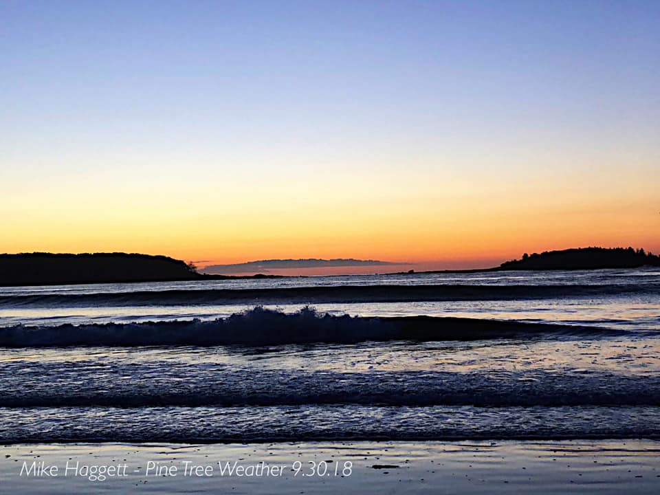
Nationwide Wireless Emergency Alert Test WednesdayFor those with mobile devices, expect an odd sound and vibration at 2:18 PM as a nationwide test is being conducted by the Federal Emergency Management Agency (FEMA) and the Federal Communications Commission (FCC) will conduct radio tests soon after. For those who are not informed of this, expect a few laughs, some surprises, perhaps some choice vocabulary, and a chance for dropped phones. Please share this with your friends and family so they are not caught off guard. Rain totals inching northwardNot including the rain on Tuesday, much of northern New England, upstate New York and Cape Cod areas are running at a rainfall deficit. Rainfall has been increasing as of late, and for most of the area, its one solid soak away from normal totals for the year. I know there is plenty of anxiety out there on ground water resources which is justified from the abnormally dry spring. October is a long month, and will likely be stormy at times as they usually are. Stay tuned. Leslie to bring surfLeslie has been spinning around and around the Atlantic for days and will likely continue to for a while yet. The ocean is an atmospheric traffic jam and with the warm water and plenty of moisture, the storm will cause an inconvenience to the shipping lanes and cause some surf for the shorelines. With the weather looking good for the weekend, the waves will be great for observation and photography. High tides are roughly in the 9 AM/PM hour on Saturday and 10 AM/PM hour on Sunday. Tides are rising this weekend due to the new moon, and could cause some splash over in low lying areas. PLEASE respect the power of the ocean, enjoy from a safe distance, and be aware of the wave activity. 5-Day Outlook through SaturdayAs far as rain chances go, Thursday is the only daytime period of concern through the next five days. The main area of shower activity will be for northern and western areas, but a few isolated showers could make it to the coast Thursday afternoon. Another weak frontal boundary passes through Saturday night which may bring a light shower over northern and mountain areas again overnight, but that appears to be gone by Sunday morning. A peek at Columbus Day indicates a virtual carbon copy to Sunday, but a bit cooler. Stay updated!For the latest official forecasts, bulletins and advisories, please check in with the National Weather Service in Gray for western and southern areas, or Caribou for northern and eastern parts of Maine.
For more information from me, please follow the Pine Tree Weather Facebook page and my Twitter feed. Thanks as always for your support! Please consider making a donation to keep Pine Tree Weather going. Check out the donate page on how to contribute. Always stay weather aware! - Mike |
Mike Haggett
|

