Bundle up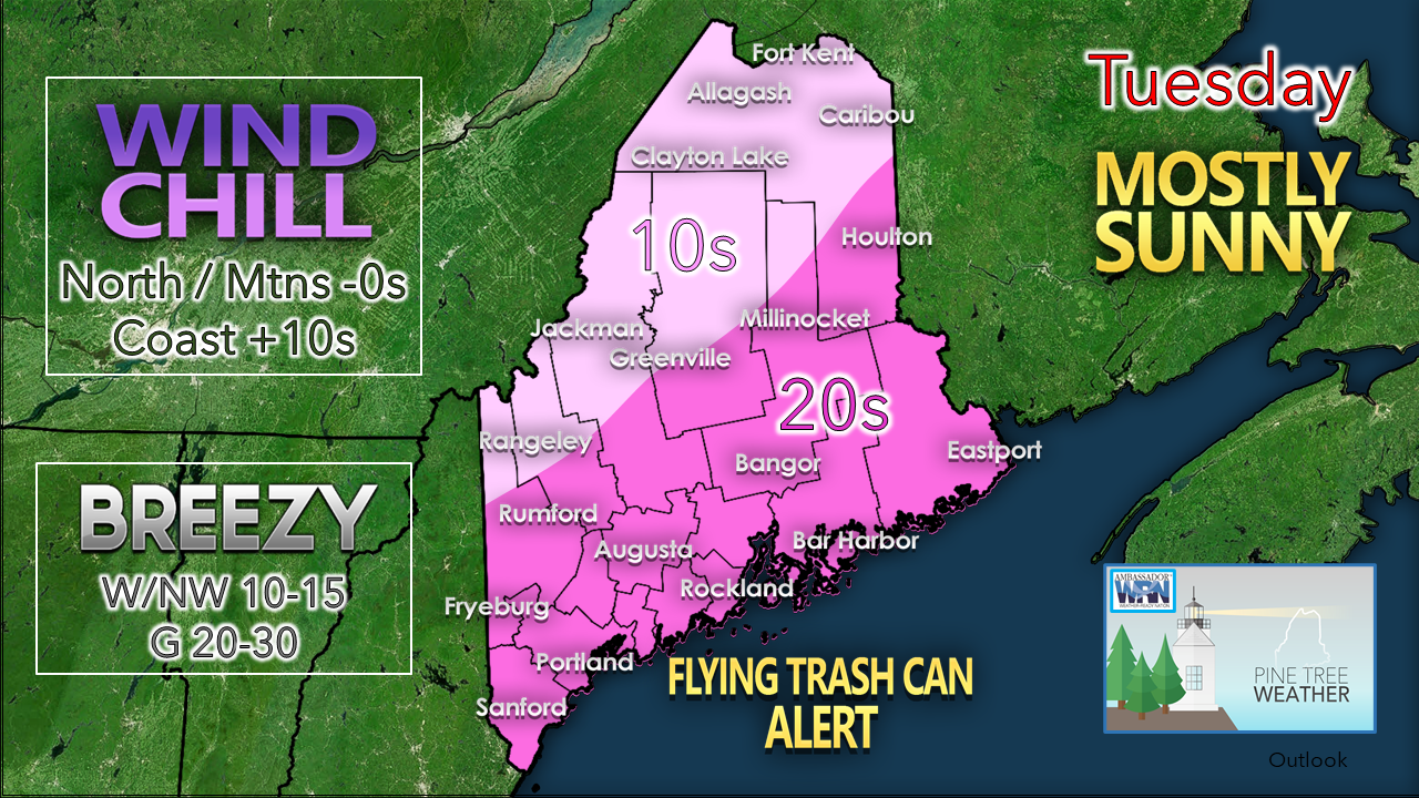 The only two words you need to know today. Add extra layers and more firewood to the stove. Secure any loose objects. The wind stays steady until tonight. 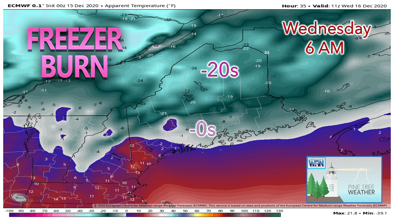 With the arctic high moving in, it will be a bitter cold start to Wednesday. Actual lows below zero to start the day in the north and mountains, with single digits and teens for the coastal plain. Highs for Wednesday in the single digits above 0° in the north, teens for eastern and western areas, and low 20s south. A major storm to the south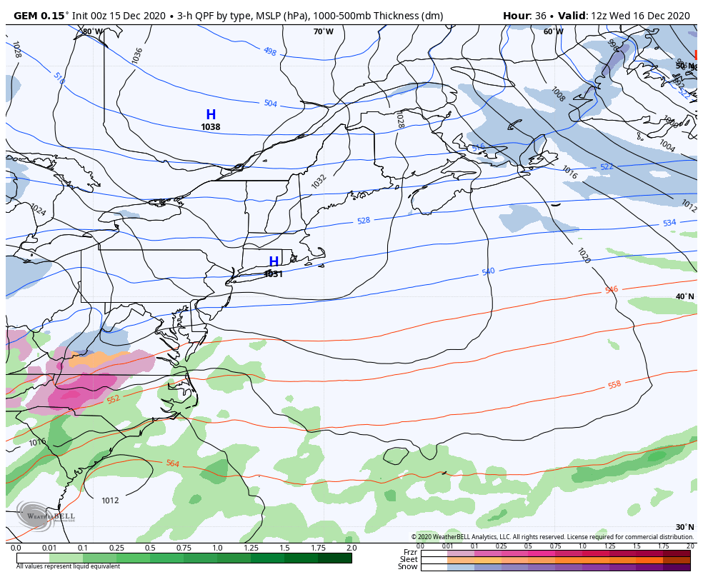 GEM model idea of sea level pressure and precipitation from 7 AM Wednesday to 1 AM Friday Folks in the MidAtlantic and Southern New England are on track to get the biggest winter storm in two years. For us in Maine, we're on the fringe of the storm. This is definitely an all snow event for the region as cold air will hold into the north. The storm track comes very close to the 40°N / 70°W benchmark point and tracks east. It does not appear to be a very strong event, but there is ample moisture in the key areas of the atmosphere to bring a fluffy snow. Western and southern areas see the first snow flakes Wednesday night after the evening commute. Snow moves east Wednesday night into the wee hours of Thursday. Snow ends over western and southern areas Thursday morning, eastern areas Thursday afternoon. 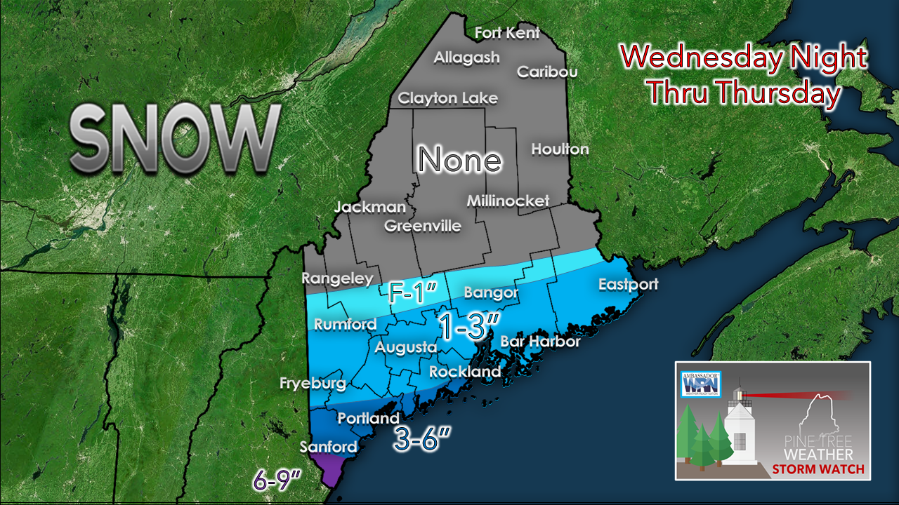 For the mountains and north, it appears to be a shut out, outside of possible snow showers for the western peaks on the fringe. 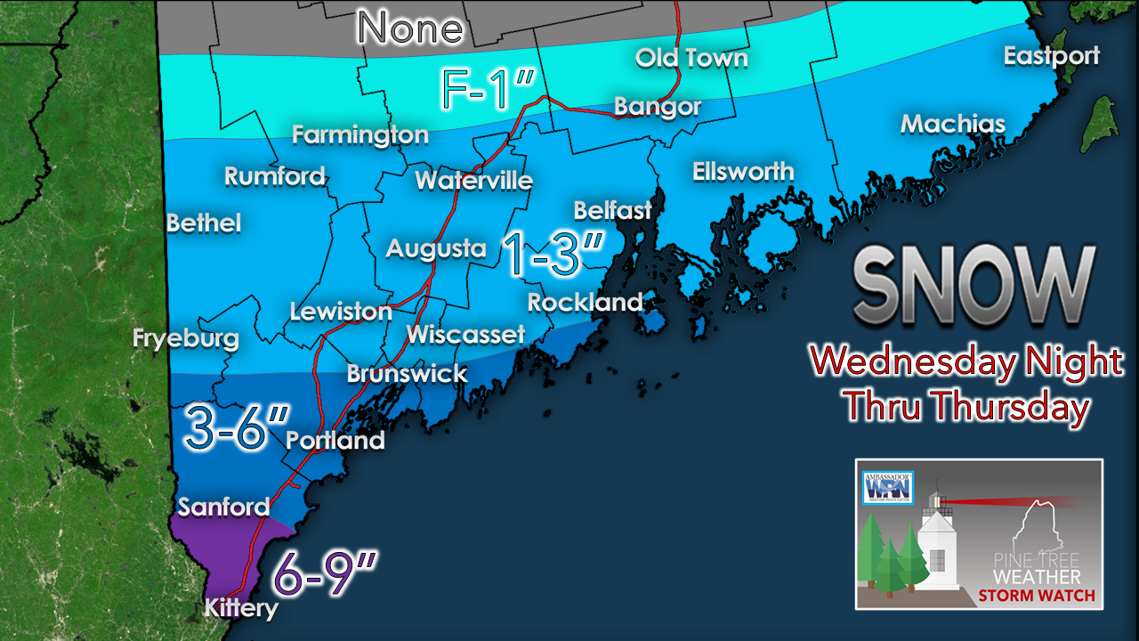 Zooming in a bit closer, York County gets the most from this event. There is still wiggle room with the track. Any variations could add more or less. That is life on the edge. As I said here on Monday, Rumford to Calais south should expect to plow. I see no reason to change that idea at this point. It will be fluffy and easy to move. Coastal areas may see it blow around a bit Thursday afternoon as the low moves east. The coastal plain will see the breeze continue into Friday. Expect a slow commute Thursday in areas of snow. Expect slick spots along the coast from blowing snow through Friday.  Temperatures and outlook through MondayAfter the storm Thursday, there is a chance for mountain snow showers Saturday night as a weak clipper passes through. After Wednesday, temperatures modify slowly upward towards normal by the first of next week. 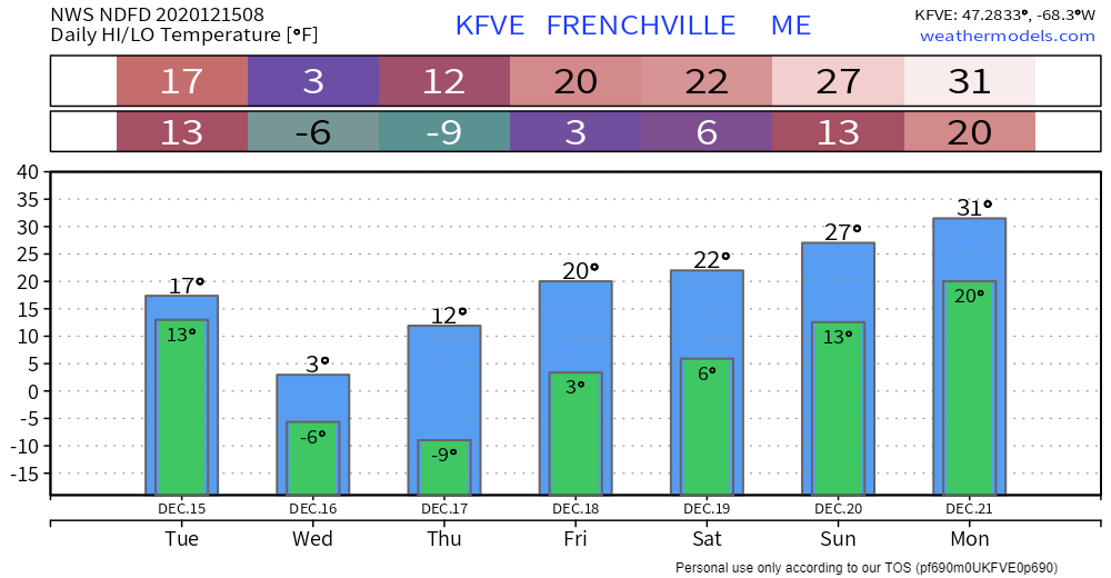 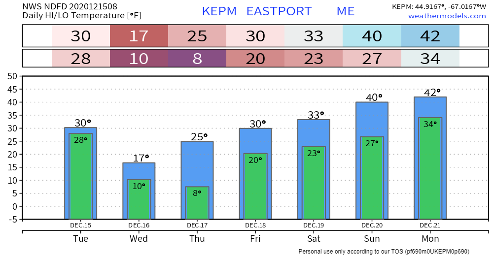 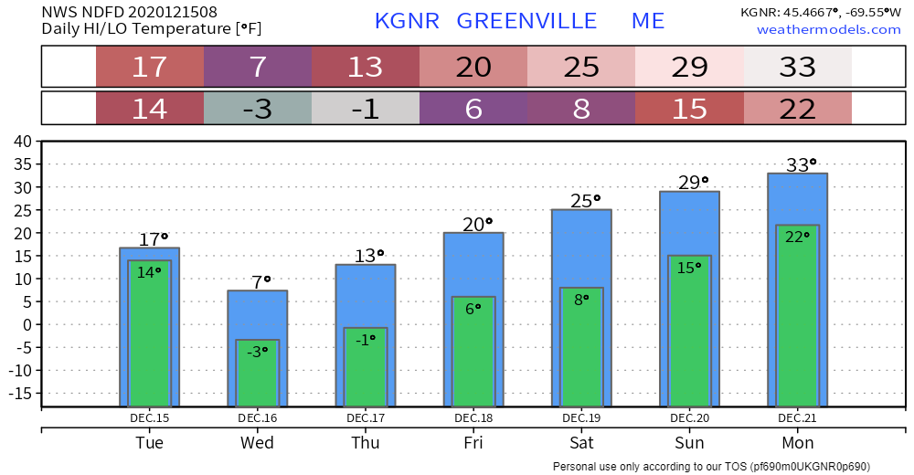 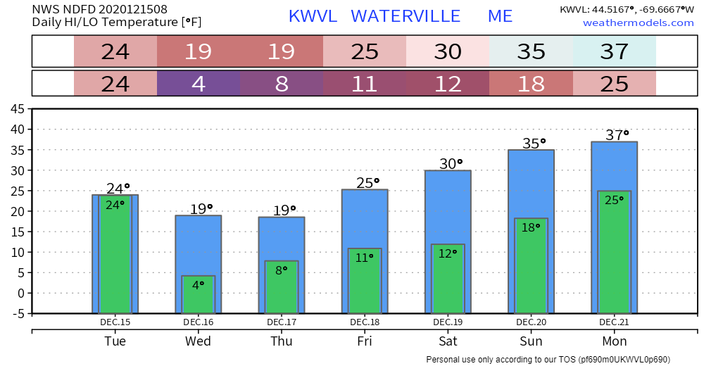 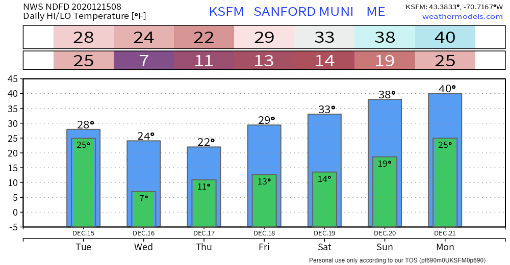 The science of wind chill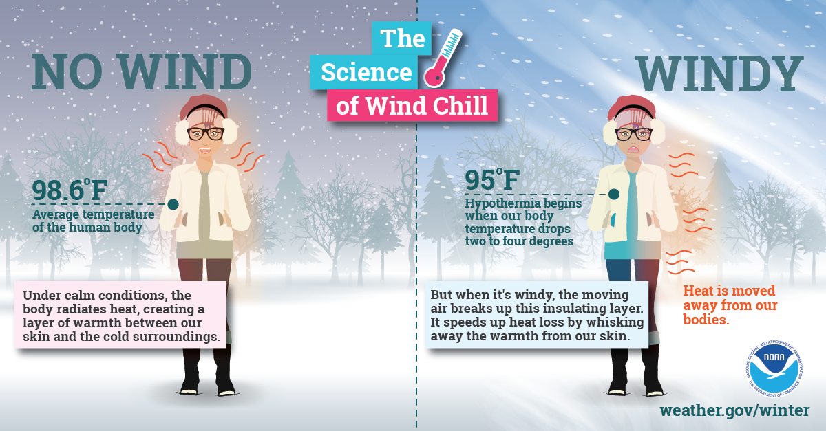 With little wind, your body is able to maintain a thin layer of warmer air between your skin and colder air surrounding you. However, higher winds can eliminate that thin layer, and your body can begin to cool at a dangerously fast rate. Visit weather.gov/safety/cold for more winter science! Be prepared to receive alerts and stay updated!
For more information, please follow Pine Tree Weather on Facebook and Twitter.
** FUNDING NEEDED FOR 2021 ** Thank you for supporting this community based weather information source that is funded by your financial contributions. Stay updated, stay on alert, and stay safe! - Mike |

Mike Haggett
|