
More rainfall Saturday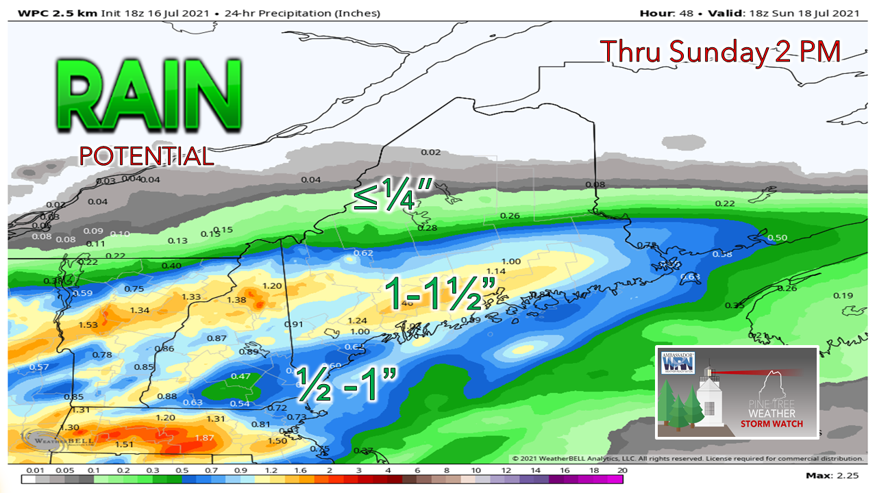 For Saturday a pattern of early morning calm followed by increased clouds and rain as the day continues will likely be due to a weak high pressure prevailing during the early day followed by a low pressure system moving into the area by late afternoon to early evening which will lead into potential severe weather for Sunday . The southern half of the state has the most potential to see rain for Saturday and Sunday given the path of an incoming warm front to the south of Maine bringing with it heavy rainfall and intense storms. Precipitation totals for Saturday into Sunday show areas along the midcoast accumulating the most rainfall with totals above 1 inch and decreasing amounts as you move northward and inland. High temperatures for Saturday are forecasted to reach near 80 in the north while the south will likely experience temperatures in the 70s to low 80s due to elevated cloud coverage. Severe weather Sunday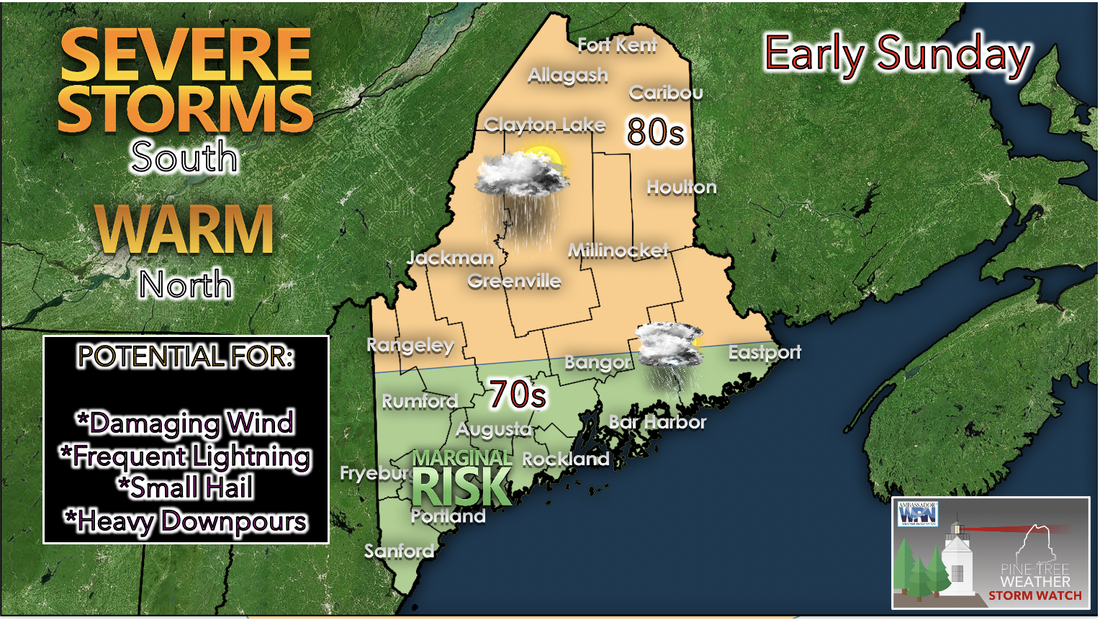 Sunday looks to be an eventful day especially in the early morning as severe conditions ramp up and take over the southern half of the state. The potential for severe storms should not be taken lightly as damaging winds, lightning, hail, and heavy downpour are all likely to appear along with this type of weather. While the southern portion of the state is expected to have the potential to see severe storms on Sunday the north will be relatively warmer and calmer. However it is still likely that the north will experience rainfall Sunday since the same low pressure system's effects may still reach into the northern region. High temperatures for Sunday will likely hover in the low 80s for the north and be seasonally cool in the south in the 70s. The reason for this swap in highest temperature location is likely due to the lessened cloud coverage in the north and increased coverage in the south. Severe weather can be very dangerous so please remember to stay low and sheltered when dark clouds roll through. Rain slows by Monday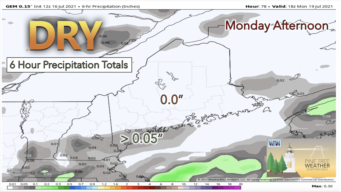 Monday afternoon will be much calmer compared to the weekend as the low pressure system that brought severe weather the day before weakens. As the above graphic shows, the total precipitation in the 6 hours leading up to Monday afternoon has is little to no precipitation expected for the state of Maine for the beginning of the upcoming workweek. This will be a nice break from the wetter weather that is likely to occur over the immediate weekend. Temperatures for Monday will reach highs in the upper 70s to low 80s. The highest dew point temperatures for the day will just reach the lower 60s and therefore air will seem less humid than in previous days. Some sun for Tuesday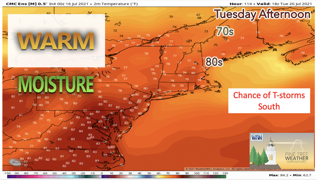 Tuesday morning will be somewhat calmer and peaks of sun are expected during the morning hours. However, by Tuesday afternoon showers and thunderstorms are likely to move back into the region from the north. The front associated with this weather has the potential to stall overhead and therefore keep rainy conditions in the area through the rest of the day Tuesday and into Wednesday with the mid level shortwave overhead. Temperatures are forecasted to be slightly warmer on Tuesday compared to Monday with the southern and coastal regions in the low 80s and the northern and western regions in the mid to high 70s. A break in the Rain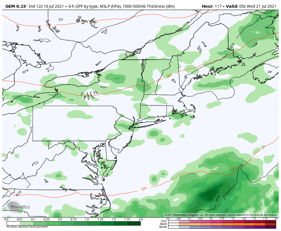 As the week comes to and end, Wednesday has continued showers in store as a result of the post-frontal airmass from Tuesday. On Thursday we can expect a brief break in the active weather on as the flow places Maine in between shortwaves in the pattern. Friday shows another chance for rain in the early hours. Temperature outlook for next weekElevated temperatures this Friday and into the weekend begin a slight cooling trend for the upcoming week. This weekend temperatures are mostly seasonable with highs in the upper 70s to low 80s and lows in the near 60s. As the week continues temperatures gradually decrease hitting a low point mid week and begin to clim again toward the end of the workweek. 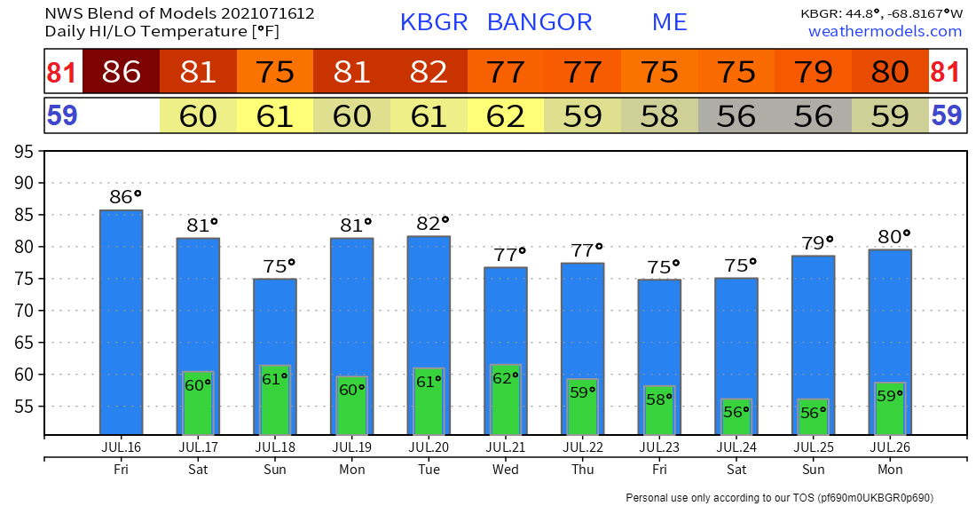 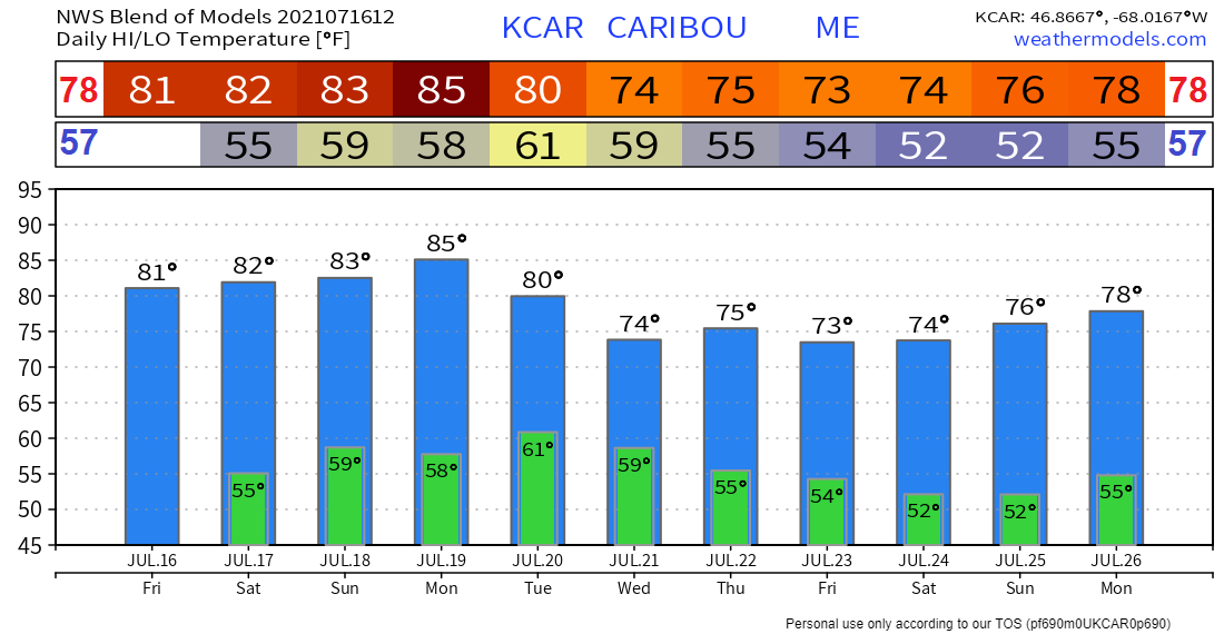 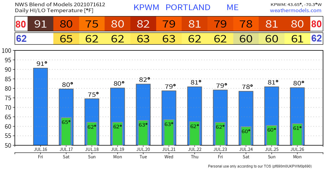 Hurricane Preparedness - Determine Your Risk 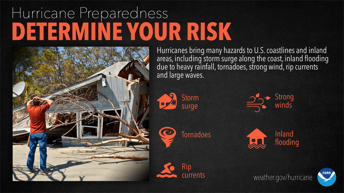 The threats from hurricanes to you and your family can vary widely depending on where you live. It’s not just those along the coast that can experience significant, life-threatening impacts. Evaluate what you need to do to protect your home and family NOW, before the storms. For more information ► hurricanes.gov/prepare Be prepared to receive alerts and stay updated! BE PREPARED WITH A NOAA Weather Radio. For $20-$40, it could provide vital information to you when you need it. The weather bands are standard on most public safety scanners, and newer scanner models. Weather radios can be programmed for auto alert. Click here for more information.  ► ► For the latest official forecasts, bulletins, and advisories, please check in with the National Weather Service in Gray for western and southern areas, or Caribou for northern and eastern parts of Maine. 
|

Mike Haggett
|


