Pine Tree Weather
  • DISCUSSIONS
  • DONATE
  • MAPS
  • NWS BRIEFINGS
  • SATRAD
  • MARINE
  • SNOW / ICE OUTLOOK
  • RAIN OUTLOOK
  • CPC OUTLOOK
  • Kennebunk
  • OBSERVING WEATHER
  • Who We Are
  • My Photography
  • DISCUSSIONS
  • DONATE
  • MAPS
  • NWS BRIEFINGS
  • SATRAD
  • MARINE
  • SNOW / ICE OUTLOOK
  • RAIN OUTLOOK
  • CPC OUTLOOK
  • Kennebunk
  • OBSERVING WEATHER
  • Who We Are
  • My Photography

Another blast of summer heat, humidity and storms through Wednesday

8/30/2022

Comments

 
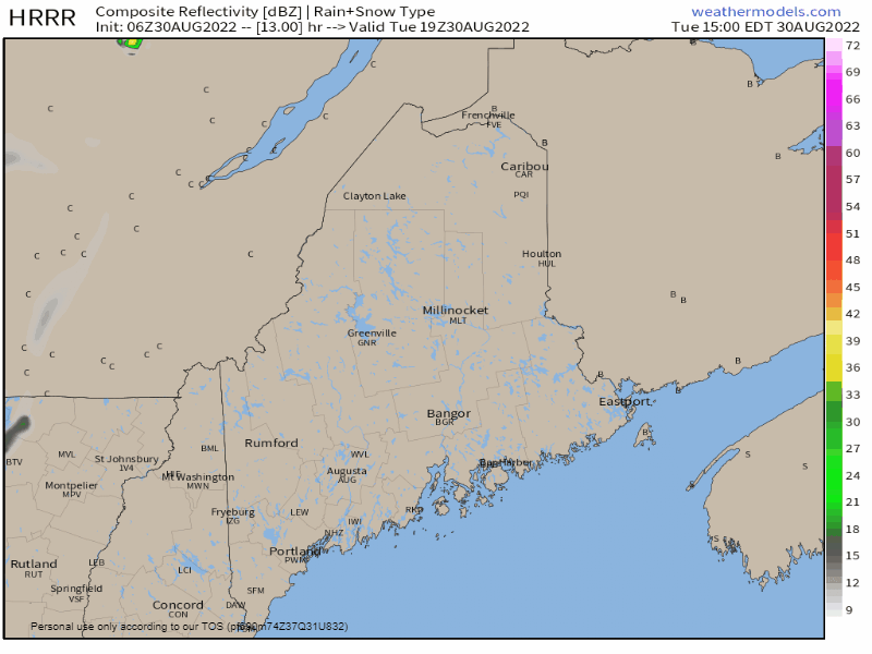
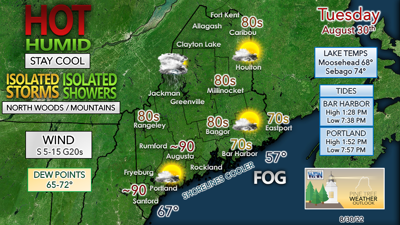
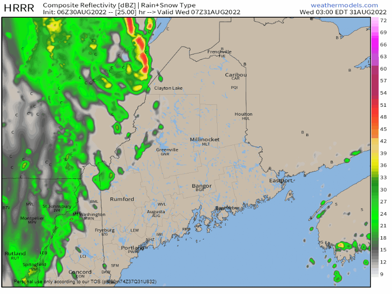
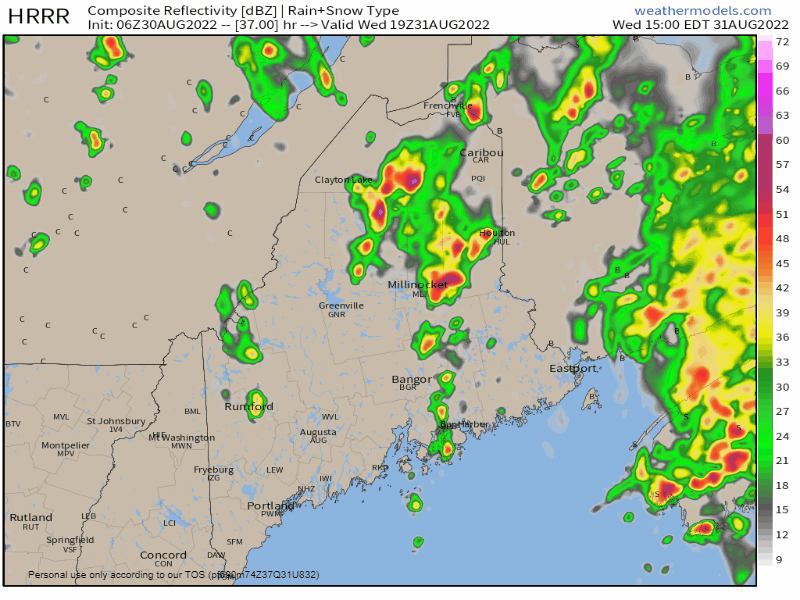
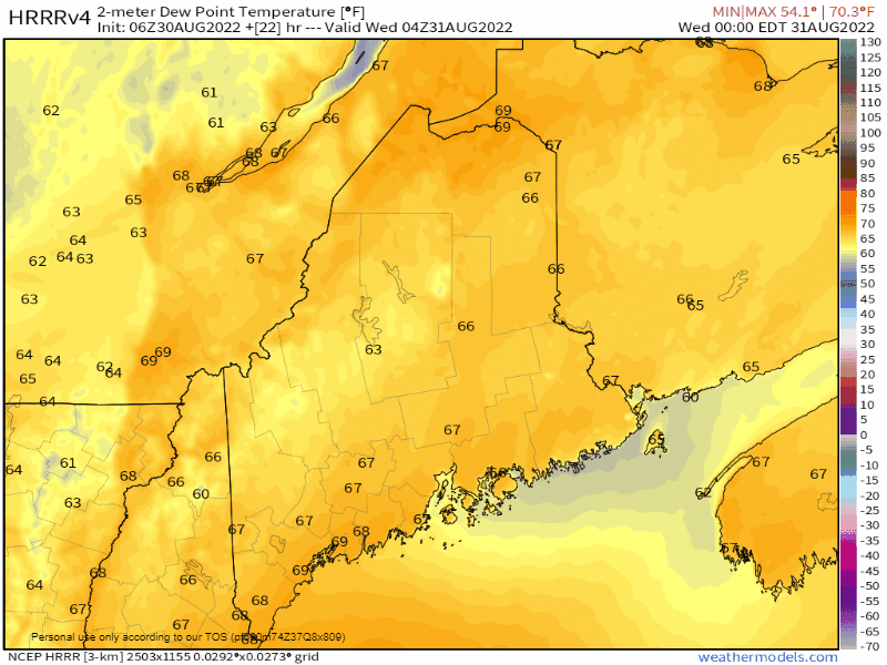
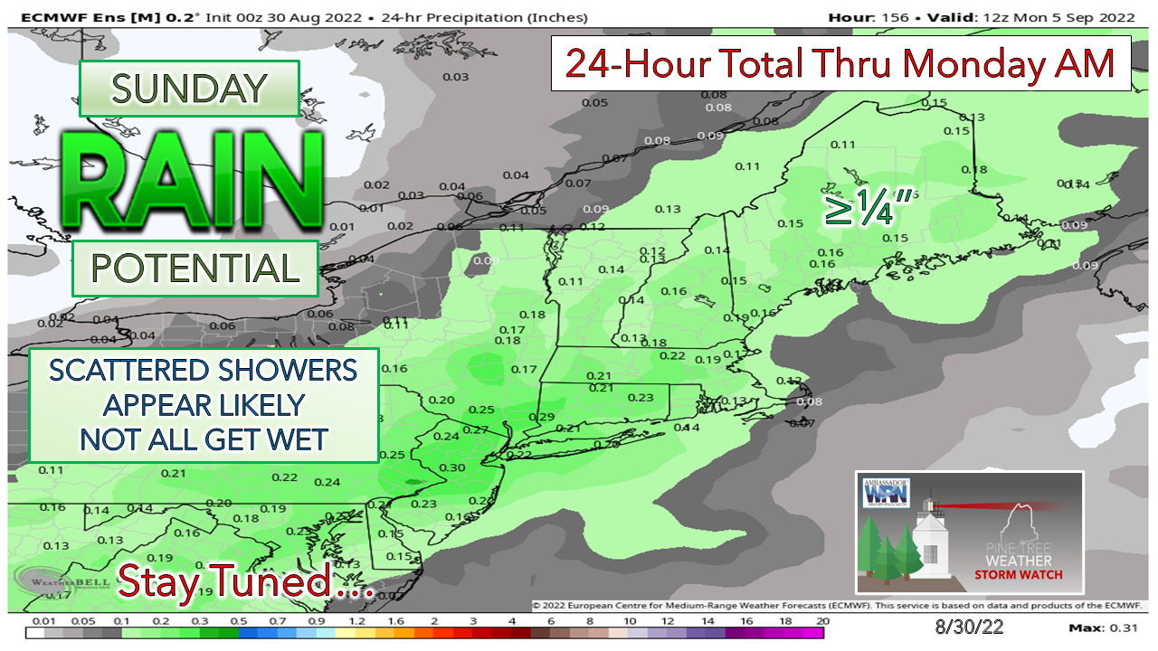
Before I get into the outlook, a heads up for folks in the western mountains. The Sugarloaf Mountain NOAA Weather Radio transmitter is offline and will be for a few days. With the potential for strong to severe storms through Wednesday, please make sure your radios are set to pick up forecast information and warnings from any of the three stations that you can pick up. I know it can be a bit tricky to get alternate stations in the valleys. Make sure that you test to find out what station you can receive well and check your phones for service quality. Have weather app that can deliver bulletins to you. My personal preference is the AccuWeather app based on experience in comparison to others.

Back to the swamp once again

Picture
It's those icky, sticky, late days of summer. The dew points have been higher at times previous, but the relative humidity levels may be higher this time around. What is the difference between dew point and relative humidity? The dew point is the condensation temperature of the air. Relative humidity is the amount of moisture in the air relative to the air temperature. With dew points around 70° and actual temperatures in the 80s, relative humidity levels push to 60-65% which is gross factor 4 out of 5 level. It won't be as bad as we've seen this summer, but humid enough to be air-you-can-wear.

Relief is coming! 

A late afternoon shower / storm possible
​for the Quebec border areas

Picture
Tuesday 3 PM to Wednesday 3 AM - Guidance has been rather poor with the timing of the approach of the frontal boundary over the past couple of days. I've stated ad nauseum on this site over the years that models are too progressive with cold air and get caught in that trap. It's an indicator of just how refreshing the air will be behind the front. While the HRRR idea here shows showers and storms holding off until early evening, there is the risk some outflow cells may pop early. Keep an eye to the sky after 3 PM. With the region squarely in the warm sector, some rumbles of thunder are possible heading into the evening. While the severe risk is low, the main threat is for gusty wind and downpours with any storms that develop.  
Picture
MidCoast and DownEast areas may be dealing with fog for a good portion, if not the entire day. A breeze off the water keeps temperatures cooler along the shorelines that will increase as the front approaches in the afternoon. Heat indices will reach the low 90s into The County. It's a day to take it easy if you are working outside, stay hydrated and take frequent breaks to cool down. 

If you are headed for the beach, go early, and claim a spot in the dry sand. Tides are not crowd friendly with the high-water mark in the early afternoon on the smaller beaches.

Showers and storms through Wednesday

Picture
Wednesday 3 AM to 3 PM - Some folks could get a decent shot of rainfall; others may not get anything given this potluck set up. Where heavy rain falls, some areas may max out with 1"+ if the ball on the roulette wheel falls right. The heavier showers and isolated storms may backfill to enhance rainfall. Southern areas have the best chance for a shower and/or storm in the morning. Much of the activity is expected for eastern and northern areas in the afternoon, with isolated showers possible for the western mountains. 
Picture
Wednesday 3 PM to Thursday Midnight - Showers and storms end from west to east for the interior heading into Wednesday night. Folks camping out at Baxter may be drip-drying overnight. Expect the possibility of a rumble as a parting gift. 

Relief from the humidity for all by early Thursday

Picture
Wednesday Midnight to Thursday 2 AM - I had to drop this in the update, just because it is going to feel awesome. Windows open, air conditioners off, enjoy a wonderful sleep.

​Is this the last of the heat? Too early to say. Seeing where we've had 80s in late September last year and the way the Bermuda High may play a factor in the pattern next month, I am not sticking a fork in the heat and humidity just yet. 

Outlook through Sunday

Picture
The only blip on the radar for some shower activity after Wednesday comes on Sunday. For now it appears to be an afternoon / evening affair, and I don't expect too much of an inconvenience at this point. Dew points remain comfortable. Temperatures are expected to be in the mid-70s to low-80s with dew points in the low to mid-50s.  It'll be a great weekend overall. 
Picture

Thank you for supporting this community-based weather information source which operates by financial contributions from people like you. 
​
NEXT UPDATE: WEDNESDAY

Stay updated, stay on alert, and stay safe!


- Mike

​NOTE: The forecast information depicted on this platform is for general information purposes only for the public and is not designed or intended for commercial use. For those seeking pinpoint weather information for business operations, you should use a private sector source. For information about where to find commercial forecasters to assist your business, please message me and I will be happy to help you.

Comments
    Picture

    Mike Haggett
    Kennebunk, ME

    Certified Weather
    Forecaster
    Penn State '21

    American Meteorological Society

    National Weather Association

    Weather-Ready Nation 
    Ambassador
    ​
    ​SKYWARN-CWOP

    Matthew 19:26


    Support
    Pine Tree Weather

    DONATE

    Picture

    Picture

    Picture

    Picture

    Picture

    Picture

    Picture

    Picture

    Picture

    Picture

    Archives

    January 2023
    December 2022
    November 2022
    October 2022
    September 2022
    August 2022
    July 2022
    June 2022
    May 2022
    April 2022
    March 2022
    February 2022
    January 2022
    December 2021
    November 2021
    October 2021
    September 2021
    August 2021
    July 2021
    June 2021
    May 2021
    April 2021
    March 2021
    February 2021
    January 2021
    December 2020
    November 2020
    October 2020
    September 2020
    August 2020
    July 2020
    June 2020
    May 2020
    April 2020
    March 2020
    February 2020
    January 2020
    December 2019
    November 2019
    October 2019
    September 2019
    August 2019
    July 2019
    June 2019
    May 2019
    April 2019
    March 2019
    February 2019
    January 2019
    December 2018
    November 2018
    October 2018
    September 2018
    August 2018
    July 2018
    June 2018
    May 2018
    April 2018
    March 2018
    February 2018
    January 2018
    December 2017
    November 2017
    October 2017

    RSS Feed

Proudly powered by Weebly