Wednesday storm about what was expectedNo real surprises with the storm yesterday. Our power grid showed it's vulnerability again with over 115,000 losing power at its height. Foliage on the trees and severe drought with the combination of wind speeds 40-50 mph is not a good combination. Preliminary rainfall totals supplied to NWS Gray and NWS Caribou through early last evening showed the results that were expected, with more for interior areas and less for the coast. The High Wind Warning verified DownEast as Bar Harbor recorded a gust to 62 mph. The 0.88" I recorded on my CWOP station in Kennebunk was the most I've seen since late August. We've got a bit more on the way, but no real confidence in any drought busters appear in sight for now. A showery Friday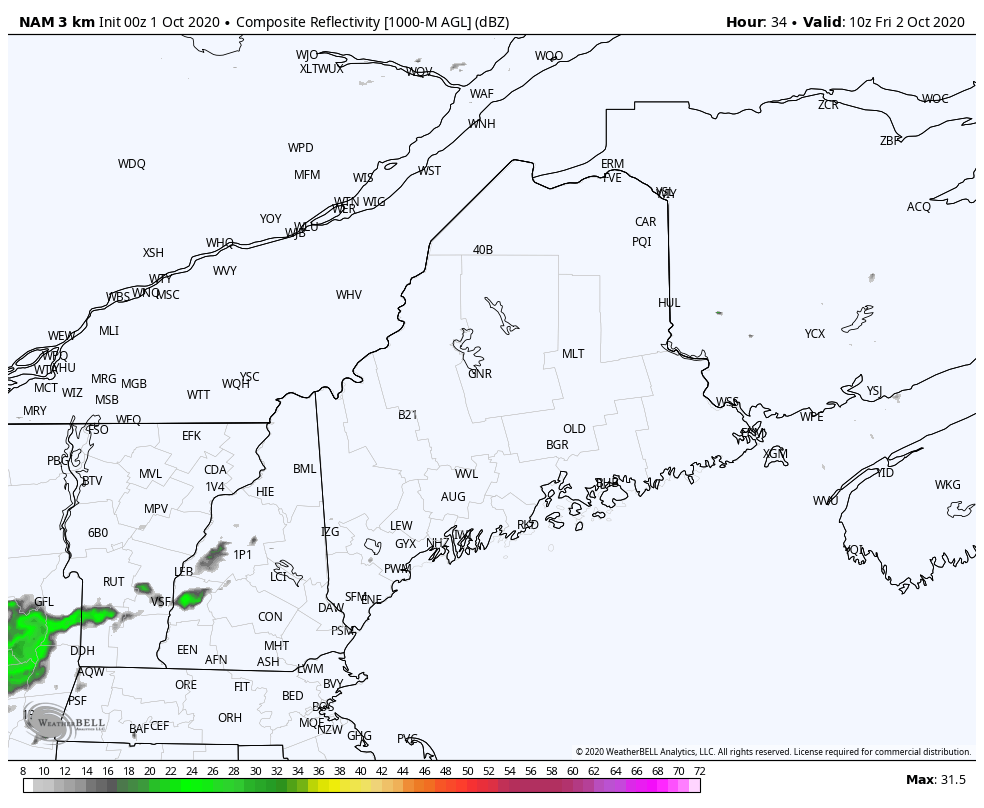 We'll wrap up the work week with another round of showers as an approaching frontal boundary draws moisture up from the southwest. There is not a whole lot of energy associated with this, but just juicy enough to bring a bit more rain to the region Areas along the international border with Quebec see showers Friday morning. As the front approaches, showers move eastward during the afternoon, then clear out of most areas Friday evening. 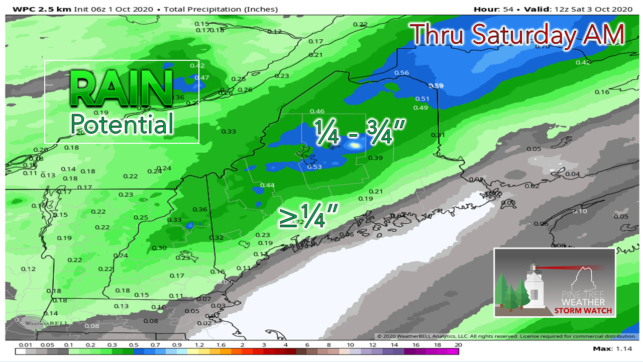 The south facing mountain slopes see the most from this one, with lesser amounts expected closer to the coast. Some DownEast areas may take a pass on this one without any rain at all.  Ocean storm may miss the region early next week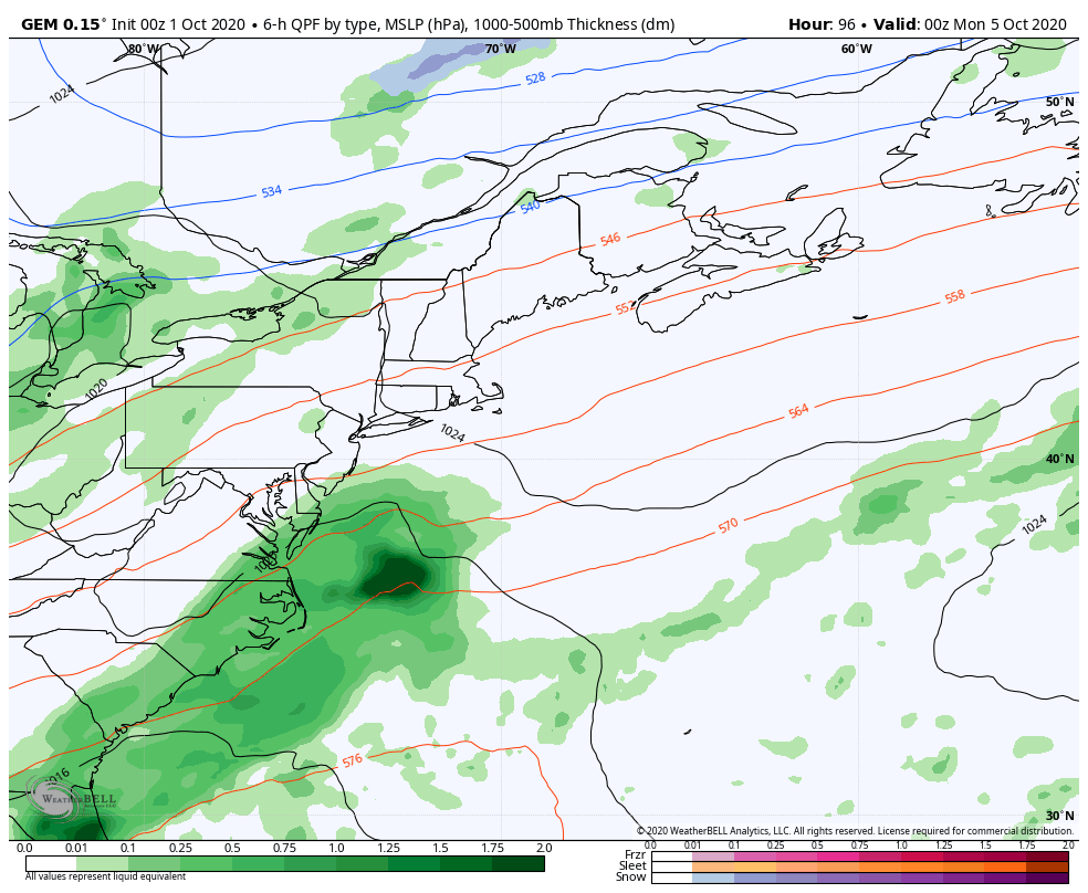 In typical fashion, models have been bullish on storms in the day 5 to day 7 and then back off when time gets closer. Earlier in the week, this storm Monday into Tuesday appeared to be a decent one. Now it appears coastal areas may get a shower and perhaps a breeze out of it, but that is about it. There are hints of another storm potentially toward the latter part of next week, but confidence is low on that idea. Outlook / temperature forecastFolks who are still gardening should be aware of frost potential Friday night and Saturday night. Temperatures will be a few degrees below normal through the middle part of next week. 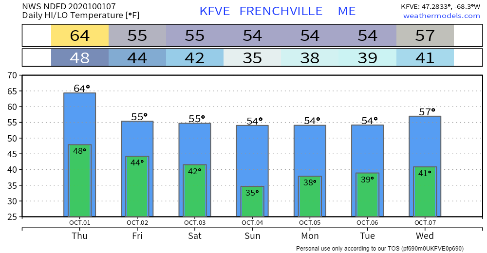 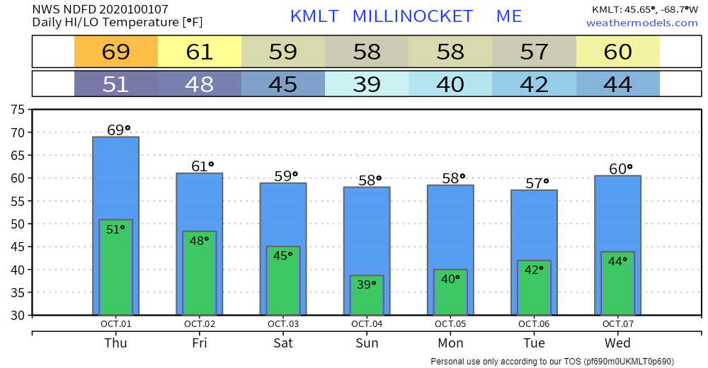 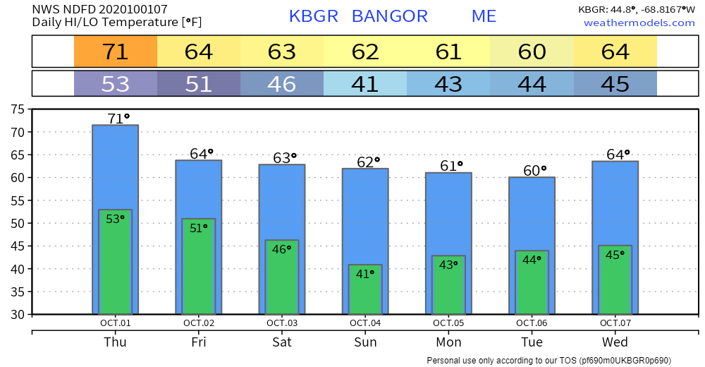 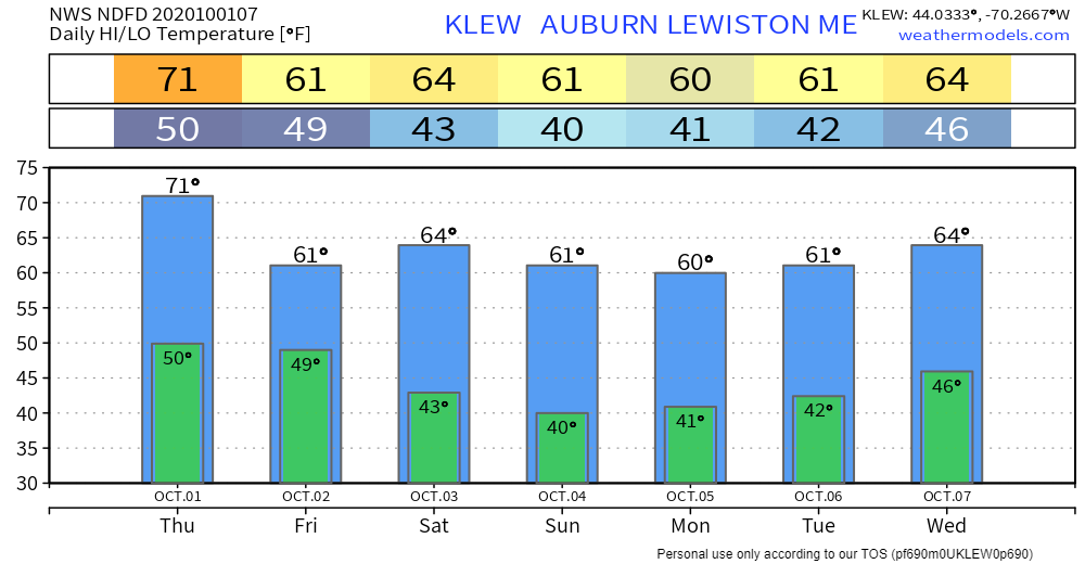 Precipitation observers wanted!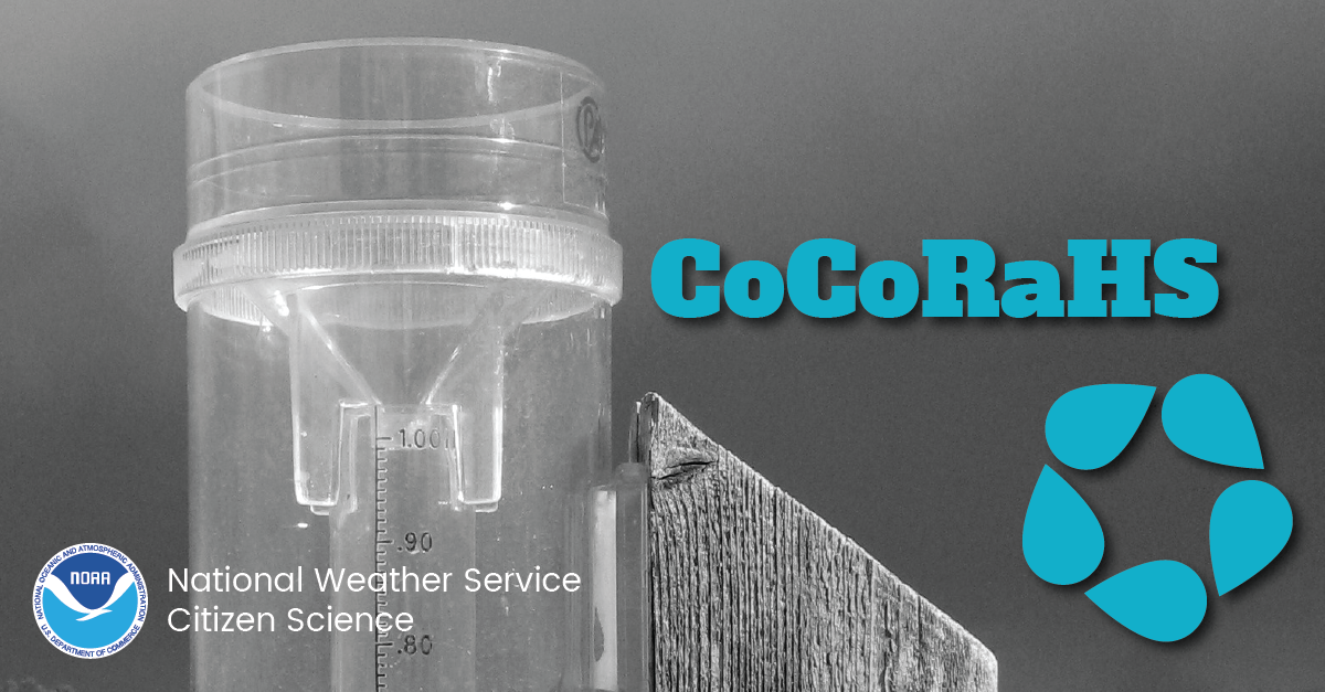 Ever wanted to take rain or snow measurements? Join CoCoRaHS or the Community Collaborative Rain, Hail, and Snow Network. This volunteer network of observers measures precipitation from their backyards. Any age can volunteer. Data is used by NWS meteorologists to help with forecasts. www.cocorahs.org You can also message me for more information. Be prepared to receive alerts and stay updated!
For more information, please follow Pine Tree Weather on Facebook and Twitter.
** FUNDING NEEDED FOR 2021 ** Thank you for supporting this community based weather information source that is funded by your financial contributions. Stay updated, stay on alert, and stay safe! - Mike |

Mike Haggett
|