 Eastern areas get the bulk of the rain Tuesday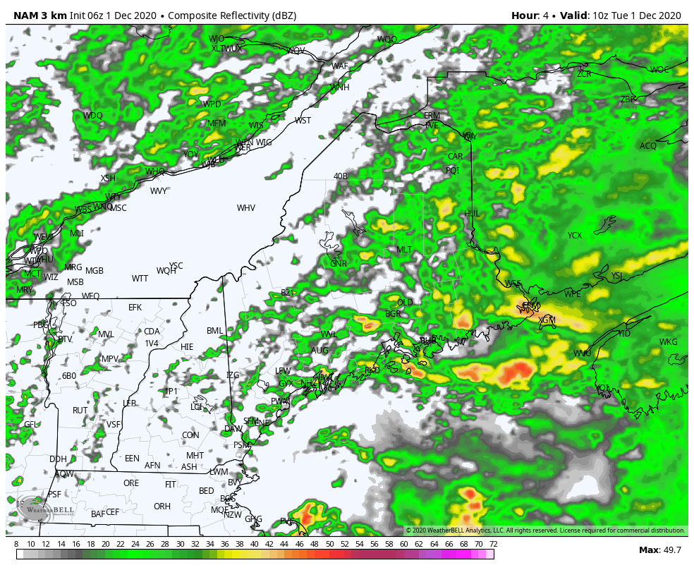 NAM3 Model idea of radar reflectivity from 5 AM - 7 PM Tuesday As of Tuesday morning, the storm was centered over northern New York with a cold front over the MidAtlantic. That cold front will work through Maine during the day, but it will be a very slow process. Scattered showers, drizzle and fog are expected for western and southwestern areas through the day. Far southwestern and northwestern areas may see a poke of sun around sunset. For the Capital District, Penobscot Bay region of the MidCoast, along with northern and eastern areas, the steady moderate to heavy rain continues all day. Expect reduced visibility from heavy rain and fog, potential for hydroplaning on roadways, and areas of flooding. 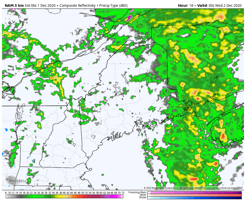 NAM3 Model idea of radar reflectivity from 7 PM Tuesday to 7 AM Wednesday By Tuesday evening, the front passes through the region and will shut the faucet off. Rain and shower activity ends from west to east. Snow showers may pop over the western mountains heading into Wednesday morning. 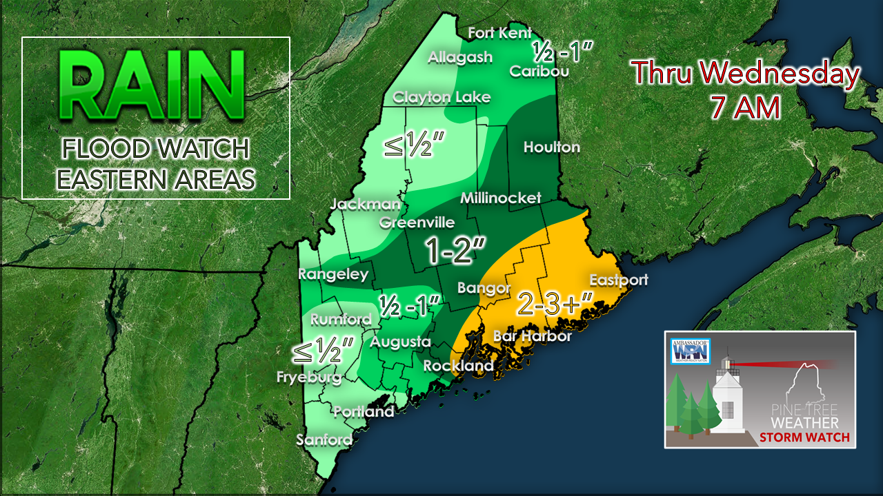 Some eastern areas could pick up a grand total of 5" of rain from this by the time the last drops fall. Expect urban street flooding and localized areas of flash flooding. The wind continues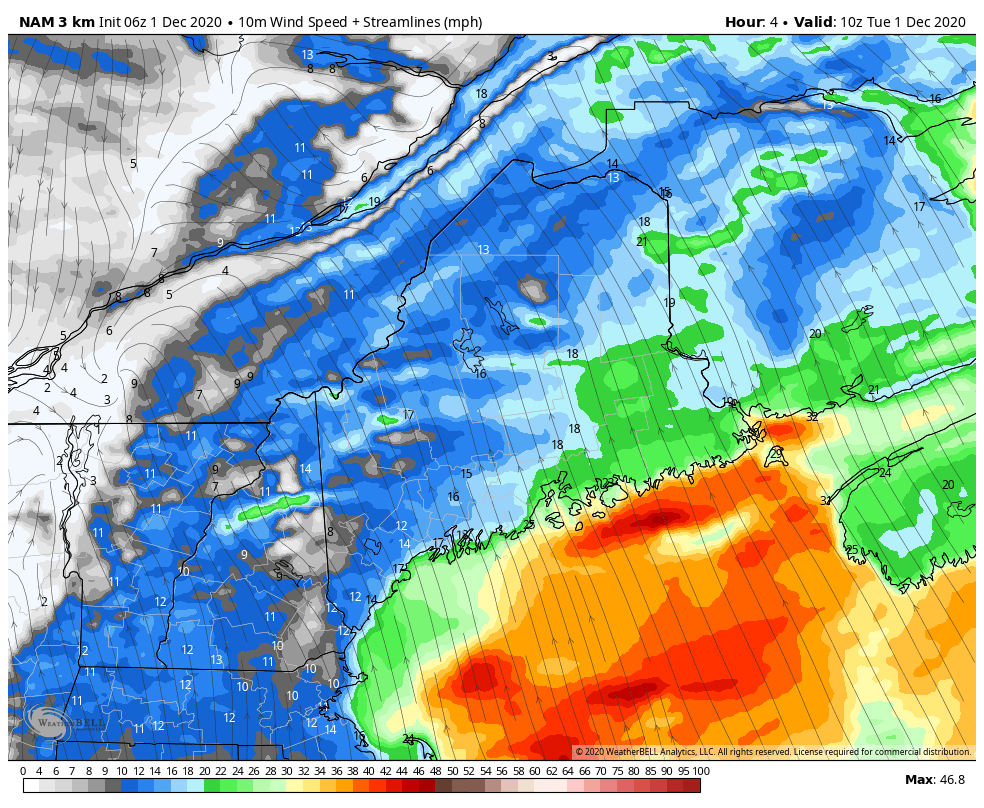 Already some impressive wind speeds reported by NWS Caribou and NWS Gray early Tuesday morning. For the Penobscot Bay region eastward, the strong wind continues through the day. This loop of sustained wind speeds forecast by the NAM3 indicates what I mentioned previously that the wind is likely to continue Wednesday and into Thursday. While I expect the high wind warning and wind advisory to drop, I do expect flying trash can status through Wednesday, and into Thursday morning. Expect the wind chill to return as well. Snow showers return Wednesday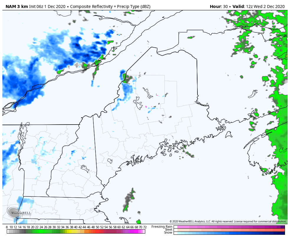 After the cold front passes, cold air returns aloft and will bring a chance for snowflakes to the state on Wednesday. A reinforcing cold front passes through Wednesday night into Thursday, and may bring an inch or two of snow for the mountains and dust up the roads over interior areas, which could make for some slick spots going into Thursday morning. Mixed signals on the next storm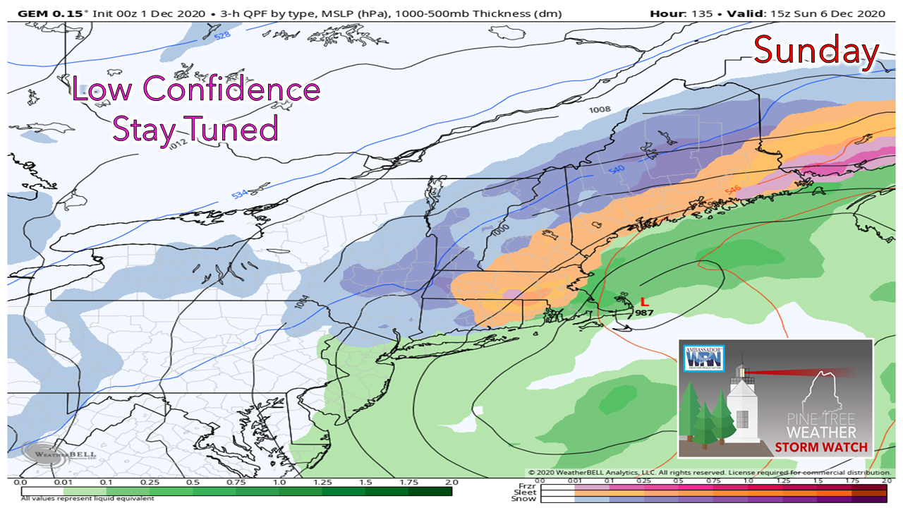 Our active pattern continues this weekend with a potential storm of a more wintry type Saturday into Sunday. This idea is low confidence for now due to varying solutions, and updates will come on the outlook.  Temperature outlook through MondayTemperatures go from well above normal to below normal by the start of next week. 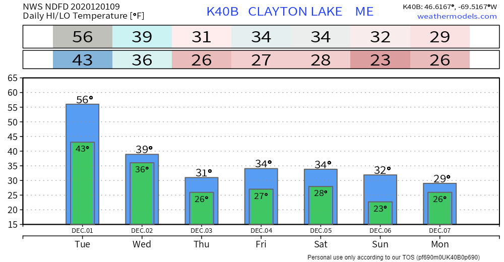 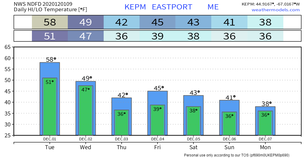 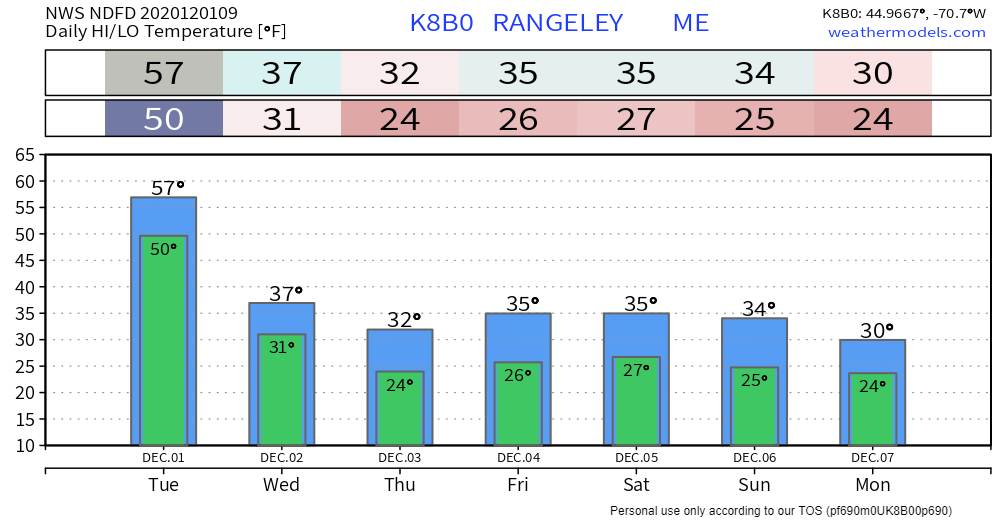 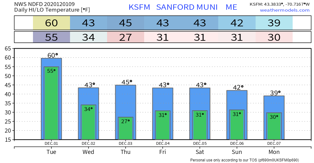 Small Decisions: Floods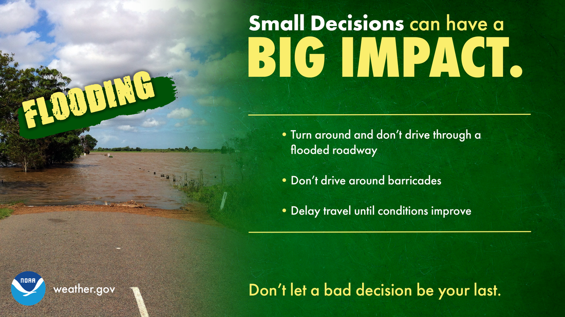 Most flood fatalities occur in vehicles, and it only takes 12 inches of water to sweep a car away. Sometimes the difference between life and death are small decisions. Small decisions like turning around and not driving through a flooded roadway, not driving around barricades, and delaying travel until conditions improve, can make a big impact on whether you keep your car...or even your life. Turn Around, Don’t Drown. weather.gov/safety/flood Be prepared to receive alerts and stay updated!
For more information, please follow Pine Tree Weather on Facebook and Twitter.
** FUNDING NEEDED FOR 2021 ** Thank you for supporting this community based weather information source that is funded by your financial contributions. Stay updated, stay on alert, and stay safe! - Mike |

Mike Haggett
|